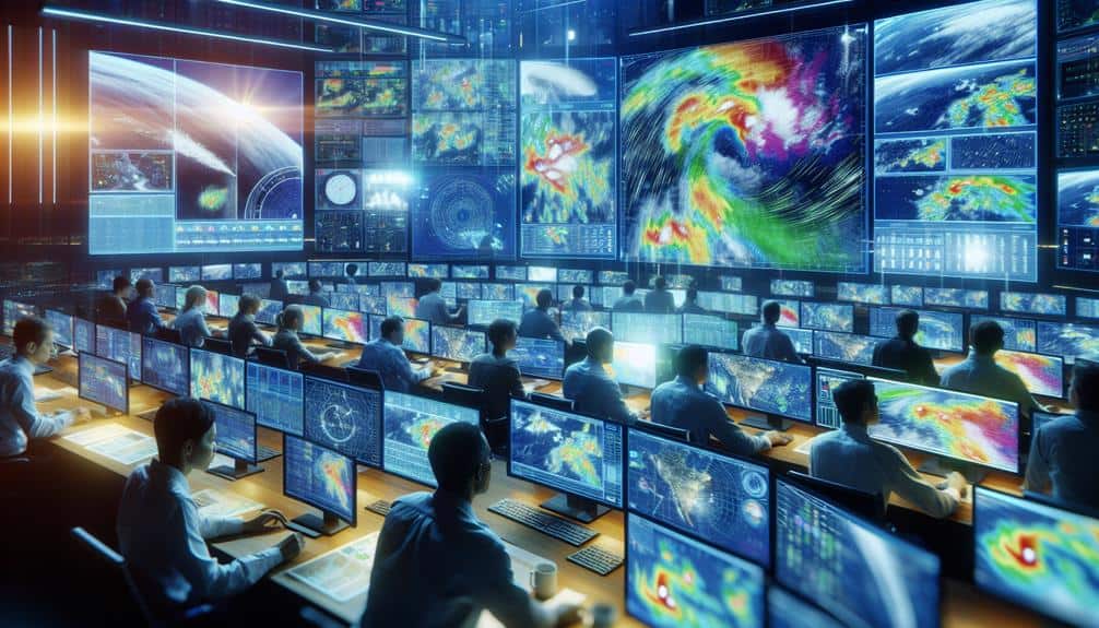
We rely on cutting-edge meteorological tools to enhance storm forecasting accuracy for storm chasers. Satellite imagery provides real-time data on cloud formations and potential storm paths. Doppler radar systems measure storm velocity and precipitation intensity with precision. Weather modeling software simulates storm behavior using advanced algorithms and real-time data. Mobile weather stations collect instantaneous atmospheric data such as temperature, humidity, and wind speed from multiple locations. Lightning detection networks offer real-time updates on lightning activity, essential for thunderstorm tracking. For a deeper understanding of these tools' capabilities and applications, more details await.
Key Points
- Satellite imagery provides real-time data on cloud formations and atmospheric conditions for predicting storm paths and intensity.
- Doppler radar systems measure storm velocity and precipitation intensity, identifying severe conditions and tornado precursors.
- Weather modeling software simulates storm behavior with advanced algorithms and real-time data assimilation for accurate forecasts.
- Mobile weather stations collect real-time atmospheric data like temperature, humidity, and wind speed from multiple locations for precise storm tracking.
Satellite Imagery
Satellite imagery offers meteorologists with real-time data necessary for accurate storm forecasting. By analyzing cloud formations and atmospheric conditions, we can identify early signs of storm development and track storm movement. This technology captures high-resolution images that reveal intricate details of weather patterns, allowing us to predict potential storm paths and intensity.
In particular, satellite images help us monitor the vertical and horizontal distribution of clouds, which is pivotal for understanding storm dynamics. We can observe the formation of cumulonimbus clouds, indicating severe weather potential, and track their progression across regions. This data enables us to assess atmospheric conditions such as humidity, temperature, and wind speed at various altitudes.
Moreover, satellite imagery provides a detailed view of large-scale weather patterns, making it easier to predict how different systems will interact. By examining these interactions, we can forecast changes in storm movement and intensity with greater accuracy. This real-time monitoring is essential for storm chasers and meteorologists alike, as it allows us to make informed decisions quickly.
Ultimately, satellite imagery empowers us with the freedom to anticipate and respond to severe weather events, improving public safety and minimizing damage.
Doppler Radar Systems
Doppler radar systems offer meteorologists precise measurements of storm velocity and precipitation intensity, necessary for accurate and timely weather forecasts. These systems work by emitting microwave signals that reflect off precipitation particles. By analyzing the frequency shift of the returned signal, we can determine the motion of raindrops or hailstones, providing data on storm velocity. This capability is vital for storm tracking, allowing us to predict the path and development of severe weather events with high accuracy.
Doppler radar's ability to measure precipitation intensity helps us gauge storm severity. High reflectivity values indicate heavy rainfall or hail, which are often associated with severe weather. When we combine this data with velocity measurements, we can identify rotation patterns within thunderstorms, a precursor to tornado formation. This level of detail enables us to issue timely warnings, enhancing public safety and reducing potential damage.
The real-time data provided by Doppler radar systems empower storm chasers to make informed decisions on positioning and movement. By understanding storm dynamics, we can navigate safely and capture critical data. Essentially, Doppler radar systems are indispensable for storm tracking and managing severe weather scenarios, enabling us to respond proactively and effectively.
Weather Modeling Software
Building on the detailed data provided by Doppler radar systems, weather modeling software allows us to simulate and predict storm behavior with advanced algorithms and computational power. These tools enable us to engage in precise storm tracking, analyzing variables like wind speed, temperature, and humidity in real-time.
Advanced atmospheric modeling software integrates multifaceted datasets, offering thorough simulations that can predict storm paths, intensities, and potential impacts.
By leveraging numerical weather prediction models, we can run simulations that provide essential insights into evolving weather patterns. These models use equations to represent atmospheric processes, making it possible to forecast storms days, or even weeks, in advance.
High-resolution models like the Weather Research and Forecasting (WRF) model give us granular details, necessary for making informed decisions in the field.
Moreover, ensemble forecasting, a technique where multiple simulations are run with varied initial conditions, allows us to assess probabilities and uncertainties. This method enhances our ability to anticipate sudden changes, a critical aspect of storm tracking.
Integrating real-time data assimilation further refines our models, ensuring our predictions remain as precise as possible. Through weather modeling software, we gain a powerful toolset that bolsters our storm-chasing endeavors, offering both precision and freedom in our pursuit of understanding nature's most dynamic phenomena.
Mobile Weather Stations
Let's explore how mobile weather stations enhance our storm forecasting capabilities. These units provide real-time data collection and feature high-resolution sensors, allowing us to capture granular atmospheric conditions.
Real-Time Data Collection
Mobile weather stations, equipped with advanced sensors, provide real-time data essential for accurate storm forecasting. These mobile units are indispensable for storm chasers like us because they enable precise storm tracking and improve forecast accuracy. By capturing and transmitting current meteorological data, mobile weather stations offer us the freedom to make informed decisions in the field.
Here's how real-time data collection enhances our storm chasing capabilities:
- Instantaneous Data Acquisition: Mobile weather stations deliver immediate measurements of temperature, humidity, wind speed, and atmospheric pressure, ensuring that we've up-to-the-minute information.
- Enhanced Mobility: These stations can be mounted on vehicles, allowing us to follow storms closely and gather data from multiple locations.
- Data Integration: The collected data can be seamlessly integrated into weather models, boosting forecast accuracy and enabling better storm tracking.
- Remote Monitoring: We can access data remotely, allowing us to stay safe while still obtaining critical information.
Utilizing mobile weather stations, we can respond swiftly to evolving weather conditions, maximizing our ability to predict storm paths and impacts. With this real-time data, we gain the autonomy to navigate complex weather systems effectively, staying ahead of the storm.
High-Resolution Sensors
High-definition sensors in our mobile weather stations capture detailed atmospheric data, providing unmatched precision in storm forecasting. These advanced sensors measure variables such as temperature, humidity, pressure, and wind speed with exceptional accuracy. By deploying these sensors strategically, we can gather vital data from the core of the storm, enhancing our understanding of its dynamics.
Our mobile weather stations are equipped with remote monitoring capabilities, allowing us to collect and analyze data in real-time. This remote access is essential, especially when we're tracking fast-moving or rapidly evolving storm systems. The high-definition sensors enable us to detect minute changes in atmospheric conditions, which can be crucial for predicting storm development and potential severity.
Sensor deployment in key locations is necessary for obtaining a thorough picture of the storm environment. By positioning sensors in multiple areas, we can triangulate data points and create detailed models of the storm's behavior. This multi-point data collection leads to more precise forecasts and timely warnings, ultimately contributing to public safety and preparedness.
Lightning Detection Networks

Lightning detection networks play an essential role in storm forecasting by providing real-time data on lightning activity and intensity. These networks give us the edge we need for effective thunderstorm tracking and storm interception. By leveraging precise lightning risk evaluation and continuous storm monitoring, we can make informed decisions that keep us safe and efficient in the field.
Let's explore why lightning detection networks are indispensable:
- Real-Time Data: Instant updates on lightning strikes help us track storm development minute-by-minute.
- Geospatial Accuracy: Pinpointing the precise locations of lightning strikes enhances our ability to intercept storms accurately.
- Intensity Measurement: Understanding the power of lightning events aids in evaluating the storm's overall severity.
- Risk Assessment: By measuring lightning frequency and distribution, we can evaluate potential risks more effectively.
These tools empower us to pivot quickly and adjust our strategies as storms evolve. They integrate seamlessly with other technologies to provide a thorough picture of storm activity.
As storm chasers dedicated to the excitement and science of storm forecasting, using lightning detection networks is non-negotiable. They offer the precision and real-time insights that grant us the freedom to navigate the ever-changing dynamics of severe weather safely.
High-Resolution Weather Maps
When we utilize high-resolution weather maps, we gain real-time access to critical meteorological data. These maps provide detailed precipitation patterns, allowing us to predict storm intensity and duration accurately.
Additionally, enhanced wind analysis on these maps helps us anticipate changes in storm trajectories.
Real-time Data Access
Accessing up-to-the-minute high-resolution weather maps allows meteorologists to monitor storm developments with unparalleled accuracy. These maps, powered by advanced remote sensing technologies, provide us with a dynamic, data-driven visualization of atmospheric conditions.
Leveraging mobile apps and meteorological databases, we can access critical data on the go, guaranteeing we're always one step ahead of the storm.
Real-time data access translates intricate meteorological information into actionable insights. Here's how it enhances our storm forecasting capabilities:
- Immediate Updates: High-resolution weather maps offer instant updates on storm movements, allowing us to adjust our plans in real-time.
- Precision Tracking: With real-time data, we can pinpoint storm locations and predict their paths more precisely.
- Enhanced Safety: Access to up-to-the-minute information helps us make informed decisions, reducing risks associated with storm chasing.
- Data Integration: By combining data from multiple sources, including satellites, radar, and ground stations, we get a comprehensive view of the storm environment.
The integration of mobile apps and meteorological databases guarantees we've continuous access to essential data, no matter where we are. This freedom to access up-to-the-minute high-resolution weather maps empowers us to chase storms safely and effectively.
Detailed Precipitation Patterns
How do high-definition weather maps allow us to analyze detailed precipitation patterns with remarkable precision?
These advanced maps provide detailed data that enable us to identify micro-scale rainfall patterns, which are essential for effective storm tracking. By leveraging cutting-edge radar technology, we can pinpoint areas with intense precipitation, helping us anticipate flash floods and other hazardous conditions.
High-definition weather maps utilize data from multiple sources, including satellite imagery and ground-based radar stations.
This integrated approach offers a thorough view of precipitation distribution and intensity. With real-time updates, we can monitor changes in rainfall patterns minute by minute, ensuring our forecasts are current and reliable.
The accuracy of these maps allows us to make informed decisions quickly.
For instance, during severe weather events, knowing exactly where the heaviest rainfall is occurring can guide our storm chasing routes, maximizing both safety and data collection. Additionally, the detailed visualization aids in distinguishing between various types of precipitation, such as rain, sleet, and hail, further refining our storm tracking efforts.
Enhanced Wind Analysis
Building on our ability to analyze detailed precipitation patterns, high-definition weather maps also provide exceptional precision in improved wind analysis. With these advanced tools, we can explore wind pattern analysis and storm tracking with unparalleled accuracy. This capability is essential for storm chasers who rely on precise data to stay safe and effectively monitor storm developments.
High-definition weather maps provide a detailed view that aids in:
- Wind Pattern Analysis: By examining intricate wind flow at various altitudes, we can predict storm behavior more accurately.
- Storm Tracking: These maps allow us to identify and follow storm systems in real-time, enhancing our ability to anticipate changes in storm direction and intensity.
- Wind Speed Estimation: Accurate wind speed data helps us understand the potential impact of storms, especially regarding damage to structures and landscapes.
- Microburst Detection: Identifying sudden, intense downdrafts is vital for safety and preparedness, as microbursts can cause severe localized damage.
The precision offered by high-definition weather maps empowers us to make informed decisions quickly. By utilizing these tools, we not only enhance our storm tracking capabilities but also increase our freedom to chase storms safely and effectively.
Frequently Asked Questions
How Do Storm Chasers Ensure Their Safety During Severe Weather Events?
During one chase, we followed strict safety protocols and used advanced equipment to remain informed. We had emergency response strategies, like predefined escape routes, ensuring our freedom to explore while minimizing risks from severe weather events.
What Qualifications Are Needed to Become a Professional Storm Chaser?
To become professional storm chasers, we need extensive meteorological knowledge and substantial field experience. Our qualifications include formal education in meteorology, hands-on training, and data-driven analysis skills to predict and navigate severe weather events safely.
Our real-time communication and data sharing are beyond essential, they're life-saving! We utilize advanced GPS, mobile apps, and radio frequencies to coordinate and exchange meteorological data instantly, ensuring we stay ahead of the storm and safe.
Are There Specific Vehicles Designed for Storm Chasing?
We utilize specialized vehicles with custom modifications like reinforced frames, advanced radar systems, and communication equipment. These adaptations guarantee mobility and safety while collecting precise meteorological data, allowing us to maintain autonomy in unpredictable storm environments.
What Role Do Drones Play in Modern Storm Chasing Efforts?
Drones revolutionize storm chasing with advanced drone technology, precise data collection, and effective aerial reconnaissance. They enhance storm tracking, providing real-time data and unique perspectives. We can analyze storm patterns more accurately, ensuring our safety and freedom in the field.


