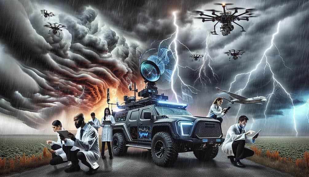
To boost storm interception success, we utilize advanced weather models, satellite data analysis, and radar interpretation techniques. By integrating precise forecasts, high-resolution satellite imagery, and Doppler radar data, we refine our understanding of storm behavior. Real-time data collection empowers us to make immediate evidence-based decisions, while predictive analytics tools analyze vast datasets to forecast developments accurately. Machine learning algorithms further enhance our predictive capabilities by identifying storm patterns and anomalies. This data-driven approach enables us to enhance situational awareness and response efficiency, offering a detailed strategy for those seeking in-depth knowledge.
Key Points
- Leverage advanced weather models to provide precise forecasts for strategic storm interception.
- Utilize high-resolution satellite imagery to gain real-time insights into storm development and behavior.
- Employ radar interpretation techniques to measure precipitation intensity and wind patterns accurately.
- Integrate machine learning algorithms for anomaly detection and trend analysis in storm data.
Utilizing Weather Models
We enhance our storm interception strategies by leveraging advanced weather models that provide precise forecasts and real-time data. By integrating data visualization techniques and storm tracking algorithms, we can interpret complex climatological patterns with greater clarity. This allows us to anticipate storm trajectories more accurately, ultimately improving our forecasting accuracy.
Our approach starts with collecting vast amounts of meteorological data, which we then feed into sophisticated weather models. These models use storm tracking algorithms to predict the path and intensity of storms. Through real-time data updates, we can adjust our strategies dynamically, ensuring we stay ahead of rapidly changing weather conditions.
Data visualization techniques play an essential role in this process. By transforming raw data into comprehensible graphical representations, we can quickly identify key trends and anomalies in climatological patterns. This not only aids in immediate decision-making but also helps us refine our models for future forecasts.
Satellite Data Analysis
Leveraging high-resolution satellite imagery, we gain unparalleled insights into storm development and behavior, enhancing our ability to make informed decisions swiftly. By analyzing vast datasets captured from space, we can visualize storm patterns and detect pivotal changes in real-time. This capability empowers us to anticipate and respond to severe weather events more effectively.
Data visualization plays a pivotal role in interpreting satellite data. Through sophisticated graphical representations, we can identify trends and anomalies within storm systems. Machine learning algorithms further enhance our analysis by automating anomaly detection, pinpointing unusual patterns that may indicate the onset of severe weather.
- Enhanced predictive capabilities: Using trend analysis, we can forecast storm intensity and trajectory with greater accuracy.
- Real-time monitoring: Satellite data provides continuous updates, enabling immediate response to developing storms.
Radar Interpretation Techniques
In addition to satellite data, radar interpretation techniques provide vital insights into storm dynamics by capturing detailed information on precipitation intensity and wind patterns. Utilizing Doppler radar, we can measure the velocity of raindrops, which enables us to estimate wind speeds and directions within a storm system. This is essential for accurate storm tracking, as it allows us to predict the movement and development of storm cells with a high degree of precision.
By analyzing radar reflectivity, we can determine the type and rate of precipitation, giving us a robust method for precipitation estimation. High reflectivity values typically indicate heavy rainfall or hail, both of which are important for evaluating potential flood risks and storm severity. This data-driven approach allows us to make informed decisions quickly, ensuring timely warnings and effective resource deployment.
Moreover, advanced radar interpretation techniques, such as dual-polarization radar, enhance our ability to differentiate between rain, snow, and mixed precipitation types. This detailed level of information is indispensable for both short-term storm tracking and long-term climatological studies. By integrating radar data with other meteorological inputs, we can create a thorough picture of storm systems, thereby boosting our interception success rates significantly.
Real-Time Data Collection
Real-time data collection empowers meteorologists to make immediate, evidence-based decisions during storm events, enhancing predictive accuracy and response strategies. By deploying sensors strategically, we gather critical data on atmospheric conditions, wind speeds, and precipitation rates. This influx of real-time information allows us to visualize storm patterns dynamically, aiding in the anticipation and interception of severe weather phenomena.
To illustrate the impact of real-time data collection, consider the following benefits:
- Increased accuracy: Immediate data from sensor deployment guarantees our forecasts are based on the latest atmospheric conditions.
- Enhanced situational awareness: Continuous data streams facilitate up-to-the-minute data visualization, allowing us to adjust our strategies as storm conditions evolve.
Harnessing real-time data collection means that we can react swiftly and efficiently, maximizing our ability to mitigate harm and protect communities. Advanced sensor deployment and sophisticated data visualization tools are paramount in this endeavor, providing the granular, real-time insights necessary for effective storm interception.
As we continue to refine these technologies, the precision and reliability of our storm response strategies will only improve, guaranteeing we remain at the forefront of meteorological science.
Predictive Analytics Tools

Harnessing sophisticated predictive analytics tools, we can analyze vast datasets to forecast storm developments with remarkable precision. By leveraging machine learning advancements, we're able to process historical weather data, real-time sensor inputs, and satellite imagery.
These predictive analytics applications enable us to identify patterns and make more accurate predictions about storm trajectories and intensities.
Our data interpretation strategies are essential in refining these predictions. We utilize algorithms that can detect subtle changes in atmospheric conditions, providing actionable insights that traditional methods might miss. These insights allow us to implement proactive measures, ensuring a quicker and more effective response to approaching storms.
Data visualization techniques play a pivotal role in this process. By converting complex data sets into intuitive visual formats, we empower decision-makers with clear, actionable information. Visual dashboards and real-time maps enhance our ability to monitor storm developments and communicate potential threats to the public efficiently.
As we continue to refine our use of predictive analytics tools, our ability to intercept and mitigate storm impacts will only improve. This technological evolution not only enhances our storm interception success but also aligns with our collective desire for greater freedom and security in the face of unpredictable weather events.
Frequently Asked Questions
How Do Storm Interception Strategies Impact Local Communities and Infrastructure?
Storm interception strategies act like a double-edged sword. While they mitigate economic impact and bolster community resilience, they can't entirely prevent infrastructure damage. Emergency response efforts, though critical, still face challenges in preserving our communities' freedom.
What Training Is Required for Storm Intercept Teams?
We need rigorous training requirements and skill development to guarantee our storm intercept teams are effective. They must master meteorology, data analysis, and emergency response to optimize safety, precision, and impact, securing our communities remain resilient and free.
How Can the Public Access Storm Interception Data?
The public can access storm interception data through our online portals, ensuring data accessibility. We're committed to public engagement, offering real-time updates like a well-oiled machine, empowering everyone with the freedom to stay informed.
What Are the Environmental Impacts of Storm Interception Activities?
We need to analyze storm interception activities' environmental impacts. They can disrupt ecological balance and potentially exacerbate climate change. Data-driven assessments help us understand these consequences and make sure we make informed, freedom-preserving decisions.
How Do Budget Constraints Affect Storm Interception Programs?
When facing funding challenges, we must make operational adjustments, impacting resource allocation and program effectiveness. Limited budgets often force us to prioritize certain activities, potentially compromising the overall efficiency and success of storm interception programs.