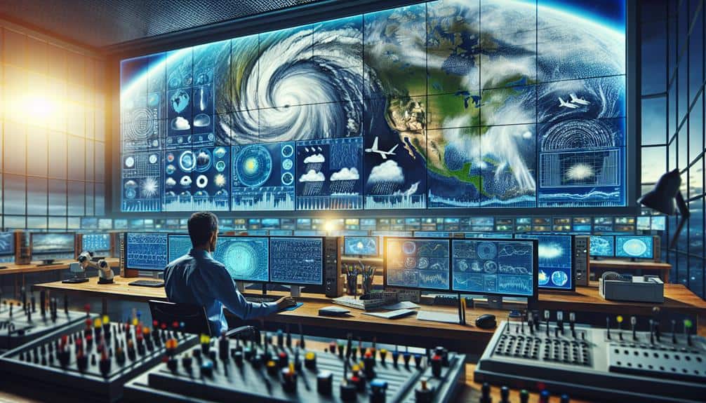
By leveraging satellite meteorological data, we revolutionize storm chasing with unprecedented accuracy and predictive capabilities. Geostationary and polar-orbiting satellites provide detailed real-time monitoring of atmospheric conditions, cloud formations, wind speeds, and moisture levels. Advanced sensors like radiometers and spectrometers guarantee data precision, enabling us to construct predictive models and analyze storm behaviors meticulously. Real-time data transmission allows for immediate updates and informed decision-making, greatly enhancing safety and reducing risks. This integration of high-resolution satellite imagery with storm chasing practices opens up innovative approaches, transforming how we predict and track storm paths with remarkable efficiency. Discover more about these advancements.
Key Points
- Real-time satellite data improves storm path predictions for targeted and safer storm chasing.
- High-resolution satellite imagery aids in identifying storm structures and potential development areas.
- Continuous monitoring from geostationary satellites ensures up-to-date information on storm evolution.
- Advanced sensors on polar-orbiting satellites provide detailed global coverage for comprehensive weather analysis.
Importance of Satellite Data
Understanding the significance of satellite data, we acknowledge its role in providing precise, real-time information essential for accurate storm tracking and prediction.
Satellite technology empowers us to gather extensive weather monitoring data, including cloud cover, wind speeds, and precipitation. These datasets are essential for storm chasers, as they offer the freedom to anticipate and respond to volatile weather conditions with enhanced accuracy.
By leveraging advanced satellite technology, we can detect storm genesis and evolution in near real-time. For instance, geostationary satellites provide continuous monitoring over specific regions, enabling us to track the development of severe weather systems with high temporal resolution.
Meanwhile, polar-orbiting satellites contribute by offering global coverage and higher spatial resolution, vital for detecting smaller-scale phenomena that could escalate into significant storms.
Furthermore, the integration of satellite data with ground-based observations and numerical weather models enhances the reliability of storm forecasts. This synthesis guarantees that we aren't just reacting to weather events but proactively planning our storm-chasing strategies.
Understanding Meteorological Satellites
Meteorological satellites, integral to modern weather forecasting, provide essential data through two main types: geostationary and polar-orbiting. Geostationary satellites maintain a fixed position relative to the Earth's surface, offering continuous monitoring over specific regions.
Polar-orbiting satellites, on the other hand, traverse the globe, capturing extensive data from pole to pole. Advancements in satellite technology have greatly enhanced our storm-chasing capabilities. By leveraging these satellites, we gain unprecedented insights into storm formation, evolution, and dissipation.
For instance, high-resolution imagery and advanced sensors equip us to track and analyze weather systems with enhanced accuracy.
- Geostationary Satellites: Positioned at approximately 36,000 kilometers above the equator, these satellites provide constant surveillance over large areas.
- Polar-Orbiting Satellites: Orbiting at lower altitudes (about 800 kilometers), these satellites offer detailed global coverage, passing over the same location twice daily.
- Advanced Sensors: Instruments like radiometers and spectrometers measure various atmospheric parameters, enhancing data precision.
Data Collection Techniques
Building on the capabilities of meteorological satellites, we utilize sophisticated data collection techniques to capture and analyze atmospheric conditions with high precision. By leveraging remote sensing technologies, we gather extensive data from Earth's atmosphere, ocean, and land surfaces. This data encompasses parameters such as temperature, humidity, wind speed, and cloud cover, enabling us to thoroughly monitor and predict storm patterns.
Our use of advanced sensors onboard satellites, like radiometers and spectrometers, guarantees data accuracy. These instruments measure electromagnetic radiation across various wavelengths, providing precise readings of atmospheric phenomena. Additionally, we utilize geostationary and polar-orbiting satellites to maintain continuous observation and data collection, making certain that no essential storm developments are missed.
Data transmission is another vital aspect of our techniques. We rely on high-frequency communication links to relay collected data to ground stations in real-time. This immediate access to fresh data allows us to update storm models and forecasts promptly.
Moreover, we integrate data from multiple satellites and other remote sensing sources to create a thorough dataset. This interoperability enhances our ability to validate and cross-check information, further improving the accuracy and reliability of our storm predictions. Through these meticulous techniques, we empower ourselves to track storms with informed precision.
Analyzing Satellite Imagery
When analyzing satellite imagery, we focus on extracting key details from high-resolution data to accurately interpret storm dynamics. Our primary goal is to utilize satellite tracking to observe weather patterns and understand the development of storms in real-time. By leveraging advanced image interpretation techniques, we can pinpoint the vital indicators that signal the onset of severe weather.
We follow a systematic approach to analyze satellite images:
- Identify cloud formations: We assess the shape, size, and type of clouds to determine storm potential.
- Measure temperature gradients: By examining thermal infrared data, we can gauge the temperature differences within the storm system.
- Track moisture levels: Using water vapor imagery, we evaluate the humidity and moisture content, essential for storm intensification.
Through this data-driven, analytical approach, we can dissect the intricate details of storm systems. Our focus on high-resolution satellite tracking and sophisticated image interpretation allows us to stay ahead of rapidly evolving weather patterns.
Predicting Storm Paths
With the integration of satellite meteorological data, we can precisely predict storm paths by analyzing wind patterns, temperature gradients, and moisture levels in real-time. This data integration allows us to construct highly accurate predictive models that map out storm behavior with remarkable precision.
By examining satellite-derived wind vectors, we gain insights into the storm's direction and speed. Temperature gradients, derived from infrared satellite imagery, help us understand the thermal dynamics driving the storm's development and potential changes in intensity.
Through advanced storm tracking techniques, we compile this data to generate detailed models. These predictive models utilize algorithms that factor in historical storm behavior, current atmospheric conditions, and geospatial data. By continuously updating these models with real-time satellite data, we can anticipate shifts in storm paths more effectively than ever before.
The key to our success lies in the seamless data integration from multiple satellite sources. This integration not only enhances our predictive capabilities but also empowers us with the freedom to make informed decisions.
Real-Time Data Applications
Leveraging real-time satellite meteorological data, we can enhance our storm chasing strategies by accessing instantaneous updates on storm intensity, location, and trajectory. With this data, our ability to track volatile weather systems improves exponentially, allowing us to make informed decisions when every second counts.
By integrating mobile apps with satellite data, we gain a powerful tool for weather tracking that's both portable and precise. These apps can deliver real-time alerts, map overlays, and predictive models directly to our devices.
The key advantages include:
- Instantaneous Data Access: Real-time updates on storm metrics help us stay ahead of rapidly evolving weather conditions.
- Enhanced Accuracy: Satellite data reduces the margin of error in tracking storm paths and predicting potential impacts.
- Improved Decision-Making: High-resolution imagery and data analytics allow us to make quick, informed decisions on the ground.
Combining satellite meteorological data with mobile apps revolutionizes our approach to storm chasing. This synergy offers a level of freedom and precision that was previously unattainable, empowering us to pursue our passion without compromising safety or accuracy.
Future of Storm Chasing

The future of storm chasing will be shaped by advancements in satellite meteorological technology, offering unparalleled accuracy and predictive capabilities. As technology advancements continue, the integration of high-detail satellite imagery and real-time data analytics will transform storm detection. We'll be able to pinpoint storm development with enhanced precision, enabling us to chase storms more effectively and efficiently.
Satellite integration will enrich our understanding of storm structures and behaviors. By leveraging data from geostationary and polar-orbiting satellites, we can continuously monitor atmospheric conditions, track storm evolution, and predict potential paths. This all-encompassing approach won't only enhance our predictive models but also reduce false alarms, allowing for more focused and strategic chases.
Chase safety will also benefit greatly from these technological innovations. With precise, real-time data, we can make informed decisions about when and where to position ourselves, minimizing risks associated with unpredictable weather conditions. Enhanced communication systems, supported by satellite networks, will guarantee that all team members are updated instantaneously, further boosting our operational safety.
In essence, the fusion of satellite meteorological data with on-the-ground storm chasing practices will open new horizons for us. We'll chase storms with greater confidence, knowing that our actions are guided by the most advanced technology available.
Frequently Asked Questions
How Do Satellite Data Improve Safety for Storm Chasers?
Satellite data improve our safety by providing accurate weather prediction, enabling real-time tracking, and enhancing communication tools. These safety measures allow us to make informed decisions and stay ahead of dangerous conditions during storm chasing.
What Equipment Do Storm Chasers Need to Access Satellite Data?
Did you know that 75% of storm chasers rely on real-time data? We need satellite receivers and tracking software to access satellite data. This technology gives us the freedom to make informed decisions and stay safe.
How Do Satellite Advancements Impact Storm Chasing Strategies?
Satellite advancements boost our storm chasing strategies by enhancing forecast accuracy and real-time tracking. Improved navigation techniques and aerial perspective allow us to anticipate storm paths more precisely, optimizing our safety and data collection efficiency.
Can Satellite Data Help in Post-Storm Damage Assessment?
Yes, satellite data can help us in post-storm damage assessment. Remote sensing enhances damage analysis by providing high-resolution imagery, allowing precise evaluation of affected areas, and supporting efficient recovery planning. This empowers us with accurate, actionable insights.
How Do Storm Chasers Get Trained to Interpret Satellite Data?
Storm chasers undergo intensive training programs and interpretation techniques. We prioritize data analysis and forecast accuracy, enabling us to interpret satellite data effectively. This analytical approach guarantees we make informed decisions in the field.