Chasing intense thunderstorms offers us an exciting educational journey rooted in meteorological science. We utilize advanced radar, GPS, and high-resolution cameras to track and document these powerful storms. Real-time meteorological data and tools like CAPE values and vertical wind shear analysis enhance our predictions and safety measures. Thorough planning, including risk assessments and emergency protocols, ensures we stay prepared. Analyzing data from Doppler radar, satellites, and weather models helps us understand key atmospheric conditions. This fieldwork not only hones our forecasting skills but also contributes to the broader scientific community's knowledge on severe weather phenomena. Explore with us and uncover more insights.
Key Points
- Real-time weather data and radar systems help pinpoint storm initiation zones for safe and effective storm chasing.
- Emergency supplies like first aid kits and communication tools ensure preparedness and safety during storm chasing expeditions.
- High-resolution cameras and tripods are essential for capturing dramatic visuals of severe thunderstorms.
- Understanding atmospheric instability, wind shear, and moisture convergence is crucial for predicting storm development.
Understanding Severe Thunderstorms
When we explore severe thunderstorms, we need to understand their formation, characteristics, and the atmospheric conditions that trigger their development. Thunderstorms form when there's significant atmospheric instability, which occurs when warm, moist air near the ground rises rapidly into cooler, drier air above. This rising air cools and condenses to form towering cumulonimbus cloud formations. These clouds are the breeding ground for many storm elements, including lightning dangers that pose substantial risks.
Atmospheric instability is essential for thunderstorm development. We measure this instability through parameters like CAPE (Convective Available Potential Energy), which indicates the potential energy available for convection. Higher CAPE values suggest more robust storm potential. Wind patterns also play a role.
Vertical wind shear, the change in wind speed and direction with height, helps organize thunderstorms into supercells, which are the most severe type. Understanding these dynamics allows us to better predict and respond to severe weather. By analyzing data on atmospheric conditions, we can anticipate when and where thunderstorms will form.
This knowledge isn't only empowering but necessary for successfully navigating the inherent risks and seizing the freedom to chase these natural phenomena safely.
Tools for Storm Chasing
When we chase severe thunderstorms, having the right tools is critical for both data collection and safety.
Our essential chasing equipment includes:
- Advanced radar systems
- GPS devices
Additionally, we rely on robust communication tools like:
- Satellite phones
to stay informed and connected.
Essential Chasing Equipment
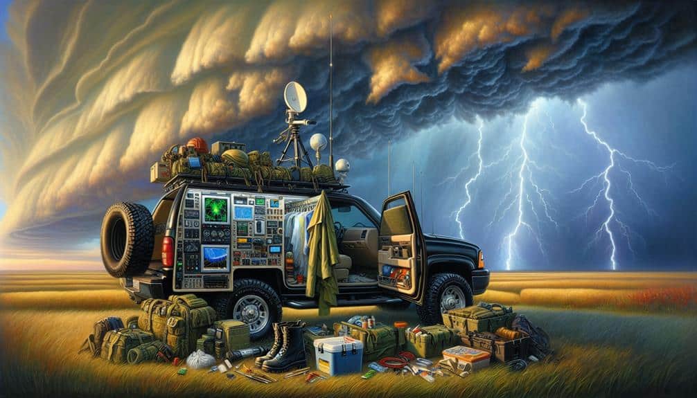
Equipping ourselves with advanced weather radar systems, GPS devices, and reliable communication tools is necessary for effective and safe storm chasing. Radar technology allows us to monitor storm development in real-time, enabling precise tracking and forecasting. High-resolution radar images provide vital data on storm structure, intensity, and movement, informing our decisions on positioning and timing.
Complementing radar technology, GPS devices guarantee we can traverse the often remote and challenging terrains we encounter, keeping us on the correct path and away from danger.
Capturing the raw power of nature requires specialized equipment for storm photography. High-quality cameras with rapid shutter speeds and wide-angle lenses allow us to document the dramatic visuals of severe weather. Tripods and stable mounts are essential for steady shots in high winds, while waterproof cases protect our gear from the elements.
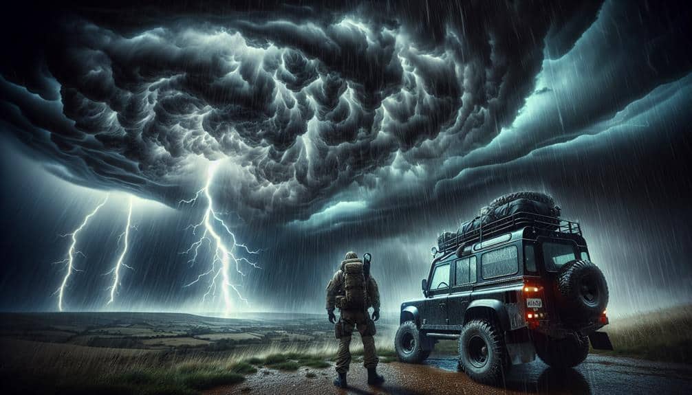
Proper vehicle preparation is paramount. We equip our vehicles with reinforced tires, additional fuel reserves, and emergency supplies like first aid kits, water, and non-perishable food. These precautions guarantee we can respond to unexpected situations, whether it's traversing debris-laden roads or enduring prolonged periods in the field.
With the right tools and preparation, we maximize both our effectiveness and safety while chasing storms.
Safety and Communication Tools
While advanced equipment and vehicle preparation are critical, our safety and communication tools are equally important for successfully handling severe thunderstorms. Emergency preparedness involves having a well-defined plan and the right tools.
First, we must make sure our GPS units and weather radar apps are updated. Reliable data feeds allow us to track storm movements accurately.
Our communication strategies include maintaining multiple channels for contact. Mobile phones, satellite radios, and two-way radios guarantee we can reach team members and emergency services, even when cell signals are weak. Real-time communication can be a lifesaver during rapidly evolving weather conditions.
Safety protocols are paramount. We use technology advancements such as portable weather stations to monitor atmospheric changes closely. These devices provide data on wind speed, humidity, and barometric pressure, helping us make informed decisions. Personal protective equipment (PPE) like helmets, gloves, and reinforced clothing adds another layer of security.
Moreover, having a first-aid kit, fire extinguisher, and emergency blankets in our vehicles is non-negotiable. These items allow us to respond swiftly to injuries or sudden environmental changes.
Planning a Chase Route
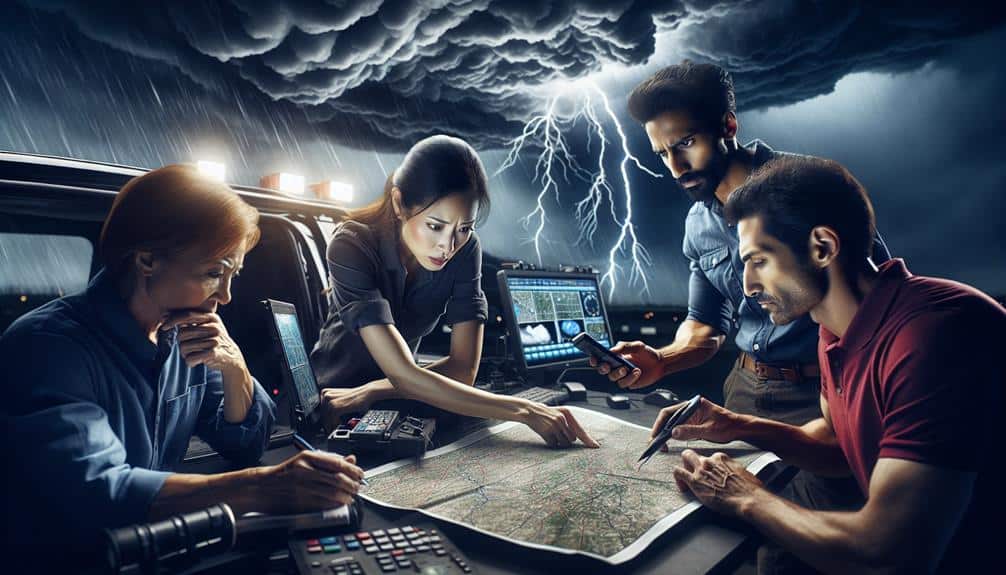
To efficiently plan a chase route, we must analyze real-time meteorological data and model forecasts to pinpoint potential storm initiation zones. We start by examining radar and satellite imagery, surface observations, and upper-air soundings to refine our storm prediction. This data helps us identify key elements such as wind shear, moisture convergence, and instability. By integrating this information with numerical weather prediction models, we can forecast where and when severe weather might develop.
Once our initial route is plotted, we remain flexible to make route adjustments as conditions evolve. Mobile weather apps and GPS devices assist in real-time monitoring, enabling us to adapt quickly to shifts in storm paths.
Effective emergency response plans are crucial; we should always be prepared to reroute or seek shelter if conditions deteriorate unexpectedly.
Communication strategies are another essential component. We establish clear channels for team communication through radios and mobile networks to guarantee everyone is informed of any changes or hazards. This coordinated effort maximizes our safety and efficiency.
Safety Precautions
Prioritizing our safety, we must meticulously implement protocols that address various hazards associated with severe thunderstorm chasing. To guarantee our adventure is both thrilling and secure, we need a robust risk assessment and a clear understanding of emergency protocols.
Each of us should be equipped with the necessary safety gear and an effective communication plan.
Here's what we need:
- Emergency Protocols: Establish clear procedures for different scenarios, such as encountering hail, tornadoes, or flash flooding. Regularly review these protocols to confirm everyone is familiar with them.
- Risk Assessment: Conduct thorough risk assessments before and during the chase. This includes analyzing weather forecasts, identifying safe zones, and constantly monitoring the storm's behavior to make informed decisions.
- Safety Gear: Equip ourselves with essential safety gear like helmets, protective eyewear, and sturdy footwear. Additionally, validate our vehicles are well-maintained and stocked with emergency supplies, including first aid kits and water.
- Communication Plan: Develop a robust communication plan involving multiple channels (e.g., radios, cell phones, GPS) to maintain contact with each other and emergency services. Confirm everyone knows the plan and has the necessary equipment.
Analyzing Weather Data

We need to meticulously examine real-time weather data to predict the development and trajectory of severe thunderstorms. By scrutinizing weather patterns through data analysis, we can identify the conditions that support storm formation. We rely on advanced tools like Doppler radar, satellite imagery, and weather models to collect and interpret this data. These instruments provide us with crucial information on atmospheric pressure, humidity levels, wind speed, and temperature gradients.
Forecast accuracy hinges on our ability to interpret this data correctly. Patterns such as supercell formations, squall lines, and frontal boundaries are key indicators of severe weather potential. By cross-referencing current weather conditions with historical data, we can enhance our predictive accuracy. Data interpretation isn't just about recognizing isolated variables but understanding how they interact within the broader atmospheric context.
Our analytical approach involves continuous monitoring and updating of weather data to refine our forecasts. This dynamic process guarantees that we can adapt to rapidly changing conditions, maximizing our ability to predict severe thunderstorms.
Educational Outcomes
Next, let's evaluate the educational outcomes from chasing severe thunderstorms.
We'll focus on how this experience enhances our meteorological skills, reinforces important safety practices, and provides opportunities for real-world data collection.
These elements are essential in developing a thorough understanding of severe weather phenomena.
Meteorological Skills Development
Developing advanced meteorological skills in chasing severe thunderstorms hinges on rigorous data analysis and hands-on experience in the field. Our ability to understand storm dynamics and employ precise forecasting techniques is essential. Mastering weather patterns and atmospheric conditions allows us to predict storm behavior accurately and make informed decisions.
To develop these skills, we focus on several core areas:
- Data Collection: Gathering high-quality data from weather stations, satellites, and radar systems. This raw data forms the foundation of our analysis.
- Analytical Tools: Utilizing software and models to interpret data. Tools like Python and MATLAB help us analyze trends and predict storm movements.
- Field Experience: Engaging in storm chasing expeditions to observe real-time weather events. This hands-on approach solidifies theoretical knowledge through practical application.
- Continuous Learning: Staying updated with the latest research and technological advancements in meteorology. Attending workshops, webinars, and conferences ensures we're at the forefront of the field.
Critical Safety Practices
Understanding storm dynamics is only part of the equation; strict adherence to critical safety practices is essential for our safety during these intense weather events. First, we must conduct thorough risk assessments before any storm spotting activity. This involves analyzing weather models and real-time data to identify potential hazards. By doing so, we can make informed decisions about when and where to position ourselves safely.
Emergency procedures are crucial in our toolkit. Each team member should be well-versed in first aid and have a clear understanding of evacuation routes. We must also establish communication protocols to guarantee constant contact with local weather services and emergency responders.
Weather awareness is crucial. We need to continuously monitor updates from reliable sources, such as the National Weather Service, and use advanced radar systems to track storm movements. Real-time information helps us anticipate changes and adjust our plans accordingly.
In practice, storm spotting demands a balance between our passion for exploration and an unwavering commitment to safety. By integrating rigorous risk assessments, following emergency procedures, and maintaining high levels of weather awareness, we can pursue our educational adventure with confidence and freedom, knowing we're prepared for any eventuality.
Real-World Data Collection
Collecting real-world data during severe thunderstorms provides invaluable insights that enhance our understanding of these phenomena and improve our predictive models. When we engage in storm tracking and data analysis, we tap into a treasure trove of meteorological observations that inform our research findings. This process isn't just about excitement; it's about contributing to the broader scientific community and enhancing public safety.
By gathering empirical data, we can achieve several educational outcomes:
- Enhanced Predictive Models: Accurate data collection allows us to refine algorithms that predict storm behavior, leading to better forecasting and early warning systems.
- Hands-On Learning: Being in the field provides firsthand experience with meteorological instruments, making theoretical knowledge tangible and applicable.
- Critical Thinking: Analyzing real-time data hones our ability to make rapid, informed decisions, a skill vital for both safety and scientific accuracy.
- Collaborative Research: Sharing our findings with other researchers fosters a collaborative environment, pushing the boundaries of meteorological science.
We believe that the freedom to explore and understand the natural world is essential. By participating in this rigorous data collection, we not only satisfy our curiosity but also contribute meaningfully to the body of knowledge surrounding severe thunderstorms.
Frequently Asked Questions
How Do Storm Chasers Stay Connected With Each Other During a Chase?
We stay connected using various communication methods and technology advancements, ensuring team coordination and adherence to safety protocols. Real-time data from GPS, radios, and mobile apps allows us to track weather patterns and make informed decisions.
What Types of Vehicles Are Best Suited for Storm Chasing?
Safety first, freedom follows. For storm chaser vehicles, we prefer SUVs and trucks due to their durability and versatility. These vehicles allow us to navigate tough terrains while following strict safety precautions. Their reliability is essential.
Can Storm Chasing Be Done as a Solo Activity?
Yes, storm chasing can be a solo experience, but we must prioritize safety precautions. Having data on weather patterns, emergency gear, and communication tools greatly increases our chances of safely maneuvering this thrilling, yet risky, endeavor.
How Do Storm Chasers Handle Encounters With Wildlife?
When the wild roars, we face wildlife encounters with calculated precision. We prioritize safety precautions, analyzing animal behavior to guarantee our storm chaser response is effective and safe. Freedom's pursuit demands respect for nature's unpredictable elements.
Are There Any Specific Apps Recommended for Storm Chasers?
For storm tracking and safety precautions, we recommend RadarScope, Storm Shield, and MyRadar. These apps provide real-time data, detailed radar imagery, and alerts, ensuring we stay informed and safe while chasing storms.