We utilize cutting-edge Doppler radar, meteorological drones, and storm chaser vehicles to intercept severe thunderstorms with precision. By analyzing atmospheric instability, humidity, and wind patterns, we pinpoint the formation of cumulonimbus clouds. Advanced radar systems track storm intensity and movement, while dual-polarization technology distinguishes precipitation types. Our drones gather high-resolution data, enhancing real-time predictive models. Storm chaser vehicles, equipped with specialized tools, validate forecasts on the ground. Through these methods, we achieve thorough insights into storm behavior and ensure accurate, timely alerts. Stay with us to uncover the full depth of intercepting these formidable weather phenomena.
Key Points
- Advanced radar systems track storm movement and intensity in real-time for accurate interception and timely warnings.
- Meteorological drones collect high-resolution atmospheric data from within storms, enhancing predictive models and safety.
- Satellite imagery provides a panoramic view for real-time analysis and understanding of storm development and trajectory.
- Storm chaser vehicles equipped with specialized tools and modifications collect precise data, aiding in forecast validation and model improvement.
Understanding Thunderstorm Formation
To understand thunderstorm formation, we must analyze the intricate interplay between atmospheric instability, humidity, and wind patterns. These elements form the foundation of thunderstorm evolution and determine the storm dynamics that lead to severe weather events.
Atmospheric instability occurs when warm, moist air at the surface becomes buoyant and rises rapidly into the cooler, less dense air above. This vertical movement is key to developing towering cumulonimbus clouds that characterize thunderstorms. Humidity contributes by providing the moisture necessary for cloud formation and subsequent precipitation. High humidity levels enhance the storm's intensity, driving more robust updrafts and downdrafts.
Wind patterns also play a pivotal role in thunderstorm dynamics. Variations in wind speed and direction with altitude, known as wind shear, influence the storm's structure and severity. Strong wind shear can tilt the storm, preventing the updraft from being choked off by downdrafts, thereby sustaining its lifecycle.
Analyzing lightning patterns offers another layer of insight into the storm's behavior. Frequent lightning indicates strong updrafts and significant atmospheric instability.
Tools of the Trade
To intercept severe thunderstorms effectively, we rely on advanced radar systems, specialized storm chaser vehicles, and meteorological drones. These tools provide us with precise data on storm development, movement, and intensity.
Advanced Radar Systems
Advanced radar systems, harnessing Doppler technology and dual-polarization capabilities, offer meteorologists the crucial data necessary to accurately track and analyze severe thunderstorms. These radar technologies enable us to measure wind speed within storms, which is essential for predicting tornado formation and other severe weather phenomena. By using dual-polarization radar, we can differentiate between various types of precipitation, such as rain, hail, and snow, improving our storm interception strategies.
Our tracking systems have evolved significantly, allowing us to pinpoint storm locations and forecast their paths with remarkable accuracy. Doppler radar's capability to detect movement toward or away from the radar site provides us with real-time insights into storm dynamics. This radar technology is vital for issuing timely warnings, aiding in protecting lives and property.
Furthermore, the integration of advanced algorithms enables continuous analysis of radar data, furnishing us with a thorough understanding of storm structures. These systems aren't solely for observation; they're for grasping the intricate details of severe weather events.
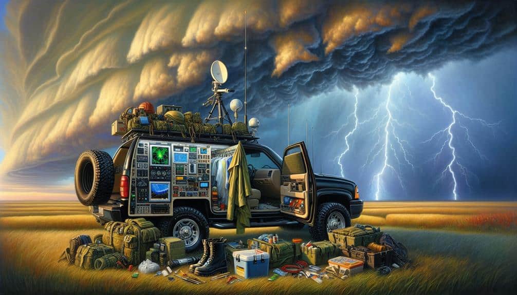
Storm Chaser Vehicles
As we leverage advanced radar systems to predict and track severe thunderstorms, our storm chaser vehicles, equipped with cutting-edge tools, play a pivotal role in gathering on-the-ground data and validating our forecasts. These vehicles are meticulously modified to withstand extreme weather conditions, ensuring both safety and functionality during storm interception.
Our vehicle modifications include reinforced frames and roll cages to protect against debris, as well as specialized tires for enhanced traction on wet or muddy terrain. High-speed capabilities are essential; as a result, we use turbocharged engines to make sure we can keep pace with fast-moving storms.
Additionally, our vehicles are outfitted with anemometers, barometers, and other meteorological instruments, enabling real-time storm tracking and data collection.
Incorporating radar systems within the vehicles allows us to monitor storm developments on the move, providing immediate feedback for adjustments in our interception strategies. These modifications and tools are crucial for obtaining precise measurements of wind speeds, pressure changes, and precipitation rates, which are vital for improving our predictive models.
Meteorological Drones
Meteorological drones have revolutionized our ability to collect high-resolution atmospheric data from within severe thunderstorms. By deploying sophisticated drone technology, we can now gather critical metrics such as wind speed, temperature, humidity, and barometric pressure directly from storm cores, areas too dangerous for manned aircraft. This capability allows for real-time monitoring, providing us with unprecedented insights into storm dynamics and behavior.
These advanced drones are equipped with sensors that deliver immediate feedback to ground-based systems. Real-time monitoring is pivotal for tracking rapid changes within a storm, enabling us to predict severe weather events more accurately. For instance, sudden shifts in wind patterns, often precursors to tornado formation, can be detected and analyzed on the fly.
Moreover, drone technology enhances our spatial coverage and temporal resolution. Traditional weather balloons and radar systems, while effective, have limitations in maneuverability and data granularity. Drones, on the other hand, can navigate precisely through storm layers, capturing data at various altitudes and locations within the storm system. This multidimensional data collection helps us refine our predictive models, ultimately improving public safety and preparedness.
In essence, meteorological drones represent a significant leap forward in our storm interception toolkit, ensuring we stay ahead in the race against nature's most formidable forces.
Advanced Meteorological Techniques

We leverage Doppler radar innovations to measure storm velocity and precipitation intensity with unprecedented accuracy.
By integrating real-time satellite data, we can track storm development and movement on a global scale.
These advanced meteorological techniques enable us to predict severe weather patterns more reliably and issue timely warnings.
Doppler Radar Innovations
Doppler radar innovations have transformed our ability to predict severe thunderstorms with exceptional accuracy and speed. By leveraging innovative technology, we've enhanced radar capabilities to detect storm patterns, wind speeds, and precipitation levels with remarkable precision. Modern Doppler radar systems now utilize dual-polarization techniques, allowing us to distinguish between rain, hail, and snow, offering a thorough meteorological snapshot.
Our advanced radar capabilities enable us to pinpoint the exact locations of severe weather phenomena, providing vital lead time for warnings and preparations. For example, phased array radar systems notably reduce scan times, offering near real-time data that's essential for quick decision-making. This level of detail empowers us to issue timely alerts, potentially saving lives and reducing property damage.
Moreover, we integrate data from multiple Doppler radar stations, creating a composite image that enhances our understanding of storm dynamics over larger areas. This networked approach guarantees we capture the full scope of a thunderstorm's development and trajectory. By continuously enhancing these technologies, we push the limits of meteorological science, revealing new insights and ensuring enhanced public safety.
The ability to explore these advancements propels our unwavering pursuit of excellence in weather prediction.
Satellite Data Utilization
Leveraging high-resolution satellite data, we can monitor and analyze severe thunderstorms with unprecedented detail and accuracy. Satellite imagery provides us with a panoramic view that ground-based systems simply can't match. This data is pivotal for real-time analysis and forecasting, equipping us with the tools to decode the intricate dynamics of severe weather events.
Through meticulous data interpretation, we convert raw satellite imagery into actionable insights. This involves analyzing visible, infrared, and water vapor channels to understand the vertical structure of storms. By doing so, we can identify key features like overshooting tops and anvil clouds, indicators of severe convection and potential tornado formation.
Our ability to synthesize this data into predictive models enhances our capacity to issue timely warnings and mitigate risk. As we push the boundaries of satellite technology, we empower ourselves with the freedom to anticipate and respond to severe thunderstorms with greater efficacy.
- High-Resolution Imaging: We can visualize storm development and movement in near real-time.
- Cloud Top Temperature: By analyzing thermal data, we can infer storm intensity and potential severity.
Safety Protocols
In the face of severe thunderstorms, our safety procedures prioritize real-time data analysis and swift response measures to minimize risk. By leveraging advanced meteorological tools, we guarantee our emergency response is both timely and efficient. Real-time data feeds from radar and satellite imagery enable us to predict storm trajectories with high precision, allowing for well-informed decisions. When severe weather is imminent, our first action is to issue alerts through multiple communication channels, making sure the public receives timely warnings.
We implement detailed evacuation plans that are dynamically updated based on evolving storm data. These plans include designated evacuation routes and shelters equipped to handle large populations. Coordination with local authorities is essential, as it ensures seamless execution and minimizes chaos. We also conduct regular drills to test our procedures, identifying and rectifying any weaknesses.
In addition, our protocols include ongoing monitoring and post-event analysis. We gather data to improve future responses, enhancing our ability to protect lives and property. By combining analytical insight with real-time data, we provide a thorough framework for severe thunderstorm interception, guaranteeing the freedom and safety of our communities.
Data Collection Methods

To make sure we intercept severe thunderstorms effectively, we employ a variety of advanced data collection methods that provide accurate, real-time information. Our approach guarantees we can anticipate and respond to dynamic weather patterns with precision.
We utilize a combination of advanced technologies to enhance our storm tracking capabilities:
- Doppler Radar Systems: These systems allow us to detect wind speed and precipitation intensity within storm cells, offering vital insights into storm behavior.
- Satellite Imagery: High-resolution satellite data helps us monitor large-scale weather patterns and identify potential thunderstorm development areas.
By integrating these methods, we can identify severe weather patterns early and track storm movements with a high degree of accuracy. Each data collection method complements the others, painting a detailed picture of the storm environment.
This integrated approach not only enhances our storm tracking abilities but also guarantees we can act swiftly and decisively.
Our commitment to using cutting-edge technology in tracking and analyzing severe thunderstorms reflects our dedication to ensuring safety and preparedness in the face of nature's most formidable phenomena.
Analyzing Storm Data
We meticulously scrutinize storm data to extract actionable insights that drive our decision-making processes. By leveraging advanced storm tracking technologies, we capture real-time data on variables such as wind speed, atmospheric pressure, and precipitation rates. These data points allow us to build detailed models that predict storm behavior with high accuracy.
Our data analysis techniques involve a multi-layered approach. First, we use machine learning algorithms to identify patterns and anomalies in the data. This helps us pinpoint areas where severe weather events are likely to develop. Next, we cross-reference this information with historical storm data to validate our predictions. By doing so, we refine our models and improve their reliability.
Freedom in decision-making comes from our ability to quickly interpret these analyses and implement preventative measures. For instance, when our models indicate a high probability of a severe thunderstorm, we can issue timely alerts and deploy resources to mitigate potential damage. Our analytical processes aren't just about understanding the storm; they're about empowering us to act decisively and protect communities.
In essence, our commitment to accurate and thorough data analysis ensures that we stay ahead of the storm, safeguarding both lives and property.
Frequently Asked Questions
How Do Severe Thunderstorms Affect Local Wildlife and Ecosystems?
Imagine a forest as a symphony; severe thunderstorms disrupt the harmony, affecting wildlife impacts and ecosystems. Biodiversity suffers, yet some species adapt, showcasing nature's resilience. Such disruptions highlight the need for adaptive strategies in conservation efforts.
What Role Do Government Agencies Play in Severe Thunderstorm Interception?
We rely on government involvement for storm monitoring, ensuring precise data collection and timely warnings. Their analytical insight helps us prepare and respond effectively, balancing public safety with the freedom to make informed decisions during severe thunderstorms.
Can Climate Change Influence the Frequency of Severe Thunderstorms?
We grasp the delicate balance nature holds. Climate change can indeed alter storm intensity, affecting severe weather and shifting precipitation patterns. Increased atmospheric energy might lead to more frequent and intense thunderstorms, demanding our analytical insight and adaptive strategies.
How Can the Public Contribute to Storm Data Collection Efforts?
We can boost storm data collection through community involvement and citizen science. By reporting weather conditions via apps and participating in local meteorological projects, we enhance data precision and contribute valuable insights for better storm prediction and response.
What Are the Economic Impacts of Severe Thunderstorms on Communities?
Imagine the heartache of seeing our homes shattered—severe thunderstorms wreak havoc causing infrastructure damage and property loss. Emergency response costs skyrocket, yet our community resilience shines, proving freedom thrives even in adversity's face.