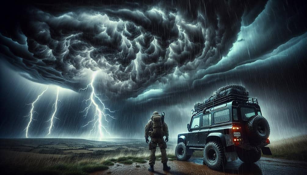
We rely on a combination of advanced meteorological instruments, such as Doppler radar, mobile mesonets, and satellite imagery for intercepting severe thunderstorms. These tools help us analyze weather data, track storm movement, and predict behavior in real-time. Using GIS and machine learning models, we map out routes, ensuring dynamic adjustments based on live data. Our strategies include precise timing for interception and strict adherence to safety protocols, such as identifying emergency shelters and having evacuation plans. Effective team communication and coordination enhance data collection and safety measures. By prioritizing these methods, we can improve our storm interception accuracy. Discover how we refine these tactics scientifically.
Key Points
- Utilize Doppler radar and satellite imagery for real-time tracking and storm intensity analysis.
- Equip with reliable meteorological instruments, GPS units, and satellite communication for accurate data collection and precise positioning.
- Analyze radar reflectivity patterns and dual-polarization data to identify hail cores and precipitation types.
- Plan routes using GIS integration, real-time weather updates, and historical storm patterns for safe navigation.
Choosing the Right Equipment
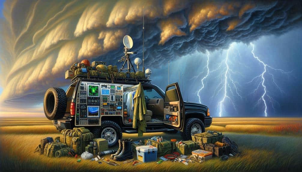
When intercepting severe thunderstorms, we must make certain our equipment is both reliable and equipped with advanced meteorological instruments to gather accurate data. Our primary concern during equipment selection is the precision and durability of our devices.
High-resolution Doppler radar systems and mobile mesonet units are essential for storm tracking, providing real-time data on wind patterns, precipitation, and storm intensity.
As storm chasers, we rely heavily on GPS units and satellite communication to maintain our positions relative to the storm. These tools guarantee we can track the movement of thunderstorms accurately and adjust our course as needed. Additionally, we must equip ourselves with anemometers to measure wind speed and barometers to monitor atmospheric pressure changes.
Safety gear is non-negotiable. Helmets, reinforced vehicle windows, and emergency medical kits are necessary to protect ourselves while in the field. We also use weather-resistant laptops and data loggers, so our data collection isn't compromised by harsh conditions.
Portable power sources and redundant systems are vital to avoid any loss of data due to equipment failure.
Analyzing Weather Data
To effectively intercept severe thunderstorms, we must analyze weather data with precision.
We'll utilize satellite imagery for real-time cloud pattern analysis and interpret radar data to track storm cell movements and intensity.
Satellite Imagery Utilization
Leveraging high-resolution satellite imagery, we can precisely analyze weather patterns and predict severe thunderstorms with greater accuracy. By observing cloud patterns, we identify early signs of storm formation and evolution. The data provided by satellites enables us to track storm movements in real-time, offering a detailed view of the atmosphere's dynamic processes.
Satellites such as the GOES-R series provide invaluable geostationary data, capturing images every five minutes. This frequency allows us to monitor the rapid development of cumulonimbus clouds, which are often precursors to severe weather events. By analyzing these cloud formations, we can recognize the vertical growth indicative of thunderstorm potential.
Furthermore, satellite-based infrared imagery helps us detect temperature variations at different atmospheric levels. Cooler cloud tops generally signify strong updrafts, a key factor in storm intensity. By integrating this thermal data, we enhance our storm tracking capabilities, accurately predicting the path and potential impact zones.
The use of multispectral satellite sensors also aids in differentiating between various cloud types and moisture contents, refining our understanding of storm systems. Through these advanced techniques, we empower ourselves with the knowledge to anticipate severe weather, ultimately safeguarding lives and property.
Radar Data Interpretation
Radar data offers us a powerful tool to analyze precipitation intensity, storm structure, and movement with remarkable precision. By utilizing Doppler radar technology, we can track the velocity of raindrops, enabling accurate storm tracking. This data is invaluable for predicting the trajectory and potential impact zones of severe thunderstorms. We focus on reflectivity patterns to determine precipitation intensity and identify potential hail cores, which are critical indicators of storm severity.
For effective data analysis, we rely on algorithms that process radar returns to generate detailed visual representations of storm cells. By interpreting these visuals, we can distinguish between different types of precipitation, such as rain, snow, and hail. Additionally, radar data allows us to detect phenomena like mesocyclones and tornado signatures, which are essential for issuing timely warnings.
Furthermore, dual-polarization radar enhances our ability to discriminate between precipitation types and assess storm structure more accurately. This advanced technology provides us with a thorough understanding of storm dynamics, enabling us to make informed decisions about storm interception strategies.
Mapping Out Routes
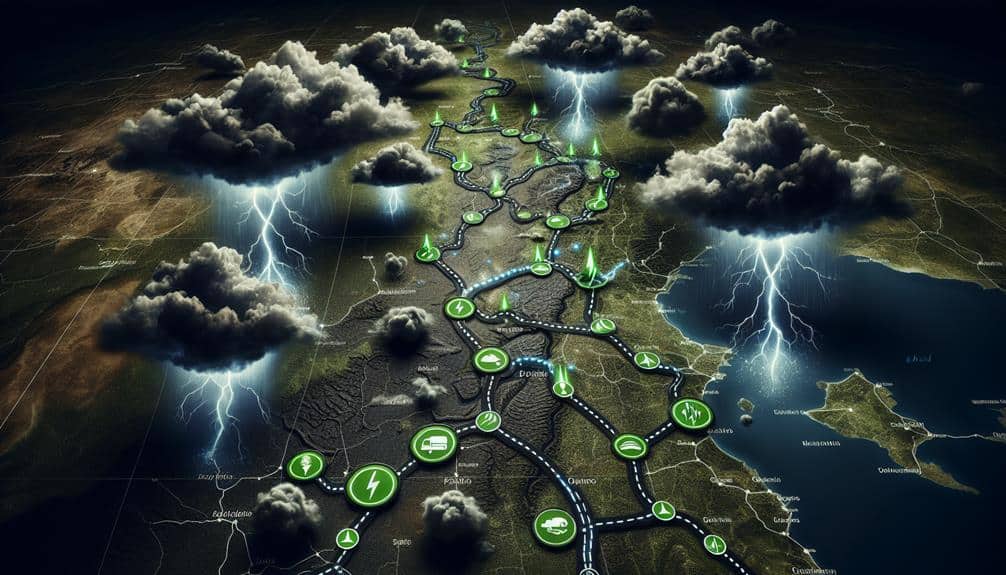
To effectively intercept severe thunderstorms, we rely on real-time weather updates from radar and satellite data. These updates allow us to dynamically adjust our planned routes, ensuring we can position ourselves strategically.
Additionally, we'll prepare alternate routes to account for sudden changes in storm trajectories and other unforeseen variables.
Real-time Weather Updates
Accurate real-time weather updates enable us to map out best routes and avoid severe thunderstorms effectively. By leveraging advanced storm tracking systems, we can monitor weather patterns with precision, thereby enhancing our emergency response capabilities.
Meteorological experts utilize sophisticated tools like Doppler radar and satellite imaging to provide continuous updates. These real-time insights are essential for devising strategies that prioritize safety and efficiency.
Thanks to robust communication protocols, we can disseminate critical information rapidly. Automated alerts and data feeds guarantee that our teams are well-informed, enabling quick decision-making. When we integrate this data with Geographic Information Systems (GIS), we can visualize storm trajectories and potential impact zones, further refining our route planning.
Moreover, the integration of machine learning algorithms helps us predict storm behavior, making our responses even more proactive. Historical data combined with real-time inputs allows for accurate forecasting, reducing the risks associated with severe weather conditions.
We can't emphasize enough how essential these updates are for maintaining operational freedom while ensuring safety. By staying informed and prepared, we can navigate around severe thunderstorms, minimizing disruptions and safeguarding both lives and assets.
Alternate Route Planning
Effective alternate route planning hinges on our capacity to analyze real-time meteorological data and historical storm patterns, guaranteeing best safety and efficiency in our navigational strategies. By integrating Doppler radar, satellite imagery, and predictive models, we can dynamically adjust our course to avoid severe weather conditions.
Key to this approach is the use of Geographic Information Systems (GIS), which allow us to map out precise routes and identify potential hazards in real time.
Incorporating emergency shelter locations into our route planning is critical. Knowing where these shelters are situated helps us make quick decisions if conditions deteriorate rapidly. Additionally, having pre-established evacuation plans in place guarantees that we're not caught off guard. These plans should be flexible, accounting for varying storm trajectories and intensities.
Our goal is to maintain the freedom to move safely and efficiently, even when nature is at its most unpredictable. By leveraging data-driven insights and incorporating robust contingency plans, we can navigate around severe thunderstorms with confidence.
This approach not only maximizes safety but also assures we can continue our operations with minimal disruption, reinforcing our commitment to preparedness and resilience.
Timing the Interception
Precise timing for intercepting severe thunderstorms relies on real-time data from Doppler radar and satellite imagery. As storm chasers, we rely on advanced tracking technology to pinpoint the storm's location, velocity, and potential development patterns.
Doppler radar provides us with critical data on wind speeds and precipitation intensity, while satellite imagery offers a broader view of cloud formations and storm movement.
Effective storm spotting requires a combination of these tools and robust communication methods. We utilize mobile apps and GPS to share our positions and storm observations with fellow chasers. This collaborative data stream ensures we can adjust our routes dynamically based on the storm's behavior.
Radio communication also plays an essential role, especially in areas with limited mobile coverage, enabling us to maintain constant contact and share updates rapidly.
Timing the interception involves analyzing the storm's trajectory and estimating its future path using meteorological models. We must position ourselves at a safe distance where we can observe and document the storm without being in immediate danger.
Safety Precautions

Securing our safety during storm chasing requires adherence to strict protocols and ongoing monitoring of changing weather conditions. We must first establish thorough storm preparedness, which includes identifying potential emergency shelters along our route. These shelters should be sturdy structures capable of withstanding high winds, heavy rain, and hail.
Our evacuation plans must be detailed and flexible, allowing us to quickly adapt to rapidly changing storm paths. This includes pre-determined exit routes and contingencies for road closures or other unforeseen obstacles. It's crucial to regularly update these plans based on real-time meteorological data.
When it comes to lightning safety, we need to be vigilant. Lightning strikes are a significant risk during thunderstorms, and we should avoid open fields, isolated trees, and tall structures. Staying inside our vehicle with windows closed can offer some protection, as the metal frame acts as a Faraday cage.
We also utilize advanced storm tracking technology, such as Doppler radar and satellite imagery, to predict and respond to severe weather. Ongoing communication with meteorological services ensures we're informed about any sudden developments.
Collaborating With Teams
Collaboration with other storm chasing teams enhances our data collection capabilities and improves overall safety. Effective team communication and coordination are pivotal when intercepting severe thunderstorms. By pooling our resources, we can share real-time meteorological data, including radar readings, wind speeds, and humidity levels. This collective approach allows us to cover a broader area and gather more extensive data sets.
Resource sharing is another critical aspect of our collaborative efforts. We can deploy various instruments and vehicles strategically, making sure that each team member has access to the necessary tools without redundant overlap. For instance, one team may focus on deploying doppler radar systems while another handles drone-based atmospheric sampling. This delegation of tasks maximizes efficiency and minimizes risk.
Coordination extends beyond just data collection. By synchronizing our movements, we can avoid congested routes and potential hazards, enhancing our overall safety. Regular check-ins via radio or digital communication platforms make sure everyone is on the same page, allowing us to make quick, informed decisions in dynamic weather conditions.
In essence, our collaborative strategy leverages the strengths of each team, leading to more accurate weather forecasting and safer storm-chasing endeavors. Together, we navigate the complexities of severe weather with precision and confidence.
Frequently Asked Questions
How Do Severe Thunderstorms Typically Form?
When we talk about thunderstorm formation, we envision colossal clouds colliding, creating chaos. Severe thunderstorms typically form from complex weather patterns involving unstable air masses, moisture, and lifting mechanisms, resulting in towering cumulonimbus clouds and intense atmospheric disturbances.
What Are the Common Indicators of a Severe Thunderstorm?
We monitor common indicators of a severe thunderstorm like wind gusts exceeding 58 mph and frequent lightning detection. These data points provide us with the freedom to predict and respond effectively to severe weather threats.
How Do Meteorologists Classify the Intensity of Thunderstorms?
We classify thunderstorm severity by analyzing meteorological intensity, categorizing them based on factors like wind speed, hail size, and tornado potential. This data-driven approach guarantees accurate assessment, empowering us to make informed decisions and stay safe.
What Are the Potential Risks of Intercepting Severe Thunderstorms?
Folks, let's discuss the potential dangers of intercepting severe thunderstorms. We're facing risks like hail, lightning, and tornadoes. Adhering to rigorous safety precautions, such as real-time data analysis and robust protective gear, is essential for minimizing these hazards.
How Do Severe Thunderstorms Impact the Environment and Local Communities?
Severe thunderstorms cause environmental damage, impacting ecosystems and local infrastructure. Community preparedness and emergency response are critical to mitigate economic impact. Effective data-driven strategies enhance resilience, ensuring our communities can recover and thrive post-storm.