Intercepting severe thunderstorms in mountainous regions allows us to collect essential real-time data, improving forecasting and public safety measures. These areas present unique challenges due to intricate terrain, which hampers radar signal propagation and storm tracking accuracy. Using advanced technologies such as ground-based sensors, mobile radar units, and unmanned aerial vehicles, we can overcome data gaps and rapidly changing weather conditions. High-detail models and localized weather stations assist in precise atmospheric condition assessments. This approach not only enhances our understanding of storm dynamics but also refines predictive models, ultimately safeguarding lives and property. Discover how these techniques advance our meteorological capabilities.
Key Points
- Enhances accurate storm forecasting and early warning systems to protect lives and property.
- Collects real-time data to improve understanding of storm dynamics in complex terrains.
- Advances scientific research and innovation in meteorological equipment and predictive models.
- Mitigates risks by improving emergency response and evacuation strategies.
Unique Challenges
One of the unique challenges of intercepting severe thunderstorms in mountainous regions is the intricate terrain, which can impede radar signal propagation and storm tracking accuracy. As we navigate these rugged landscapes, terrain navigation becomes critically important. High elevations and variable topography obscure radar signals, leading to data gaps that complicate real-time storm analysis. This necessitates alternative methods, such as ground-based observations and mobile radar units, to ensure thorough data collection.
In mountainous areas, our risk assessment must adapt to rapidly changing weather conditions and limited visibility. Storms can develop quickly, often with little warning, and their paths are unpredictable due to terrain influences. We must constantly evaluate the potential for flash flooding, landslides, and severe wind gusts, which are exacerbated by the region's topographical features. Accurate risk assessment in these conditions requires not only technological tools but also experiential knowledge of the terrain.
Moreover, the logistical challenges amplify the risks. Limited road networks and inaccessible areas can delay response times and hinder evacuation efforts. As a result, our strategies must include contingency plans for rapid deployment and emergency response.
Meteorological Insights
Analyzing meteorological data in mountainous regions requires integrating high-detail models and localized weather stations to accurately predict severe thunderstorm behavior. We must adopt advanced techniques to enhance forecast accuracy and improve storm prediction. Here are the key components:
- High-Detail Models: These models simulate atmospheric dynamics at finer spatial scales, capturing the complex interactions between terrain and weather systems. They help us predict localized severe weather events with higher precision.
- Localized Weather Stations: Deployed strategically across the mountainous terrain, these stations provide real-time data on temperature, humidity, wind speed, and atmospheric pressure. This granular information is essential for refining our models and forecasts.
- Remote Sensing Technologies: Utilizing satellites and radar systems, we gather detailed data on cloud formation, precipitation patterns, and storm development. This technology enhances our ability to track severe weather in real-time.
- Data Assimilation Techniques: By integrating observational data from multiple sources, we create a more accurate and cohesive picture of the atmospheric conditions. This fusion of data improves our predictive models and increases the reliability of our forecasts.
Safety Precautions
Prioritizing safety measures during severe thunderstorms in mountainous regions is vital to reduce the risks posed to both residents and meteorologists. We need to establish thorough emergency procedures to guarantee timely and effective responses.
Risk mitigation strategies must include real-time weather monitoring and early warning systems, allowing us to anticipate storm trajectories and intensities.
In mountainous areas, identifying and clearly marking evacuation routes is crucial. These routes should be mapped out in advance and made accessible through public information campaigns. Emergency shelters must be strategically located to provide refuge from the elements, fortified to withstand severe weather, and equipped with necessary supplies.
Data-driven analysis shows that rapid evacuation decreases injury rates by up to 50%. As a result, practicing regular evacuation drills enhances preparedness and response efficiency.
In addition, communication networks should be robust, ensuring that alerts reach even remote areas promptly.
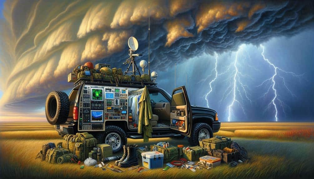
Equipment Needed
Let's focus on the equipment essential for intercepting severe thunderstorms in mountainous regions.
We'll need thorough safety gear, advanced tracking technology, and reliable communication tools to guarantee accuracy and safety.
Essential Safety Gear
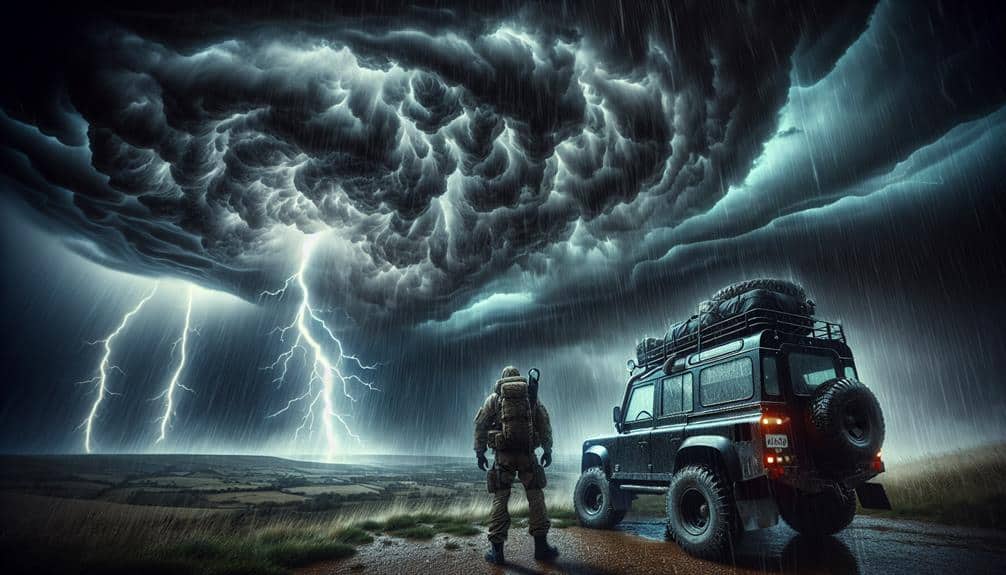
When preparing to intercept severe thunderstorms in mountainous regions, we must prioritize necessary safety gear to guarantee both our effectiveness and well-being during the mission. Severe weather conditions in these areas can be unpredictable and dangerous, so equipping ourselves with the right tools is vital.
First, an emergency shelter is non-negotiable. The terrain and weather can change rapidly, so having a portable, durable shelter ensures we've a safe refuge if conditions worsen.
Second, protective clothing is essential. We need gear that's waterproof, wind-resistant, and insulated to shield us from hypothermia and other weather-related hazards. This clothing should also be lightweight to secure mobility.
Third, we should carry a first aid kit. While this might seem basic, the mountainous environment can worsen minor injuries, making immediate treatment necessary. Our kit should include supplies for cuts, sprains, and other common injuries.
Fourth, a reliable communication device is crucial. Whether it's a satellite phone or a two-way radio, maintaining contact with our team and emergency services can be a lifesaver.
Here's a list of these necessary items:
- Emergency shelter
- Protective clothing
- First aid kit
- Communication device
Advanced Tracking Technology
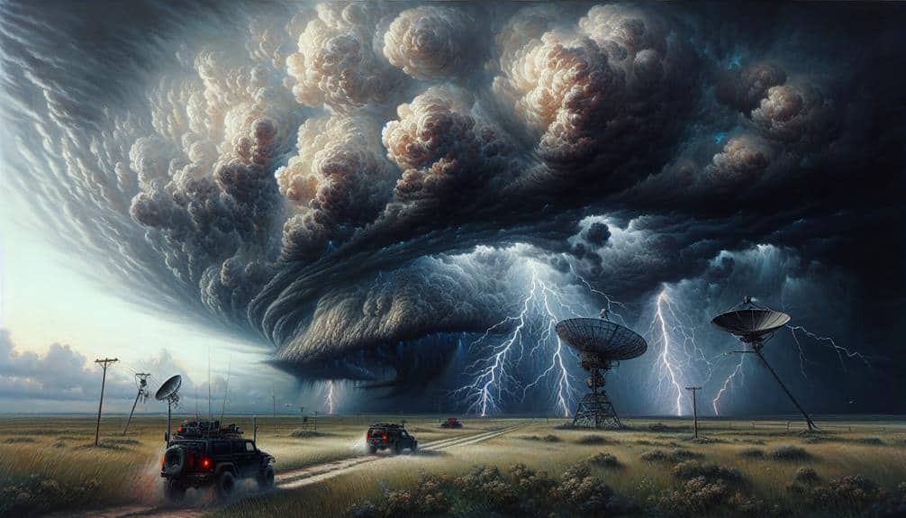
To effectively intercept severe thunderstorms in mountainous regions, we must equip ourselves with advanced tracking technology that provides real-time data and precise location information. Leveraging cutting-edge tools allows us to analyze weather patterns and predict storm movements with unprecedented accuracy. Our primary assets include Doppler radar systems, which measure wind velocity and precipitation intensity, and satellite imagery, offering a detailed view from above.
Aerial monitoring is crucial in these rugged terrains. Unmanned aerial vehicles (UAVs) equipped with meteorological sensors can gather high-resolution data on atmospheric conditions, enabling us to refine our storm prediction models. Additionally, mobile weather stations, which can be deployed swiftly in the field, provide localized data that enhances our understanding of microclimates in mountainous regions.
Terrain mapping is another essential component. Using LiDAR technology, we can generate detailed topographical maps, allowing us to assess how the mountainous landscape influences storm behavior. These maps are vital for determining safe observation points and potential escape routes.
Incorporating these advanced technologies not only enhances our ability to track and predict severe weather but also guarantees we can make informed, timely decisions. This data-driven approach empowers us to navigate the challenges of storm interception in mountainous regions effectively.
Reliable Communication Tools
Effective storm interception in mountainous regions necessitates an array of reliable communication tools to facilitate seamless coordination and data transmission. In such challenging terrains, real-time monitoring and swift emergency response become vital. We can't afford lapses in communication when every second is critical.
Here's a list of essential equipment we need:
- Satellite Phones: These provide robust connectivity where traditional cell networks fail. Real-time updates and emergency alerts can be transmitted without interruption, guaranteeing that all team members stay informed and responsive.
- Two-Way Radios: Ideal for short-range communication, especially in rugged areas where line-of-sight communication is essential. These radios support real-time monitoring by enabling quick, direct exchanges between field teams and command centers.
- Wireless Mesh Networks: Deploying these networks ensures data can be transmitted across multiple nodes, maintaining a resilient communication chain. This is vital for real-time data sharing and emergency response coordination, especially in areas with variable topography.
- GPS Tracking Devices: These devices allow precise location tracking of team members and equipment. Integrated with other communication tools, they enhance situational awareness and streamline coordination efforts, guaranteeing everyone remains connected and safe.
Data Collection Methods

Collecting accurate data on severe thunderstorms in mountainous regions requires deploying a combination of ground-based sensors, remote sensing technology, and mobile storm-chasing units.
Ground-based sensors offer real-time data on meteorological variables such as temperature, humidity, and wind speed. These sensors are strategically placed at various altitudes to capture vertical profiles of the atmosphere, providing important data that inform predictive models.
Remote sensing technology, such as weather satellites and radar systems, plays a vital role in monitoring high-altitude phenomena. Satellites equipped with advanced imaging instruments can detect cloud formations, storm intensity, and precipitation patterns from space.
Doppler radar systems, on the other hand, enable us to measure storm velocity and precipitation rates with high precision, even in the challenging terrains of mountainous regions.
Mobile storm-chasing units are essential for obtaining ground-truth data. These units are equipped with portable meteorological instruments and high-resolution cameras, allowing us to capture data on storm dynamics and structure directly from the field.
Benefits and Risks
While our extensive data collection methods provide invaluable insights into severe thunderstorms in mountainous regions, it's essential to weigh both the benefits and risks associated with these approaches.
Our primary goal is to enhance predictive models and improve public safety, but we must be mindful of the inherent challenges.
Benefits:
- Enhanced Predictive Models: By intercepting storms, we gather real-time data, enabling more accurate forecasting and providing communities with advanced warnings.
- Public Safety: Improved storm tracking and prediction directly contribute to safeguarding lives and property in vulnerable mountainous regions.
- Scientific Knowledge: Each intercept expands our understanding of storm dynamics in complex terrains, which is pivotal for meteorological advancements.
- Technological Development: Field operations drive innovation in storm-chasing equipment and data analysis tools, benefiting the broader scientific community.
Risks:
- Safety Concerns: Intercepting storms in mountainous areas poses significant risks to the team, requiring meticulous risk assessment and strategic positioning.
- Resource Allocation: High costs associated with field operations can strain budgets, necessitating careful planning and prioritization.
- Environmental Impact: Frequent operations might disturb local ecosystems, necessitating a balance between data collection and environmental preservation.
- Data Reliability: Mountainous terrain can interfere with instruments, potentially compromising the quality of collected data.
Frequently Asked Questions
How Do Local Communities React to Storm Chasers in Mountainous Areas?
We've observed that community perceptions of storm chasers are mixed. While some appreciate the data collected for tourist safety during mountain storms, others express concerns about the potential risks and disruptions caused by their presence.
Are There Any Famous Historical Instances of Mountain Storm Interception?
Coincidentally, one of the most famous storm chasers, Dr. Fujita, documented historical successes in mountainous regions. His work had a substantial impact on locals, providing vital data for future storm chasers. These efforts continue to benefit mountainous communities.
How Do Animals in Mountainous Regions Behave During Severe Thunderstorms?
During severe thunderstorms, we observe wildlife exhibiting specific survival behaviors. Animals seek safety by finding shelter in caves or dense vegetation. This animal behavior is essential for their survival, minimizing exposure to harsh weather conditions.
What Is the Economic Impact of Severe Thunderstorms in Mountainous Regions?
The economic consequences of severe thunderstorms in mountainous regions include significant infrastructure damage and crop losses. Our emergency response systems face increased strain, requiring substantial resources and coordination to mitigate the adverse effects on local economies and communities.
How Can Amateur Meteorologists Get Involved in Storm Interception Activities?
To get involved, we recommend amateur meteorologists pursue training programs; they're the keys to the kingdom. These programs offer essential meteorologist training and storm spotting opportunities, allowing us to safely and effectively contribute to storm interception activities.