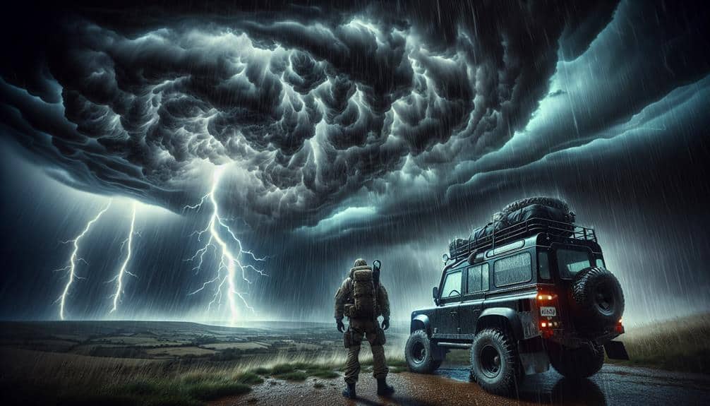
When chasing severe thunderstorms in rural areas, we must meticulously prepare and employ advanced strategies to guarantee both safety and efficient data collection. We should equip ourselves with first aid supplies, flashlights, non-perishable food, and water. Before heading out, let's confirm our vehicle is in prime condition and carry reliable communication tools like two-way radios. Utilizing radar tracking and satellite imagery provides real-time storm data, while physical maps serve as backups. Effective communication with local authorities and community engagement enhance our preparedness. Positioning cameras strategically and following strict safety protocols during filming optimizes data collection. More systematic techniques await exploration.
Key Points
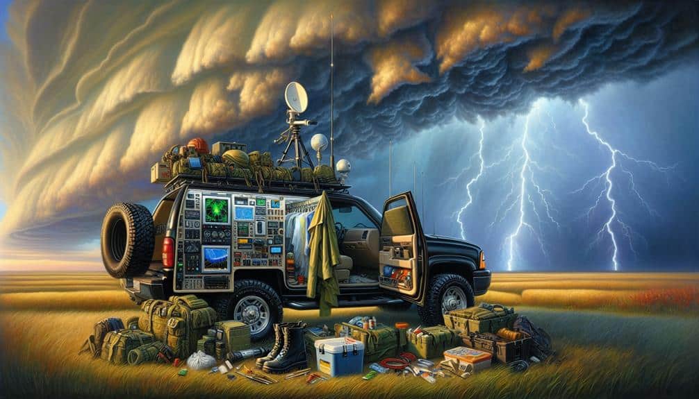
- Pack an emergency kit with first aid supplies, flashlights, non-perishable food, water, and a multi-tool.
- Utilize real-time storm data from radar tracking and satellite imagery for accurate weather forecasting.
- Conduct a thorough vehicle check-up including tire pressure, battery, and fuel before starting the chase.
- Establish communication protocols with local authorities and use two-way radios or satellite phones.
Essential Gear Checklist
When chasing severe thunderstorms in rural areas, we must make sure our gear checklist is detailed and meticulously prepared.
First, let's talk about emergency supplies. We can't afford to be caught off guard, so a well-stocked emergency kit is essential. This should include first aid supplies, flashlights with extra batteries, non-perishable food, bottled water, and a multi-tool. Each item serves a specific purpose, ensuring we're ready for any unforeseen situation that might arise.
Next, vehicle maintenance is crucial. Our vehicle is our lifeline out there, so it needs to be in top condition. Before we even hit the road, we should conduct a thorough check-up. This includes inspecting tire tread and pressure, ensuring the battery is fully charged, and verifying that the fuel tank is full. Additionally, carrying spare tires, jumper cables, and essential fluids like oil and coolant can make all the difference if we encounter any mechanical issues.
Safety Precautions
Alongside having the right gear and a well-maintained vehicle, we must diligently adhere to safety precautions to reduce the risks associated with chasing severe thunderstorms in rural areas. One important step is identifying emergency shelters along our route. Knowing where these safe havens are located allows us to react promptly if the storm intensifies beyond our control. We should mark these locations on our maps before setting out and remain vigilant about our proximity to them during the chase.
Lightning safety is another vital consideration. When thunderstorms are severe, lightning strikes can pose a significant danger. We should remain inside our vehicles during lightning activity, as the metal frame can provide some protection. Avoid touching metal parts within the car and make sure all electronic devices are unplugged to prevent electrical surges.
Moreover, it's essential to maintain constant communication. Using two-way radios or satellite phones ensures we can call for help if cellular networks fail. Additionally, we should always inform someone about our planned route and expected return time.
Weather Forecasting Tools
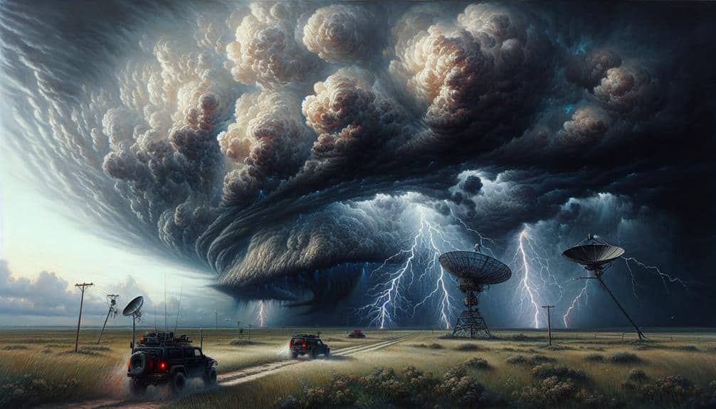
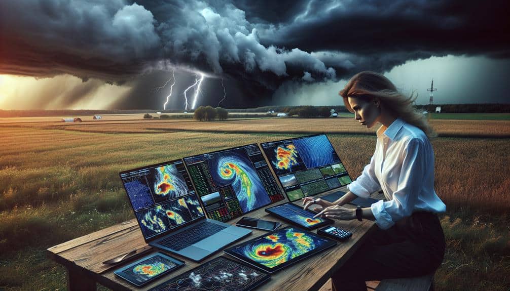
We rely on an array of advanced weather forecasting tools to accurately predict severe thunderstorms and plan our chase routes effectively. At the forefront of our toolkit is radar tracking, which provides real-time data on storm intensity, movement, and structure. Radar systems like Doppler radar can detect wind patterns and precipitation, allowing us to pinpoint areas of severe weather with precision. This information is vital for making split-second decisions during a chase.
Complementing radar tracking is satellite imagery. High-resolution satellite data offers a broad view of atmospheric conditions, covering cloud formations, temperature, and moisture levels across vast regions. Geostationary satellites, such as the GOES series, deliver continuous monitoring, helping us track the development and progression of storm systems from their nascent stages to full maturity.
Together, radar tracking and satellite imagery form a thorough forecasting strategy. By analyzing these data sources, we can identify potential severe weather events well in advance. This enables us to chart ideal routes, avoiding unnecessary risks and maximizing our chances of capturing the most dramatic storm footage.
Our ability to interpret and act on this detailed meteorological information is what sets us apart in the high-stakes world of storm chasing.
Traversing rural roads demands careful planning and real-time adjustments to guarantee our safety and success during severe thunderstorm chases. First, we need to assess road conditions. Many rural roads may be unpaved or poorly maintained, turning into mud traps under heavy rain. It's essential to check weather updates and use reliable GPS systems that account for real-time road closures or hazards.
We should also familiarize ourselves with rural landmarks. Grain silos, water towers, and barns can serve as navigation aids when digital tools fail. These landmarks help us maintain orientation in areas with sparse road signage.
Navigation tips include carrying physical maps as backups. Digital devices can lose signal or battery power. Marking potential shelter locations in advance, such as community centers or schools, can save valuable time during emergencies.
Having emergency contacts is non-negotiable. Share our planned routes and check-in times with a trusted person who can alert authorities if we go off-grid. Additionally, keeping local emergency service numbers handy ensures prompt assistance if we encounter trouble.
Communicating With Local Authorities
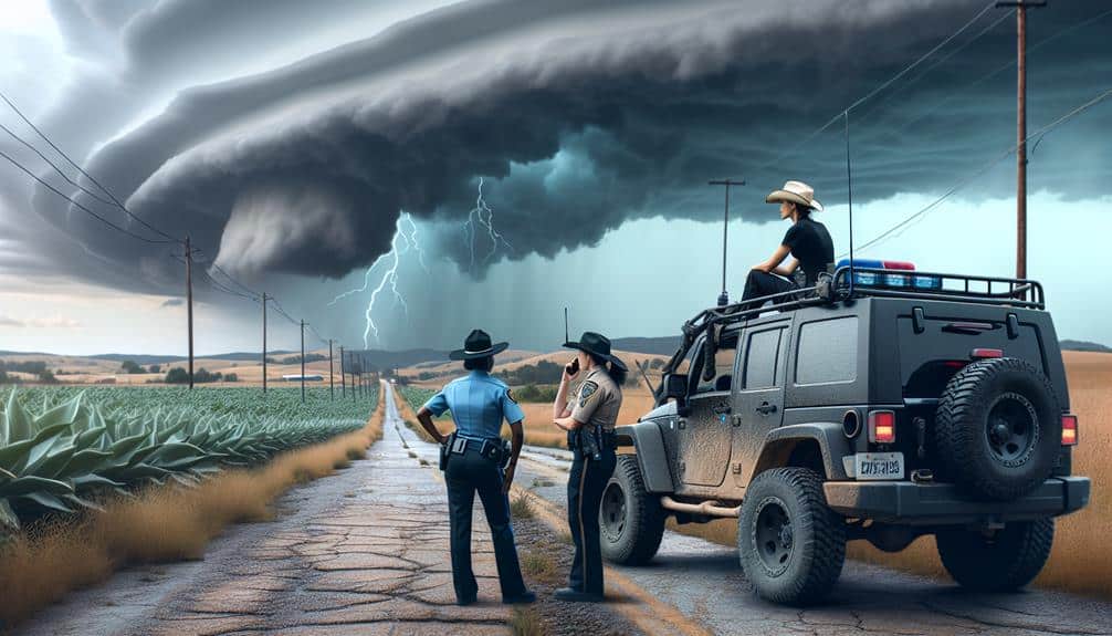
To guarantee effective collaboration with local authorities, we must establish clear contact protocols and utilize local communication channels.
By sharing real-time weather data, we can provide them with critical information for timely decision-making.
This coordination enhances our ability to track severe thunderstorms while prioritizing public safety.
Establishing Clear Contact Protocols
Frequently, establishing clear contact protocols with local authorities is essential for guaranteeing timely and accurate communication during severe thunderstorms in rural areas. To effectively manage emergency response and foster community engagement, we must outline specific procedures that inform local authorities of our activities and anticipated movements.
First, we should identify key contact points within local emergency response teams, including police, fire departments, and emergency medical services. Having direct lines of communication guarantees that we can relay critical information swiftly. We must document and share our contact details, vehicle descriptions, and planned routes with these authorities to avoid misunderstandings and guarantee our safety.
Next, we should schedule regular check-ins. By establishing predetermined intervals for communication, we provide updates and receive real-time information about storm developments. This proactive engagement helps local authorities coordinate their resources more efficiently and enhances overall community safety.
Additionally, incorporating clear, concise communication protocols—such as using standardized terminology and maintaining a log of all interactions—guarantees that information is accurately exchanged. This structured approach not only aids in our storm-chasing efforts but also strengthens our relationship with the community.
Utilizing Local Communication Channels
Building on our established contact protocols, we now focus on leveraging local communication channels to enhance our coordination with local authorities during severe thunderstorms. By tapping into these channels, we can guarantee timely exchange of critical information and bolster our storm-chasing efforts while maintaining safety and efficiency.
First, we should integrate with community networks. These networks often have direct lines to local emergency services and can disseminate emergency alerts swiftly. They also provide grounded insights into area-specific risks and safe zones.
Second, harnessing social media platforms is essential. Local authorities frequently post weather updates on these channels, which can be pivotal for real-time decision-making. Monitoring these feeds allows us to stay informed about changing conditions and local advisories.
Lastly, establishing a direct communication line with local emergency management offices ensures we receive official updates and can report our observations effectively. This two-way communication is crucial for mutual situational awareness.
Here's a concise action plan:
- Join Community Networks: Engage with local emergency groups and forums.
- Monitor Social Media: Follow local authority pages for real-time updates.
- Establish Direct Lines: Set up communication with local emergency management.
Sharing Real-Time Weather Data
How can we guarantee the seamless sharing of real-time weather data with local authorities to enhance our storm-chasing operations and public safety measures?
First, we need to establish robust communication channels that allow for instant data transfer. Utilizing platforms like mobile apps, satellite communication, and specialized weather monitoring networks guarantees that our storm tracking data reaches local authorities without delay.
Community engagement is essential. By actively collaborating with local stakeholders, we can integrate our real-time data into their emergency response frameworks. This cooperation not only amplifies the accuracy of weather alerts but also strengthens the community's overall preparedness.
Our data collection methods should be optimized for rapid dissemination. High-resolution radar scans, GPS tracking, and ground-based sensors offer precise weather monitoring capabilities. Sharing this data in a standardized format allows local authorities to make informed decisions swiftly.
Additionally, leveraging social media and dedicated communication channels, such as encrypted messaging groups, ensures that critical updates are accessible in real-time. By prioritizing these strategies, we can enhance the synergy between storm chasers and local authorities, ultimately bolstering public safety and community resilience during severe weather events.
Capturing Storm Footage
To capture high-quality storm footage, we must strategically position our cameras to maximize visibility while safeguarding our safety from potential hazards. Proper planning and execution are crucial to obtaining clear, dramatic visuals of severe weather phenomena.
First, maintenance of equipment is essential. Regularly inspect and clean lenses, sensors, and housings to prevent dust and moisture damage, which can impair image quality. Ensure batteries are fully charged and carry spares to avoid interruptions.
Second, employ precise editing methods to enhance the footage. Use software to adjust exposure, contrast, and color balance, bringing out the storm's intensity. Stabilize shaky clips and remove any artifacts to maintain a professional look.
Finally, consider these key steps for effective storm footage capture:
- Location Scouting: Identify vantage points free from obstructions, ensuring an unobstructed view of the storm's progression.
- Safety Protocols: Set up at a safe distance to avoid lightning strikes, high winds, and debris. Always have an escape route planned.
- Timing and Patience: Arrive early and be prepared to wait. Storms can be unpredictable, and the best footage often requires patience.
Analyzing Storm Data
Analyzing storm data requires us to meticulously examine meteorological parameters such as radar readings, wind patterns, and temperature fluctuations to accurately predict storm behavior and potential impact.
Our first step in data interpretation involves scrutinizing radar imagery. High-resolution radar helps us identify storm structures, such as mesocyclones or hook echoes, which can signify tornado formation. By tracking these features in real-time, we gain insights into the storm's trajectory and potential threats.
Understanding wind patterns is equally essential. We analyze wind shear and velocity data to gauge the storm's intensity and direction. Vertical wind profiles, obtained via weather balloons or Doppler radar, reveal how winds change with altitude, aiding in storm tracking. These profiles are vital for understanding the storm's rotation and updraft strength, key indicators of severe weather potential.
Temperature fluctuations play a pivotal role in storm development. By performing statistical analysis on temperature data, we identify trends and anomalies in weather patterns that could trigger severe storms. For instance, rapid temperature drops can indicate a cold front's approach, often a precursor to thunderstorm activity.
Combining these data points allows us to construct a detailed forecast, empowering us to make informed decisions while chasing severe thunderstorms.
Frequently Asked Questions
How Do I Join a Storm Chasing Group or Community?
Joining a storm chasing group? We start by joining online forums, embracing storm chaser etiquette. Safety precautions are essential. Building relationships comes next. With freedom-loving spirits, we'll connect, learn, and chase storms together, responsibly and effectively.
What Is the Best Time of Year to Chase Storms in Rural Areas?
We find the best time to chase storms in rural areas is spring through early summer when weather patterns are most active. During this period, let's make sure our storm chasing equipment is ready for the dynamic weather conditions.
Can Storm Chasing Be a Professional Career?
We could say storm chasing offers a unique income potential. With proper training and an educational background in meteorology, job opportunities exist. It's not just about thrill; it requires dedication and skill to turn into a professional career.
How Do I Fund My Storm Chasing Trips?
To fund our storm chasing trips, we can utilize crowdsourcing and fundraising platforms. Additionally, securing sponsorships and applying for grants from scientific and meteorological organizations can provide substantial financial support for our expeditions.
What Are the Legal Considerations for Storm Chasing?
We might think we're invincible storm chasers, but liability risks and insurance aren't just for the faint-hearted. Watch out for private property and trespassing laws; otherwise, we'll be chasing more than storms—like legal trouble.