In our Midwest storm intercept guide, we elaborate on selecting the appropriate gear such as high-definition cameras, dependable GPS, and robust tripods. We examine weather patterns, concentrating on atmospheric pressure, humidity, and wind shear for precise storm forecasts. Safety is crucial, so we outline procedures and vehicle lightning protection systems. Recognizing ideal spots in Kansas, Oklahoma, Nebraska, and Iowa boosts our likelihood of capturing severe weather. Effective team communication using Doppler radar and secure messaging guarantees synchronized efforts. For those interested in a methodical approach to storm chasing, our guide offers the data-driven insights necessary for successful interceptions.
Key Points
- Equip vehicles with high-definition cameras, sturdy tripods, and reliable GPS systems for effective storm documentation.
- Monitor atmospheric pressure, humidity, wind patterns, and temperature gradients to predict severe storm behavior accurately.
- Prioritize safety by identifying emergency shelters, using lightning protection, and maintaining constant communication with the team.
- Target prime storm chasing regions like central Kansas, the Oklahoma Panhandle, eastern Nebraska, and western Iowa for optimal storm intercept opportunities.
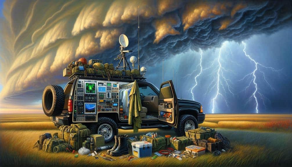
Choosing the Right Equipment
Selecting the right equipment is crucial for accurate data collection and safety during storm intercepts. Our vehicle becomes our command center, so ensuring it's in peak condition is non-negotiable. Regular vehicle maintenance, such as checking tire pressure, oil levels, and battery health, guarantees we avoid breakdowns when we're in the heart of a storm. We need to keep an emergency repair kit on hand, including spare tires, jacks, and basic tools.
Our cameras are equally critical. High-definition quality and optimal camera settings enable us to capture precise images, which are invaluable for analysis. We should configure our cameras for low-light conditions and rapid movement. Adjusting ISO settings, shutter speed, and aperture guarantees that we can capture clear, detailed images even in the most challenging weather. A sturdy tripod is essential to keep our shots steady amidst strong winds.
To sustain our freedom on the road, we should also have a reliable GPS system, weather radio, and data logging equipment. These tools help us navigate safely and collect accurate data.
Understanding Weather Patterns
Understanding weather patterns is essential for predicting storm behavior and making informed decisions during intercepts. When we investigate weather forecasting and storm tracking, we reveal the ability to anticipate severe weather events with precision. To excel in this, we must analyze multiple data points, including atmospheric pressure, humidity, and wind patterns.
- Atmospheric Pressure: Changes in atmospheric pressure often signal the development of storm systems. Low-pressure areas are particularly indicative of severe weather potential.
- Humidity Levels: High levels of moisture in the atmosphere can fuel thunderstorm formation. Monitoring dew points helps us predict storm intensity.
- Wind Patterns: The interplay of wind at different altitudes, known as wind shear, can either inhibit or enhance storm development. Identifying wind shear is vital for anticipating tornadoes.
- Temperature Gradients: Sharp temperature differences between air masses can create a volatile environment conducive to severe storms.
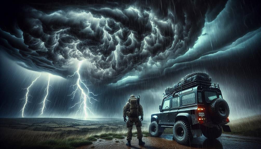
Safety Precautions
As we analyze weather patterns to anticipate severe storms, it's essential we also prioritize our safety measures to guarantee successful and secure intercepts. First and foremost, identifying potential emergency shelter locations is crucial. These shelters should be within a short driving distance from our intercept routes. Data indicates that proximity to emergency shelters can reduce response times by up to 50%, ensuring rapid refuge during escalating conditions.
We must also address lightning dangers, a prevalent threat in severe thunderstorms. According to the National Weather Service, lightning can strike up to 10 miles away from the storm center. To mitigate risks, we should equip our vehicles with lightning protection systems and avoid open fields or tall structures. The use of mobile radar data can aid in predicting lightning activity, allowing us to adjust our positioning accordingly.
Furthermore, constant communication is vital. By utilizing GPS tracking and real-time weather updates, we can maintain situational awareness and make informed decisions. Our storm chase teams should conduct regular safety drills, ensuring everyone is familiar with emergency protocols.
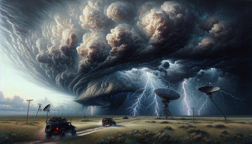
Best Midwest Locations
Ideal Midwest locations for storm intercepts are determined by analyzing historical weather data, storm frequency, and topographical features conducive to visibility and access. By leveraging this data, we can identify prime regions that maximize our chances for successful storm chasing and storm photography.
- Central Kansas: This area is renowned for its high frequency of severe thunderstorms, particularly supercells. The relatively flat terrain provides excellent visibility, making it easier to track and photograph storms.
- Oklahoma Panhandle: With a unique combination of frequent tornadic activity and open landscapes, this region allows us to intercept storms with minimal obstructions. The road network also facilitates quick repositioning.
- Eastern Nebraska: Historical data shows a consistent pattern of severe weather events here. The combination of river valleys and prairies provides varied backdrops for dramatic storm photography.
- Western Iowa: Known for its rolling plains, this location offers both elevated viewpoints and extensive road access, enhancing our ability to navigate and capture storm activity effectively.
Communicating With Team
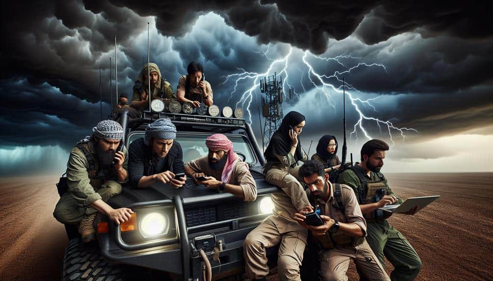
Effective communication with our team is crucial for coordinating storm intercepts and ensuring real-time data sharing during storm chases. We rely on a multi-channel communication setup, utilizing radio frequencies, mobile data networks, and satellite links to maintain constant contact. This redundancy in team communication guarantees we can relay critical updates about storm tracking even in areas with weak signals.
Using data from Doppler radar, GPS coordinates, and weather models, we provide real-time updates to our team members. Our communication protocol includes predefined codes and shorthand to minimize transmission time and avoid misunderstandings. For instance, we might use 'Tornado 5 miles NW' instead of a longer, more detailed report. This efficiency is crucial when seconds can make a difference in storm intercepts.
We also leverage advanced software platforms that integrate multiple data sources, allowing us to visualize storm paths and predict movements. These tools enable us to send precise, actionable information to all team members simultaneously. Tactical decisions, like repositioning or deploying probes, are discussed via encrypted messaging apps to prevent data leaks and maintain operational security.
Frequently Asked Questions
How Can I Predict the Timing of Storm Initiation?
We navigate the tempest's dance by mastering storm tracking techniques and weather radar analysis. Predicting storm initiation requires decoding atmospheric signals and leveraging technology, ensuring we seize the moment with precision and embrace the freedom of the chase.
What's the Best Way to Document My Storm Chase Experiences?
To document our storm chase experiences, we should use advanced photography tips, such as high-speed shutters and wide-angle lenses. Implement storm tracking techniques like GPS logging and radar to guarantee accurate data collection and detailed visual records.
Are There Any Specific Apps Useful for Storm Chasers?
When it rains, it pours; we rely on apps like RadarScope for detailed weather radar and My Lightning Tracker for real-time lightning alerts. These tools give us the freedom to chase storms effectively and safely.
What Is the Ideal Vehicle for Storm Chasing?
When selecting a storm chasing vehicle, we prioritize features like 4WD, reinforced windows, and advanced radar systems. These guarantee peak performance in severe weather conditions while maximizing safety and mobility for us, allowing greater freedom during intercepts.
How Do I Handle Encounters With Law Enforcement While Chasing?
When dealing with authorities, we must utilize proper communication. Present credentials, explain our safety protocols, and provide real-time data. This approach minimizes conflicts, ensuring our freedom to conduct storm chasing activities efficiently and legally.