We set out on the thrilling pursuit of severe thunderstorms across the Great Plains, armed with high-definition cameras, portable weather stations, and Doppler radar systems. We analyze atmospheric dynamics, focusing on wind shear, instability, and moisture content to predict and confirm tornadoes. Safety's paramount; we conduct thorough risk assessments and carry robust emergency supplies. Tracking storm movements requires real-time data from radar and satellites. Capturing the perfect shot means precise timing and positioning, maintaining situational awareness, and a solid understanding of storm behavior. Our journey combines scientific rigor and the adrenaline rush of nature's ultimate spectacle. For a deeper dive, keep exploring.
Key Points
- Utilize Doppler radar and satellite imagery for real-time storm tracking and navigation.
- Carry advanced meteorological instruments to analyze atmospheric dynamics and storm potential.
- Maintain robust emergency supplies and follow strict safety protocols to ensure personal safety.
- Position high-definition cameras at safe distances for capturing lightning and storm formations.
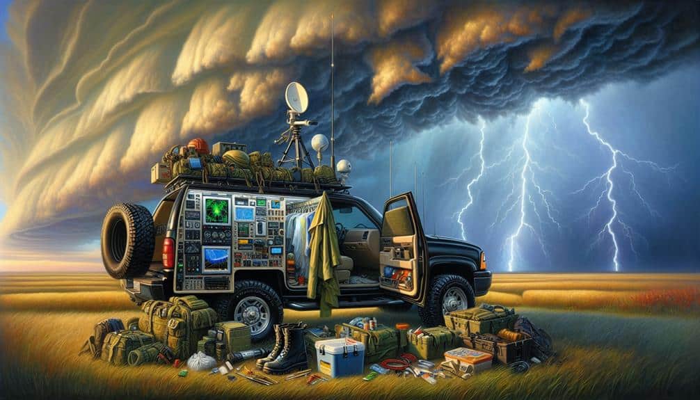
Essential Gear for Storm Chasing
For effective storm chasing on the Great Plains, we must equip ourselves with advanced meteorological instruments, high-definition cameras, and reliable communication devices.
Our toolkit begins with Doppler radar systems to monitor wind velocities and identify rotation in supercells. Portable weather stations, capable of measuring temperature, humidity, and barometric pressure, provide real-time data essential for forecasting storm behavior.
High-definition cameras are vital for documenting phenomena such as wall clouds, funnel clouds, and tornadoes. These images not only help us analyze storm structure but also serve as empirical evidence for scientific studies.
Furthermore, having a robust set of emergency supplies, including first aid kits, non-perishable food, and water, guarantees our safety during extended chases.
Communication devices are non-negotiable. Satellite phones and two-way radios maintain our connection with local weather services and fellow storm chasers, even in areas with limited cell coverage. GPS units with real-time tracking facilitate precise navigation and coordination, essential for avoiding hazardous storm paths.
Understanding Severe Weather Patterns
To understand severe weather patterns, we must analyze atmospheric dynamics. This includes wind shear, instability, and moisture content, which contribute to storm formation and intensity. Wind shear is the variation of wind speed and direction with altitude, playing a critical role in the development of supercell thunderstorms.
Instability, determined by temperature and humidity differences between the ground and the upper atmosphere, fuels the rising air currents essential for storm formation. Moisture content, often measured by dew point, provides the necessary humidity for cloud and precipitation development.
Examining these factors, we see how climate change exacerbates severe weather trends. Rising global temperatures increase atmospheric moisture, leading to more intense storms. Changes in long-term weather patterns also alter wind shear and instability profiles, driving more frequent and severe thunderstorms.
Witnessing the raw power of nature's fury, feeling the thrill of the chase.
Experiencing the adrenaline rush when data confirms a potential tornado.
Understanding the intricate dance of weather dynamics offers us true freedom.
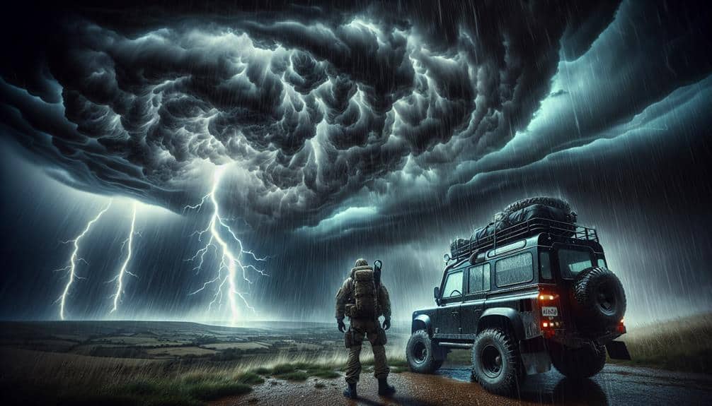
Safety Measures in the Field
While understanding severe weather patterns is vital, guaranteeing our safety in the field requires thorough preparation and adherence to strict protocols. We begin with detailed risk assessment, analyzing meteorological data to predict potential storm paths and intensities. This analysis includes evaluating radar signatures, atmospheric instability indices, and wind shear values. We need to understand the environment's dynamics to minimize exposure to hazardous conditions.
Emergency protocols are our lifeline. Our vehicles are equipped with advanced communication systems, first aid kits, and GPS tracking devices. In case of imminent danger, we establish predetermined escape routes and rendezvous points. We also maintain constant communication with local emergency services and weather stations for real-time updates.
Before heading out, we conduct equipment checks to ensure all devices are operational, from anemometers to barometers. Personal protective gear, such as helmets and reinforced clothing, is non-negotiable. We also monitor team member locations to avoid separation during high-risk moments.
In the field, situational awareness is paramount. We constantly reassess our position relative to the storm, adjusting as necessary to avoid core regions where hail, lightning, and tornadoes are most likely. By following these protocols and assessments, we can safely navigate the volatile Great Plains.
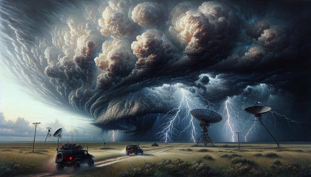
Tracking Storm Movements
We rely on Doppler radar, satellite imagery, and ground-based observations to pinpoint and track storm movements across the Great Plains. Utilizing storm radar, we can measure wind velocities within the storm, giving us real-time data on its intensity and trajectory.
Satellite imagery complements this by providing a broader view of cloud formations and temperature gradients, essential for predicting storm development. Ground-based observations are indispensable for verifying radar and satellite data. We often encounter sudden lightning strikes, which are both awe-inspiring and indicative of the storm's energy.
By synchronizing these data sources, we achieve a thorough understanding of storm dynamics, allowing us to predict movements with greater accuracy.
Our freedom to chase these storms hinges on accurate and timely information. Storm radar provides detailed insights into the storm's heart, while lightning strikes serve as immediate markers of activity. This multi-faceted approach ensures we're always one step ahead, navigating the Great Plains with precision and an unwavering spirit for adventure.
- The thrill of lightning illuminating the dark skies.
- The tension of tracking ever-evolving storm paths.
Capturing the Perfect Shot
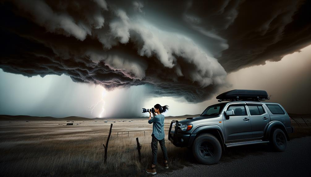
Capturing the perfect shot often demands a delicate balance of precise timing, best positioning, and a thorough understanding of storm behavior. We rely on real-time data from Doppler radar and satellite imagery to pinpoint the prime location.
When it comes to photographing lightning strikes, timing is everything. We use high-speed cameras with lightning triggers set to milliseconds to capture the exact moment a bolt illuminates the sky.
Positioning is equally vital. We aim to be at a safe distance, approximately 5 to 10 miles from the storm's core, to guarantee a clear line of sight. This distance also allows us to capture expansive cloud formations that add context and drama to our images. Supercells, with their towering cumulonimbus clouds, provide particularly breathtaking backdrops.
Understanding storm behavior is essential for anticipating the most photogenic moments. We analyze wind shear, humidity levels, and atmospheric instability to predict when and where the storm will peak in intensity. This scientific approach minimizes uncertainty and maximizes our chances of capturing that perfect shot.
Our goal isn't just to document the storm but to convey its raw power and beauty, offering a glimpse of nature's wild freedom.
Frequently Asked Questions
How Do Storm Chasers Communicate With Each Other in Remote Areas?
We utilize satellite technology and emergency beacons for reliable communication in remote areas. These tools guarantee we maintain constant contact, share precise data, and coordinate efficiently, enhancing our freedom to operate safely in challenging environments.
What Qualifications Are Needed to Become a Professional Storm Chaser?
To become professional storm chasers, we need meteorological knowledge and field experience. For example, completing a degree in meteorology and logging hours in severe weather conditions prepares us to analyze storm data and chase effectively.
How Do Storm Chasers Fund Their Expeditions?
We primarily fund expeditions through diverse funding sources, including grants and personal investments. Sponsorship opportunities from media organizations and research institutions also play an essential role in securing necessary resources for our scientific and exploratory endeavors.
What Impact Do Storm Chasers Have on Local Communities?
Some locals may worry, but storm chasers actually enhance community relationships by sharing scientific data. We prioritize safety precautions, aiding emergency response, and fostering a sense of adventure and freedom along the way.
Are There Any Ethical Considerations When Chasing Storms?
When considering ethical storm chasing, we must evaluate the environmental impact, safety concerns, legal ramifications, and public perception. Scientifically, minimizing habitat disruption and ensuring compliance with regulations are crucial for maintaining our freedom to chase responsibly.