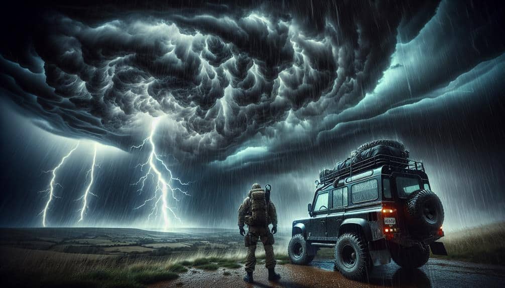
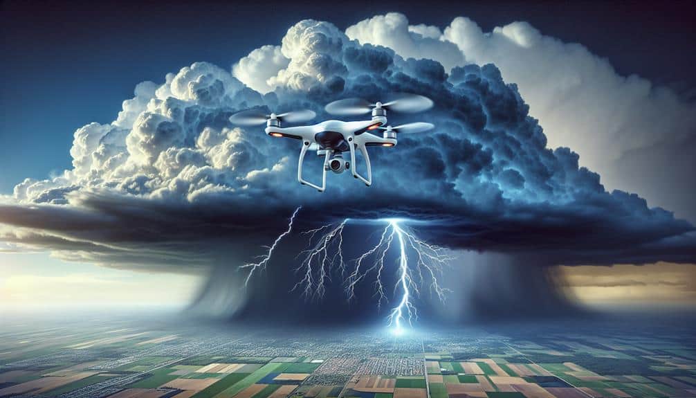
We use drones to intercept severe thunderstorms because they collect high-resolution, real-time meteorological data, enhancing safety and forecast accuracy. Drones equipped with sensors measure temperature, humidity, wind speed, and atmospheric pressure at various altitudes, allowing us to monitor storm dynamics closely. This timely data identifies patterns that signal dangerous phenomena like tornadoes. Strategically deploying drones in volatile storm areas maximizes data precision, improving coordination with emergency response teams while reducing human risk. Additionally, drones offer cost-effective, remote monitoring solutions inaccessible to manned aircraft, revolutionizing our approach to storm prediction and mitigation. To discover the full potential of drones in storm interception, keep exploring our insights.
Key Points
- Drones provide real-time, high-resolution meteorological data from severe thunderstorms, enhancing forecast accuracy.
- Remote monitoring with drones allows continuous data collection from inaccessible storm regions.
- Using drones reduces human exposure to dangerous weather conditions during storm interception.
- Drones offer a cost-effective alternative to traditional manned aircraft operations for storm analysis.
Enhanced Data Collection
By deploying drones equipped with advanced meteorological instruments, we can gather high-resolution, real-time data from within severe thunderstorms. This capability allows us to closely monitor weather patterns, enabling a more granular understanding of storm dynamics.
Drone technology, with its ability to navigate through turbulent conditions, provides unprecedented access to data points that are otherwise hard to obtain. We can precisely measure temperature, humidity, wind speed, and atmospheric pressure at various altitudes. This data is crucial for improving our predictive models of storm behavior.
By analyzing the collected information, we can identify patterns and anomalies that indicate the development of potentially dangerous weather phenomena, such as tornadoes or hailstorms. Moreover, the real-time data collection provides immediate insights, allowing meteorologists to issue more accurate and timely warnings.
This aspect of drone technology not only enhances our understanding of weather patterns but also empowers us to react more swiftly to imminent threats. The freedom to deploy these drones as needed, without the restrictions of fixed weather stations, represents a significant leap forward in meteorological research and public safety.
This precise, data-driven approach guarantees that we remain proactive in our efforts to mitigate the impacts of severe weather.
Increased Safety Measures
We can improve safety measures by leveraging real-time data collection and remote monitoring capabilities.
This allows us to implement precise response planning, minimizing risks associated with severe thunderstorms.
Real-Time Data Collection
Collecting real-time data with drones significantly improves our ability to implement increased safety measures during severe thunderstorms. By leveraging advanced sensors, we can conduct detailed analysis of storm systems, capturing vital metrics like wind speed, humidity, and temperature. This data allows us to make informed decisions quickly, ensuring that safety protocols are both timely and effective.
Our strategic deployment of drones enables us to position them in ideal locations, maximizing data collection while minimizing risk. Unlike traditional weather monitoring methods, drones can navigate directly into the most volatile parts of a storm, providing us with high-resolution data that ground-based systems can't match. This real-time information is essential for forecasting storm paths and intensities, allowing us to issue more accurate warnings and advisories.
Moreover, by having immediate access to these precise measurements, we can better coordinate with emergency response teams. This proactive approach reduces the likelihood of property damage and loss of life, empowering communities to take preemptive action.
Essentially, drones offer a faster, safer, and more thorough method for storm analysis, aligning perfectly with our goal of enhancing public safety while respecting individual freedom.
Remote Monitoring Capabilities
Leveraging remote monitoring capabilities through drones, we can greatly enhance safety measures during severe thunderstorms by obtaining continuous, high-fidelity data streams from otherwise inaccessible storm regions. These drones enable us to conduct real-time aerial surveillance, capturing detailed information on storm dynamics and weather patterns that would be impossible to gather from the ground.
By deploying drones equipped with advanced sensors, we can measure wind speeds, precipitation rates, and atmospheric pressure with remarkable precision. This data allows us to create accurate models of storm behavior, providing critical insights into the development and trajectory of severe weather events. Additionally, drones can operate in hazardous conditions without risking human lives, granting us a significant safety advantage.
Our ability to remotely monitor thunderstorms in real-time means we can track rapid changes in weather patterns, such as the formation of tornadoes or sudden shifts in storm intensity. This continuous data stream is essential for issuing timely warnings and implementing safety protocols.
Enhanced Response Planning
Implementing advanced response planning through the precise data collected by drones allows us to develop targeted safety measures that greatly reduce the risks posed by severe thunderstorms. By utilizing high-resolution meteorological data, we can improve response coordination and emergency preparedness, guaranteeing we're ready for any eventuality. Real-time drone surveillance enables us to pinpoint the exact locations where storms will hit hardest, allowing us to deploy resources efficiently and effectively.
Data-driven risk management is pivotal in our disaster response strategy. Drones provide us with critical, accurate information that informs our decision-making processes. This precision mitigates the uncertainties typically associated with severe weather events. By analyzing wind speed, precipitation levels, and storm trajectories, we can predict potential damage zones with heightened accuracy.
Moreover, the freedom to navigate and monitor vast, otherwise inaccessible areas ensures we're not restricted by traditional limitations. This capability enhances our situational awareness, allowing us to implement proactive measures that protect lives and property.
Advanced response planning, powered by drone technology, isn't just about reacting to storms but anticipating them. This forward-thinking approach transforms our disaster response, making it more agile, informed, and ultimately, more effective.
Real-Time Weather Analysis
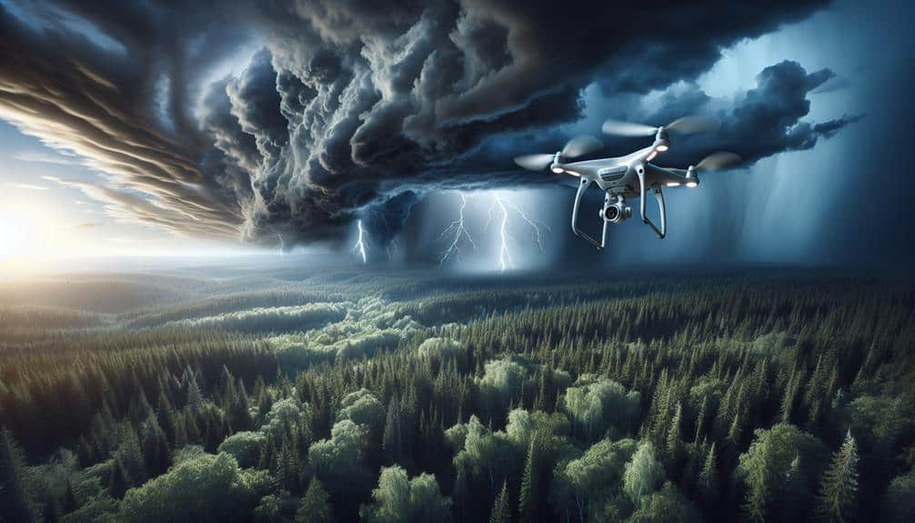
In real-time weather analysis, drones equipped with advanced sensors provide immediate data on storm development and movement. With aerial surveillance, we can monitor severe thunderstorms as they evolve, capturing high-resolution images and detailed weather metrics. These drones measure atmospheric parameters, such as temperature, humidity, and barometric pressure, at various altitudes, offering a multi-dimensional view of the storm.
Weather monitoring via drones allows us to track rapid changes in storm intensity and trajectory with unprecedented accuracy. We can deploy these drones into the heart of severe weather systems, obtaining real-time data that ground-based sensors might miss due to geographical limitations. This capability is essential for delivering timely warnings and actionable insights to communities in the storm's path, thereby enhancing public safety and preparedness.
Drones equipped with LiDAR and radar systems enhance our understanding of storm dynamics by providing precise measurements of wind speed and direction, precipitation rates, and cloud formations. This data is transmitted in real-time to meteorological centers, where it's analyzed to predict storm behavior more accurately. By leveraging these technologies, we gain a significant edge in mitigating the impact of severe thunderstorms, empowering us to act swiftly and effectively.
Cost-Effective Solutions
While real-time weather analysis via drones offers unparalleled insights, the focus now shifts to exploring cost-effective solutions for widespread deployment.
Utilizing drones for severe thunderstorm interception can be remarkably budget-friendly compared to traditional methods. For instance, manned aircraft operations not only involve higher costs but also pose significant risks. Conversely, drones provide a safer and more economical alternative, reducing operational expenses by up to 70%.
We need efficient solutions that maximize the utility of available resources. Advances in drone technology have led to the development of budget-friendly alternatives like lightweight, long-endurance drones equipped with high-resolution sensors.
These drones can be deployed in swarms, covering larger areas at a fraction of the cost. Furthermore, their maintenance and operation are less resource-intensive, further driving down expenses.
Accessibility to Remote Areas
Drones offer unprecedented access to remote areas, enabling us to gather essential data from regions previously unreachable by traditional methods. By deploying drones, we can collect real-time meteorological data that enhances our understanding of severe thunderstorms. This capability is priceless for weather forecasting, as it allows us to monitor atmospheric conditions in isolated locations, where ground-based sensors and human observers are impractical.
In emergency response scenarios, drones prove indispensable. They can quickly reach areas affected by severe weather, providing crucial information to first responders. For instance, drones can relay high-resolution images and atmospheric data, facilitating rapid assessments of storm damage and informing rescue operations. This swift access is vital in minimizing response times and improving the efficiency of aid delivery.
Moreover, drones can operate under conditions that would be hazardous for manned aircraft, such as high winds or poor visibility. By leveraging autonomous flight capabilities, we can guarantee continuous data collection even in the most challenging environments. This not only enhances our ability to predict and respond to severe weather events but also underscores the transformative potential of drone technology in expanding our reach and capabilities in weather forecasting and emergency response.
Improved Forecast Accuracy
Leveraging the real-time meteorological data collected by drones, we can immensely enhance the accuracy of severe thunderstorm forecasts. Our ability to capture high-resolution atmospheric measurements allows us to refine forecast models with unparalleled data precision. Drones equipped with advanced sensors provide insights into parameters like temperature, humidity, wind speed, and pressure at various altitudes. This granularity in data leads to noteworthy meteorological advancements.
Traditionally, weather balloons and radar systems have offered valuable data, but they can't match the spatial and temporal resolution that drones deliver. By deploying drones directly into storm systems, we gather immediate, localized data that improves forecast accuracy. This precision helps meteorologists to predict storm paths, intensity, and development more reliably, offering communities better preparation time.
Additionally, research advancements made possible through drone data contribute to our broader understanding of thunderstorm dynamics. We can validate and enhance simulation models, pushing the boundaries of meteorological science. As a result, our forecasts become more reliable, reducing the margin of error significantly.
Incorporating drone technology into our forecasting toolkit empowers us to make informed decisions, ultimately providing greater freedom from the unpredictability of severe weather. This leap in data precision marks a transformative shift for both meteorological science and public safety.
Minimizing Human Risk
We can greatly minimize human risk by implementing enhanced safety measures and utilizing drones for remote data collection. By keeping meteorologists and storm chasers out of harm's way, we reduce the likelihood of injury or fatality.
Additionally, drones provide precise meteorological data without necessitating human presence in hazardous storm environments.
Enhanced Safety Measures
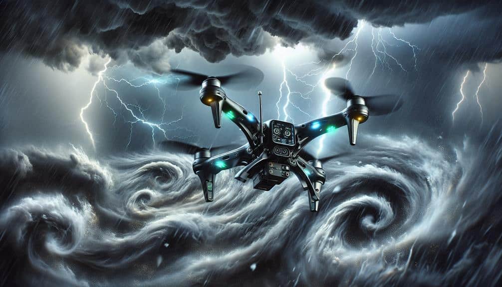
Using drones for storm interception reduces direct human exposure to hazardous weather conditions, thereby enhancing overall safety. With advanced drone technology, we can efficiently conduct storm interception, providing critical weather prediction data without risking human lives. According to recent studies, drones equipped with high-resolution sensors and real-time communication systems can safely navigate severe thunderstorms, capturing essential atmospheric data. This data enables meteorologists to improve weather prediction models to a significant extent.
The safety benefits of using drones are substantial. Traditional storm chasing often involves dangerous, close encounters with severe weather, putting human lives at a considerable risk. By deploying drones, we can achieve the same, if not better, data collection from a safe distance. Drones can withstand harsh weather conditions that would be perilous for human operators, such as high winds, heavy rain, and lightning. This capability ensures continuous data flow even in the most severe weather, enhancing our understanding of storm dynamics.
Moreover, the ability to operate drones remotely allows us to cover larger areas more efficiently than manned missions. This not only minimizes human risk but also optimizes resource utilization. By embracing drone technology for storm interception, we can prioritize safety while advancing our weather prediction capabilities.
Remote Data Collection
Remote data collection through the use of drones significantly reduces human risk while providing accurate, real-time atmospheric data vital for enhancing weather prediction models. By deploying drones equipped with advanced sensors, we can conduct aerial surveillance of severe thunderstorms without endangering human lives.
These drones capture essential meteorological data, including temperature, humidity, wind speed, and pressure variations, at various altitudes and locations within the storm.
Our approach leverages drones' ability to navigate hazardous environments, where traditional manned aircraft might face significant danger. With drones, we're not just collecting data; we're revolutionizing weather mapping. They fly into the heart of the storm, gathering high-resolution data that enhances our understanding of storm dynamics and aids in refining predictive algorithms.
This real-time data acquisition allows meteorologists to update weather models more frequently and with greater accuracy, thereby improving early warning systems for severe weather.
Drones also offer the flexibility to be deployed quickly and repeatedly, ensuring continuous monitoring of evolving storm conditions. By eliminating the need for human presence in dangerous storm-chasing missions, we prioritize safety while achieving unparalleled levels of data precision and comprehensiveness.
This fusion of technology and meteorology empowers us to safeguard lives and property with greater effectiveness.
Frequently Asked Questions
How Do Drones Withstand Extreme Weather Conditions During Thunderstorms?
Drones possess extreme durability, practically indestructible! They're engineered with top-tier weather resistance, ensuring they can withstand thunderstorms. Advanced materials and cutting-edge technology allow them to navigate high winds and heavy rain, ensuring mission success and data integrity.
What Types of Sensors Are Equipped on Weather Drones?
We equip weather drones with sensors for temperature, humidity, pressure, and wind speed. These allow for remote monitoring and real-time analysis, offering precise data essential for understanding severe thunderstorms and ensuring our freedom to predict weather accurately.
How Long Can Drones Typically Stay Airborne in Severe Weather?
Drones typically stay airborne for 30-60 minutes in severe weather. Their battery life and flight endurance depend on weather durability and remote operation capabilities, ensuring they withstand harsh conditions while collecting critical data.
Are There Any Legal Restrictions on Using Drones for Weather Monitoring?
Like vigilant guardians, we must guarantee regulatory compliance and address privacy concerns when using drones for weather monitoring. Data accuracy and public safety are paramount, balancing freedom with precision in a scientifically regulated environment.
How Does Drone Data Compare to Traditional Weather Monitoring Methods?
Drone data often exhibits higher data accuracy and cost effectiveness compared to traditional methods. We gain detailed, real-time insights, minimizing data gaps. This empowers us with precise analysis, maximizing our freedom to make informed decisions.