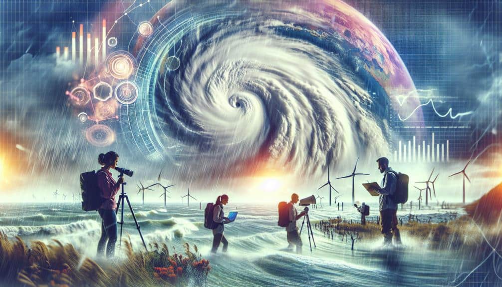
We use an interdisciplinary approach to understand hurricanes, integrating meteorology, oceanography, and atmospheric science. By leveraging advanced predictive models and high-resolution satellite data, we can track storm paths and predict intensity. Oceanographic factors like sea surface temperatures, salinity gradients, and currents play pivotal roles in storm development. Atmospheric insights on air pressure, wind patterns, and humidity decode the complexities of hurricane formation. Cutting-edge satellite and radar technologies enable real-time monitoring, enhancing our storm tracking accuracy. We also study hurricanes' environmental impacts to refine future forecasts and improve coastal resilience. Together, these disciplines provide a thorough understanding, offering deeper insights into hurricane dynamics.
Key Points
- Integrate meteorology, oceanography, and atmospheric science to predict and understand hurricane behavior comprehensively.
- Utilize high-resolution satellite data and advanced radar technology for accurate storm tracking and real-time monitoring.
- Analyze sea surface temperatures, salinity gradients, and ocean currents to understand their impact on hurricane formation and intensity.
- Study air pressure, wind patterns, and humidity levels to decode interactions influencing hurricane development.
Meteorology and Hurricane Analysis
In meteorology, we utilize advanced predictive models and high-resolution satellite data to analyze and forecast the complex behavior of hurricanes. By integrating these sophisticated tools, we can more accurately predict storm intensity and track their paths.
As climate change continues to impact global weather patterns, we've observed a notable increase in the frequency and intensity of hurricanes. This phenomenon is closely linked to rising sea surface temperatures, which provide the necessary energy to fuel these powerful storms.
Our predictive models incorporate a vast array of data, from atmospheric pressure changes to wind speed variations, to generate precise forecasts. These models enable us to simulate various scenarios, helping us understand how different variables, such as climate change, influence hurricane development and intensification.
High-resolution satellite imagery complements these models by offering real-time data, allowing us to adjust our predictions as storms evolve.
Oceanography's Role in Storm Development
Understanding hurricane development requires us to analyze oceanographic factors such as sea surface temperatures, salinity gradients, and ocean currents, which significantly influence storm formation and intensity.
Our predictive models show that warm sea surface temperatures fuel hurricanes by providing the necessary heat and moisture. A one-degree Celsius increase can notably amplify a storm's power, underscoring the role of climate change in heightened hurricane intensity.
Ocean currents also play a pivotal role. They redistribute heat across the globe, affecting regional sea surface temperatures. For instance, the Gulf Stream's warm waters contribute to the formation and intensification of storms along the Atlantic coast. By mapping these currents, we can better predict where and when hurricanes might form.
Salinity gradients further complicate this dynamic. Variations in salinity can affect ocean stratification, influencing how heat is stored and released. Our data-driven simulations indicate that lower salinity levels can enhance storm formation by creating more favorable conditions for convection.
Atmospheric Science Contributions
Atmospheric science provides critical insights into hurricane formation by analyzing factors such as air pressure, wind patterns, and humidity levels. By conducting thorough data analysis, we can decode the intricate interactions between these variables.
For instance, the differential air pressure between the storm center and its periphery drives wind speeds, while wind patterns shape the storm's trajectory. When we overlay humidity levels, we gain a clearer picture of how moisture fuels hurricane intensity.
In our quest for understanding, climate modeling stands out as a pivotal tool. These models, built on historical data, help us simulate various scenarios, predicting potential storm paths and intensities. By integrating real-time data, we refine these models, enhancing their accuracy.
This approach not only aids in immediate storm prediction but also contributes to long-term climate studies, offering insights into how global warming might affect future hurricane activity.
We focus on the freedom that comes from knowledge, empowering communities to make informed decisions. By harnessing atmospheric science, we're not just predicting hurricanes; we're preparing for them, reducing their impact, and safeguarding our future.
Data-driven insights and predictive models are our allies in this endeavor, helping us navigate the complexities of nature.
Technological Advances in Storm Tracking
Leveraging cutting-edge satellite technology, we can now track hurricanes with unprecedented accuracy, enhancing our predictive models and response strategies.
By employing high-resolution satellite imagery, we're able to monitor storm development in real-time and gather vital data on atmospheric conditions. This data is fed into sophisticated algorithms that refine our predictive capabilities, allowing us to forecast hurricane paths more reliably.
Utilizing advanced radar technology, we gain detailed insights into the structure and intensity of these storms. Doppler radar systems, for instance, provide valuable data on wind speeds and precipitation rates within hurricanes. This information is crucial for fine-tuning our predictive models and issuing timely warnings to affected regions.
Our ability to integrate satellite imagery and radar technology has revolutionized storm tracking. We can now generate more accurate forecasts and improve evacuation plans, giving communities the freedom to prepare adequately.
This technological synergy not only enhances our situational awareness but also empowers individuals and authorities to make informed decisions in the face of impending threats. By continually advancing our storm tracking technologies, we're better equipped to mitigate the impact of hurricanes, ultimately safeguarding lives and properties.
Environmental Impact Studies
By examining the environmental aftermath of hurricanes, we can quantify their long-term effects on ecosystems and communities, refining our models to predict future impacts with greater accuracy. Ecosystem disruption is evident in the uprooting of trees, erosion of coastal areas, and subsequent loss of habitat for wildlife. These disruptions, exacerbated by climate change effects, alter nutrient cycles and can lead to reduced biodiversity.
Our research integrates satellite imagery and ground-based observations to assess the extent of damage. Data on soil erosion, salinity changes, and water quality allow us to create predictive models that highlight areas of coastal vulnerability. These models are essential for disaster preparedness, providing communities with actionable insights to mitigate future risks.
Moreover, understanding the compounding effects of climate change is crucial. Warmer ocean temperatures and rising sea levels intensify hurricane strength and frequency, necessitating more robust environmental impact studies.
Frequently Asked Questions
How Do Hurricanes Historically Affect Economic Stability in Coastal Regions?
We've seen hurricanes have a substantial impact on coastal economies, disrupting economic stability. Through environmental impact assessments and predictive models, we can enhance community resilience, streamline disaster relief efforts, and support economic recovery to guarantee long-term regional freedom and stability.
What Role Do Social Sciences Play in Hurricane Preparedness and Response?
We evaluate the role of social sciences in hurricane preparedness by analyzing community engagement, disaster relief efforts, public policy, and emergency communication. Data-driven predictive models inform our strategies, ensuring communities' freedom and resilience during and after storms.
How Can Interdisciplinary Education Improve Hurricane Awareness and Safety?
Interdisciplinary education boosts hurricane awareness and safety by integrating community engagement and risk assessment. We use predictive models and technical terminology to empower communities, fostering informed decision-making and enhancing overall preparedness and resilience.
What Psychological Effects Do Hurricanes Have on Affected Populations?
We can't overlook the trauma response hurricanes trigger, impacting mental health greatly. Predictive models show increased anxiety, depression, and PTSD in affected populations. Data-driven strategies are crucial for fostering resilience and ensuring long-term psychological well-being.
How Do Hurricanes Influence Long-Term Urban Planning and Infrastructure Development?
Coincidentally, our focus on predictive models shows hurricanes drive urban planning. We integrate sustainability considerations and disaster resilience, ensuring cities withstand future threats. Data-driven strategies empower communities, enhancing both freedom and long-term infrastructure development.