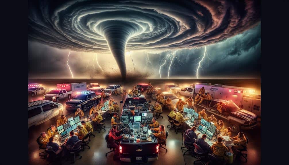
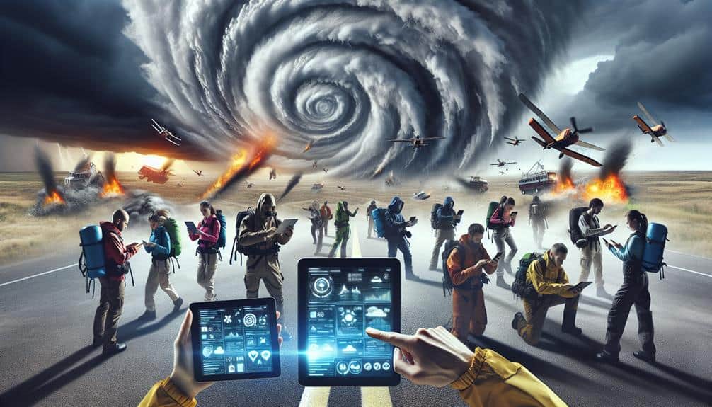
We've pinpointed the ten most essential tech tools for storm chasers and response teams. Real-time weather apps give us accurate storm updates and prioritize lightning detection. Mobile radar systems offer detailed storm tracking and pinpoint storm movement. GPS navigation tools secure accurate positioning and seamless integration with storm predictions. Satellite communication devices assure uninterrupted global connectivity. Drones provide real-time aerial surveys and damage assessments. Emergency alert systems, data logging software, social media monitoring, and collaboration platforms enhance our situational awareness and decision-making. Explore further to see how these tools elevate our operational capabilities.
Key Points
- Real-time weather apps provide accurate storm updates and prioritize lightning detection.
- Mobile radar systems offer detailed storm tracking with high-resolution Doppler radar.
- GPS navigation tools ensure accurate positioning and route planning in complex terrains.
- Satellite communication devices guarantee uninterrupted connectivity and global coverage.
Real-Time Weather Apps
We frequently rely on real-time weather apps to provide accurate and immediate updates on storm conditions. These apps are indispensable tools for storm chasers like us, offering vital insights into evolving weather patterns.
One of the key features we prioritize is lightning detection. Advanced algorithms within these apps can pinpoint lightning strikes in real-time, enabling us to assess the intensity and proximity of electrical activity. This capability is essential for ensuring our safety and optimizing our storm tracking strategies.
Storm tracking is another crucial function provided by these apps. Real-time weather apps utilize data from multiple sources, including satellites and ground-based sensors, to map out the trajectory and development of storm systems. By analyzing this data, we can make informed decisions about our movements and anticipate potential changes in weather conditions. This level of precision allows us to maintain a high degree of mobility and freedom while chasing storms.
With the integration of lightning detection and robust storm tracking, real-time weather apps empower us to navigate storm environments more safely and efficiently. These tools provide the actionable intelligence we need to stay ahead of the storm, enhancing both our safety and our ability to capture compelling meteorological data.
Mobile Radar Systems
While real-time weather apps provide essential updates, mobile radar systems offer an unparalleled level of detail and accuracy in storm tracking. These systems are indispensable for storm chasers who need precise, real-time data to navigate the unpredictable nature of severe weather events.
By integrating advanced radar accuracy, mobile radar systems enable us to pinpoint storm locations, intensity, and movement with remarkable precision.
The technology behind mobile radar systems allows for rapid mobile deployment, ensuring we're always one step ahead of the storm. Equipped with high-resolution Doppler radar, these systems provide detailed imagery, enabling us to analyze wind patterns, precipitation rates, and potential tornado formations.
The ability to deploy these systems on-the-go means we can adapt to changing weather conditions swiftly, ensuring our safety and enhancing our data collection capabilities.
Additionally, mobile radar systems offer a significant advantage over stationary radar installations. Their flexibility and mobility empower us to venture into areas where traditional radar coverage might be limited or non-existent. This capability is essential for accurate storm analysis and effective response coordination.
Traversing through severe weather demands precise GPS guidance tools that guarantee accurate positioning and route planning, necessary for storm chasers working in unpredictable environments. We rely on advanced GPS tracking systems to make sure we're always on the right path. These tools are essential for storm prediction and planning our routes efficiently during emergency response situations.
To maximize our effectiveness, we integrate several key features into our GPS navigation toolkit:
- Real-time GPS tracking: Provides immediate location updates, allowing us to adapt quickly to changing weather conditions and reroute as necessary.
- High-detail maps: Detail-rich maps help us navigate complex terrains and avoid roadblocks, ensuring swift and safe travel.
- Storm prediction integration: Seamlessly combines weather data with GPS, offering predictive insights that inform our route planning.
These GPS navigation tools empower us to maintain operational freedom and safety, even in the most volatile conditions. By leveraging cutting-edge technology, we can predict storms more accurately, optimize our routes, and respond effectively to emergencies.
In an environment where every second counts, our GPS systems are our guiding stars.
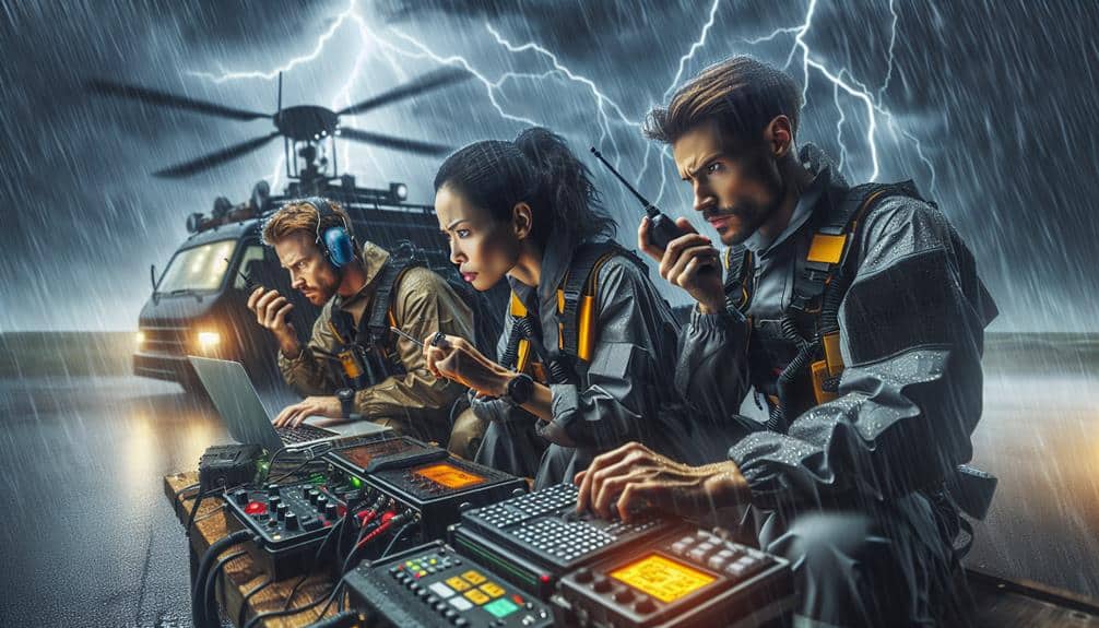
Satellite Communication Devices
Amidst the chaos of severe weather, satellite communication devices are essential, guaranteeing uninterrupted connectivity and real-time data exchange. These tools are necessary for storm chasers who need reliable communication when traditional networks fail. By leveraging satellites, we maintain a stable connection regardless of terrestrial infrastructure damage.
Signal strength is vital for effective communication. Satellite devices, like the Iridium Extreme or Globalstar GSP-1700, offer robust signal strength, even in remote areas. This reliability ensures we can relay critical information promptly. Equally significant is battery life; long-lasting power sources like lithium-ion batteries extend operational time, essential during extended field operations.
Coverage area is another important factor. Devices with global coverage, such as those operating on the Iridium network, provide extensive reach, allowing us to connect from virtually anywhere on Earth. This broad coverage is crucial when tracking storms across diverse terrains.
Data speed also plays a significant role. High-speed data transmission enables us to send and receive large files, including weather models and high-resolution images, without delays. Devices supporting broadband-like speeds, such as the Inmarsat IsatPhone Pro, enhance our ability to make informed, timely decisions.
Drones for Aerial Surveys
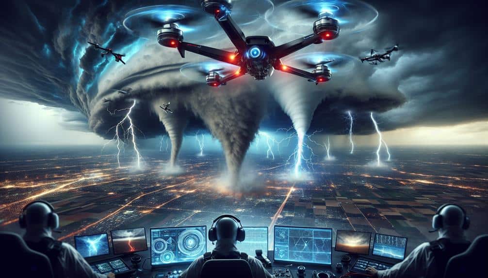
When we use drones for aerial surveys, we gain the ability to perform real-time damage assessments and enhance our weather monitoring capabilities. These devices provide important data that can inform our decisions during storm tracking and response.
With high-resolution imaging and rapid deployment, drones greatly improve our situational awareness.
Real-time Damage Assessment
Employing drones for aerial surveys allows us to conduct real-time damage assessments with remarkable accuracy and speed. Using drones for assessment, we can swiftly capture high-resolution images and video of affected areas, enabling immediate analysis and response. This approach minimizes the time and risk involved in manual inspections, especially in hazardous environments.
Our capability to integrate mobile damage tracking with drone data means we can update damage assessments dynamically. This real-time data streamlines our decision-making process, providing actionable insights right when we need them most.
Here are some key features and benefits of using drones for real-time damage assessment:
- High-Resolution Imaging: Captures detailed photos and videos that reveal even minor structural damages.
- Rapid Deployment: Drones can be launched quickly, covering large areas faster than ground teams.
- 3D Mapping: Generates accurate 3D models of the terrain and structures, aiding in precise damage analysis.
Utilizing drones for aerial surveys significantly enhances our ability to assess and respond to storm damage efficiently. This technology empowers us to make informed decisions rapidly, ensuring timely and effective disaster response.
Enhanced Weather Monitoring
Leveraging drones for aerial surveys greatly enhances our weather monitoring capabilities by providing real-time, high-resolution data from otherwise inaccessible areas. These advanced tools are essential in our quest for precise weather tracking and storm mapping. Drones equipped with specialized sensors can capture crucial atmospheric data, such as temperature, humidity, and wind speed, allowing us to build accurate models of storm behavior.
By deploying drones, we can monitor evolving storm conditions with exceptional detail. The high-resolution imagery captured from these aerial surveys offers a bird's-eye view, enabling us to identify storm patterns and potential impact zones. This precise information aids in refining our predictive models and facilitates timely warnings, contributing to more effective storm response strategies.
Furthermore, drones enable us to conduct thorough post-storm assessments. By flying over affected areas, we can quickly evaluate the extent of damage, providing essential data for emergency response teams. This ability to cover large areas rapidly and safely ensures that resources are allocated efficiently, minimizing overall response time.
Portable Weather Stations
Portable weather stations provide storm chasers with real-time, on-site meteorological data essential for tracking and analyzing severe weather patterns. By utilizing these advanced tools, we effectively enhance our storm tracking capabilities and improve our data collection accuracy. The mobility and precision of portable weather stations allow us to deploy them rapidly in key locations, capturing critical atmospheric conditions as a storm evolves.
Portable weather stations are equipped to measure:
- Temperature and Humidity: Accurate readings of the ambient temperature and humidity levels help us better understand the storm's potential intensity and development.
- Wind Speed and Direction: Real-time data on wind dynamics is vital for predicting storm paths and identifying dangerous conditions.
- Barometric Pressure: Observing pressure changes helps us identify the formation of severe weather systems, such as tornadoes and hurricanes.
These stations are indispensable for storm chasers who need to make quick, informed decisions in the field. The immediate feedback from these devices empowers us to act swiftly and strategically, ensuring that our efforts in storm tracking and data collection are both effective and efficient.
Emergency Alert Systems
As storm chasers, we depend on emergency alert systems to provide real-time severe alerts, ensuring we stay informed and safe.
These systems use automated warning dissemination to quickly spread vital information.
Understanding how these technologies function is essential for effective storm chasing.
Real-Time Severe Alerts
Real-time severe alerts from emergency alert systems are crucial for storm chasers to receive immediate updates on hazardous weather conditions. These alerts enable us to make quick, informed decisions, enhancing both our safety and the effectiveness of our storm tracking efforts. The integration of advanced technologies like lightning detection and wind speed tracking guarantees that we stay ahead of evolving weather patterns.
For efficient storm chasing, we rely on systems that provide:
- Precise storm tracking: Accurate data on storm movements allows us to predict paths and make strategic decisions.
- Lightning detection: Real-time updates on lightning activity help us avoid danger zones and understand storm intensity.
- Flood warnings: Early alerts about potential flooding enable us to avoid areas at risk and plan safe routes.
We demand freedom in our pursuits without compromising safety. Having access to real-time severe alerts is indispensable. These tools empower us to navigate hazardous environments with confidence, ensuring we can continue our work effectively and safely.
Automated Warning Dissemination
Automated warning dissemination systems, like emergency alert systems, consistently assure that storm chasers receive crucial updates in a timely and efficient manner. These systems utilize automated warning distributions to significantly that we remain informed about imminent weather threats. By integrating weather alert automation, we can streamline our emergency response coordination, thereby enhancing our disaster response strategies.
In practice, weather alert automation provides real-time notifications, reducing the lag between data collection and dissemination. This rapid information flow allows us to make swift, informed decisions, essential for both our safety and the accuracy of our storm tracking. Automated warning distributions leverage multiple channels—such as SMS, email, and specialized apps—to guarantee redundancy and reliability in communication.
Moreover, these systems can be tailored to our specific needs, filtering alerts based on geographic location, severity, and type of weather event. This customization is critical in avoiding information overload and focusing on the most pertinent data. Our ability to react promptly and effectively is greatly bolstered by these automated systems, making them indispensable tools in our storm-chasing arsenal.
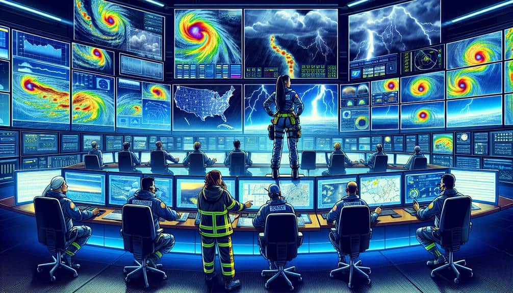
Data Logging Software
Logging meteorological data efficiently is vital for storm chasers to analyze patterns and predict severe weather events accurately. By leveraging advanced data logging software, we can enhance our data analysis capabilities and guarantee remote access to critical information, regardless of our location. This allows us to make informed decisions swiftly and stay a step ahead of Mother Nature.
Data logging software offers several key features that are indispensable for storm chasers:
- Real-time data collection: Captures meteorological data continuously and in real-time, ensuring we don't miss significant changes in weather patterns.
- Cloud integration: Enables remote access to data from any device, providing us with the flexibility to analyze information from the field or a command center.
- Data visualization tools: Transforms raw data into understandable graphs and charts, facilitating quick interpretation and trend identification.
Utilizing these tools, we can improve our data analysis processes and enhance our predictive capabilities. With remote access and real-time updates, we're empowered to make better decisions on the go, guaranteeing both our safety and the effectiveness of our storm-chasing endeavors.
Social Media Monitoring
In addition to leveraging data logging software, monitoring social media platforms allows us to gather real-time reports and firsthand observations from people on the ground, enhancing our situational awareness and response strategies. By tracking trending topics on platforms like Twitter and Facebook, we can identify emerging threats and areas of impact almost instantaneously. This capability is vital for storm chasers who need to make rapid, informed decisions.
We employ specialized tools to filter and analyze social media data, focusing on relevant keywords and geotagged posts. This method not only helps us pinpoint affected regions but also provides us with a wealth of unfiltered information that mightn't be available through traditional channels. Influencer engagement plays a key role here; by collaborating with local influencers, we can amplify critical updates and make sure that crucial information reaches a broader audience.
Moreover, social media monitoring enables us to verify the authenticity of reports by cross-referencing multiple sources. This cross-verification is important for maintaining the accuracy and reliability of our data.
Ultimately, integrating social media monitoring into our toolkit allows us to act swiftly and efficiently, maximizing our operational effectiveness while safeguarding our freedom to adapt dynamically to unfolding situations.
Collaboration Platforms
Harnessing collaboration platforms enables us to synchronize efforts, share real-time data, and coordinate strategies seamlessly among storm chasers. These tools facilitate remote collaboration and guarantee that our team coordination remains efficient, even when we're scattered across different locations. By integrating these platforms into our workflow, we elevate our operational capabilities and enhance our responsiveness.
Here are some key features we should look for in collaboration platforms:
- Real-Time Communication: Instant messaging and video conferencing enable immediate decision-making and problem-solving.
- Data Sharing: Securely sharing high-resolution maps, weather models, and live updates keeps everyone on the same page.
- Task Management: Assigning and tracking tasks with deadlines ensures that all critical actions are completed promptly.
Utilizing these features allows us to maintain a high level of situational awareness and adapt to rapidly changing conditions.
As storm chasers, our ability to leverage these advanced tools directly impacts our effectiveness and safety. By fostering robust remote collaboration and precise team coordination, we can anticipate and respond to severe weather events more effectively, ultimately achieving our mission with greater precision and agility.
Frequently Asked Questions
What Safety Protocols Should Storm Chasers Follow During Severe Weather Events?
We should always identify emergency shelters and map out evacuation routes. Staying informed through reliable weather updates, maintaining communication, and having a well-equipped emergency kit are essential for our safety during severe weather events.
How Can Storm Chasers Ensure They Have Enough Power for Their Devices in the Field?
To guarantee enough power for our devices in the field, we should carry portable chargers and solar panels. Portable chargers provide immediate power, while solar panels offer a sustainable solution, maximizing our independence and operational efficiency during extended missions.
What Are the Best Practices for Maintaining and Calibrating Tech Tools Used in Storm Chasing?
We should regularly perform calibration maintenance and tech tool calibration to guarantee storm chaser safety. Let's prioritize power management, obtain drone permissions, and maintain adequate insurance coverage to stay prepared and protect our freedom.
How Can Storm Chasers Secure Permissions for Using Drones in Restricted Airspaces?
We must secure drone regulations permissions by applying through the FAA's online portal. Ensuring compliance with airspace restrictions is essential. We analyze flight paths and obtain necessary clearances for safe, lawful operation in restricted zones.
What Insurance Options Are Available for Storm Chasers and Their Equipment?
For the Current Question, we should explore insurance coverage options that include liability and equipment protection. All-encompassing plans safeguard us against damages and losses, ensuring we can chase storms freely without worrying about costly setbacks.