In our real-time storm tracking guide for storm chasers, we utilize Doppler radar for raindrop speed, satellite imagery for cloud analysis, and GPS for pinpointing locations. Weather apps deliver real-time data and alerts, enhanced by high-definition radar and severe weather notifications. Interpreting radar reflectivity measures storm strength, while velocity data reveals wind patterns. Safety precautions include identifying shelter locations, pre-planning routes, and using vehicles as Faraday cages against lightning. Employing redundant communication systems guarantees continuous data flow. Integrating these tools and techniques enables accurate, data-driven storm monitoring. Dive further to master safe and effective storm chasing techniques.
Key Points
- Use Doppler radar to measure raindrop velocity and assess storm intensity and movement.
- Monitor satellite imagery for real-time cloud formations to predict storm paths accurately.
- Utilize GPS tracking for precise location data of storm chasers and affected areas.
- Receive real-time lightning strike data through lightning detection systems for storm severity insights.
Essential Tools
To effectively track storms in real-time, we need a suite of essential tools that include Doppler radar, satellite imagery, and advanced weather modeling software. Doppler radar allows us to measure the velocity of raindrops within a storm, providing vital data for storm intensity and movement.
Satellite imagery offers a broader view, capturing cloud formations and storm development over large areas, necessary for accurate storm prediction and understanding storm dynamics.
Next, GPS tracking is indispensable. By integrating GPS tracking with our other tools, we can pinpoint the exact location of storm chasers and affected areas, ensuring precise data collection and safety. This real-time positioning aids in correlating ground observations with radar and satellite data, enhancing our overall storm analysis.
Another essential tool is lightning detection systems. These systems provide real-time data on lightning strikes, which are important indicators of storm severity and potential escalation. Lightning detection helps us predict the intensification of storms and take necessary precautions.
Lastly, advanced weather modeling software synthesizes data from these various sources, allowing us to create accurate storm predictions. These models simulate storm behavior, offering valuable insights into potential paths and impacts, thereby empowering us with the freedom to make informed decisions during storm tracking endeavors.
Weather Apps
In addition to our suite of advanced tools, leveraging weather applications on mobile devices allows us to access real-time storm data and alerts directly in the field. These applications provide critical information that enhances our responsiveness and decision-making capabilities. With features like high-definition radar, storm tracking, and severe weather alerts, we can monitor evolving weather conditions with exceptional accuracy and reliability.
The user experience is paramount. We prioritize applications that offer user-friendly interfaces and customizable notifications. For example, applications like RadarScope and Storm Radar provide detailed radar imagery and storm attributes, enabling us to pinpoint storm locations and predict movement. The ability to zoom in on specific areas and receive real-time updates guarantees we stay ahead of any changes.
Accuracy and reliability are non-negotiable. We rely on data sourced from reputable meteorological institutions, ensuring the information we receive is both precise and up-to-date. Many weather applications integrate multiple data streams, including satellite, radar, and surface observations, to deliver thorough storm insights.
Radar Interpretation
Understanding radar interpretation is important for accurately analyzing storm structures and predicting their development. By mastering this skill, we can better track storm movement, conduct intensity analysis, and anticipate changes in weather patterns.
Let's explore some key elements of radar interpretation.
- Reflectivity: This radar product measures the amount of transmitted power returned to the radar. High reflectivity values indicate heavy precipitation, which helps in evaluating storm strength.
- Velocity: This product shows the speed and direction of wind within a storm. By examining velocity data, we can identify rotation and potential tornado formations.
- Dual-polarization: This advanced technology provides information on the shape and size of precipitation particles. It's important for distinguishing between rain, snow, and hail.
Radar interpretation requires us to constantly analyze cloud formations and their evolution. By doing so, we can anticipate changes and adapt our strategies in real time. Analyzing radar data accurately allows us to make informed decisions, enhancing our ability to chase storms effectively while maintaining our freedom to explore nature's most powerful phenomena.
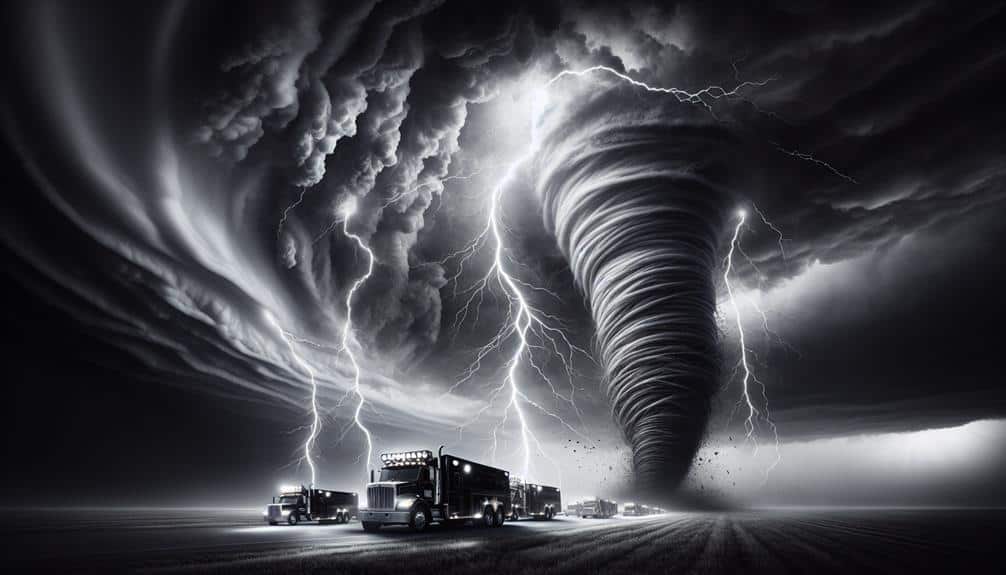
Safety Precautions
Safety measures are vital when tracking storms, guaranteeing we can gather data without compromising our well-being. Our first priority should always be identifying emergency shelter locations.
We need to pre-plan our routes to include nearby buildings or sturdy vehicles, which can serve as last-minute refuges from severe weather conditions. It's essential to avoid structures like mobile homes that offer inadequate protection against high winds and flying debris.
Lightning risks are another significant concern. Statistically, lightning strikes are a leading cause of storm-related injuries. We should maintain a safe distance from tall objects such as trees and power lines, and avoid open fields where we become prime targets. Utilizing a vehicle as a Faraday cage is a proven method to mitigate lightning risks, provided we keep our hands off metal surfaces.
Maintaining communication channels is also vital. Reliable weather radios, mobile apps, and GPS devices can provide real-time updates, helping us make informed decisions quickly.
Best Practices
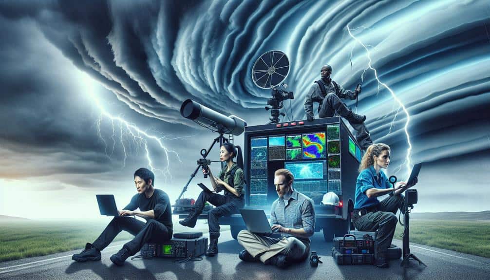
Implementing best practices maximizes data accuracy while minimizing risks during storm tracking operations. To achieve this, we need to focus on effective communication strategies and advanced storm interception techniques. Maintaining a strong communication network among team members is essential. We should utilize both radio and digital communication platforms to maintain constant contact and share real-time data. Additionally, leveraging multiple data sources such as radar, satellite imagery, and mobile weather stations enhances our situational awareness.
Storm interception techniques must be precise and calculated. We should always analyze storm dynamics, including wind shear, updrafts, and downdrafts, to determine the safest and most efficient interception routes.
Here are some key best practices:
- Redundant Communication Systems: Utilize both primary and backup communication channels to guarantee continuous data flow.
- Real-time Data Integration: Combine data from various sources for thorough storm analysis.
- Pre-established Safety Protocols: Establish clear safety procedures, including evacuation routes and emergency contacts.
Frequently Asked Questions
How Do I Find and Join a Storm Chasing Community or Group?
Joining a storm chasing community is like opening a door to adventure. We can find groups on online forums or local meetups. They provide safety tips, equipment needed, and invaluable camaraderie for those who crave freedom.
What Types of Storms Are Best for Beginners to Chase?
For beginners, chasing thunderstorms classified as supercell or squall line is best. We should make sure equipment essentials like radar, GPS, and communication devices are ready. These storms offer excitement without the extreme unpredictability of tornadoes or hurricanes.
How Do I Identify Safe Parking Spots While Storm Chasing?
We can't ignore safety. To identify safe parking spots, we should choose areas near emergency shelters and use strategic positioning. Always consider weather conditions and have backup plans. This guarantees maximum freedom and minimal risk.
What Should I Do if I Encounter a Tornado While Driving?
If we encounter a tornado while driving, we'll follow tornado safety precautions. We'll execute emergency response procedures: seek shelter in a sturdy building or lie flat in a ditch, avoiding underpasses for better protection.
To document and share our storm chasing experiences effectively, we should combine social media sharing with video editing. Blogging and using advanced photography techniques can enhance our content, ensuring our audience gets a detailed, data-driven narrative.