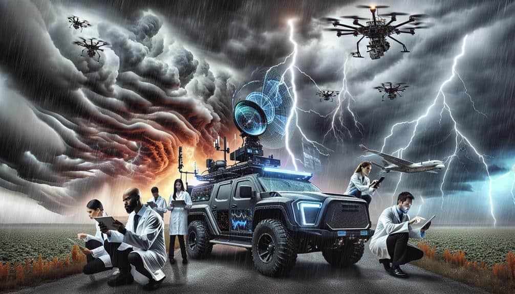
We enhance storm chaser efficacy by integrating advanced meteorological data analysis technologies. By monitoring atmospheric pressure fluctuations, we predict storm formation and paths. Real-time wind pattern tracking through predictive analytics and data visualization boosts collaboration. Temperature variation sensors identify instability areas and frontal boundaries. Advanced humidity tracking provides insights into severe weather events. Cloud formation analysis, especially cumulonimbus identification, benefits from Doppler radar data, while radar enhances situational awareness with mesocyclone tracking. High-resolution satellite imagery gives detailed storm overviews. Together, these methods improve storm prediction, creating a unified and effective approach for storm chasers keen to refine their strategies.
Key Points
- Use real-time data integration to enhance wind pattern tracking and storm trajectory monitoring.
- Employ advanced sensors for detailed temperature profiles and rapid detection of storm precursors.
- Leverage Doppler radar and satellite imagery for accurate storm development tracking and real-time updates.
- Analyze atmospheric pressure fluctuations to predict storm intensity and path accurately.
Understanding Atmospheric Pressure
Atmospheric pressure, defined as the force exerted by the weight of the air above us, plays a pivotal role in predicting weather patterns and storm development. By examining pressure fluctuations, we can anticipate notable changes in weather.
For instance, a rapid drop in atmospheric pressure often indicates the formation of a storm, as lower pressure allows for the rising of warm, moist air that fuels storm systems.
High altitude patterns also provide critical data for storm development. The pressure gradient at these altitudes drives wind patterns and the movement of air masses. A steep pressure gradient typically results in stronger winds, which can contribute to the severity and speed of storm formation.
By analyzing these gradients, we can better predict the path and intensity of impending storms.
Our ability to interpret these atmospheric signals gives us the freedom to make informed decisions about safety and preparedness. By understanding how pressure fluctuations and high altitude patterns influence weather, we can develop more accurate forecasts.
This empowers us to navigate storm-prone areas with greater confidence and precision, notably reducing the risks associated with storm chasing.
Tracking Wind Patterns
Let's analyze how tracking wind patterns involves real-time data integration, predictive wind modeling, and visualizing wind shifts.
By leveraging advanced meteorological instruments, we can capture and interpret wind data instantaneously.
This enables us to develop accurate predictive models and visually map wind trajectories, which are essential for effective storm chasing.
Real-Time Data Integration
Integrating real-time data is vital for accurately tracking wind patterns and predicting storm behavior. By leveraging data visualization and predictive analytics, we can monitor and interpret wind trajectories with heightened accuracy. Our ability to receive real-time updates on mobile platforms empowers us to make swift, informed decisions when chasing storms. This dynamic integration of live data streams not only enhances our situational awareness but also augments our predictive capabilities.
We utilize mobile integration to access a continuous flow of meteorological information, ensuring that we're always equipped with the latest data. This real-time connectivity allows us to visualize wind patterns as they evolve, providing a detailed and dynamic landscape of potential storm paths. By analyzing these patterns through advanced predictive analytics, we can anticipate changes in storm behavior with greater precision, which is essential for our safety and success in the field.
Moreover, the integration of real-time data supports more effective collaboration among storm chasers. Sharing up-to-the-minute information and visualizations ensures that our team operates with a unified understanding of developing weather conditions. This collaborative approach, underpinned by cutting-edge technology, grants us the freedom to navigate unpredictable environments with confidence and agility.
Predictive Wind Modeling
Predictive wind modeling enables us to track wind patterns with remarkable precision by leveraging sophisticated algorithms and high-resolution meteorological data. By analyzing vast datasets, we can decode the complexities of wind direction and wind intensity, offering invaluable insights for storm prediction. These models integrate multiple data sources, including satellite imagery, radar readings, and ground-based observations, to project the storm path with unprecedented accuracy.
Understanding wind patterns is vital for storm chasers as it directly influences our ability to anticipate changes in storm behavior. For instance, shifts in wind direction can signal an imminent change in the storm's trajectory, allowing us to adjust our positions strategically. Additionally, accurately gauging wind intensity helps us assess the potential severity of the storm, informing decisions about safety and logistical planning.
These predictive models utilize machine learning algorithms that continuously refine their forecasts by comparing real-time data with historical patterns. As a result, we achieve a dynamic and adaptive approach to storm prediction.
Embracing this technology empowers us to navigate the unpredictable nature of storms with greater confidence and precision, granting us the freedom to chase storms more effectively and safely.
Visualizing Wind Shifts
Visualizing wind shifts is crucial for accurately tracking storm patterns and anticipating their developments. When we analyze changes in wind speed and wind direction, we gain crucial insights into the dynamics of storm systems. By using advanced meteorological tools, we can map these shifts in real time, allowing us to predict storm trajectories and intensities with greater precision.
Using Doppler radar and anemometer data, we can create detailed visualizations that highlight variations in wind speed and direction. These visual aids help us identify areas of increasing turbulence and convergence zones, which are often precursors to severe weather events. For example, sudden shifts in wind direction at varying altitudes can indicate the formation of supercells, which are infamous for producing tornadoes.
Additionally, integrating GIS (Geographic Information System) technology enhances our ability to overlay wind data with other meteorological variables, such as temperature and humidity. This multidimensional approach allows us to see the bigger picture, making our analysis more all-encompassing. By doing so, we're not just reacting to storms; we're proactively strategizing our positioning and safety measures.
In essence, visualizing wind shifts empowers us to navigate the unpredictable nature of storms with a sense of freedom and confidence, grounded in scientific rigor.
Monitoring Temperature Variations
Accurate monitoring of temperature variations provides critical data for storm chasers to predict severe weather patterns. By observing temperature spikes, we can identify areas of instability that often precede storm development. Utilizing advanced sensors and real-time data feeds, we track these sudden changes in temperature, which serve as precursors for severe weather events.
Temperature gradients, the differences in temperature over a specific distance, are equally pivotal in storm prediction. These gradients can indicate the presence of frontal boundaries where storms are likely to form. By analyzing these variations, we can refine our predictive models and enhance our situational awareness in the field.
Our goal is to capture the most granular data possible. We use mobile weather stations equipped with high-precision thermometers to record temperature data at various altitudes and locations. This enables us to map out detailed temperature profiles that reveal hidden patterns and anomalies.
Analyzing Humidity Levels
While monitoring temperature variations provides crucial insights, analyzing humidity levels offers additional layers of data that are vital for predicting severe weather events. By examining humidity distribution, we can ascertain the likelihood of storm formation, as moisture-rich environments are conducive to severe weather patterns.
Precise measurements of atmospheric moisture help us determine potential storm intensity and trajectory. Using advanced moisture tracking techniques, we can map areas with high humidity and identify regions at risk for storm development. Accurate humidity data allows us to detect shifts in weather patterns that might indicate the onset of severe conditions.
For instance, a sudden increase in humidity in a particular area could signify the convergence of air masses, creating the perfect conditions for a storm. Analyzing humidity levels isn't just about recognizing where moisture exists; it's about understanding its role in storm dynamics.
When we correlate humidity data with other meteorological variables, we gain a comprehensive view of the atmospheric conditions. This inclusive approach enables us to predict severe weather events with greater accuracy, providing us the freedom to make informed decisions and enhance our storm-chasing expeditions. Our aim is to optimize safety and maximize the effectiveness of our predictive models.
Identifying Cloud Formations

Let's start by examining key cloud formations critical for storm prediction.
We'll focus on recognizing cumulonimbus clouds, analyzing cloud movement patterns, and identifying stratocumulus formations.
Recognizing Cumulonimbus Clouds
Identifying cumulonimbus clouds is essential for storm chasers as these formations are typically associated with severe weather phenomena like thunderstorms and tornadoes. By mastering cloud identification, we can enhance our storm tracking capabilities and improve weather prediction accuracy. Recognizing these towering giants requires keen observation and understanding of specific cloud characteristics.
Cumulonimbus clouds are usually identifiable by their immense vertical development and distinct features. Here's a quick guide to help us pinpoint these formations:
- Anvil Shape: The cloud top spreads out horizontally at high altitudes, forming a flat, anvil-like shape. This indicates strong updrafts and potential severe weather.
- Dark Base: The base of these clouds is typically dark and ominous, signaling heavy precipitation and potential hail.
- Vertical Extent: They often extend high into the atmosphere, reaching the tropopause, and can span several kilometers in height.
Analyzing Cloud Movement
Analyzing cloud movement involves tracking the speed, direction, and evolution of cloud formations using meteorological data and advanced imaging techniques. By focusing on cloud rotation, we can make more accurate storm predictions. This requires us to meticulously observe Doppler radar data, which delineates rotational patterns within cloud masses. Recognizing these patterns is essential for predicting severe weather events such as tornadoes.
Wind convergence is another vital factor that we monitor. When winds from different directions meet, they can force air upward, intensifying a storm. By analyzing wind convergence data, we can estimate the potential storm intensity. Advanced satellite imagery and ground-based radar systems provide the necessary data to identify these regions of convergence. Understanding these dynamics allows us to predict not only the formation of severe weather but also its potential path and impact.
As storm chasers, our freedom hinges on the accuracy of our data analysis. We aim to understand the complex interplay between cloud rotation and wind convergence to improve our storm prediction capabilities. With each storm we track, we refine our methodologies, ensuring we're better prepared for the next chase. This persistent pursuit of precise data keeps us ahead of the storm.
Identifying Stratocumulus Patterns
Having examined the dynamics of cloud rotation and wind convergence, we now turn our attention to identifying stratocumulus patterns, focusing on their distinct characteristics and implications for weather forecasting.
Stratocumulus clouds, typically forming in the lower troposphere, play a pivotal role in cloud classification and understanding vertical development within weather systems.
To accurately identify stratocumulus patterns, we must analyze several key features:
- Cloud Structure: Stratocumulus clouds generally appear as low, lumpy layers, often covering large portions of the sky but with breaks allowing sunlight to penetrate. These structures are indicative of stable atmospheric conditions with minimal vertical development.
- Temperature Gradients: Observing temperature gradients helps us predict the formation and sustainability of stratocumulus clouds. Typically, a slight temperature inversion at low altitudes supports their persistence, preventing significant vertical convection.
- Precipitation Formation: While stratocumulus clouds rarely produce heavy precipitation, they can result in light rain or drizzle. Monitoring humidity levels and cloud thickness can offer insights into their potential for precipitation formation.
Utilizing Radar Data
Leveraging radar data allows us to accurately track storm development and predict its path with high precision. By utilizing advanced radar visualization tools, we can dissect storm structures and identify key features such as mesocyclones and hook echoes. These radar signatures are vital for storm prediction, enabling us to anticipate severe weather events and make informed decisions about our chasing strategies.
In storm tracking, real-time radar data interpretation is essential. We analyze Doppler radar outputs to measure wind velocity and precipitation intensity within storm systems. This data helps us to determine the rotation and speed of storm cells, providing insights into their potential severity and movement patterns. By integrating radar-derived information with ground reports, we can enhance our situational awareness and optimize our chase routes.
Radar data also aids in distinguishing between different types of precipitation, such as rain, hail, and snow, which is important for evaluating storm impact. Our ability to interpret complex radar imagery, including reflectivity and velocity data, empowers us to navigate the unpredictable nature of storms with greater confidence.
Ultimately, mastering radar data interpretation not only enhances our storm chasing effectiveness but also strengthens our safety and preparedness.
Leveraging Satellite Imagery

Satellite imagery provides us with a detailed overview of storm systems, enabling the identification of large-scale weather patterns and cloud formations. By leveraging high satellite resolution, we can analyze intricate storm dynamics and improve our storm prediction models. The precision of satellite data allows us to track storm evolution and anticipate potential severe weather events with greater accuracy.
Satellite data enhances our analytical capabilities through:
- High-Resolution Imagery: With advancements in satellite resolution, we can detect minute changes in cloud structures and precipitation rates, which are critical for understanding storm intensity.
- Real-Time Data Access: Continuous satellite monitoring offers real-time updates, helping us make immediate decisions during storm chasing.
- Comprehensive Coverage: Satellite imagery provides a broad geographic overview, capturing weather patterns across vast regions that might be missed by ground-based radar.
These capabilities empower us to interpret complex atmospheric phenomena and refine our storm prediction methods. By integrating satellite data with other meteorological tools, we gain a holistic view of storm systems, facilitating timely and informed responses.
As storm chasers, this technological edge grants us the freedom to navigate and study severe weather systems with enhanced safety and precision.
Frequently Asked Questions
How Can Storm Chasers Ensure Their Data Collection Equipment Remains Calibrated?
We maintain our data collection equipment remains calibrated by scheduling regular calibration maintenance and performing routine checks. This practice guarantees data accuracy, enabling us to analyze meteorological phenomena effectively and make informed decisions independently.
What Safety Protocols Should Storm Chasers Follow During Severe Weather Events?
We should identify emergency shelters and evacuation routes, wear protective gear, and maintain communication devices. Analyzing real-time weather data guarantees informed decisions, balancing our quest for freedom with safety during severe weather events.
How Do Storm Chasers Communicate Real-Time Data to Meteorological Organizations?
We capture, analyze, and transmit data in real-time to guarantee data accuracy. We use satellite links, mobile networks, and specialized software to share findings with meteorological organizations, enabling timely decision-making and enhancing public safety during severe weather events.
What Mobile Apps Are Recommended for Real-Time Storm Tracking?
For real-time storm tracking, we recommend mobile apps like RadarScope and Storm Shield. These apps provide real-time alerts and interactive maps, enabling us to make data-driven decisions while maintaining the freedom to chase storms effectively.
How Can Storm Chasers Optimize Their Routes Using Meteorological Data?
We can optimize our routes by leveraging advanced meteorological data, enhancing forecasting accuracy, and integrating real-time updates. Utilizing high-resolution models and GPS algorithms guarantees we make data-driven decisions, maximizing our freedom to chase effectively.