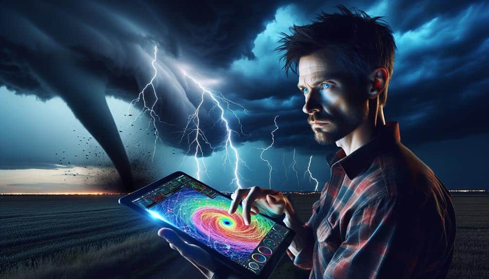
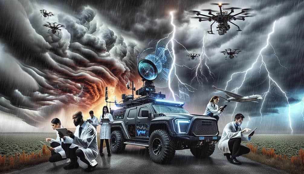
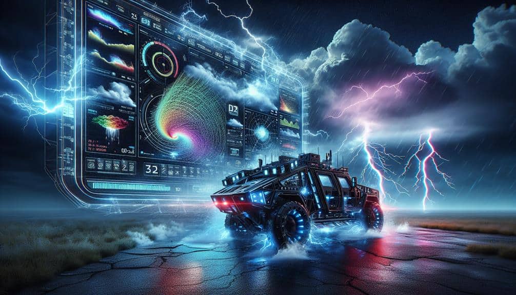
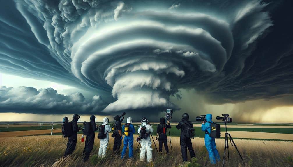
Analyzing storm patterns is critical for us, storm chasers, as it allows accurate prediction and safe navigation through severe weather. We leverage high-frequency radar systems and Doppler radar to track storms in real-time and estimate wind speeds. High-resolution satellite imagery and temperature gradient analysis help us identify developing severe weather conditions early. Using numerical weather prediction models like GFS and ECMWF, we simulate atmospheric dynamics for precise forecasts. Field observations, including mobile meteorological units and drones, provide essential real-time data. Understanding the intricacies of storm systems enhances our safety measures and forecast accuracy, ensuring we're always a step ahead.
Key Points
- Enhances the accuracy of storm predictions, increasing safety and reducing risk for storm chasers.
- Enables real-time tracking of storm developments, allowing for timely and informed decision-making.
- Improves the ability to anticipate severe weather conditions, such as tornadoes and hail, ensuring proper preparedness.
- Provides critical data for identifying safe zones and optimal positioning during storm events.
Importance of Storm Data
Storm data is essential for understanding and predicting weather patterns, enabling us to improve safety measures and mitigate damage. By meticulously gathering and analyzing storm data, we can enhance our data interpretation techniques. This involves examining variables such as wind speed, barometric pressure, and precipitation rates to derive meaningful insights.
Accurate data interpretation is critical because it directly impacts forecast accuracy, allowing us to predict storm paths and intensities with greater precision. We rely on a multitude of data sources, including satellite imagery, weather stations, and historical storm records. By integrating this diverse dataset, we can identify trends and anomalies, which helps refine our predictive models.
Enhanced forecast accuracy empowers communities to prepare adequately, reducing the risk of casualties and property damage. Moreover, real-time data collection and analysis enable us to update forecasts dynamically, adapting to evolving storm conditions. This agility is key for those of us who value freedom and the ability to act based on the most current information.
As we continue to refine our data interpretation methods, we edge closer to achieving best forecast accuracy, ultimately safeguarding lives and enhancing our ability to respond to severe weather events.
Utilizing Radar Technology
Harnessing advanced radar technology, we can greatly amplify the accuracy and timeliness of our storm predictions. By utilizing high-frequency radar systems, we achieve real-time storm tracking that furnishes us with detailed data on storm formation, intensity, and trajectory. This thorough data analysis empowers us to forecast severe weather events with unparalleled forecasting precision.
Our radar technology employs Doppler radar, which gauges the velocity of precipitation particles. This enables us to determine wind speeds and detect rotational patterns suggestive of tornado formation. By examining reflectivity data, we can also approximate precipitation rates and identify potential hail cores within a storm cell.
Moreover, dual-polarization radar further enhances our data by transmitting both horizontal and vertical pulses. This dual approach assists us in distinguishing between various types of precipitation, such as rain, sleet, and snow, enriching our situational awareness and response strategies.
The integration of radar data into our forecasting models notably diminishes the margin of error, equipping us with the actionable intelligence necessary to make informed decisions.
As storm chasers, this level of precision not only aids in our pursuit of extreme weather but also secures our safety and the safety of those in the storm's path.
Satellite Imagery Analysis
Integrating high-resolution satellite imagery, we can analyze cloud formations and storm development with exceptional clarity and accuracy. Satellite tracking provides us with continuous updates on atmospheric conditions, allowing us to monitor the evolution of storm systems in real-time. This data is critical; it offers insights into temperature gradients, humidity levels, and wind patterns—key factors that influence storm intensity and behavior.
By leveraging geostationary and polar-orbiting satellites, we obtain detailed views of storm structures. High-resolution imagery helps us identify the formation of cumulonimbus clouds, which are precursors to severe thunderstorms and tornadoes. For instance, the Visible Infrared Imaging Radiometer Suite (VIIRS) offers detailed images that reveal cloud top temperatures and moisture content, essential for predicting storm paths and potential impact zones.
We can also analyze temporal changes in atmospheric conditions, such as shifts in the jet stream or the development of low-pressure systems. This enables us to anticipate changes in storm trajectories and intensity. Satellite tracking, thus, isn't just about observation; it's a proactive approach to storm chasing, ensuring we can adapt our strategies quickly and effectively as new data comes in.
This empowers us to navigate the unpredictability of severe weather with greater confidence and precision.
Weather Modeling Techniques
Weather modeling techniques allow us to simulate atmospheric dynamics and predict storm behavior with remarkable accuracy. By leveraging numerical simulations, we can analyze how varying atmospheric conditions interact to create severe weather patterns. These simulations use mathematical algorithms to represent physical laws governing the atmosphere. The data we input—such as temperature, humidity, wind speed, and pressure—enables our models to generate precise forecasts.
For instance, numerical weather prediction (NWP) models like the Global Forecast System (GFS) and the European Centre for Medium-Range Weather Forecasts (ECMWF) are instrumental in our analyses. These models run on supercomputers, processing vast amounts of data to predict storm evolution. The resolution of these models, often down to a few kilometers, allows us to capture intricate details of storm systems.
Moreover, ensemble forecasting, where multiple simulations are run with slightly varied initial conditions, helps us understand the range of possible outcomes. This approach enhances our ability to anticipate storm severity and trajectory, providing a broader picture of potential scenarios.
Field Observation Methods
How do we capture real-time data to validate and enhance our weather models?
Our primary method involves deploying a combination of mobile units equipped with advanced meteorological instruments. These units allow us to engage in precise data collection and storm tracking. By measuring variables such as wind speed, atmospheric pressure, temperature, and humidity, we gather essential data that supplements satellite and radar information.
We utilize Doppler radar systems integrated into our vehicles to monitor storm rotation and velocity fields. Additionally, we employ drones outfitted with sensors to collect atmospheric data at various altitudes, providing a three-dimensional perspective of storm dynamics. This multi-layered approach ensures that our data collection is both thorough and highly accurate.
Our field observation methods don't just stop at hardware. We also use software for real-time data analysis. High-resolution models and algorithms process incoming data, allowing us to track storm development minute by minute. This rapid analysis is crucial for making timely decisions on storm tracking and safety protocols.
Frequently Asked Questions
How Do Storm Chasers Stay Safe During Severe Weather Events?
We stay safe during severe weather events by strictly following emergency protocols, using advanced safety equipment, identifying evacuation routes, and knowing shelter locations. Our data-driven approach guarantees we minimize risks while maximizing our freedom to chase.
What Tools Do Storm Chasers Carry in Their Vehicles?
We arm our vehicles with weather radar and GPS trackers, our digital compasses guiding us through nature's fury. These tools provide us with precise data, ensuring we navigate storms safely and effectively, embracing the freedom of the chase.
How Do Storm Chasers Communicate With Each Other in the Field?
In the field, we use various communication methods, including radio frequencies and satellite phones, ensuring team coordination. Adhering to safety protocols and emergency response plans, we maintain constant contact to optimize efficiency and minimize risks.
What Qualifications Are Needed to Become a Professional Storm Chaser?
To become a professional storm chaser, we need specific training requirements, experience in meteorology, and proficiency with necessary equipment. Our vehicles must be specialized for severe weather, ensuring safety and data collection. This grants us operational freedom.
How Can the Public Access Real-Time Data From Storm Chasers?
We can enhance data accessibility for the public through mobile apps and live feeds. Citizen scientists benefit from real-time data shared by storm chasers, allowing them to stay informed and make decisions based on accurate, instantaneous information.