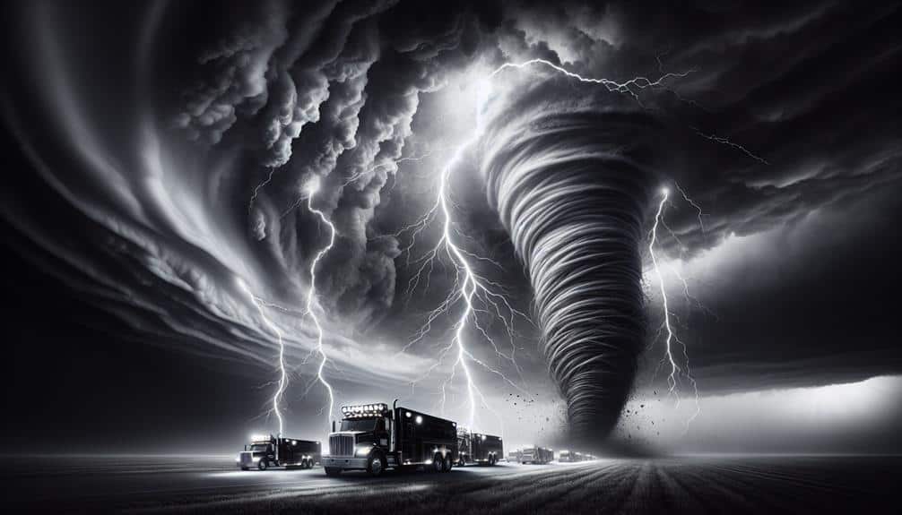
We depend on up-to-date data and state-of-the-art tools like mobile weather stations, GPS-enabled devices, and Doppler radar to monitor and analyze storms accurately. Satellite imagery and aerial reconnaissance from drones offer detailed insights, while interpreting radar echoes helps identify storm structure and intensity. Utilizing mobile apps and satellite communication systems guarantees continuous data-sharing and connectivity. Rigorous safety protocols, including real-time GPS tracking and personal protective equipment, are essential for minimizing risk. For a thorough understanding of these technologies and strategies that improve our storm-chasing precision, join us as we explore further.
Key Points
- Use mobile weather stations to gather real-time atmospheric data for accurate storm tracking.
- Leverage GPS-enabled devices to monitor storm paths and optimize response strategies.
- Analyze Doppler radar data for high-resolution insights into storm dynamics and rotation patterns.
- Employ high-definition cameras and drones for comprehensive aerial reconnaissance and storm documentation.
Importance of Real-Time Data
Real-time data is crucial for storm monitoring because it enables us to make swift, informed decisions to mitigate potential damage. When we're tracking a storm's path, data accuracy and response time are critical. Precise data allows us to pinpoint the storm's location, intensity, and potential direction. This information, when received promptly, sharpens our decision-making process and enhances our ability to perform timely risk assessments.
Our freedom to maneuver and respond effectively during storm events hinges on this immediate access to precise information. It guarantees that our actions are based on the most current conditions, not outdated reports that could mislead us. This immediacy in data transmission reduces the lag time between observation and response, allowing us to deploy resources, issue alerts, and take protective measures with confidence.
Data-driven insights also play a pivotal role in our risk assessment strategies. By continuously analyzing real-time data, we can identify patterns and predict potential hazards, enabling us to prioritize areas that need urgent attention. This proactive approach not only maximizes our operational efficiency but also empowers us to safeguard lives and property more effectively.
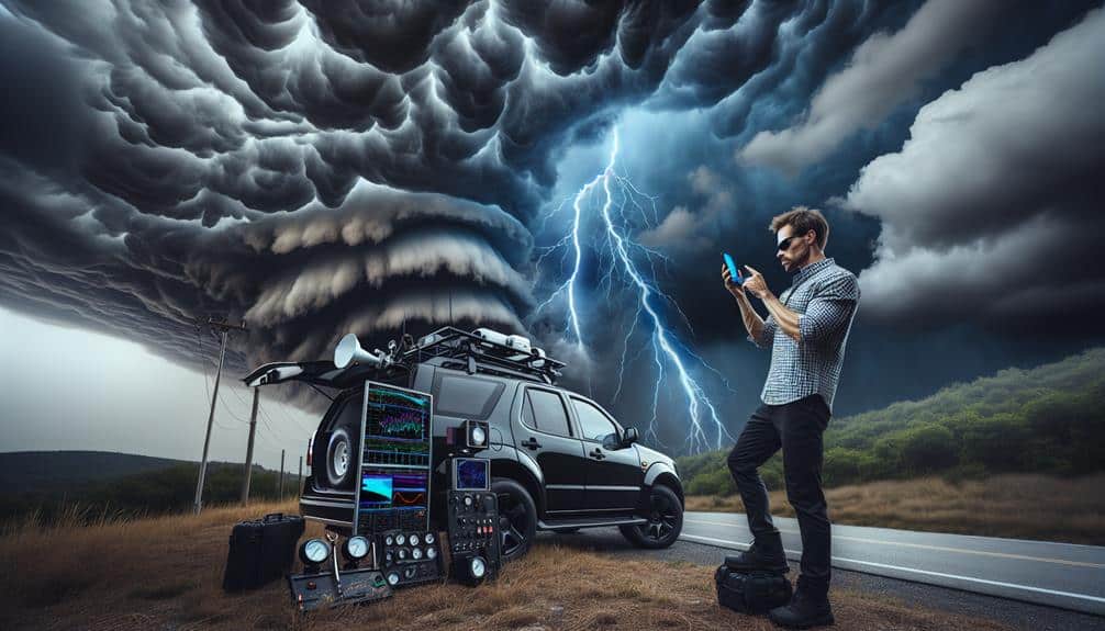
Essential Tools and Equipment
To effectively monitor storms, we depend on a suite of advanced tools and equipment that provide accurate and timely data. These instruments enable us to make crucial decisions and enhance our emergency response capabilities.
One indispensable tool in our arsenal is the mobile weather station. Equipped with barometers, anemometers, and hygrometers, these stations give us real-time data on atmospheric pressure, wind speed, and humidity levels. This granular data is essential for precise weather forecasting.
We also make extensive use of GPS-enabled devices for tracking storm trajectories. Real-time location data allows us to predict the storm's path and potential impact areas, optimizing our response strategies.
Another key piece of equipment is the Doppler radar, which offers high-resolution insights into storm dynamics, such as wind patterns and precipitation intensity.
Furthermore, we employ high-definition cameras and drones for aerial reconnaissance. These tools provide visual confirmation of storm conditions and help us assess structural damage quickly.
Satellite communication systems ensure we stay connected, even in remote locations, providing a reliable stream of data to our base operations.
Weather Radar Interpretation
Let's examine how we interpret weather radar data to monitor storms effectively.
By analyzing radar echoes, we can identify significant features such as precipitation intensity and storm structure.
Additionally, identifying rotation patterns within these echoes is important for detecting potential tornadoes and issuing timely warnings.
Analyzing Radar Echoes
Analyzing radar echoes involves scrutinizing the intensity and movement of various reflectivity patterns to determine precipitation types, storm structure, and potential severe weather threats. Using Doppler radar, we can measure both the position and velocity of precipitation particles, providing a thorough view of storm dynamics. By interpreting reflectivity values, we identify heavy rain, hail, and snowfall, and distinguish between different precipitation types.
When we examine storm structure, we look for specific patterns like hook echoes or bow echoes, which can indicate tornadoes or strong straight-line winds. The vertical structure of storms, seen through Doppler radar cross-sections, reveals critical insights into updrafts and downdrafts, helping us predict severe weather events.
We also monitor the evolution of these radar signatures over time. For instance, a rapidly intensifying core with high reflectivity could signal a developing severe thunderstorm. The spatial arrangement of echoes helps us understand storm organization, from single-cell thunderstorms to supercells.
This data-driven approach empowers us to make real-time decisions, enhancing our situational awareness and increasing our ability to navigate storm environments effectively. By mastering radar interpretation, we gain the freedom to chase storms with greater confidence and precision.
Identifying Rotation Patterns
Frequently, identifying rotation patterns within storm systems involves scrutinizing velocity couplets and shear markers on Doppler radar to detect mesocyclones and possible tornado genesis. By analyzing these features, we can pinpoint areas of strong wind convergence and divergence, crucial for rotation detection. The velocity couplets, represented by adjacent red and green colors on the radar, indicate opposing wind patterns, which signal rotational motion within the storm structure.
To achieve precise rotation detection, we focus on the mesoscale details of a storm formation. By examining wind patterns at different altitudes, we can differentiate between benign and potentially tornadic rotations. For instance, consistent rotation across multiple radar scans suggests a persistent mesocyclone, an important precursor for tornado development.
Additionally, shear markers, which highlight abrupt changes in wind speed and direction, are essential in identifying the storm's rotational intensity and potential for strengthening.
Our analysis doesn't stop there. We integrate data from multiple radar sites to triangulate precise locations of rotation within the storm structure. This multi-faceted approach enables us to provide timely and accurate warnings, empowering communities to take necessary precautions and embrace the freedom of informed decision-making.
Satellite Imagery Analysis
Let's examine how high-resolution satellite imagery enhances our storm monitoring capabilities by providing detailed data on cloud structures.
We can identify specific cloud patterns that indicate storm development, intensity, and movement. This resolution allows us to detect subtle changes in storm systems that low-resolution images might miss.
Image Resolution Importance
High-resolution satellite imagery is essential for accurately monitoring and analyzing storm development and progression. When we talk about image resolution clarity, we're referring to the level of detail present in the satellite images. Higher resolution provides us with finer details, allowing for more precise storm tracking accuracy. We can detect smaller cloud formations, wind patterns, and precipitation areas, which are critical for understanding a storm's current state and potential path.
The data visualization impact of high-resolution imagery can't be overstated. With clearer images, we can create more accurate models and simulations. These models improve our forecasting precision, giving us the ability to predict storm intensity and movement with greater confidence. The higher the resolution, the more data points we have, leading to more robust and reliable forecasts.
Furthermore, high-resolution satellite imagery enables us to observe micro-scale features that are often missed in lower-resolution data. These features play a significant role in storm dynamics. By incorporating this detailed information into our analyses, we elevate our ability to make informed decisions and provide timely warnings, ultimately granting us the freedom to better prepare and respond to severe weather events.
Cloud Pattern Recognition
Understanding cloud pattern recognition through satellite imagery analysis allows us to decode the complex structures and behaviors within storm systems, enhancing our predictive capabilities. By examining cloud formations, we gain insights into atmospheric conditions that drive storm development.
Satellite imagery provides real-time data, capturing the dynamic evolution of cloud systems, which is essential for accurate storm prediction.
When analyzing satellite imagery, we look for specific patterns that indicate potential storm activity. For instance:
- Cumulonimbus Clouds: These towering formations signal severe weather, including thunderstorms and tornadoes. Identifying them early helps us prepare and take necessary precautions.
- Anvil-shaped Clouds: These formations, often associated with mature thunderstorms, indicate the presence of strong updrafts and downdrafts, crucial for storm development analysis.
- Spiral Bands: These are indicative of tropical cyclones. Recognizing these patterns allows us to track storm intensity and trajectory, important for issuing timely warnings.
Mobile Apps for Storm Chasing
While storm chasing has traditionally relied on advanced meteorological tools, mobile apps now provide real-time data and sophisticated tracking capabilities that enhance our ability to monitor severe weather events. With GPS tracking integrated into apps like RadarScope and Storm Shield, we can pinpoint our location relative to storm cells, optimizing our routes for safety and observation.
These apps send us storm alerts, offering immediate updates on severe weather conditions, essential for making split-second decisions.
Live streaming functionality in apps such as Periscope and YouTube Live allows us to broadcast our experiences in real-time. This not only aids in video documentation but also provides a resource for meteorologists and fellow chasers. The ability to capture and share high-quality footage instantly means we contribute valuable data to the broader storm-chasing community, enhancing collective knowledge and response strategies.
Using these apps, we track storm development, movement, and intensity with unparalleled precision. The data-driven insights we gain from these tools empower us to act autonomously in the field, making informed decisions while embracing the freedom of the chase.
The integration of mobile technology into our workflows transforms storm chasing into a more dynamic and interactive endeavor.
Communicating With Fellow Chasers
How do we effectively use communication tools to coordinate with fellow chasers and enhance our storm monitoring efforts? Effective group coordination and maintaining situational awareness are crucial for storm chasers. Utilizing advanced communication tools can greatly boost our operational efficiency and emergency response capabilities.
First, we need to leverage real-time data-sharing platforms. These platforms allow us to instantly share essential information, enhancing our situational awareness and enabling us to make informed decisions quickly.
Second, joining a spotter network amplifies our efforts. By connecting with a broader community of chasers, we can access shared intelligence, which helps us to track storm movements more accurately and respond proactively to changing conditions.
Lastly, we should employ encrypted communication channels. Security is paramount, especially during high-stakes situations. Encrypted channels prevent unauthorized access, ensuring that our group coordination remains uncompromised.
Here's how we can make a difference:
- Real-time data-sharing: Instant updates keep everyone on the same page.
- Spotter network: Collective intelligence strengthens our tracking and response capabilities.
- Encrypted channels: Secure communication safeguards our efforts.
Safety Precautions and Protocols
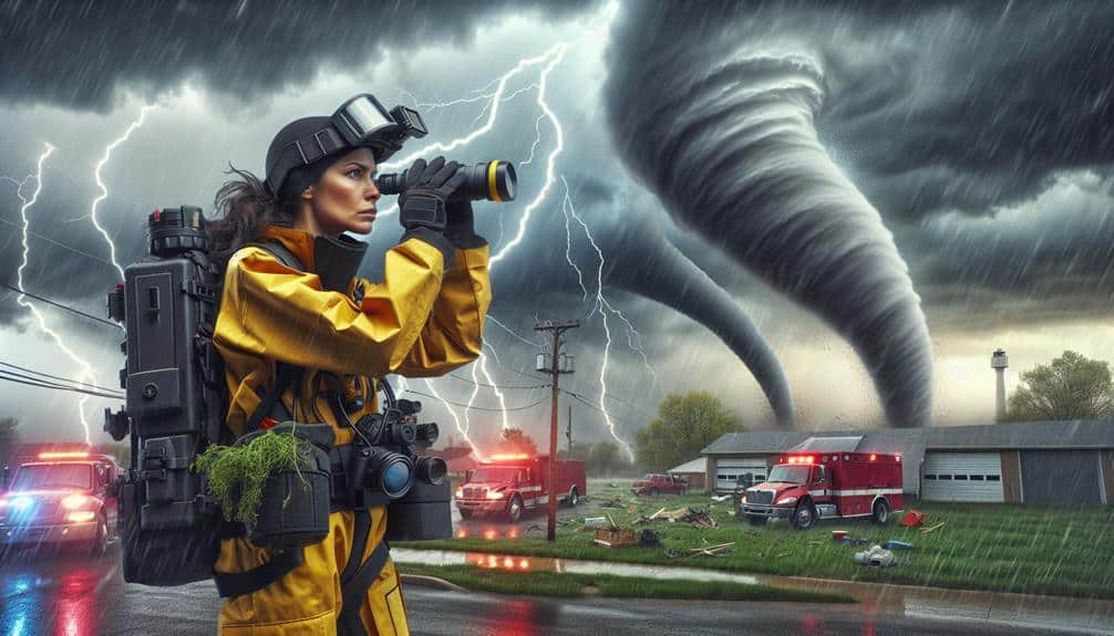
Ensuring our safety demands rigorous adherence to established protocols and constant vigilance in the field. We must always prioritize risk assessment by continuously monitoring atmospheric data and radar updates. Emergency procedures should be ingrained in our routine.
For instance, knowing the exact location of storm shelters within our operational area can be the difference between life and death during an unexpected tornado.
Operational coordination is paramount. We utilize real-time GPS tracking and communication devices to maintain situational awareness and relay critical updates. Our vehicles are equipped with reinforced structures and specialized gear, like portable weather stations, to analyze storm intensity and trajectory accurately.
This data-driven approach allows us to make informed decisions swiftly.
When deploying, we never compromise on personal protective equipment. Helmets, reinforced gloves, and weather-resistant attire are essential to mitigate injury risks from flying debris or hazardous conditions. In the event of an emergency, our protocol mandates immediate regrouping at pre-designated safe zones or storm shelters.
Lastly, post-chase debriefing sessions provide analytical insights, helping refine our safety measures and protocols. By embracing these rigorous standards, we maximize our freedom to explore severe weather phenomena while minimizing inherent risks.
Frequently Asked Questions
How Can I Become a Certified Storm Chaser?
To become certified storm chasers, we need storm chasing certification and dedication to chasing safety precautions. We must complete meteorology courses, attend safety workshops, and gain practical experience. Certification guarantees our readiness, safety, and freedom to pursue storms.
What Should I Do if I Encounter a Tornado While Driving?
If we encounter a tornado while driving, we should prioritize safety measures and emergency response. Analyzing data, it is clear that seeking shelter in a sturdy building or low-lying area, avoiding overpasses, greatly enhances our survival chances.
Are There Specific Regions More Prone to Severe Storms?
Yes, certain regions are more prone to severe storms due to specific storm patterns and forecasting models. Climate change also has implications, altering these patterns and potentially increasing the frequency and intensity of severe weather events.
How Do I Document and Report My Storm Observations?
We collect data using instruments and apps, analyze it for patterns and anomalies, and report our findings through detailed logs and digital platforms. Effective communication guarantees our observations contribute to broader weather insights and public safety.
What Are the Signs of an Impending Severe Storm?
When we observe cloud formations darkening rapidly, or feel sudden pressure changes, it's a clue. Increased lightning frequency paired with erratic wind patterns often signals an impending severe storm. Let's stay alert and ready.