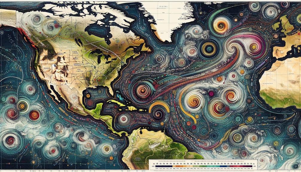
We depend on various data-driven methods to predict hurricane paths accurately. Advanced satellite imagery provides real-time views of cloud formations and sea surface changes, while computer models simulate atmospheric dynamics. Doppler radar offers precise wind and precipitation data, and aircraft reconnaissance collects critical atmospheric metrics. Ocean buoys supply continuous sea surface and atmospheric condition updates. Our historical data analysis enriches predictive models, integrating past storm paths. We also examine wind patterns, sea surface temperatures, and use ensemble forecasting models to thoroughness. By combining these techniques with advanced data assimilation, we guarantee our predictions are as precise as possible. Explore our extensive methods for deeper insights.
Key Points
- Satellite Imagery: Captures real-time cloud formations and sea surface changes for early hurricane detection.
- Computer Models: Simulate atmospheric dynamics and adjust variables for accurate hurricane trajectory prediction.
- Doppler Radar: Uses real-time data on precipitation and wind speeds to enhance forecasting accuracy with machine learning algorithms.
- Aircraft Reconnaissance: Provides precise atmospheric data on wind speeds and pressure for accurate path prediction.
Satellite Imagery
Leveraging satellite imagery, we capture real-time data on cloud formations, sea surface temperatures, and atmospheric conditions to predict hurricane paths with greater accuracy. Satellite technology advancements have greatly improved our ability to monitor and analyze weather patterns.
Improvements in image resolution allow us to pinpoint minute details in cloud structures and sea surface changes, essential for early detection and path prediction. High-resolution images enable us to discern small-scale features that were previously undetectable. This increased granularity fosters more precise predictions, allowing communities to prepare adequately and mitigate potential damages.
Additionally, advancements in data transmission speed guarantee that we receive and process information almost instantaneously, an important factor when dealing with rapidly evolving weather systems. However, we must also contend with challenges such as cloud cover interference, which can obscure crucial data.
Despite this, modern satellites are equipped with sophisticated sensors that can penetrate cloud layers, providing us with uninterrupted data flow. By continually refining these technologies, we enhance our predictive capabilities, empowering individuals and communities to take proactive measures. Our commitment to utilizing cutting-edge satellite imagery ensures that we stay ahead of the curve in hurricane path prediction, ultimately protecting lives and property.
Computer Models
To complement the insights gained from satellite imagery, we employ sophisticated computer models that simulate atmospheric dynamics to predict the trajectory of hurricanes with remarkable precision. These models integrate vast arrays of data, including temperature, humidity, wind speed, and sea surface conditions, to create dynamic simulations that evolve over time.
Our focus on computer model validation guarantees that these simulations accurately represent real-world phenomena. By comparing model outputs to historical hurricane paths, we fine-tune the algorithms and parameters, improving predictive accuracy. Uncertainty analysis plays a pivotal role in this process, helping us quantify the confidence levels in our predictions and identify potential deviations.
Sensitivity to model input is another critical aspect. Small changes in initial conditions can greatly impact the predicted path of a hurricane. As a result, we conduct rigorous sensitivity analyses to determine which parameters most influence the model's outcomes. This allows us to prioritize the most impactful data inputs, enhancing the model's reliability.
Parameter tuning is an ongoing task, requiring us to adjust variables continually to reflect the latest meteorological research and observational data. This iterative process ensures that our models remain at the cutting edge of hurricane prediction, empowering communities to prepare effectively and minimize risk.
Doppler Radar
Let's examine how Doppler radar enhances our ability to predict hurricane paths.
By collecting real-time data on precipitation and measuring wind speeds, we gain vital insights into a hurricane's structure and movement.
This technology allows us to make more accurate forecasts, ultimately improving our preparedness and response efforts.
Real-time Data Collection
Using Doppler radar, we can capture real-time data that's necessary for accurately predicting hurricane paths. This sophisticated remote sensing technology provides us with detailed information on precipitation, wind speed, and storm structure as it unfolds.
By integrating data visualization techniques, we transform this raw data into understandable formats, allowing meteorologists to analyze complex patterns quickly.
Our approach leverages advanced machine learning algorithms to process the massive influx of real-time data. These algorithms identify trends and predict the hurricane's trajectory with higher precision by learning from historical and live data. Real-time updates enable us to refine these models continuously, ensuring timely and precise forecasts.
Key to maximizing the effectiveness of Doppler radar is sensor calibration techniques. Proper calibration guarantees the data we collect is both reliable and accurate. By regularly calibrating our sensors, we eliminate potential errors and maintain the integrity of the data. This is essential for making informed decisions that can greatly impact public safety.
In essence, Doppler radar, when combined with cutting-edge data analysis tools and rigorous calibration, empowers us to monitor and predict hurricane paths with unprecedented accuracy, providing the freedom to make proactive, life-saving decisions.
Wind Speed Measurement
Accurate wind speed measurement is at the core of Doppler radar's capability to predict hurricane paths effectively. By utilizing Doppler radar, we can measure the velocity of wind particles with high precision, providing critical data for wind direction analysis and storm tracking techniques. This technology sends out a burst of energy and measures the frequency shift of returned signals, allowing us to determine wind speeds within the storm system.
With this data, we can enhance our forecasting accuracy by interpreting patterns and velocity changes within the hurricane. The Doppler radar's ability to capture real-time wind data enables us to predict the storm's trajectory and intensity more reliably. Data interpretation techniques, such as analyzing the Doppler velocity signature, help us understand the cyclone's structure and dynamics.
Moreover, integrating Doppler radar data with other meteorological tools, like satellite imagery and weather models, enables a comprehensive approach to hurricane prediction. The synergy between these technologies allows us to refine our storm tracking techniques and improve our forecasts.
Ultimately, leveraging Doppler radar for wind speed measurement not only bolsters our predictive capabilities but also empowers us to make informed decisions, safeguarding lives and property against the devastating impact of hurricanes.
Aircraft Reconnaissance
Frequently, aircraft reconnaissance plays a pivotal role in gathering real-time data essential for predicting hurricane paths. We rely on specialized aircraft, often referred to as hurricane hunters, to penetrate the storm's core and collect essential atmospheric data. These missions involve flying directly into the hurricane's eye, where we can measure wind speeds, pressure, temperature, and humidity. This storm penetration provides us with data that satellite observations alone can't offer, making it indispensable for accurate forecasting.
During these missions, we deploy a range of instruments, including dropsondes, which descend through the storm and transmit detailed atmospheric data back to us. This information helps us understand the hurricane's structure and intensity, as well as the surrounding weather patterns. By analyzing this data, we can refine our models and improve the accuracy of our path predictions.
Aircraft reconnaissance isn't just about gathering data; it's about ensuring that the data is fresh and precise. Real-time updates allow us to track changes in the hurricane's path and intensity, enabling timely warnings and better preparation measures.
Without these missions, our ability to predict and respond to hurricanes would be markedly compromised.
Ocean Buoys

Ocean buoys provide us with essential, real-time data on sea surface temperatures, wave heights, and atmospheric conditions, which are necessary for predicting hurricane paths. By strategically placing these buoys, we can monitor ocean currents and track storms with great precision. This data helps meteorologists refine their models and improve the accuracy of hurricane forecasts.
Our efforts in buoy deployment are paramount. We place these instruments in key locations where they can gather the most pertinent data. Once deployed, buoys continuously transmit information back to analysis centers where we process and interpret the data. The insights derived from this data analysis are invaluable for predicting hurricane behavior and potential landfall points.
Here are some benefits of using ocean buoys for hurricane prediction:
- Real-Time Data: Provides up-to-the-minute information on changing oceanic and atmospheric conditions.
- Comprehensive Monitoring: Enables extensive ocean current monitoring, essential for understanding storm movement.
Weather Balloons
We rely on weather balloons to collect essential atmospheric data efficiently. These balloons provide high-altitude measurements with remarkable accuracy, important for predicting hurricane paths.
Data Collection Efficiency
How effectively do weather balloons enhance our data collection capabilities for predicting hurricane paths?
Weather balloons play an essential role in gathering atmospheric data, which is necessary for the accuracy of our predictive models. These high-altitude instruments collect real-time data on temperature, humidity, pressure, and wind speed, all of which are crucial variables in our data analysis strategies and predictive modeling.
By integrating this data with advanced machine learning applications, we can significantly enhance our forecasting accuracy. Weather balloons provide:
- Comprehensive Data Collection: They capture detailed atmospheric profiles, enabling us to refine our predictive models.
- High Temporal Resolution: With frequent launches, we get up-to-date information, essential for timely predictions.
These advantages allow us to bolster our data sets, feeding more accurate and diverse information into our forecasting systems.
When combined with machine learning algorithms, the richness of this data translates into more reliable hurricane path predictions. This empowers us to make better-informed decisions, ultimately providing greater freedom and safety for those in the potential path of these devastating storms.
Altitude Measurement Accuracy
Altitude measurement accuracy in weather balloons is vital for guaranteeing the reliability of the atmospheric data we gather for hurricane path prediction. With advancements in altitude measurement technology, we've greatly enhanced our ability to predict hurricane paths. Accurate data from weather balloons helps us understand the vertical profile of atmospheric conditions, which is essential for precise prediction accuracy.
When weather balloons ascend, they encounter varying atmospheric conditions such as temperature, pressure, and humidity. These conditions can impact altitude measurement, potentially skewing the data we depend on. To mitigate this, modern weather balloons are equipped with sophisticated sensors and GPS technology, which enhance the precision of altitude measurement. This ensures that the data we collect accurately reflects the atmospheric layers' true state.
Additionally, integrating this high-precision data into our predictive models allows us to forecast hurricane paths more effectively. Accurate altitude measurements enable us to better understand the dynamics of the atmosphere, such as wind shear and thermal gradients, which are vital for predicting a hurricane's strength and direction.
Historical Data
Analyzing historical data offers invaluable insights into the patterns and behaviors of past hurricanes, providing a foundation for more precise path predictions. By examining previous hurricane paths, we enhance our predictive modeling capabilities and understand the climate change impact on hurricane frequency. Historical data enables us to identify recurring trends and anomalies, which are vital for developing robust forecasting tools.
We can leverage decades of hurricane records to refine algorithms that predict storm trajectories more accurately. Historical data helps us recognize shifts in hurricane intensity and movement, influenced by evolving climatic conditions. Understanding these patterns is essential for disaster preparedness, allowing communities to better anticipate and respond to impending storms.
To make the most of historical data, we focus on:
- Data Integration: Combining satellite imagery, oceanic measurements, and historical storm paths to enrich our predictive models.
- Pattern Recognition: Utilizing machine learning to identify correlations between past hurricanes and current environmental conditions.
Wind Patterns
Understanding wind patterns is essential for predicting hurricane paths, as they play a significant role in steering and intensifying these powerful storms. By analyzing the behavior of atmospheric winds, we can gain insights into a hurricane's trajectory and potential impact areas.
Wind patterns, particularly the trade winds and the jet stream, guide hurricanes as they travel across the ocean. Variations in these patterns can alter a storm's course dramatically.
Climate change is influencing wind patterns globally, adding a layer of complexity to our predictive models. As the atmosphere warms, shifts in wind patterns may occur, leading to changes in hurricane paths and intensity.
For instance, research indicates that altered wind patterns due to climate change could push hurricanes closer to coastlines or cause them to stall, increasing the risk of prolonged damage.
Sea Surface Temperatures

As we examine the factors influencing hurricane paths, sea surface temperatures stand out as a critical element due to their direct impact on storm formation and intensity. Warmer waters provide the necessary energy to fuel hurricanes, making accurate prediction of these temperatures essential.
With climate change, we're seeing a significant rise in global sea surface temperatures, which in turn affects hurricane behavior.
To accurately predict hurricane paths, we must consider:
- Historical Data Analysis: Studying past sea surface temperature data helps us identify patterns and trends that can forecast future hurricane activity.
- Real-Time Monitoring: Using satellites and ocean buoys, we can gather real-time data to adjust our models quickly, improving the accuracy of our predictions.
Data Assimilation Techniques
Let's explore how data assimilation techniques enhance our hurricane path predictions through ensemble forecasting models, satellite data integration, and numerical weather prediction.
By combining real-time satellite observations with advanced computational models, we can achieve more accurate and timely forecasts.
These methods allow us to refine our predictions and better prepare for potential impacts.
Ensemble Forecasting Models
Ensemble forecasting models use data assimilation techniques to integrate real-time observations with multiple model simulations, enhancing the accuracy of hurricane path predictions. By leveraging diverse datasets, we can validate models and perform uncertainty analysis, ensuring that our forecasts are both dependable and robust. This approach not only improves forecast accuracy but also refines our communication strategies, providing clear and actionable information to the public.
To break it down, here's how ensemble forecasting models work:
- Data Integration: We combine data from various sources, like buoys, aircraft, and radar, to create a thorough initial state for our models.
- Multiple Simulations: Instead of relying on a single model, we run several simulations with slight variations in initial conditions to account for uncertainties.
Satellite Data Integration
Incorporating satellite data into our models allows us to capture real-time atmospheric and oceanic conditions, greatly enhancing the accuracy of hurricane path predictions. By leveraging sophisticated data assimilation techniques, we can ingest vast amounts of satellite-derived information, such as sea surface temperatures, atmospheric pressure, and wind patterns, directly into our predictive models. This continuous stream of high-resolution data guarantees our models remain up-to-date and reflective of the current environmental conditions.
Machine learning integration plays a pivotal role in processing and interpreting this voluminous satellite data. Through advanced algorithms, machine learning can identify patterns and anomalies that might be overlooked by traditional methods, thereby refining our predictive capabilities. By training these algorithms on historical hurricane data and their corresponding satellite observations, we can improve the model's performance in forecasting hurricane trajectories.
Data visualization techniques are equally essential in this process. They enable us to effectively communicate complex data insights, making it easier to understand and respond to potential threats. Visual tools like heat maps and trajectory plots help us to quickly interpret satellite data, facilitating faster decision-making and more accurate public advisories. Thus, integrating satellite data not only enhances predictive accuracy but also empowers us with actionable intelligence.
Numerical Weather Prediction
Numerical weather prediction relies on advanced data integration techniques to merge observations from various sources into our models, enhancing the accuracy of hurricane path forecasts. By blending satellite data, weather balloons, ground stations, and more, we achieve a thorough view of atmospheric conditions. This allows our models to make precise adjustments, leading to better forecasting accuracy and significant model advancements.
In the face of climate change impacts, predicting hurricane paths becomes even more demanding. The increased frequency and intensity of storms push our models to their limits. However, continuous improvements in data integration techniques help us stay ahead. These advancements are vital as we aim to provide reliable forecasts that can save lives and property.
To illustrate the importance of data integration techniques, consider the following:
- Multi-Source Fusion: Combining weather data from satellites, aircraft, and ground stations creates a more accurate initial state for models.
- Real-Time Updates: Implementing real-time data adjustments ensures that our models reflect the most current atmospheric conditions.
Frequently Asked Questions
How Do Human Activities Influence Hurricane Formation and Paths?
We see that human impact, like greenhouse gas emissions, alters atmospheric conditions, increasing sea surface temperatures. This can intensify hurricanes and potentially change their paths, highlighting our responsibility in mitigating these effects for greater freedom and safety.
What Role Does Climate Change Play in Altering Hurricane Trajectories?
We're investigating how climate change alters hurricane trajectories. With the impact of warming oceans and changing patterns, hurricanes are becoming more unpredictable. Data shows increased intensity and altered paths, challenging our understanding of these powerful storms.
Can Certain Geographical Features Impact the Accuracy of Hurricane Path Predictions?
Yes, geographical features like ocean currents and topography greatly impact hurricane path prediction accuracy. Atmospheric conditions and land use also play vital roles by influencing storm behavior, which necessitates precise data analysis for reliable forecasts.
How Do Emergency Response Plans Factor Into Hurricane Path Predictions?
We integrate emergency response strategies into hurricane path predictions to enhance community preparedness. Accurate data-driven predictions allow us to optimize resource allocation, minimize risks, and guarantee timely evacuations, empowering communities to stay safe and maintain their freedom.
What Are the Economic Implications of Inaccurate Hurricane Path Forecasting?
When hurricane forecasts miss the mark, it's a domino effect of monetary losses and business disruptions. We must enhance accuracy to safeguard economies, reduce financial strain, and guarantee businesses can operate freely without unexpected interruptions.