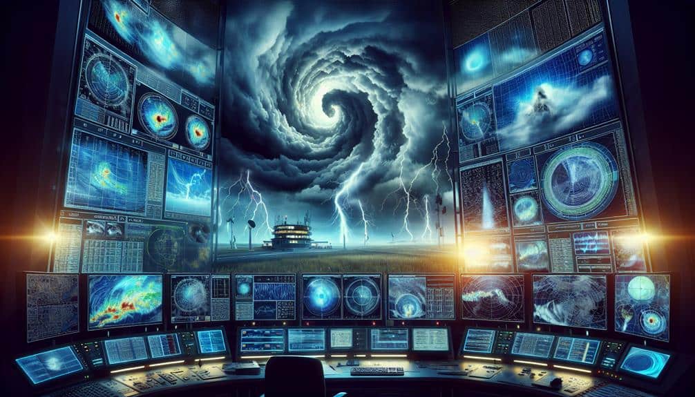
We've pinpointed ten essential tools for predicting severe weather formations that leverage advanced technology and data integration. Doppler radar systems and satellite imaging provide real-time atmospheric data. Weather balloons and anemometers capture critical in-situ measurements. Barometric pressure trends and supercomputer-based storm prediction models offer detailed forecasting capabilities. Lightning detection systems and lightning strike analysis enhance our understanding of storm dynamics. Weather drones and barometers add precision in tracking and predicting weather changes. By combining these tools, we enhance our ability to predict severe weather accurately. Explore further to gain insights into optimizing these predictive technologies.
Key Points
- Doppler Radar Systems provide high-resolution data for tracking storm movements and intensity.
- Weather Balloons measure atmospheric pressure, temperature, and humidity at various altitudes.
- Satellite Imaging offers comprehensive real-time views of weather patterns and storm development.
- Supercomputers run advanced climate models and simulations for accurate severe weather predictions.
Doppler Radar Systems
How do Doppler radar systems enhance our ability to predict severe weather with greater precision?
By leveraging cutting-edge radar technology advancements, we can enhance severe weather tracking and storm detection. Doppler radar systems measure the velocity of precipitation particles, allowing us to determine wind patterns within a storm system.
This data is essential for weather forecasting, as it enables meteorologists to identify rotation patterns indicative of tornadoes or other severe weather phenomena.
With advancements in radar technology, modern Doppler systems can provide high-definition, real-time data. For instance, dual-polarization radar can differentiate between types of precipitation, such as rain, hail, or snow, aiding in more accurate storm analysis.
The reliability of these systems allows us to issue timely warnings, giving individuals and communities the freedom to take necessary precautions.
Moreover, Doppler radar systems have revolutionized our approach to storm detection by providing detailed insights into the structure and intensity of storm cells. The integration of this technology into weather forecasting models enhances predictive capabilities, reducing uncertainty and improving public safety.
As we continue to innovate, the precision and reliability of Doppler radar systems will further empower us to anticipate and respond to severe weather events effectively.
Weather Balloons
Utilizing weather balloons equipped with advanced sensors, we can gather critical atmospheric data such as temperature, humidity, and pressure at various altitudes. These atmospheric measurements are essential for meteorological research and precise weather forecasting. By deploying weather balloons, we obtain real-time data that helps us understand vertical profiles of the atmosphere, which is instrumental in predicting severe weather formations.
When we analyze the data collected from these balloons, we can identify thermal inversions, moisture layers, and pressure changes that are precursors to storms. The detailed data analysis provides insights into the dynamic processes occurring in the atmosphere, enabling us to make informed predictions. These measurements are particularly useful for detecting conditions favorable for thunderstorms, tornadoes, and other severe weather events.
Weather balloons reach altitudes of up to 35 kilometers, providing a thorough vertical snapshot of atmospheric conditions. This high-altitude data is invaluable for improving the accuracy of weather models. By integrating balloon data into our forecasting systems, we can enhance our capabilities in predicting severe weather, ultimately granting us more freedom and preparedness in responding to impending meteorological threats.
The precision and depth of the information gathered fortify our understanding and forecasting accuracy, making weather balloons indispensable in our toolkit.
Satellite Imaging
Satellite imaging provides us with detailed, high-resolution data that's important for monitoring and predicting severe weather formations from a global perspective. By capturing intricate images of cloud formations and atmospheric conditions, satellites enable us to recognize weather patterns and track storms with remarkable accuracy.
Using advanced sensors, these satellites measure various atmospheric parameters such as temperature, humidity, and wind speed at different altitudes. The data collected allows us to analyze the dynamics of cloud formations and detect early signs of severe weather developments.
For example, we can identify the buildup of cumulonimbus clouds, which often precede thunderstorms and tornadoes, or track the evolution of tropical cyclones in near real-time.
Weather pattern recognition is greatly improved by satellite imaging. The continuous flow of high-resolution imagery provides a detailed view of how weather systems evolve over time. This enhances our ability to forecast severe weather events, giving us vital lead time to issue warnings and take preventive measures.
Satellite imaging isn't just about capturing static images; it's about dynamic storm tracking. By monitoring the movement and development of storms, we can predict their path and potential impact zones, thereby safeguarding lives and property through timely information dissemination.
Supercomputers
We can't overlook the pivotal role of supercomputers in predicting severe weather formations.
These machines process vast datasets at unprecedented speeds, enabling real-time analysis.
With advanced climate models, they simulate complex atmospheric interactions to provide accurate forecasts.
Data Processing Speed
With the advent of supercomputers, we can process vast datasets at unprecedented speeds, thereby enhancing our ability to predict severe weather formations with greater accuracy. This rapid data processing is essential for leveraging cloud computing efficiency and machine learning algorithms.
By utilizing these technologies, we can analyze complex atmospheric patterns in real-time. Supercomputers allow us to ingest immense volumes of meteorological data and run sophisticated simulations that would be unattainable on traditional hardware.
Our network infrastructure scalability guarantees that these vast datasets are transmitted and processed without bottlenecks, maintaining the integrity and timeliness of predictions. Supercomputers use advanced data visualization techniques to transform raw data into understandable models, enabling meteorologists to identify potential severe weather formations more effectively.
This real-time visualization is critical for issuing timely warnings, potentially saving lives and property.
Moreover, the integration of machine learning algorithms allows us to refine our predictive models continuously. By learning from historical data, these algorithms improve their accuracy over time, providing more reliable forecasts.
When combined with the unparalleled processing speed of supercomputers, we achieve a synergy that significantly enhances our predictive capabilities. Essentially, supercomputers aren't just tools; they're revolutionizing our approach to severe weather prediction.
Advanced Climate Models
Harnessing the unparalleled computational power of supercomputers, advanced climate models can simulate intricate atmospheric dynamics with remarkable precision. These models incorporate vast datasets, ranging from sea surface temperatures to greenhouse gas concentrations, to project future weather scenarios. By doing so, we can better understand the climate change impact on severe weather formations and predict weather pattern shifts with higher accuracy.
Our reliance on supercomputers allows us to run complex simulations that resolve atmospheric processes down to the kilometer scale. This granularity is vital for forecasting localized severe weather events such as hurricanes, tornadoes, and flash floods. Supercomputers like the Earth Simulator and IBM's Blue Gene can process petabytes of data, enabling us to scrutinize the subtleties of atmospheric interactions.
Moreover, these advanced climate models employ sophisticated algorithms to factor in feedback mechanisms and non-linear dynamics, which are fundamental for capturing the real-world complexities of climate systems. By continuously refining these models with real-time observational data, we can mitigate the uncertainties in our predictions.
In essence, leveraging supercomputers for advanced climate modeling not only enhances our predictive capabilities but also empowers us to prepare for and adapt to the evolving challenges posed by climate change and shifting weather patterns.
Storm Prediction Models
Storm prediction models leverage advanced algorithms and vast datasets to provide accurate forecasts of severe weather events. By integrating real-time data from various sources, these models enhance our storm tracking capabilities and improve forecast accuracy. This allows us to make informed decisions and exercise our freedom in planning and safety measures.
Storm prediction models utilize several core components:
- Data Assimilation: Incorporates real-time observational data from satellites, radar, and weather stations to update and refine model forecasts.
- Numerical Weather Prediction (NWP): Uses mathematical formulations to simulate atmospheric processes and predict future weather patterns.
- Ensemble Forecasting: Runs multiple simulations with slightly varied initial conditions to estimate the range of possible outcomes and provide probabilistic forecasts.
- Machine Learning: Employs algorithms to identify patterns in historical data, thereby improving predictive capabilities and reducing forecast errors.
Mobile Weather Apps
When evaluating mobile weather apps, we need to think about their capability to provide real-time weather updates and interactive radar maps.
These features enable us to track severe weather patterns with precision and make data-driven decisions quickly.
Real-Time Weather Updates
Mobile weather apps provide real-time updates by leveraging advanced meteorological algorithms and extensive sensor networks to deliver precise forecasts directly to users' devices. These apps enhance weather forecasting accuracy by processing vast amounts of data, but there are still limitations due to the unpredictable nature of weather systems.
Despite these constraints, the impact of real-time updates on emergency response planning is substantial. Rapid dissemination of information allows emergency services to allocate resources more effectively and the public to make informed decisions, increasing overall safety.
- Precision Forecasting: Uses algorithms to analyze minute-to-minute changes.
- Alert Systems: Sends push notifications for severe weather warnings.
- Crowdsourced Data: Incorporates user-submitted weather reports for localized accuracy.
- Customizable Interfaces: Lets users set preferred parameters for alerts and updates.
Our reliance on these mobile apps underscores their importance in modern weather prediction. While the inherent limitations mean we can't always predict severe formations perfectly, the real-time updates they provide are a game-changer.
They empower us to prepare better and respond quicker, embodying the freedom that comes with being well-informed and ready to act.
Interactive Radar Maps
Interactive radar maps in weather apps offer an invaluable tool for visualizing storm development and tracking weather patterns in near real-time. By leveraging high-resolution radar data, we can monitor atmospheric disturbances with remarkable accuracy. These maps use Doppler radar technology to detect precipitation, its intensity, and movement, providing a dynamic visual representation of weather systems.
For effective weather tracking, radar maps update every few minutes, ensuring we've the most current information. We can zoom in on specific regions to scrutinize local conditions or zoom out for a broader perspective of weather fronts. This capability is essential for storm monitoring, allowing us to predict potential severe weather events like thunderstorms, tornadoes, and hurricanes.
These interactive maps also feature color-coded legends that help us differentiate between types of precipitation and intensity levels. For instance, green typically indicates light rain, while red denotes heavy rainfall or potential severe weather.
The integration of these advanced features in mobile apps empowers us to make informed decisions, whether we're planning outdoor activities or seeking safety during extreme weather conditions. By utilizing this technology, we gain a greater sense of autonomy and readiness in navigating our weather-dependent world.
Weather Drones
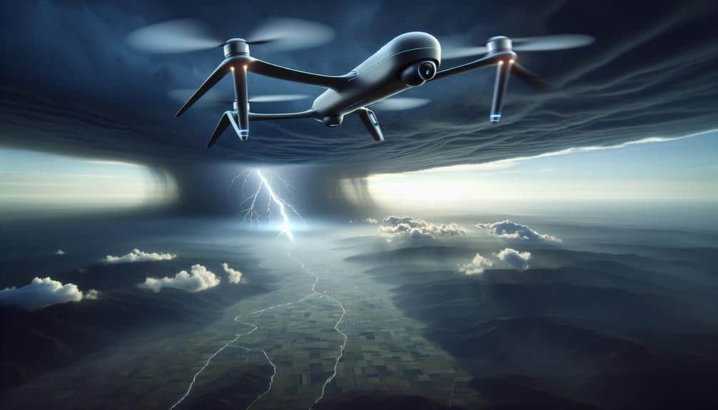
In recent years, weather drones have revolutionized the accuracy and scope of severe weather predictions by providing real-time atmospheric data from remote and hazardous locations. Leveraging drone technology advancements, we can now gather critical data points that were previously unreachable. These drones are equipped with sophisticated sensors that measure temperature, humidity, wind speed, and atmospheric pressure, allowing us to enhance our severe weather response strategies to a great extent.
The integration of weather drones into meteorological practices has yielded several benefits:
- High-resolution data collection: Drones capture detailed atmospheric conditions, allowing for precise forecasting.
- Rapid deployment: Drones can be quickly dispatched to emerging weather formations, providing timely data.
- Cost-effectiveness: Compared to traditional weather monitoring systems, drones are a more affordable option.
- Safety: Drones can access dangerous weather zones without risking human lives.
Anemometers
Anemometers, vital tools in meteorology, measure wind speed with high precision, enabling us to analyze and predict severe weather phenomena accurately. By capturing data on wind velocity, we can detect patterns that might indicate the formation of storms, hurricanes, or tornadoes. High wind speeds often correlate with significant atmospheric pressure changes, providing pivotal data points for our models.
Modern anemometers, such as cup anemometers and ultrasonic anemometers, offer reliable measurements across a range of conditions. Cup anemometers, with their rotating cups, provide consistent data even in harsh weather. Meanwhile, ultrasonic anemometers use sound waves to measure wind speed and direction without moving parts, reducing maintenance and increasing accuracy.
Data collected from anemometers is integrated into atmospheric models, enhancing our predictive capabilities. By analyzing wind speed in tandem with atmospheric pressure data, we identify areas of potential severe weather development. This synergy of data allows us to issue timely warnings, potentially saving lives and minimizing property damage.
Barometers

Barometers, essential for measuring atmospheric pressure, play a pivotal role in our ability to forecast severe weather events accurately. Historically, these instruments have been instrumental in the evolution of meteorology.
Modern applications have taken barometry to new levels, integrating digital sensors and wireless communication for real-time data transmission.
Let's explore the importance and applications of barometers in weather prediction:
- Historical significance: Barometers date back to the 17th century, providing the foundation for atmospheric science.
- Modern applications: Today's barometers are equipped with advanced technologies, enabling precise weather forecasting and integration into complex meteorological networks.
- DIY calibration: Ensuring accurate readings requires regular calibration. Simple DIY methods include comparing readings with a trusted source or using calibration software.
- Maintenance tips: Regularly clean the sensor and check for any physical damage. Ensuring the device is kept in a stable environment helps maintain its accuracy.
Lightning Detection Systems
Lightning detection systems have transformed our ability to monitor and predict severe weather by providing real-time data on electrical discharges in the atmosphere. These systems utilize a network of ground-based sensors and satellite technology to detect and triangulate the location of lightning strikes.
Through lightning strike analysis, we can achieve unprecedented storm tracking accuracy, which is essential for timely and effective weather warnings.
By integrating data from multiple sources, these systems enhance our thunderstorm prediction techniques. For instance, a rapid increase in lightning activity often precedes severe weather events like tornadoes and hailstorms. This correlation allows us to issue more precise alerts, thereby improving public safety and preparedness.
Implementing lightning safety measures is another vital benefit. Real-time data empowers communities and organizations to take immediate action, such as halting outdoor activities or initiating emergency protocols. Furthermore, sectors like aviation and maritime operations rely heavily on these systems to navigate safely around storm cells.
Frequently Asked Questions
How Do Weather Predictions Impact Emergency Preparedness?
How do weather predictions impact emergency preparedness? Imagine knowing a storm's path days in advance. We can coordinate emergency response, ensuring community safety. Data-driven forecasts empower us, providing critical information for timely evacuations and resource allocation.
What Role Do Meteorologists Play in Severe Weather Forecasting?
We depend on meteorologist expertise and real-time data interpretation to forecast severe weather accurately. Their precise analysis guarantees timely warnings, enabling us to make informed decisions and maintain our freedom to act swiftly in emergencies.
How Does Climate Change Affect Severe Weather Patterns?
We observe that climate change, driven by the impact of emissions, intensifies extreme events. Data shows increased frequency and severity of storms, floods, and heatwaves. Our freedom to act is pivotal in mitigating these changes.
What Are the Limitations of Current Weather Prediction Tools?
When we investigate the limitations of current weather prediction tools, we find data accuracy and forecast uncertainty are major issues. Advanced models can't always account for rapid atmospheric changes, impacting our ability to make precise forecasts reliably.
How Can Communities Stay Informed About Severe Weather Threats?
We can improve community engagement by leveraging advanced disaster communication systems. Regular updates, using real-time data and predictive analytics, guarantee communities stay informed about severe weather threats, empowering them to take timely and effective action.


