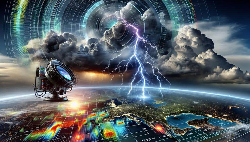
For predicting storm formations, we consider Doppler Radar, Phased Array Radar, Dual-Polarization Radar, X-Band Radar, S-Band Radar, and C-Band Radar as the most effective systems. Doppler Radar excels at tracking storm velocity and direction, while Phased Array Radar offers a 30% lead time improvement for tornado warnings. Dual-Polarization Radar gives detailed precipitation analysis, and X-Band Radar provides high-resolution imaging. S-Band Radar penetrates heavy precipitation effectively, and C-Band Radar balances range and resolution. Mobile radar systems add flexibility for data collection in various locations. Let's explore how each system enhances our predictive capabilities.
Key Points
- Doppler Radar excels in storm tracking and weather prediction by measuring storm particles' velocity and direction.
- Phased Array Radar offers rapid scanning and simultaneous functions, improving tornado warning lead times by 30%.
- Dual-Polarization Radar provides detailed precipitation analysis and differentiates rain, snow, sleet, and hail with precision.
- S-Band Radar offers superior penetration through heavy precipitation, crucial for storm formation prediction.
Doppler Radar
Doppler radar, a critical tool in meteorology, measures the velocity and direction of storm particles by analyzing the frequency shift in returned radar signals. We utilize this radar technology for precise storm tracking and weather prediction.
By emitting microwave signals and capturing the returned echoes, Doppler radar can determine the motion and intensity of precipitation. This technology enables us to identify rotation within storm systems, potentially forecasting tornadoes and severe weather events with higher accuracy.
In meteorological applications, Doppler radar's data-driven insights are indispensable. It provides real-time updates on storm developments, allowing us to make informed decisions on issuing warnings and advisories.
The ability to measure radial velocity—speed toward or away from the radar site—helps us map wind patterns and detect phenomena like gust fronts and microbursts, which can be critical for aviation safety and public preparedness.
Moreover, Doppler radar enhances weather prediction models by feeding accurate data into computational algorithms. This real-time data assimilation improves the reliability of forecasts, empowering us to anticipate storm formations and trajectories.
As we continue to leverage advanced radar technology, our capacity to predict and respond to severe weather conditions greatly enhances, offering a greater sense of freedom and security for communities.
Phased Array Radar
Phased array radar, characterized by its ability to steer the radar beam electronically without moving parts, amplifies our capability to monitor and predict storm formations in real-time. This radar technology advancement offers unparalleled weather forecasting accuracy by reducing the time required to scan the atmosphere.
Unlike traditional radar systems, phased array radar can perform multiple functions simultaneously, such as tracking multiple storm cells and detecting wind patterns, enhancing our storm tracking capabilities.
We leverage phased array radar's adaptability to swiftly focus on areas of interest, providing high-resolution data essential for identifying severe weather conditions. The electronic steering eliminates mechanical delays, allowing continuous, rapid updates that are vital for timely warnings.
According to recent studies, phased array radar systems have shown a 30% improvement in lead time for tornado warnings compared to conventional radar systems. This efficiency not only saves lives but also grants us the freedom to make proactive decisions in weather-sensitive operations.
Incorporating phased array radar into our radar applications portfolio means we can better anticipate storm formations, mitigate risks, and enhance public safety. By embracing these radar technology advancements, we push the boundaries of weather forecasting accuracy and storm tracking capabilities.
Dual-Polarization Radar
Dual-polarization radar, by transmitting and receiving both horizontal and vertical pulses, allows us to obtain detailed information about precipitation types, shapes, and sizes, thereby enhancing storm analysis and prediction accuracy. This capability is crucial for storm tracking and understanding complex weather patterns.
By analyzing polarimetric variables such as differential reflectivity (ZDR) and specific differential phase (KDP), we can differentiate between rain, snow, sleet, and hail with remarkable precision.
When we observe these polarimetric variables, we gain insights into the microphysical properties of precipitation, which directly informs our storm tracking efforts. For example, a high ZDR value indicates large raindrops or melting hail, essential for predicting severe weather events. Similarly, KDP provides us with data on the liquid water content, enabling us to anticipate flooding risks more accurately.
Furthermore, the dual-polarization radar's ability to enhance precipitation identification enables us to refine our forecasts and issue more timely warnings. This technological advancement empowers us to act decisively, providing individuals the information they need to make informed decisions and maintain their freedom during severe weather situations.
To summarize, dual-polarization radar significantly boosts our storm prediction and analysis capabilities, making it an indispensable tool in modern meteorology.
X-Band Radar
Let's examine the capabilities of X-Band radar, which excels in high-resolution weather imaging and short-range precipitation detection.
With its shorter wavelength, X-Band radar can detect smaller particles, providing detailed data on storm structures.
This technology enhances our ability to monitor localized weather events, offering critical insights for storm prediction.
High-Resolution Weather Imaging
X-Band radar technology offers unmatched high-resolution weather imaging, enabling us to detect and analyze storm formations with exceptional detail and accuracy. This advanced radar system operates at a frequency range of 8 to 12 GHz, providing data resolution that's both detailed and thorough. By capturing minute atmospheric variations, X-Band radar greatly enhances our weather prediction accuracy. We're able to pinpoint the exact locations and intensities of developing storm cells, which is essential for timely forecasting.
The impact on emergency response and disaster preparedness can't be overstated. High-resolution imaging allows emergency services to allocate resources more efficiently and prepare for imminent weather threats with a greater degree of confidence. For instance, during hurricane season, the precise data from X-Band radar can guide evacuation plans and resource distribution, minimizing the risk to life and property. The detailed imaging also plays a crucial role in post-disaster assessments, helping us understand storm behaviors and improve future predictive models.
In essence, the integration of X-Band radar into our weather monitoring systems empowers us with the freedom to act swiftly and effectively, reducing the devastating impacts of severe weather events.
Short-Range Precipitation Detection
Our X-Band radar excels in short-range precipitation detection, offering real-time data that enhances our ability to monitor and predict localized weather events with remarkable precision. This radar operates at a higher frequency, which allows for detailed observations of small-scale atmospheric conditions. Its shorter wavelength is particularly adept at detecting light to moderate precipitation, making it an essential tool for storm tracking and weather forecasting.
By providing high-resolution data, our X-Band radar supports rigorous data analysis, enabling us to dissect meteorological phenomena with granularity. We can identify the development and movement of weather cells, track their intensity, and predict their potential impact with increased accuracy. This is pivotal for issuing timely warnings and mitigating risks, especially in densely populated or vulnerable areas.
The radar's ability to detect variations in precipitation intensity and type enhances our understanding of atmospheric conditions. This detailed insight allows us to refine our predictive models, improving the overall reliability of our weather forecasting efforts. As a result, we empower communities with the freedom to make informed decisions, enhancing safety and preparedness.
Our commitment to leveraging advanced technology like the X-Band radar underscores our dedication to precision in meteorological science.
S-Band Radar
S-Band radar, operating within the frequency range of 2 to 4 GHz, offers superior penetration through heavy precipitation, making it invaluable for accurately monitoring and predicting severe storm formations. By effectively utilizing advanced signal processing and frequency modulation techniques, S-Band radar systems enhance our ability to detect and analyze storm structures with remarkable precision.
One of the key strengths of S-Band radar lies in its exceptional capability to penetrate dense rainfall, providing clearer and more reliable data. This is critical when we're dealing with extreme weather events where accurate information can mean the difference between safety and disaster. Advanced signal processing algorithms further refine the raw data, removing noise and enhancing the clarity of storm images. Frequency modulation, on the other hand, allows for fine-tuning the radar signals, enabling us to capture high-resolution data over long distances.
Consider the following emotional impacts of S-Band radar:
- Enhanced safety: Prompt and accurate storm predictions save lives.
- Economic stability: Better storm tracking minimizes damage and economic disruption.
In essence, S-Band radar systems equip us with the tools needed to confront nature's most formidable challenges, offering a blend of technological sophistication and life-saving potential.
C-Band Radar
Let's examine C-Band radar, which offers a balanced trade-off between range and resolution, making it ideal for mid-range weather monitoring.
We see its effectiveness in detecting weather phenomena such as precipitation, hail, and tornadoes.
Range and Resolution
C-Band radar systems, operating in the 4 to 8 GHz frequency range, offer a balanced trade-off between range and resolution, making them ideal for tracking and predicting storm formations. By leveraging these frequencies, we achieve improved radar coverage and precise storm tracking capabilities. This balance is vital for weather prediction, as it allows us to detect storm systems at effective distances while maintaining high-resolution data outputs.
In terms of radar technology, C-Band systems provide several advantages:
- Enhanced Data Quality: Our ability to capture detailed atmospheric data ensures more precise weather prediction models.
- Extended Operational Range: These radars can monitor large geographic areas, providing thorough storm tracking across regions.
These benefits empower us to make informed decisions quickly, which is essential for those who value the freedom to act on reliable weather information.
The technical aspects of C-Band radar, including its optimal balance of range and resolution, directly influence our ability to predict and prepare for severe weather events. By understanding and utilizing this radar technology, we can significantly improve our storm tracking capabilities and enhance the accuracy of weather prediction models.
Weather Phenomena Detection
Accurately detecting weather phenomena with C-Band radar systems hinges on our ability to interpret high-resolution data and identify key atmospheric signatures indicative of storm development. By leveraging these radars, we can track storm systems with greater precision, focusing on atmospheric conditions such as wind velocity, precipitation intensity, and cloud structures. The C-Band radar's wavelength, typically around 5 cm, makes it highly effective for storm tracking, as it balances range and resolution, enabling us to discern detailed weather patterns.
In weather prediction, the data analysis derived from C-Band radar systems plays an essential role. We use algorithms to process radar returns, converting raw data into actionable insights. Reflectivity patterns, Doppler velocity, and dual-polarization data help us distinguish between different types of precipitation and identify the rotational signatures that often precede tornado formation. This high level of detail enhances our predictive capabilities, allowing us to issue timely warnings and mitigate the impact of severe weather events.
Ultimately, our reliance on C-Band radar for weather phenomena detection guarantees we can provide accurate and timely weather predictions. This empowers communities to prepare and respond, enhancing their resilience and freedom in the face of unpredictable atmospheric conditions.
Mobile Radar Systems
While traditional fixed radar systems have their advantages, mobile radar systems provide important flexibility and enhanced data collection capabilities for predicting storm formations. With the ability to be deployed rapidly in various locations, mobile radar units offer a strategic edge in data accuracy and mobility. This adaptability is invaluable for accurate storm tracking and timely emergency response, ensuring that we can act swiftly to protect lives and property.
Mobile radar systems excel in several key areas:
- Enhanced Data Accuracy: By positioning radars closer to the storm, we collect higher-resolution data, leading to more precise predictions.
- Rapid Deployment: The mobility of these systems allows us to quickly cover gaps in fixed radar networks, enhancing overall storm monitoring.
This combination of data accuracy and mobility makes mobile radar systems indispensable tools for storm tracking and emergency response. Their ability to provide granular, real-time information allows us to stay one step ahead of evolving weather patterns.
In a world where timely data can mean the difference between safety and disaster, the role of mobile radar systems can't be overstated.
Frequently Asked Questions
How Do Radar Systems Contribute to Overall Weather Forecasting Accuracy?
Radar systems enhance weather forecasting accuracy by providing real-time data integration. We use advanced forecasting techniques to analyze this data, enabling precise predictions. This empowers us to make informed decisions and maintain our freedom from unpredictable weather events.
What Are the Limitations of Radar Systems in Predicting Storm Formations?
Radar systems can sometimes feel like deciphering an abstract painting; their data accuracy is hindered by technology limitations. These forecasting challenges arise from data interpretation complexities, leading to potential misreads in predicting storm formations.
How Do Radar Systems Integrate With Satellite Data for Storm Prediction?
We integrate radar systems with satellite data by using satellite integration to enhance data correlation. This combined approach provides an in-depth analysis of storm formations, offering a broader and more accurate prediction capability, empowering us with reliable forecasts.
What Advancements Are Being Made in Radar Technology for Better Storm Prediction?
We're seeing significant advancements in radar technology for better storm prediction. Machine learning enhances Doppler radar capabilities, improving storm tracking accuracy. These innovations empower us to predict severe weather more effectively, ensuring greater freedom from unforeseen natural disasters.
How Do Radar Systems Affect Public Safety and Emergency Preparedness?
Radar systems enhance public awareness and emergency response by providing critical data for safety measures and disaster preparedness. They help us predict storm paths, allowing for timely evacuations and resource allocation, ultimately safeguarding lives and property.


