We optimize real-time storm data analysis for storm chasers by integrating advanced meteorological instruments, high-resolution radar systems, and sophisticated machine learning models. We utilize geostationary satellites and surface-based instruments for precise measurements, while dual-polarization and Doppler radars enhance our understanding of storm structure and wind velocities. Machine learning algorithms process extensive historical and real-time data to refine predictions. To secure accurate location tracking, we deploy mobile sensors and edge computing. Our interactive maps and data visualization tools convert raw data into actionable insights, improving decision-making. Stay with us to uncover the full scope of these innovative techniques.
Key Points
- Utilize advanced radar systems like Doppler and dual-polarization radar for real-time storm intensity and wind velocity data.
- Leverage high-accuracy GPS-enabled mobile sensors to collect precise atmospheric data and ensure accurate storm tracking.
- Implement machine learning models to analyze vast datasets quickly, predicting storm behaviors with high accuracy.
- Employ automated weather stations and weather buoys for comprehensive ground-level measurements.
Gathering Accurate Storm Data
Frequently, we depend on advanced meteorological instruments and satellite technology to gather precise storm data for accurate real-time analysis. Our dedication to data accuracy is vital, as it directly influences our storm tracking capabilities.
We utilize geostationary satellites for continuous monitoring, providing high-resolution imagery that captures the developmental stages of storms. These satellites enable us to detect changes in storm intensity and movement with remarkable precision.
Surface-based instruments, such as anemometers and barometers, complement satellite data by offering ground-level measurements of wind speed, pressure, and other crucial parameters. Weather buoys and automated weather stations further enhance our dataset, making sure that every aspect of the storm environment is meticulously recorded. This multi-faceted approach ensures thorough storm tracking, allowing us to predict the storm's path and potential impact zones.
We also incorporate data from weather balloons, which ascend through the atmosphere, collecting vertical profiles of temperature, humidity, and wind patterns. By integrating this data, we achieve a three-dimensional understanding of the storm system.
This holistic view is essential for making informed decisions and taking proactive measures, ultimately granting us the freedom to navigate storm-prone areas with confidence and precision.
Utilizing Advanced Radar Systems
Utilizing advanced radar systems, we enhance our storm tracking capabilities by providing real-time data on precipitation intensity, storm structure, and movement dynamics. These radar technology advancements allow us to pinpoint storm cells with remarkable accuracy. By using dual-polarization radar, we can differentiate between various types of precipitation, such as rain, hail, and snow, improving our storm tracking efficiency.
We incorporate Doppler radar data to measure wind velocities within storms, offering insights into rotational patterns that can indicate tornado formation. This precise data interpretation is essential for issuing timely warnings and increasing storm prediction accuracy.
Moreover, phased array radar systems enable us to scan the atmosphere rapidly, capturing evolving storm details that traditional systems might miss.
Our radar systems are equipped with algorithms that process vast amounts of data, translating raw information into actionable intelligence. These tools allow us to visualize storm structures in three dimensions, enhancing our understanding of their development and potential impact.
Implementing Machine Learning Models
By integrating machine learning models into our storm data analysis, we can predict storm behaviors with greater accuracy and speed. Machine learning (ML) allows us to process vast amounts of data quickly, identifying patterns that traditional methods might miss. Through model training, we refine our algorithms to better understand and anticipate storm dynamics.
Our approach involves collecting historical storm data and feeding it into ML models. These models, trained on various datasets, learn to recognize key indicators of storm formation and progression. To confirm high prediction accuracy, we continually update and validate our models against real-world data. This iterative process enhances the models' ability to predict storm paths, intensities, and potential impacts with remarkable precision.
We utilize techniques such as supervised learning, where the model learns from labeled data, and unsupervised learning, which helps in identifying hidden patterns without pre-existing labels. By leveraging these advanced ML techniques, we can provide timely and reliable forecasts, empowering storm chasers to make informed decisions in real time.
In essence, machine learning transforms raw data into actionable insights, enabling us to stay ahead of the storm and maintain our freedom to chase with confidence and safety.
Enhancing Mobile Data Collection
How can we improve mobile data collection to guarantee storm chasers capture the most accurate and detailed real-time information? To achieve this, we must focus on integrating advanced technology and optimizing workflows. Data accuracy is vital, and remote monitoring plays a pivotal role in achieving it.
First, leveraging high-accuracy GPS systems ensures our location data is precise, minimizing errors that could compromise data integrity.
Second, using mobile sensors that measure various atmospheric parameters, like temperature, humidity, and wind speed, provides a detailed dataset. These sensors should be calibrated regularly for peak performance.
Next, real-time data transmission is essential. Utilizing strong cellular networks and satellite communication ensures continuous data flow, even in remote areas. Additionally, implementing edge computing can process data on-site, reducing delays and allowing immediate decision-making.
Real-Time Data Visualization Techniques
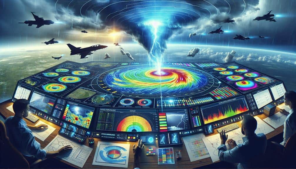
With our mobile data collection optimized for accuracy and immediacy, we now focus on transforming this data into actionable insights through advanced real-time data visualization techniques.
Interactive maps serve as our primary tool, offering a dynamic, geospatial representation of storm data that we can manipulate and analyze in real time. These maps enable us to layer various data points—such as wind speeds, precipitation levels, and storm trajectories—so we can observe complex weather patterns at a glance.
The power of visual storytelling can't be understated in our line of work. By translating raw data into compelling visual narratives, we can quickly communicate critical information to fellow storm chasers and emergency responders.
For instance, heat maps can reveal the intensity of a storm, while animated timelines can depict the progression of weather phenomena with temporal precision.
Moreover, integrating machine learning algorithms with our visualization platforms allows for predictive modeling. This means we can't only see what's happening now but also anticipate future developments, enhancing our decision-making capabilities.
Frequently Asked Questions
How Can Storm Chasers Ensure Their Safety During Extreme Weather Conditions?
During a 2019 tornado, we prioritized safety precautions by using GPS to locate emergency shelters. By continuously monitoring storm patterns and maintaining open communication, we guarantee our safety while still pursuing our passion for storm chasing.
What Are the Best Communication Tools for Storm Chasers in Remote Areas?
For reliable communication in remote areas, we utilize satellite phones and emergency beacons. Satellite phones offer global coverage, while emergency beacons provide precise location data to guarantee rapid response and maintain our freedom to chase safely.
How Do Storm Chasers Collaborate With Meteorological Agencies?
In our collaborative partnerships, we're like modern-day explorers charting unknown seas. We integrate real-time data with meteorological agencies, ensuring seamless data flow and precise storm tracking. This synergy maximizes our efficiency and enhances public safety.
What Are the Ethical Considerations for Storm Chasing?
When discussing ethical considerations for storm chasing, we must address media coverage, privacy concerns, environmental impact, and conservation efforts. Balancing public information needs with respecting individuals' privacy and minimizing ecological disruption is essential.
How Can Storm Chasers Contribute to Public Awareness and Education About Severe Weather?
We empower communities through active engagement and educational outreach. By sharing precise data and storm insights, we foster awareness and preparedness. Our efforts guarantee that people understand severe weather risks and take informed actions to stay safe.