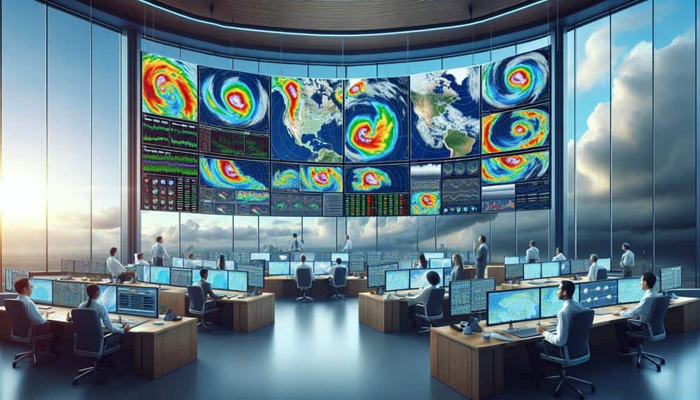
In predicting storm formations, we utilize cutting-edge real-time tracking technologies like Doppler radar and satellite imagery. By analyzing atmospheric pressure, wind patterns, and temperature gradients, we identify potential storm systems. Doppler radar informs us on precipitation velocity and wind dynamics, while satellite imagery offers expansive views and temperature insights. Utilizing weather modeling software, we input real-time metrics and historical data to forecast storm paths and intensities accurately. Our data-driven approach, enriched by advanced statistical methods and machine learning, guarantees dynamic and responsive predictions. Discover more about the tools and techniques that enhance our storm prediction capabilities further.
Key Points
- Utilize Doppler radar to measure precipitation particles' velocity and wind patterns for real-time storm intensity data.
- Monitor satellite imagery for wide-area views and continuous updates on storm system developments and cloud formations.
- Incorporate weather modeling software to forecast storm paths and intensities using sophisticated predictive algorithms.
- Analyze real-time metrics and historical data to identify patterns and trends in storm formation and behavior.
Understanding Storm Dynamics
To effectively predict storm formations, we must first explore the fundamental principles governing storm dynamics. By understanding the interplay between atmospheric pressure, wind patterns, moisture levels, and temperature gradients, we can gain insights into how storms develop.
Atmospheric pressure serves as a primary driver of storm formations. Low-pressure systems, characterized by rising air, often lead to cloud formation and precipitation. On the other hand, high-pressure systems, where air descends, usually result in clearer skies. We need to closely monitor these pressure changes to anticipate potential storm conditions.
Wind patterns play a pivotal role in storm dynamics. Converging winds can force air upwards, enhancing storm development, while diverging winds can dissipate storm energy. By analyzing wind patterns at various altitudes, we can better predict storm intensification or weakening.
Moisture levels in the atmosphere are another vital factor. High moisture content provides the necessary fuel for storm formation and sustenance. Coupled with temperature gradients—differences in temperature between two air masses—this moisture can lead to severe weather events. Areas with sharp temperature gradients are particularly prone to storm development, as warm, moist air rises rapidly, leading to thunderstorms or more severe cyclonic activity.
Understanding these elements is key to accurately predicting storm formations and ensuring timely, effective responses.
Essential Tracking Tools
Accurate storm prediction hinges on utilizing essential tracking tools like Doppler radar, satellite imagery, and weather modeling software, which provide real-time data and advanced analytics. These tools are indispensable for identifying storm formation patterns and their potential impact.
Doppler radar, for instance, offers detailed information on precipitation intensity, wind speed, and storm rotation. It's a pivotal asset for real-time storm prediction and immediate threat assessment.
Satellite imagery complements this by delivering wide-area views of cloud formations, sea surface temperatures, and atmospheric moisture. By analyzing these images, we can track the development and movement of storm systems across vast distances. This holistic view is vital for understanding the broader dynamics at play and anticipating future developments.
Weather modeling software synthesizes data from multiple sources, employing complex algorithms to forecast storm paths and intensities. These models are constantly refined with new data, enhancing their predictive accuracy.
Utilizing these tracking techniques, we're empowered to make informed decisions, safeguarding lives and property while embracing the freedom to prepare proactively.
Together, these tools form the backbone of modern storm prediction efforts, enabling us to stay ahead of nature's most unpredictable phenomena.
Analyzing Weather Data
When analyzing weather data, we focus on interpreting real-time metrics and historical patterns to generate accurate storm predictions. By leveraging sophisticated data analysis techniques, we examine variables such as temperature, humidity, wind speed, and atmospheric pressure. These metrics allow us to decode complex weather patterns critical for storm surveillance.
Our approach to predictive modeling involves integrating vast datasets from multiple sources, including ground stations and weather buoys. We employ algorithms to identify trends and anomalies that could indicate potential storm formations. By comparing current data to historical records, we can discern emerging patterns that often precede severe weather events.
Precision in data analysis is paramount. We utilize advanced statistical methods and machine learning to enhance our predictive capabilities. For instance, regression analysis helps us quantify relationships between different weather variables, while neural networks can identify nonlinear patterns often missed by traditional methods.
Effective storm surveillance hinges on our ability to synthesize data swiftly and accurately. Our models are continuously refined using feedback loops that incorporate real-time updates, ensuring our predictions remain dynamic and responsive to evolving conditions. By mastering the intricacies of data analysis and predictive modeling, we can offer timely, reliable forecasts, empowering those who crave the freedom to prepare and respond effectively.
Monitoring Satellite Imagery
Leveraging satellite imagery, we gain unparalleled insights into atmospheric conditions and storm development in real-time. Satellite technology empowers us to monitor cloud formations, wind patterns, and moisture levels across vast geographical areas. By analyzing these high-resolution images, we can identify emerging storm patterns before they intensify, providing essential lead time for weather predictions.
Our ability to interpret satellite imagery hinges on understanding various indicators of atmospheric conditions. For instance, infrared sensors detect temperature variations within storm systems, highlighting potential areas of severe weather. Visible light imagery, on the other hand, captures cloud formations, enabling us to visually track the growth and movement of storm cells.
Advanced satellite technology, such as geostationary satellites, provides continuous monitoring, allowing us to observe dynamic changes in weather systems. These satellites remain fixed over specific locations, offering real-time data that's crucial for accurate weather predictions.
Additionally, polar-orbiting satellites complement this data by providing detailed snapshots of the earth's atmosphere at different times of the day.
Using Doppler Radar
By utilizing Doppler radar, we can measure the velocity of precipitation particles, providing crucial data on storm intensity and movement. This technology allows us to detect wind speeds and directions within a storm system, enabling precise tracking of developing weather patterns. Doppler technology works by sending out a burst of radio waves and analyzing the frequency shift of the returned signal. When these waves bounce off precipitation particles, the change in frequency indicates their speed relative to the radar.
Integrating this data into storm prediction algorithms enhances our ability to forecast severe weather events. We can identify rotation within storm cells, a key indicator of potential tornado formation. This predictive capability is essential for issuing timely warnings, giving communities the freedom to take protective measures. Besides, Doppler radar helps us map rainfall intensity, providing insights into potential flooding risks.
Our analytical approach focuses on synthesizing Doppler radar data with other meteorological inputs to construct detailed models of storm behavior. By leveraging real-time data, we can refine our predictions, improving both the accuracy and lead time of storm alerts. This empowers us, and those we serve, to act decisively and effectively in the face of impending weather threats.
Frequently Asked Questions
How Can I Stay Safe During Severe Storm Conditions?
During severe storm conditions, we should prioritize our safety by identifying emergency shelters and knowing evacuation routes. Staying informed through reliable sources helps us make data-driven decisions, securing our freedom and security amidst unpredictable weather challenges.
What Are the Best Mobile Apps for Real-Time Storm Tracking?
In our quest for the best storm monitoring apps, we've found that Weather Underground and AccuWeather excel. These apps provide real-time weather radar, notifications, and alerts, ensuring we're always free to navigate safely through storms.
How Do I Create an Emergency Preparedness Plan for Storms?
To create an emergency preparedness plan for storms, we need to identify nearby emergency shelters, map out evacuation routes, and stock essential supplies. Regularly updating our plan based on recent data guarantees we maintain our freedom and safety.
What Are Common Myths About Storm Predictions?
Regarding the current question, storm prediction accuracy often faces common misconceptions. People think forecasts are 100% accurate or that storms always follow predicted paths. However, while predictions are highly reliable, there's always a margin of error.
How Can I Get Involved in Community Storm Response Efforts?
To get involved in community storm response efforts, we should explore community outreach programs and volunteer opportunities. Engaging in these initiatives empowers us to make data-driven decisions, fostering resilience and ensuring our freedom during storm emergencies.


