In our compilation of remote sensing methods for hurricane research, we integrate satellite imaging, radar systems, aerial drones, infrared sensing, and LiDAR technology. These tools provide high-resolution data on storm formations, real-time tracking, wind velocities, and precipitation. Drones enhance our insights into storm intensity, while infrared sensing tracks temperature variations and cloud structures. LiDAR offers three-dimensional data for precise damage assessment. By utilizing sophisticated algorithms and machine learning, we convert this vast data into actionable insights, enhancing our predictive capabilities. This all-encompassing approach ensures a thorough understanding of hurricane behavior, essential for accurate forecasting and impact assessment. You'll uncover how each method advances our research.
Key Points
- Satellite imaging provides high-resolution data for real-time tracking of weather patterns and ocean currents.
- Doppler radar offers detailed measurements of wind velocities and precipitation, aiding hurricane path prediction.
- Aerial drones collect high-resolution data on hurricane intensity and trajectory with sophisticated sensors and GPS systems.
- Infrared sensing tracks temperature variations and cloud structures, enhancing storm formation and intensity analysis.
Satellite Imaging Techniques
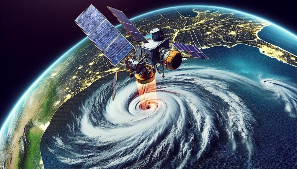
Satellite imaging techniques provide an essential tool for us to analyze and predict hurricane behaviors with precision and accuracy. By leveraging high image resolution, we can examine the nuances of storm formations and their rapid changes. These advanced images allow us to track weather patterns and ocean currents in real-time, offering invaluable data for predictive models.
Our data processing capabilities have evolved, enabling us to handle vast amounts of information swiftly. Through sophisticated algorithms, we can convert raw satellite data into actionable insights. This high-resolution data reveals detailed structures within hurricanes, such as eye walls and spiral rainbands track, which are vital for understanding the storm's intensity and potential path.
Moreover, monitoring ocean currents provides a deeper understanding of the energy sources fueling these hurricanes. The interaction between warm ocean currents and atmospheric conditions can greatly influence a hurricane's development and trajectory. By combining weather pattern analysis with ocean current data, we create thorough models that enhance our forecasting accuracy.
In essence, satellite imaging techniques empower us with detailed, real-time data, enabling us to predict hurricane behaviors more effectively. This gives us the freedom to prepare and respond proactively, mitigating risks and safeguarding communities.
Radar Systems in Hurricanes
As we enhance our predictive models with satellite imaging, radar systems offer a complementary technology that enhances our ability to observe and analyze hurricane structures in unprecedented detail. By employing Doppler radar, we can capture high-resolution data on wind velocities within hurricanes. This technology allows us to map the motion of rain droplets, providing insights into the storm's internal dynamics. Doppler radar's ability to measure wind speed and direction is vital for understanding the eye wall's rotation and the formation of rain bands, leading to improved hurricane tracking and intensity forecasts.
In addition to wind measurements, radar systems excel at precipitation measurement. Traditional satellite imagery may lack the precision needed to quantify rainfall rates accurately, but radar can fill this gap. By transmitting and receiving microwave signals, radar systems calculate the reflectivity of precipitation particles, allowing us to distinguish between rain, hail, and other forms of precipitation. This capability is essential for flood forecasting and evaluating the potential impact of hurricanes on affected regions.
Utilizing radar data, we can develop more nuanced models that predict not just the path but also the potential damage caused by hurricanes. This empowers communities with the information they need to make timely, informed decisions, enhancing their freedom to act proactively.
Aerial Drone Utilization
Let's examine how aerial drones enhance our hurricane research capabilities.
By collecting high-resolution data and enabling real-time storm tracking, drones enhance our predictive models.
Additionally, they provide critical information for improved damage assessment, allowing for more accurate post-storm analysis.
Drone Data Collection
Utilizing advanced aerial drones, we can gather high-resolution data on hurricane dynamics, enabling more precise predictions and analyses. Through precise drone flight, we capture critical metrics such as wind speed, atmospheric pressure, and humidity levels within a storm system. These drones, equipped with sophisticated sensors, enhance our remote sensing capabilities, allowing us to penetrate the hurricane's core without risking human lives.
By integrating data analysis from these drone flights, we can generate detailed models of storm behavior. This data supports storm monitoring by providing real-time insights into the hurricane's intensity and trajectory. The high-resolution imagery and atmospheric readings collected offer detailed details that traditional satellite-based remote sensing might miss. These drones can operate at varying altitudes, giving us layered perspectives on the storm, essential for accurate predictions.
Moreover, the flexibility and autonomy of these aerial drones grant us the freedom to deploy them in challenging weather conditions, ensuring continuous data collection. The combination of remote sensing and advanced data analysis techniques derived from drone operations enhances our understanding of hurricane formation and evolution. This empowers us to develop more efficient strategies for disaster preparedness and mitigation, ultimately safeguarding lives and property.
Real-Time Storm Tracking
By leveraging the real-time capabilities of aerial drones, we're able to track hurricanes with unprecedented accuracy and immediacy. This technological advancement revolutionizes storm prediction and emergency response efforts. Drones equipped with high-resolution sensors and GPS systems provide granular data on storm intensity, wind speeds, and precipitation patterns. These real-time updates are essential for refining predictive models, allowing meteorologists to forecast storm paths more precisely.
The data gathered by drones enables us to identify rapid changes in a hurricane's behavior, such as sudden intensification or shifts in trajectory. By analyzing this data, we can issue timely alerts and evacuation orders, enhancing community safety and resilience. The integration of machine learning algorithms with drone data further refines our predictive capabilities, leading to more accurate storm prediction models.
Moreover, drones offer the flexibility to operate in conditions that are too dangerous for manned aircraft, ensuring continuous data collection even during peak storm activity. This uninterrupted flow of information is crucial for coordinating emergency response efforts, enabling first responders to allocate resources efficiently and prioritize areas at greatest risk.
Through these innovations, we're not only improving our understanding of hurricanes but also empowering communities to respond swiftly and effectively.
Enhanced Damage Assessment
Deploying aerial drones for improved damage assessment enables us to swiftly and accurately evaluate the impact of hurricanes on affected areas. By using high-resolution imagery and advanced sensors, we can conduct a thorough damage severity assessment, pinpointing the most critically impacted regions. This approach greatly enhances remote sensing accuracy, providing detailed data that ground surveys might miss due to accessibility issues.
With aerial drones, we perform infrastructure vulnerability analysis in real-time, identifying structures at risk of collapse, compromised utility lines, and breached levees. This immediate feedback is vital for disaster response effectiveness, enabling emergency teams to prioritize their efforts and allocate resources where they're needed most. Drones can cover vast areas rapidly, capturing data that can be processed to generate detailed damage maps and risk assessments.
Furthermore, the integration of AI algorithms with drone-gathered data allows us to automate the analysis process, increasing both speed and precision. This advanced technology ensures that our evaluations aren't only quicker but also more reliable, giving communities the freedom to rebuild and recover with confidence.
Infrared Sensing Methods
In our research on infrared sensing methods, we can track temperature variations to pinpoint the hurricane's intensity and development.
By analyzing the cloud structures through infrared imaging, we gain insights into the storm's formation and trajectory.
These data-driven methods enable us to enhance the accuracy of our predictive models.
Temperature Variation Detection
Infrared sensing techniques allow us to precisely detect temperature changes across hurricanes, providing vital data for analyzing storm intensity and structure. By identifying thermal anomalies within the storm system, we can assess the strength of the hurricane's core and its potential impact. These anomalies often indicate areas of intense convection and energy release, which are fundamental for understanding the storm's evolution.
Through advanced infrared sensors, we can capture high-definition temperature data, allowing us to monitor changes in sea surface temperatures and the thermal composition of the hurricane. This data is invaluable, especially considering climate change, as warming ocean temperatures can lead to more frequent and severe hurricanes. By analyzing historical and real-time data, we're able to track how these temperature changes are linked to hurricane formation and progression over time.
Furthermore, the precision of these infrared methods enables us to develop predictive models that enhance our forecasting capabilities. This empowers communities to prepare more effectively and mitigate potential damage. Essentially, infrared sensing not only improves our comprehension of hurricanes but also provides us with the tools to adapt to a changing climate, ensuring we uphold our freedom and safety.
Cloud Structure Analysis
Leveraging the precision of infrared sensing, we can analyze the intricate cloud structures within hurricanes to gain insights into their development and behavior. Infrared sensors enable us to penetrate cloud cover and capture thermal radiation, which is fundamental for understanding atmospheric conditions. By examining the temperature gradients within the cloud structure, we can infer the vertical development of the storm, which is directly linked to storm intensity.
In our analysis, we utilize data-driven methods to measure key variables such as precipitation estimation and wind speed measurement. Infrared sensing helps in identifying cloud tops and estimating their heights, which correlates with the intensity and potential precipitation of the storm. High-altitude, cold cloud tops often indicate vigorous convection and strong updrafts, essential markers for high precipitation rates and intense wind speeds.
LiDAR Technology Applications
LiDAR technology revolutionizes hurricane research by providing high-resolution, three-dimensional data vital for analyzing storm impacts and coastal changes. Our ability to capture detailed topographic information before and after hurricanes allows us to assess the extent of damage and predict potential future changes with remarkable precision. The high LiDAR resolution capabilities enable us to detect even minor alterations in coastal landscapes, which is essential for accurate storm impact assessments.
In terms of LiDAR accuracy assessment, we conduct rigorous evaluations to ensure that the data meets strict standards. This involves comparing LiDAR-derived measurements with ground-truth data to quantify any discrepancies. The resulting accuracy metrics are crucial for validating our models and refining our predictive algorithms.
We leverage LiDAR technology to map coastal erosion, sediment deposition, and vegetation loss, providing a thorough view of how hurricanes reshape shorelines. By integrating LiDAR data with meteorological and oceanographic information, we can develop more comprehensive models of hurricane behavior and its effects on coastal environments. This multidisciplinary approach empowers us to make informed decisions about mitigation strategies and resource allocation, ultimately enhancing community resilience.
Data Analysis and Interpretation
Our data analysis focuses on extracting actionable insights from the vast amounts of remote sensing information, guaranteeing that every piece of data contributes to a comprehensive understanding of hurricane dynamics. By leveraging statistical modeling, we can quantify relationships between various atmospheric parameters such as wind speed, temperature, and pressure. These models enable us to predict hurricane behavior with greater accuracy, allowing us to forecast paths and intensities more reliably.
Pattern recognition techniques play a pivotal role in identifying recurring features within the remote sensing data. By applying algorithms to recognize these patterns, we can detect early signs of hurricane formation and changes in storm structure. This empowers us to issue timely warnings, thereby safeguarding lives and property.
In addition, we utilize machine learning to refine our models continuously. By training algorithms on historical hurricane data, we can improve the predictive capabilities of our models. This iterative process guarantees that our forecasts remain robust and adaptive to new data.
Our approach is both data-driven and analytical, giving us the freedom to explore new methodologies while ensuring that our findings are grounded in empirical evidence. This balance is fundamental to advancing our understanding of hurricanes through remote sensing.
Frequently Asked Questions
How Do Remote Sensing Advancements Impact Hurricane Prediction Models?
We can see that remote sensing advancements have greatly impacted hurricane prediction models by providing improved accuracy. These enhancements lead to more precise data, resulting in enhanced forecasting, which grants us greater freedom to prepare effectively.
What Are the Ethical Considerations in Remote Sensing for Hurricane Research?
Addressing ethical considerations in remote sensing is like steering through a complex storm; we must balance data privacy with the need for accurate models. Ensuring transparency and protecting personal information are critical for maintaining public trust and freedom.
How Do International Collaborations Enhance Remote Sensing Capabilities in Hurricane Studies?
International collaborations enhance our remote sensing capabilities through data sharing and technology transfer. Cross-border partnerships and research exchange enable us to leverage diverse expertise, improving predictive models and response strategies, ultimately increasing our collective freedom from hurricane impacts.
What Role Do Machine Learning Algorithms Play in Remote Sensing Data for Hurricanes?
Imagine machine learning as a master navigator guiding us through a storm's chaos. These advanced applications enhance our remote sensing data analysis techniques, offering precise predictions and insights, ultimately granting us the freedom to better understand hurricanes.
How Does Remote Sensing Contribute to Understanding the Socio-Economic Impacts of Hurricanes?
Remote sensing enables us to perform precise economic analysis by quantifying damage and aids disaster response by identifying affected areas. This data-driven approach empowers communities, giving them the freedom to plan and allocate resources efficiently.