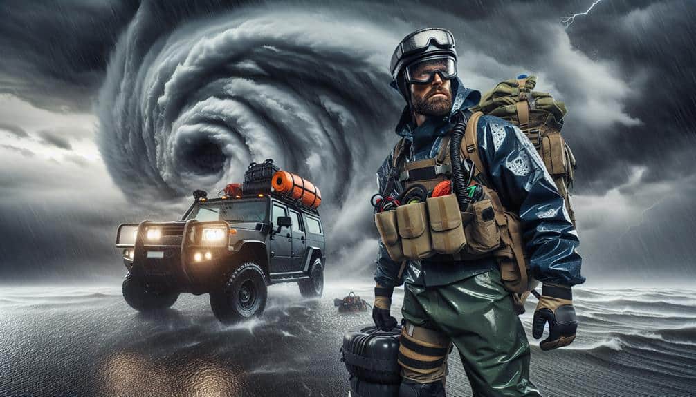
We use drones in hurricane research for various crucial reasons. They collect real-time data on wind velocity, air pressure, and moisture, aiding in forecasting storm behavior. High-definition imaging allows us to evaluate structural harm and environmental consequences with accuracy. Atmospheric sampling offers precise temperature and moisture information within the hurricane, improving our forecasting models. Wind velocity measurements provide understanding into storm structure and dynamics. Evaluation of post-storm destruction through intricate aerial data supports swift recovery efforts. These uses offer valuable insights and greatly improve our comprehension and response to hurricanes, offering more detailed information to those invested in hurricane research.
Key Points
- Real-Time Data Gathering: Drones collect real-time data on wind speed, pressure, and humidity, enhancing emergency preparedness and response.
- High-Resolution Imaging: Drones provide detailed images for analyzing hurricane structure and assessing environmental impact and damage efficiently.
- Atmospheric Sampling: Drones gather temperature, humidity, and wind data within hurricanes, improving predictive modeling and forecasting reliability.
- Wind Speed Measurement: Drones measure wind speed with high-resolution accuracy, aiding in understanding storm structure and refining predictive models.
Gathering Real-Time Data
By deploying drones equipped with advanced sensors, we can gather real-time data on hurricane dynamics with unparalleled accuracy. These technological advancements enable us to monitor parameters such as wind speed, atmospheric pressure, and humidity levels directly within the storm system. The precision and thoroughness of this data greatly enhance our understanding of hurricane behavior, aiding both scientific research and practical applications.
Our ability to achieve high data accuracy is essential for rapid response and emergency preparedness. With drones, we can swiftly collect and transmit vital information to meteorological centers, allowing for more precise forecasting. This leads to better-informed decisions regarding evacuation plans and resource allocation, ultimately safeguarding lives and property.
The integration of cutting-edge technology in drones ensures that we can adapt to the evolving nature of hurricanes, providing a dynamic tool in our arsenal against these natural disasters.
Moreover, the real-time data collected by drones allows us to identify emerging patterns and anomalies, which can be crucial in predicting the trajectory and intensity of hurricanes. This proactive approach not only enhances our emergency preparedness but also empowers communities with the freedom to make timely and informed decisions, reducing vulnerabilities and fostering resilience.
High-Resolution Imaging
High-resolution imaging from drones provides detailed visual data essential for analyzing hurricane structure and damage assessment. With the capability to capture high-definition images, we can monitor the environmental impacts of hurricanes with unparalleled precision. This data is vital for fine-tuning our environmental monitoring processes, allowing us to observe changes in real-time and respond more effectively.
In disaster response scenarios, high-resolution imaging aids in rapid damage assessment, enabling emergency management teams to prioritize and allocate resources efficiently. By utilizing aerial surveillance, we can cover extensive areas quickly, identifying critical infrastructure damage and areas most in need of immediate aid. This real-time visual information streamlines decision-making processes, reducing response times and potentially saving lives.
Furthermore, the integration of high-resolution imaging into our existing data analytics frameworks enhances our ability to model and predict hurricane behavior. By visualizing the intricate details of hurricane structures, we gain deeper insights into their development and trajectory. This analytical perspective not only improves our predictive models but also informs better preparation and mitigation strategies.
Atmospheric Sampling
Atmospheric sampling with drones enables us to collect essential data on temperature, humidity, and wind patterns within a hurricane, enhancing our understanding of its dynamics and intensity. By leveraging advanced sensors, we can achieve unprecedented data accuracy, necessary for predictive modeling and risk assessment. The use of drones allows us to penetrate the most volatile regions of a hurricane, providing real-time, high-resolution data that traditional methods simply can't match.
To paint a clearer picture of how atmospheric sampling with drones benefits hurricane research, consider the following:
- Temperature: Drones equipped with thermal sensors measure temperature gradients, enabling us to pinpoint areas of rapid intensification.
- Humidity: Hygrometers on drones provide precise humidity levels, crucial for understanding moisture content and potential rainfall.
- Wind Patterns: Anemometers gather wind speed and direction data, offering insights into the hurricane's structure and strength.
- Data Accuracy: High-fidelity sensors ensure that the data collected is accurate, supporting reliable forecasting models.
Equipment durability is another key factor. Drones must withstand extreme conditions, including high winds and heavy precipitation. Their robust construction and advanced materials ensure they can operate effectively, even in the harshest environments. This resilience is essential for continuous data collection, enabling us to make informed decisions and enhance our preparedness for future hurricanes.
Wind Speed Measurement
In addition to atmospheric sampling, drones also play a pivotal role in measuring wind speed within hurricanes, offering detailed insights into the storm's structure and potential impact. By employing remote sensing technologies, we can capture high-resolution wind speed data in real-time, which is essential for accurate aerodynamic modeling of these powerful systems.
Drones equipped with advanced anemometers and GPS sensors allow us to map wind fields with unprecedented precision. This data helps us understand the distribution of wind speeds throughout the hurricane, particularly in the eyewall and outer bands. Such detailed information is invaluable for refining predictive models and issuing timely warnings to affected regions.
Remote sensing technologies enable us to measure wind speeds at various altitudes, providing a three-dimensional perspective of the storm's dynamics. Coupled with aerodynamic modeling, we can simulate the hurricane's behavior under different conditions, enhancing our forecasting capabilities.
Post-Storm Damage Assessment
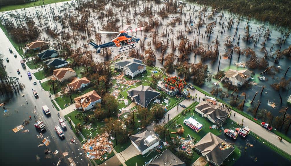
Following hurricanes, drones quickly become essential tools for conducting thorough post-storm damage evaluations, providing us with vital data to analyze the extent of destruction and prioritize recovery efforts. By utilizing drone mapping and advanced imaging technologies, we can collect high-resolution aerial data that's necessary for accurate structural analysis.
Drone mapping enables us to generate detailed 3D models of affected areas rapidly, which aids in identifying damaged infrastructure and evaluating the integrity of buildings. This precision is pivotal for immediate response and long-term recovery planning.
Here are four key benefits:
- Swift Data Collection: Drones can cover large areas in a short period, capturing extensive imagery that would take ground teams much longer to gather.
- Improved Accuracy: High-resolution images and 3D models allow for precise structural analysis, helping us identify compromised buildings and infrastructure.
- Safety: Drones can access hazardous or hard-to-reach areas without putting human lives at risk, ensuring a safer evaluation process.
- Cost-Effectiveness: Using drones reduces the need for extensive manpower and equipment, resulting in significant cost savings.
Frequently Asked Questions
How Are Drone Pilots Trained for Hurricane Research Missions?
We train drone pilots through rigorous pilot certification programs, emphasizing emergency response protocols. They undergo simulations and real-time data analysis to guarantee they're prepared for rapid deployment and effective mission execution during hurricane research missions.
What Types of Drones Are Commonly Used in Hurricane Research?
We commonly use fixed-wing and quadcopter drones for hurricane research. These drones excel in data collection and storm tracking, providing real-time atmospheric data and high-resolution imagery, greatly enhancing our understanding and predictive capabilities in hurricane dynamics.
Are There Any Legal Restrictions on Flying Drones During Hurricanes?
Flying drones during hurricanes can feel like maneuvering a legal minefield. Drone regulations prioritize safety, restricting flights to guarantee emergency response and surveillance efforts aren't hindered. It's essential to comprehend these rules to avoid costly penalties.
How Do Drones Communicate With Ground Stations During a Hurricane?
We use data transmission systems for drones to communicate with ground stations during hurricanes. Remote sensing technologies enhance disaster relief and emergency response, ensuring continuous data flow even under extreme conditions for best decision-making and operational freedom.
What Are the Costs Associated With Deploying Drones for Hurricane Research?
When evaluating the costs associated with deploying drones, we consider cost analysis, funding sources, operational expenses, and maintenance costs. We must secure adequate funding to guarantee efficient operations and maintain drones' longevity for continued research.