The jet stream directly manufactures severe storms by positioning itself as an upper-level divergence engine that pulls air upward from the surface, intensifying convection. You’ll find jet streaks—localized wind maxima within the broader flow—acting as energy conversion zones that enhance baroclinicity and trigger rapid cyclone development. When temperature gradients between polar and tropical air masses sharpen, the jet accelerates, steering extratropical systems along predetermined corridors while its meandering patterns determine whether you’ll experience tornadic supercells or flash flooding. The mechanisms governing these atmospheric transformations reveal why certain configurations produce catastrophic weather events.
Key Takeaways
- Jet streams transport weather energy west-to-east, guiding extratropical cyclones along predetermined paths and triggering severe weather systems through meandering patterns.
- Stronger temperature gradients between polar and tropical air masses generate more powerful jet stream cores, directly intensifying associated storm systems.
- Jet streaks—localized wind maxima—function as energy conversion engines, enhancing upper-level divergence that fuels rapid cyclone intensification and convective bursts.
- High-speed jet stream cores reduce vertical wind shear while increasing upper-level divergence, creating optimal conditions for explosive storm development.
- Arctic warming weakens jet streams, creating amplified wave patterns that trap weather systems in place, transforming transient storms into prolonged severe events.
Understanding Jet Streams: Fast-Moving Rivers of Air
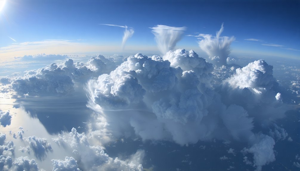
High above Earth’s surface, narrow bands of rapidly flowing air race through the upper atmosphere at speeds that can exceed 200 knots during winter months. You’ll find these jet streams positioned 5-7 miles up, near the tropopause, flowing primarily west-to-east due to Earth’s rotation and the Coriolis effect.
They’re driven by temperature contrasts between polar and tropical air masses, forming at boundaries of atmospheric circulation cells. The polar jet averages 110 mph at 30,000 feet, while the subtropical jet flows higher and weaker.
You’re observing unusual jet stream behaviors when they meander in buckled, looping patterns rather than straight flows. These variations, combined with jet stream interactions with terrain, create conditions that trigger severe weather systems you’ll experience below.
How Jet Streams Act as Storm Steering Mechanisms
When you track the movement of storm systems across continental scales, you’re observing the jet stream‘s primary function as an atmospheric conveyor belt that transports weather energy from west to east.
This high-altitude river guides extratropical cyclones along predetermined paths, establishing which regions receive jet driven precipitation and which remain dry.
Storm steering impacts become evident when the jet’s configuration shifts between zonal and meridional patterns—straight flows produce fast-moving, weaker systems, while meandering dips slow storms for intensification.
You’ll find that temperature gradients between tropical and polar air masses drive these steering currents, with stronger contrasts generating more powerful jet cores.
Small positional variations create dramatically different outcomes: a slight track shift determines whether you’ll experience heavy snowfall or merely overcast skies.
The Energy Transfer From Jet Streaks to Extratropical Cyclones
Jet streaks—localized wind maxima embedded within the broader jet stream where velocities exceed 30 m s⁻¹—function as critical energy conversion engines that transform atmospheric potential energy into the kinetic energy driving extratropical cyclone intensification.
You’ll observe this transfer through upper level divergence mechanisms occurring in the right entrance and left exit regions, where ageostrophic circulations generate vertical motion patterns.
The direct transverse circulation in entrance regions promotes ascent, while supergeostrophic winds in anticyclonic curvature enhance divergence aloft.
These dynamics produce baroclinicity enhancement impacts by steepening geopotential height and temperature gradients across frontal boundaries.
The process releases energy from horizontal temperature contrasts, converting it into cyclonic rotation.
Stronger jet streaks maintain pronounced meridional gradients over extensive areas, intensifying baroclinic processes that fuel rapid storm development without external constraint.
High-Speed Jet Streams and Rapid Storm Intensification
Beyond the regional-scale energy transfers that jet streaks impart to developing extratropical systems, the absolute velocity magnitude of jet stream cores fundamentally controls the potential for rapid intensification (RI) in both tropical and midlatitude cyclones. When jet stream hurricane interactions position high-speed winds exceeding 150 knots at 250 hPa, you’ll observe enhanced upper-level divergence that reduces vertical wind shear directly over intensifying systems.
This divergence and rapid intensification mechanism allowed 177 Atlantic cyclones to achieve the 30 kt/24h RI threshold during 1980-2023, with 22% reaching extreme rates of 50+ kt/24h. Jet-induced ageostrophic divergence aloft triggers convective bursts in eyewalls while permitting maximum potential intensity realization.
Atlantic intensification rates doubled 2001-2020 versus 1971-1990, driven by optimized jet positioning and warming sea surfaces creating conditions 400× more probable under anthropogenic forcing.
When Jet Streams Slow Down: Stalled Weather Patterns and Flooding
The momentum balance governing zonal wind speeds undergoes fundamental disruption when Arctic amplification reduces the meridional temperature gradient that sustains jet stream intensity. You’ll observe weakened eastward flow creating atmospheric blocking patterns that trap weather systems for extended periods.
These stalled configurations generate changes in precipitation regimes through stationary low-pressure centers that deliver continuous rainfall to fixed locations. During 2025’s midlatitude events, southward-displaced polar jets locked moisture-laden Gulf air masses over vulnerable regions, producing extraordinary humidity levels and prolonged droughts and floods.
Amplified planetary waves—now occurring three times more frequently than the 1950s—establish persistent blocks that prevent normal weather progression. This meandering behavior, with dramatic north-south oscillations, fundamentally alters regional hydroclimate by concentrating precipitation into intense, localized episodes rather than distributed systems.
Sting Jets: Violent Winds Born From Jet Stream Dynamics
Within rapidly intensifying extratropical cyclones, a catastrophic wind phenomenon emerges when coherent airflow descends from mid-tropospheric cloud heads at 550-600 hPa into the frontal-fracture region below.
You’ll recognize this sting jet through satellite imagery showing hook-shaped clouds with dark fingers of dry air indicating powerful descent. The mechanism involves evaporative cooling processes where precipitation from the cold conveyor belt evaporates within Arctic-sourced dry intrusions, creating negatively buoyant air masses that plummet from 3-4 km altitude.
Synoptic scale cyclone interactions enhance this descent through frontal circulations that tilt and stretch vorticity fields. You’re witnessing winds exceeding 50 knots concentrated within narrow zones—brief but devastating events lasting mere hours. High-resolution models struggle capturing these mesoscale instabilities, leaving forecasters challenged in predicting their exact intensity and location.
Temperature Contrasts and Their Influence on Jet Stream Strength
Stark temperature differentials between polar and tropical air masses generate the fundamental energy that powers jet stream circulation. You’ll observe thermal gradient variability directly controlling wind intensity through the thermal wind relation—where vertical wind shear amplifies proportionally to horizontal temperature contrasts. Cold air’s rapid pressure decrease with altitude creates pronounced height differences at constant pressure levels, driving powerful geostrophic flows that strengthen with elevation.
Winter’s enhanced polar cooling sharpens these gradients, pushing jet speeds beyond 250 mph as the stream migrates southward. Conversely, warm air encroachment impacts reduce this temperature boundary, weakening circulation and shifting the jet poleward during summer months. Your understanding of these dynamics reveals why the polar front jet reaches maximum intensity where dense Arctic air collides with subtropical warmth—transforming atmospheric temperature differences into concentrated rivers of high-velocity wind.
Arctic Warming and the Weakening Polar Jet Stream
As Arctic temperatures rise at twice the rate of mid-latitudes, you’re witnessing a measurable reduction in the meridional temperature gradient that weakens westerly winds by 14 percent since 1979.
This diminished gradient directly compromises the polar jet stream’s velocity, allowing atmospheric waves to amplify into steeper troughs and higher ridges.
When these slow-moving meanders stall weather systems over specific regions, you’ll observe prolonged extreme events—from extended droughts to catastrophic flooding—as the jet stream loses its capacity to rapidly propagate disturbances eastward.
Temperature Gradient Reduction Effects
The Arctic’s accelerated warming rate—outpacing mid-latitude regions by nearly 2:1—directly erodes the equator-to-pole temperature gradient that powers the polar jet stream through thermal wind balance. You’ll observe these temperature gradient alterations manifesting as diminished zonal wind speeds aloft, fundamentally compromising the jet’s structural integrity.
Sea ice loss in the Barents-Kara region amplifies surface warming, creating positive feedback loops that further degrade meridional temperature contrasts. These atmospheric pressure changes weaken both the stratospheric polar vortex and its tropospheric counterpart, reducing the jet’s velocity and stability.
The thermal wind relationship—where horizontal temperature differences generate vertical wind shear—weakens proportionally with gradient reduction. This mechanical degradation enables meridional flow patterns that replace efficient zonal circulation, fundamentally altering your hemisphere’s storm-tracking capabilities and extreme weather vulnerability.
Storm Stalling and Meandering
Beyond reduced zonal velocities, Arctic amplification fundamentally restructures how jet stream configurations control weather system progression across mid-latitudes. You’ll observe weather systems becoming nearly stationary for days as meandering patterns develop deep troughs beneath amplified ridges.
This stalling mechanism stems from sea ice feedback—heat flux from ice-free ocean surfaces reinforces high-pressure ridges, prolonging downstream troughs and preventing natural system migration. The jet amplification patterns you’re witnessing create wavy configurations that trap atmospheric features in place, enabling persistent weather extremes.
While observational records show no clear trend in meander frequency, these episodes demonstrate how reduced westerly components directly slow upper-level progression. The result: your regional climate experiences extended periods of identical conditions rather than the typical transient weather patterns.
Future Storm Patterns Under Shifting Jet Stream Behavior

As jet streams migrate poleward under continued Arctic amplification, you’ll observe storm tracks shifting into higher latitudes where infrastructure and populations lack historical exposure to such systems.
This displacement expands the spatial domain for both tropical cyclogenesis and extratropical storm development, simultaneously increasing coastal vulnerability in previously protected regions.
You can expect enhanced moisture flux convergence along these migrating tracks to generate more intense precipitation events, as warming atmospheric columns hold approximately 7% more water vapor per degree Celsius of temperature increase.
Poleward Migration Storm Shifts
- Southwestern U.S. faces reduced atmospheric ventilation, trapping heat and intensifying drought conditions
- Alaska receives unprecedented moisture and heat transport as Pacific systems track further north
- Mid-latitude regions experience fewer heatwaves as storm corridors shift away from traditional zones
This poleward migration demands immediate re-evaluation of agricultural planning, water resource management, and infrastructure resilience. Climate projections consistently underestimate these shifts, leaving you vulnerable to accelerating atmospheric reorganization.
Intensified Precipitation Events Ahead
The destabilization of jet stream dynamics now threatens to restructure global precipitation regimes through a convergence of amplified Rossby waves and enhanced atmospheric moisture capacity.
You’ll witness precipitation extremes intensify as Arctic warming reduces meridional temperature gradients, forcing jet streams into amplified meanders that lock blocking patterns in place. Each 1°C temperature rise injects 7% additional water vapor into atmospheric circulation, transforming stalled systems into prolonged deluge events.
Weather whiplash accelerates as blocking frequencies triple compared to 1950s baselines, with omega configurations anchoring moisture-laden systems over identical regions for weeks.
Climate projections confirm sluggish polar jet streams will increasingly trap storm systems, converting atmospheric traffic jams into flash flooding scenarios. Your region’s vulnerability depends on these shifting circulation patterns as emissions continue altering fundamental atmospheric mechanics.
Frequently Asked Questions
Can Jet Streams Be Accurately Predicted Months in Advance for Planning?
Like trying to predict individual waves months before they form, you can’t accurately forecast jet streams that far ahead. Instead, you’ll rely on seasonal variability patterns and long-term trend analysis for atmospheric planning beyond two weeks.
Do Jet Streams Affect Commercial Airline Flight Times and Fuel Consumption?
Yes, jet streams markedly impact your flight times and fuel consumption. You’ll benefit from improved flight planning that leverages tailwinds for fuel efficiency optimization eastbound, while westbound routes require additional fuel reserves to counter headwind drag forces.
How Do Subtropical and Polar Jet Streams Interact With Each Other?
You’ll observe jet stream interactions with upper level disturbances when polar and subtropical jets merge, creating dynamic imbalance. This convergence enables poleward transport of subtropical moisture into Arctic air masses, generating severe convective potential and rapid cyclogenesis through enhanced baroclinicity.
Are There Jet Streams in the Southern Hemisphere With Similar Impacts?
You’ll find polar and subtropical jets mirroring northern patterns, steering storms through seasonal migration patterns across Southern Hemisphere atmospheric circulation. They’re shifting poleward, intensifying weather extremes, and redistributing precipitation—directly impacting your regional climate autonomy and agricultural independence.
Can Human Activities Directly Modify Jet Stream Behavior Beyond Climate Change?
Beyond greenhouse emissions, you’re seeing potential jet stream modification through anthropogenic geoengineering experiments like high-altitude aerosol injections. These interventions could alter stratospheric temperature gradients and polar vortex dynamics, though large-scale implementation remains theoretical and unregulated.

