You’ll need to verify your drone’s wind resistance exceeds forecast conditions by 30%, maintain the two-thirds operational rule (never exceed 66% of rated wind capability), and conduct triple IMU diagnostics before launch. Monitor atmospheric pressure gradients, position on storm flanks away from precipitation cores, and comply with Part 107 visibility minimums while securing necessary BVLOS waivers. Launch into headwinds, set RTH at 35-40% battery, and document all preflight inspections—critical protocols that separate successful data collection from catastrophic equipment loss in these extreme environments.
Key Takeaways
- Select drones with wind resistance exceeding forecast conditions by 30% and thrust-to-weight ratios supporting payload during gusts.
- Monitor wet-bulb temperatures above 0°C, track storm movement via radar, and position on non-rainy flanks for safe operations.
- Apply the two-thirds rule by never exceeding 66% of the drone’s rated wind capability during flight.
- Launch into the wind outbound and set Return-to-Home at 35-40% battery to conserve energy for return flights.
- Maintain visual line of sight, comply with Part 107 minimums, and stay below 400 feet AGL with 3-mile visibility.
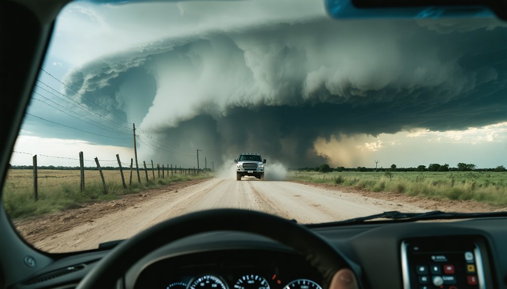
Evaluating Weather Conditions and Storm Intensity Before Flight
Before launching a drone during storm chasing operations, you must systematically evaluate multiple atmospheric parameters that directly affect aircraft survivability and regulatory compliance. Start by monitoring atmospheric pressure variations to identify frontal boundaries and intensification patterns.
Track storm cell movement using real-time radar data to maintain safe positioning throughout your mission. Verify wet-bulb temperatures remain above 0°C to prevent icing-related failures. Check current wind speeds against your drone’s maximum resistance minus 5 knots, accounting for gusts.
Confirm visibility exceeds 3 statute miles and cloud clearances meet Part 107 minimums—500 feet below, 2,000 feet horizontal. Apply the L x S risk matrix formula before launch; scores above 10 mandate mission cancellation. Document all weather parameters per §107.49 recordkeeping requirements.
Selecting and Preparing Wind-Resistant Drone Equipment
When selecting drone equipment for storm chasing operations, you must prioritize platforms with verified wind resistance capabilities that exceed anticipated field conditions by at least 30%. Professional-grade systems handling 13.9-17.1 m/s winds provide necessary margins when conditions intensify unexpectedly. You’ll need thrust-to-weight ratios sufficient for counteracting gusts while maintaining payload capacity for meteorological sensors.
Battery life management becomes critical during extended observation missions—commercial platforms offering 10-hour endurance enable thorough storm documentation without premature retreat. Before deployment, conduct rigorous sensor diagnostic checks on your triple IMU configurations and dual GNSS systems. Verify IP54 environmental sealing integrity and confirm operational temperature ranges match forecast conditions. Your redundant systems and 100-200km transmission capabilities guarantee you’ll maintain control and data collection throughout the chase.
Mastering Flight Techniques in High-Wind Environments
High-wind drone operations demand precise execution of specialized flight techniques that prioritize aircraft stability and battery conservation. You’ll need mastery in adapting flight controls through smooth, deliberate movements that counteract wind forces without jerky corrections. Apply the two-thirds rule—never fly in conditions exceeding 66% of your drone’s rated wind capability.
Crosswinds require constant lateral adjustments, while headwinds reduce speed but maintain controllability. Improving battery management becomes critical when gusts amplify power draw. Launch into the wind outbound, conserving energy for your wind-assisted return. Set Return-to-Home at 35-40% battery, not the standard 20%.
Sport mode penetrates gusts effectively but accelerates drain exponentially. Maintain steady speeds rather than fighting turbulence with aggressive inputs. Position takeoffs windward to prevent tipping, and identify multiple landing zones before launch.
Mastering flight mechanics represents only half the operational equation—storm chase drone pilots must navigate a complex regulatory framework that governs every aspect of unmanned aircraft deployment. You’ll need 49 USC 44809 compliance, maintaining visual line of sight unless you’ve secured a 91.113(b) waiver for BVLOS operations.
Storm chase drone operations demand strict regulatory compliance—visual line of sight requirements and federal airspace restrictions govern every deployment decision.
Remote identification broadcasting became mandatory September 2023 under 14 CFR 89.105—retrofit existing aircraft or purchase compliant models. Monitoring temporary flight restrictions remains critical during severe weather events when emergency aircraft populate your operational area.
Analyzing airspace constraints includes evaluating population density; sparsely populated zones simplify compliance, while populated corridors require 14 CFR 107.39 waivers. California operators face additional Penal Code 402 restrictions.
Non-compliance triggers enforcement action and operational grounding—understand regulations before deployment.
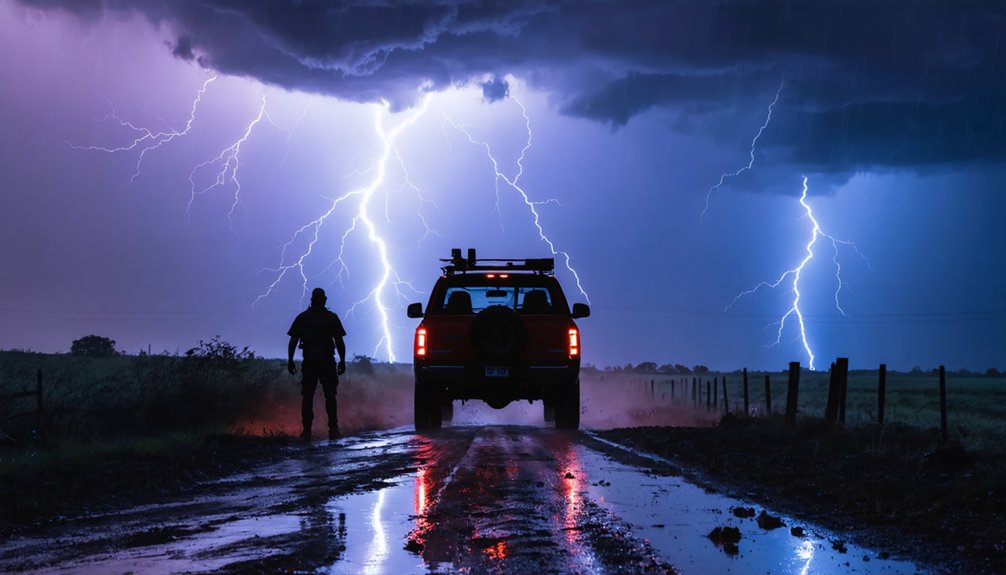
Implementing Safety Protocols for Operators and Vehicles
Storm chase drone operations demand systematic safety protocols that protect both personnel and equipment against the unique hazards of severe weather environments. You’ll need preflight inspections documented before each flight, leveraging data telemetry from 360-degree cameras for real-time storm assessment. Protect your chase vehicles with mesh canopies against hail damage while maintaining convoy formations with radar trucks.
Your operational freedom hinges on disciplined limits: stay below 400 feet AGL, maintain 3-mile minimum visibility, and position on non-rainy storm flanks to avoid RFD winds. Don’t exceed 100 mph groundspeed or operate over non-participants. Navigate road obstacles without unnecessary risks while aligning research goals with exit strategies ahead of fast-moving storms. Your greatest hazard isn’t the weather—it’s distracted chasers sharing the roads.
Frequently Asked Questions
What Insurance Coverage Is Recommended for Drone Storm Chasing Activities?
You’ll need liability insurance coverage ($1–10 million) for third-party damages and equipment replacement coverage protecting against storm damage, crashes, and theft. Most policies cost $500–$1,200 annually, ensuring you’re protected while chasing freely.
How Do I Retrieve a Downed Drone in Hazardous Terrain?
You’ll deploy a second drone with thermal imaging and GPS tracking to locate your downed unit in challenging terrain retrieval scenarios. Wait until hazardous weather conditions clear, then use LiDAR mapping to plan safe ground access routes.
Can Drones Capture Useful Scientific Data for Meteorological Research?
Yes, you’ll open meteorological frontiers through drones’ atmospheric sensor data. Your aerial observation patterns capture vertical temperature, humidity, and wind profiles with unprecedented resolution, enabling precise forecast models while maintaining safe distances from dangerous storm systems.
What Video Settings Optimize Storm Footage in Low Light Conditions?
You’ll optimize storm footage by using low light camera settings with ISO 100-400, wide aperture (f/2.8), and slower shutter speeds (1/2-1/10 sec). Manual exposure adjustments let you control lightning flash compensation while maintaining detail in cloud formations.
How Do I Coordinate Drone Operations With Media Helicopter Crews?
Don’t fly by the seat of your pants—you’ll establish pre-flight coordination through shared frequencies and altitude deconfliction protocols. Maintain in-flight communication via dedicated radio channels, transmitting real-time positioning data to guarantee helicopter crews avoid your operational airspace.