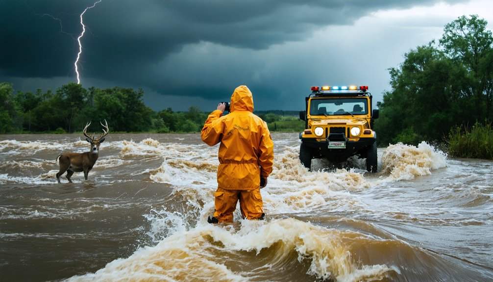
Storm chasers near floods must recognize that just 12 inches of moving water generates hydrodynamic forces sufficient to displace most passenger vehicles, while 2 feet can sweep away SUVs and trucks. You’ll need to stock window-breaking tools, increase following distances, and monitor real-time flood gauge sensors before attempting any road crossing. Never bypass barricades marking flooded routes, as these indicate verified structural failures beneath the surface. Understanding vehicle abandonment protocols and predetermined evacuation routes will maximize your survival probability when flash flood conditions rapidly materialize.
Key Takeaways
- Avoid traversing water as just 6 inches can knock down adults and 12 inches can sweep away vehicles.
- Stock emergency provisions, monitor hydroplaning risks, and increase following distances when driving near flood conditions.
- Never bypass road barriers; authorities install them based on verified structural failures and hazardous water depths.
- Identify two predetermined evacuation routes to higher ground before floods materialize using FEMA maps.
- If vehicle stalls in water, immediately release seatbelt, open windows before electrical failure, and evacuate to higher ground.
Understanding the Dangers of Moving Floodwater
While many severe weather phenomena pose significant threats to human life, flooding surpasses all other hazards as the leading cause of weather-related fatalities in the United States, accounting for the majority of natural disaster deaths through drowning.
You’ll face extreme risks in moving water—just six inches knocks you down, while twelve inches carries away most vehicles. Flash floods prove particularly lethal due to rapidly rising conditions.
Beyond drowning, you’re exposed to water contamination risks including leptospirosis, tetanus, and chemical hazards from displaced containers. Electrocution from submerged power lines presents additional fatal danger.
Your personal safety equipment won’t protect you adequately in swift currents. Flood velocity increases high-risk walking areas by over 80%, making movement through any depth of rushing water potentially fatal.
Vehicle Safety During Flood Conditions
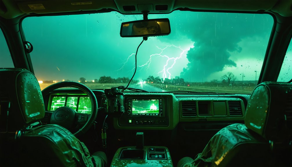
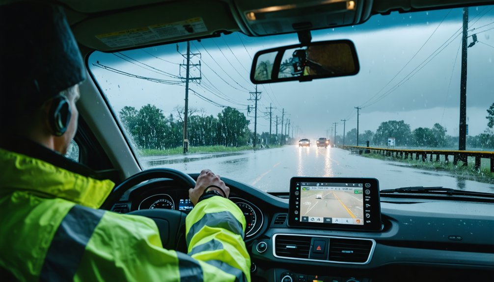
Your vehicle becomes a death trap in flood conditions, with submersion accounting for over 50% of flood-related fatalities annually according to NOAA data. Execute a thorough vehicle inspection checklist before deployment: verify brake responsiveness, confirm headlight functionality, and assess tire tread depth to prevent hydroplaning at critical moments.
Flooded roads kill more than weather itself—vehicle submersion causes over half of all flood deaths, making your car the primary hazard.
Flood resistant vehicle features prove meaningless when you’re attempting 5-10 mph traversals through standing water—your escape depends on maintaining operational control, not marketing claims.
Stock emergency provisions: charged communications device, potable water, high-calorie sustenance for extended delays. Increase following distances greatly; reduced traction demands enhanced stopping margins. Monitor tire spray patterns indicating hydroplaning risk.
If loss of traction occurs, release accelerator gradually while steering into the skid vector. Select elevated, paved routes exclusively—unpaved surfaces compromise even 4×4 capabilities during saturation events.
Recognizing When to Abandon Your Vehicle
When fast-moving water reaches 6 inches, it generates sufficient force to knock down an adult, marking the first critical threshold for vehicle abandonment.
At 12 inches of depth, hydrodynamic forces exceed the gravitational resistance of most passenger vehicles, while 2 feet of rushing water will displace SUVs and trucks.
If your vehicle stalls in flood waters or doors resist opening due to hydrostatic pressure differential, you’ve reached immediate abandonment conditions—exit the vehicle and climb to higher elevation without delay.
Water Depth Warning Signs
Flood gauge signs (W8-19) serve as critical visual indicators for storm chasers operating in flood-prone zones, displaying real-time water depth measurements at roadway low points through highly visible reflective markings that meet federal MUTCD standards. These permanent yellow diamond-shaped signs pair with W8-18 ROAD MAY FLOOD warnings to establish floodwater depth measurement protocols. Sensor activated warning systems enhance these static markers by triggering flashing signals when thresholds are reached.
Critical depth thresholds you must recognize:
- 6 inches of fast-moving water knocks over adults
- 12 inches of rushing water carries away most vehicles—immediate abandonment required
- 2 feet sweeps away SUVs and trucks
Never bypass barriers blocking flooded roads. Emergency responders rely on these markers for rapid situation assessment, making your adherence to posted warnings essential for autonomous decision-making in hazardous conditions.
Exit and Climb Protocol
As water reaches 6 inches on roadways, you’re facing critical vehicle compromise—at this depth, most passenger vehicles experience undercarriage flooding that triggers engine stall and steering failure. Maximizing reaction time requires immediate seatbelt release upon water entry, followed by window operation before electrical systems fail. You’ve got 30 seconds to 2 minutes while the vehicle remains buoyant—this floating phase represents your ideal escape window.
Leveraging vehicle features means utilizing window-breaking tools like Resqme when power windows malfunction. Execute egress through windows, not doors, as hydrostatic pressure prevents door opening. Position small children in front seats for prioritized extraction, pushing them through windows first.
Upon vehicle abandonment, move perpendicular to flow direction toward elevated terrain, avoiding low-lying areas where rapid inundation occurs.
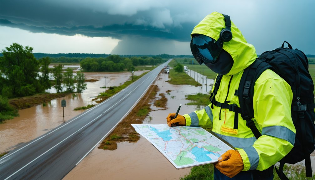
You’ll need at least two predetermined evacuation routes to higher ground before flood conditions materialize, as primary routes frequently become impassable due to rapid water accumulation rates of 6-12 inches per hour during severe storm events.
Route planning must exclude all low-lying terrain features including streams, drainage channels, highway dips, and bridge approaches where water depth can reach vehicle-floating thresholds (12 inches for sedans, 24 inches for SUVs) within minutes.
Your secondary route should diverge geographically from the primary path to prevent both from becoming simultaneously compromised by the same watershed’s flooding pattern.
Plan Multiple Evacuation Routes
Effective evacuation planning requires identifying multiple high-ground destinations before flood events occur, with Sacramento County specifically recommending elevated locations such as Carmichael, Citrus Heights, I-80 corridor cities (Rocklin and Auburn), Folsom, and Davis. You’ll need to identify safe zones using FEMA flood maps and county-prepared levee break scenarios that detail temporal inundation patterns.
Your evacuation strategy must include:
- Primary and backup routes accounting for potential blockages during flooding events
- Multiple information sources including battery-operated radios and emergency alert systems to monitor flood forecasts
- Pre-arranged destinations with contacts on elevated terrain above 100-year flood elevation zones
Avoid northbound I-5 or Highway 99 routes due to low-lying terrain and southward-flowing drainage patterns. High-ground evacuation typically requires short-distance travel rather than extended highway navigation.
Avoid Low-Lying Areas
When storm chasing near flood-prone regions, understanding water depth hazards becomes essential for survival. Six inches of moving water generates sufficient force to destabilize an adult, while 12 inches can displace small vehicles. You’ll find that 18-24 inches sweeps away SUVs and trucks without warning.
Avoid standing water in streams, drainage channels, and basins where flash flooding concentrates. Watch for debris concealed beneath murky surfaces—submerged obstacles and compromised road structures remain invisible during assessment. Darkness amplifies these hazards exponentially by eliminating visual depth perception.
Navigate to pre-identified elevated terrain immediately when conditions deteriorate. Don’t enter basements with submerged electrical outlets or seek refuge in closed attics where entrapment occurs. Bypass barricaded roads regardless of perceived time savings—authorities install barriers based on verified structural failures.
Planning Multiple Evacuation Routes
Storm chasers operating in flood-prone regions must establish at least two primary evacuation corridors and multiple secondary routes based on real-time hydrological data and official evacuation zone classifications (Coastal, A, B, C). Review statewide planning maps to identify contraflow-enabled highways and alternative transportation modes. Designate meeting places in different directions from home to account for rapidly changing floodwater dynamics.
Critical Route Planning Components:
- Pre-deployment reconnaissance – Map contraflow crossovers, inland termini, and emergency shoulder lanes on major evacuation arteries (I-37, I-2/US 83 corridors)
- Multi-modal contingency planning – Identify backup transportation options if primary vehicle becomes compromised
- Authority compliance protocol – Prioritize government-designated routes over personal preferences during mandatory evacuation orders
Monitor NOAA Weather Radio for Flash Flood Warnings requiring immediate deployment of evacuation protocols.
Electrical Hazards in Flooded Areas
Among the most critical threats storm chasers encounter in flooded environments, electrical hazards present both immediate lethality and complex spatial constraints that fundamentally compromise operational safety. Overhead power lines obstruct 67.7% of flooded municipal areas, while 46% of impacted buildings become nonrescuable due to complete isolation.
You’ll face electrocution risks from downed lines contacting floodwater—nearly half of flood fatalities occur in vehicles near electrical hazards. Proper electrical isolation demands maintaining distance from any compromised infrastructure. Storm surges damage substations, dropping lines unpredictably.
If you’re documenting flood zones, recognize that interconnected electrical systems remain energized even when partially submerged. Never assume safety based on water depth. Electrical safety inspections must precede any post-flood equipment reactivation, as wet circuits create persistent shock hazards independent of visible damage.
Maintaining Safe Distance From Power Infrastructure
Power infrastructure clearance requirements establish quantifiable safety perimeters that storm chasers must observe to prevent electrocution in flood-compromised environments. You’ll need safe electrical connections and proper grounding protocols when operating near compromised power systems.
Voltage-Based Clearance Specifications:
- Standard Distribution Lines (up to 50 kV): Maintain 10-foot minimum clearance from all equipment and personnel positioning
- Medium Transmission Lines (50-200 kV): Establish 15-foot protective perimeter around observation equipment
- High Transmission Lines (200-350 kV): Implement 20-foot exclusion zone for all field operations
Standing water exponentially increases electrocution risk by creating conductive pathways from downed lines. Your electrical equipment requires GFCI protection and weatherproof housing when deployed near flood zones. Never assume overhead lines are de-energized—utility companies may maintain power for grid stability during weather events.
Essential Protective Equipment for Flood Cleanup
When moving from observational activities to post-storm documentation and recovery operations, storm chasers must adopt a wide-ranging personal protective equipment (PPE) hierarchy that addresses the multifaceted contamination risks present in flood-affected zones.
You’ll need waterproof boots with steel reinforcement, chemical-resistant gloves, and NIOSH-approved N-95 respirators minimum for mold exposure. ANSI Z87.1-rated eye protection prevents splash contamination from sewage-laden floodwater.
For areas exceeding 100 ft² mold growth, upgrade to half-face N, R, or P-100 respirators with non-vented goggles. Effective decontamination protocols require soap-and-water cleaning between uses, thorough air-drying cycles, and proper disposal of contaminated gear when structural integrity fails.
Your independence during fieldwork demands self-sufficiency in hazard recognition and PPE selection tailored to site-specific chemical, biological, and physical threats.
Wildlife Encounters in Flood Zones
Flood-displaced wildlife presents quantifiable hazards during post-storm documentation that demand the same systematic risk assessment you’ve applied to chemical and biological contamination. Habitat inundation impacts drive species upslope, with larger animals like wildebeest and buffalo increasing 27% in refuge areas while small-bodied species decline 47%.
You’ll encounter displaced snakes, armadillos, and raccoons seeking cover in debris piles and structures—rats and martens account for 3% of indoor encounters.
Critical wildlife risk protocols:
- Debris inspection: Systematically check concealment zones before handling materials where displaced species shelter
- Spatial awareness: Maintain heightened vigilance in yards and streets where refuge area resilience patterns concentrate vulnerable species
- Non-interference: Avoid contact with newborn wildlife appearing during flood recession—prioritize human safety over wildlife reporting during active operations
Preventing Mosquito-Borne Illness After Flooding
Standing water accumulation following flood events triggers mosquito population explosions that increase your exposure risk to multiple vector-borne pathogens. Aedes aegypti populations can surge up to ten times normal estimates, creating breeding grounds for dengue, Zika, and West Nile virus transmission. You’ll face elevated infection risk for 5-6 months post-flooding, though staying indoors during peak mosquito activity reduces exposure considerably.
Protect yourself by monitoring local disease surveillance networks that track outbreak patterns in real-time. Support targeted mosquito control programs utilizing vector abundance models to identify high-risk zones. Apply EPA-approved repellents containing DEET or picaridin when conducting field observations. Eliminate standing water around your base camp within 48 hours, as mosquito larvae develop rapidly in freshwater pools. Climate projections indicate intensifying flood frequency, expanding your vulnerability across previously unaffected latitudes.
Frequently Asked Questions
What Communication Equipment Should Storm Chasers Carry During Flood Events?
You’ll need redundant two-way radios with emergency radio channels, cellular modems, and satellite phones for backup connectivity. PTT radios enable instant team coordination, while dual-modem systems extend 40-hour operation when networks fail in remote flood zones.
How Can Storm Chasers Identify Safe Locations to Park Vehicles Overnight?
You’ll maximize safety by selecting elevated terrain locations at least 100 feet above flood zones, verified through FEMA maps. Choose well-lit public areas with confirmed road access, ensuring your vehicle remains above projected water levels during overnight operations.
What Weather Monitoring Tools Help Predict Flash Flood Development Accurately?
You’ll need Multi-Radar Multi-Sensor systems tracking rainfall radar patterns at 1-km resolution every 2 minutes, combined with real-time flood gauge data from USGS sensors. FLASH’s hydrodynamic models deliver accurate depth forecasts within minutes for autonomous decision-making.
Should Storm Chasers Work Alone or in Teams Near Flooding Areas?
You’ll maximize personal safety awareness through team collaboration rather than solo operations near floods. Teams provide redundant hazard monitoring, vehicle recovery assistance when twelve-inch waters threaten flotation, and critical communication backup during rapidly evolving flash flood scenarios.
What Emergency Supplies Should Vehicles Contain for Unexpected Flood Situations?
You’ll need high clearance tires, waterproof bags for electronics, NOAA radios, GPS with backup power, flotation devices, emergency rations, first aid supplies, and communication equipment. These data-backed items guarantee you’re self-sufficient when traversing flood zones independently.