Storm chaser convergence creates dangerous conditions when hundreds of vehicles flood rural road networks targeting the same supercell, blocking emergency access routes and evacuation paths while degrading your positioning options in the storm’s critical right-front quadrant. You’ll face overlapping radar interference, compromised visual angles, and congested escape routes as traffic accumulates near mesocyclones. This crowding affects both safety margins and data collection quality, particularly when only 10-15% of mesocyclones produce tornadoes. Strategic adaptations—including targeting less-obvious setups and studying alternative road networks—become essential for maintaining operational effectiveness throughout high-risk events.
Key Takeaways
- Multiple chase teams converging on storms increases collision risks, traffic congestion, and vehicle incidents from prioritizing observation over safe driving.
- Highway gridlock from chaser convergence blocks emergency response access, evacuation routes, and compromises deployment of scientific research equipment.
- Overlapping radar signals and communication bandwidth saturation disrupt storm coordination between research vehicles and spotter networks during critical measurement windows.
- Experienced chasers provide valuable ground truthing and fill coverage gaps, but crowding interferes with systematic data collection and positioning strategies.
- Strategic adaptations include targeting less-obvious chase zones, studying alternative road networks, and considering abandoning high-risk days due to overwhelming congestion.
What Happens When Too Many Chasers Target the Same Storm
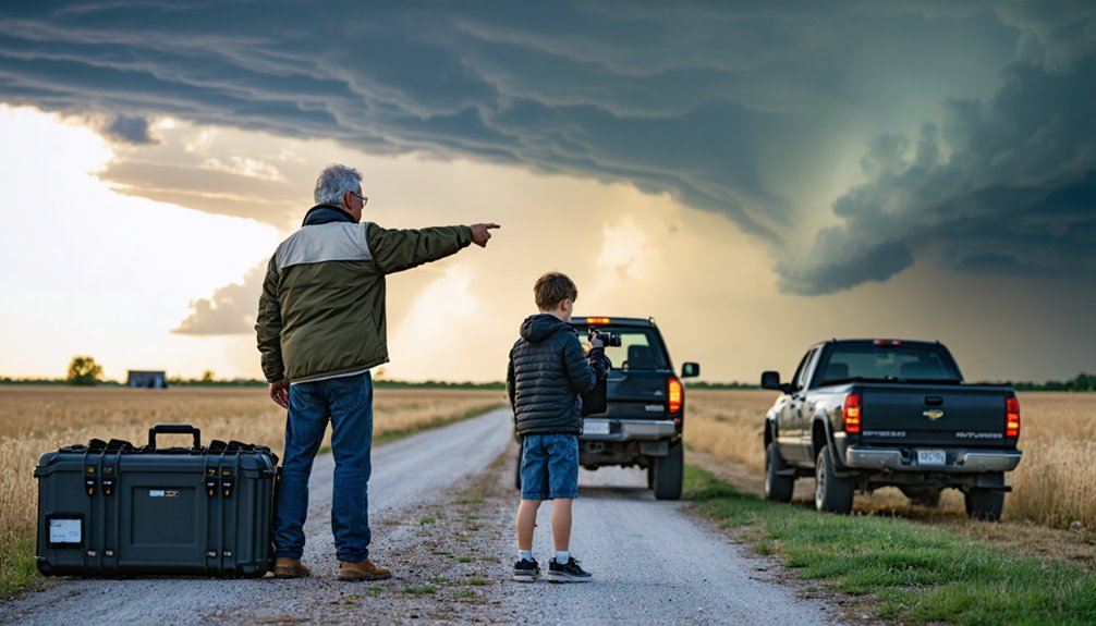
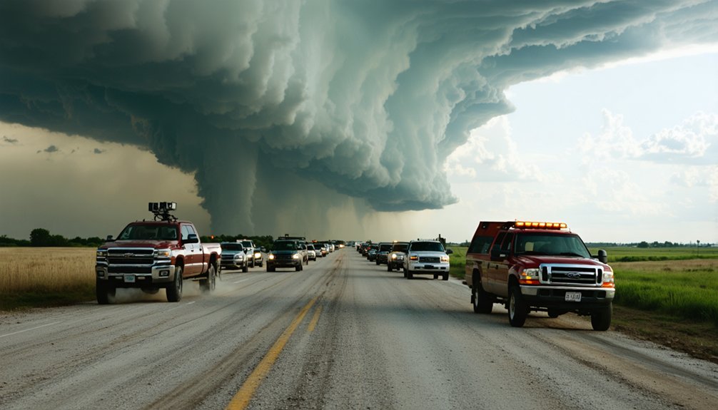
When discrete supercells develop across the High Plains—particularly along the TX Panhandle, eastern NM, and central KS corridors—storm chasers converge with unprecedented intensity. You’ll encounter heightened collision risks as multiple teams scramble for ideal positioning along the same road networks.
Mission scientists deploy instrument pods and weather balloons directly in tornado paths, while networks of mobile radars scan from competing angles. This creates storm communication disruption when ground truth reports multiply and radar signals overlap. Long-wavelength systems produce degraded data in crowded environments.
Enhanced SPC risk days (Level 3/5) funnel dozens of vehicles into identical intercept zones, with GPS and NEXRAD Level 3 data guiding everyone to the same mesocyclone. Traffic congestion compromises probe recovery and blocks emergency responder access.
Traffic Jams and Safety Hazards on Storm Days
As chaser populations exceed several hundred serious operators—plus over a thousand seasonal tour participants—the statistical probability of vehicular incidents escalates dramatically. You’ll encounter traffic accident risks when chasers prioritize skyward observation over roadway monitoring, running stop signs while pursuing rapidly evolving mesocyclones.
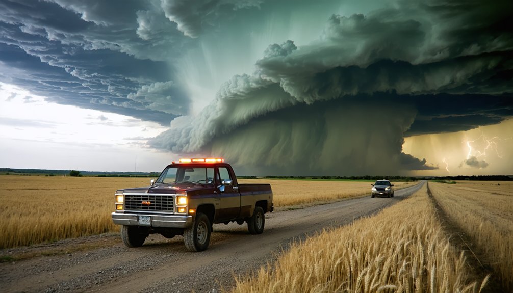
Problematic convergence events—creating mobility obstacles and safety complications—now occur biennially on average. Limited road networks force entire chase fleets onto single routes, as demonstrated during the Eldorado, Oklahoma event where Red River crossing constraints created bottlenecks.
The Minnesota fatality exemplifies cascading hazards: downed power lines necessitate highway stops, then distracted semitrailer operators plow into stationary vehicles. Emergency response coordination deteriorates when hundreds of chasers simultaneously clog rural arteries, potentially blocking evacuation routes from advancing tornadoes or catastrophic hail cores.
How Overcrowding Changes Your Chase Strategy
The escalating chaser population—now exceeding 1,500 participants on high-risk convective outlooks—forces strategic recalibration of your target selection protocols. You’ll need to prioritize less-obvious chase zones featuring ideal weather parameters rather than converging on forecast bullseyes.
Study alternative road networks identifying multiple east-west river crossings and verify cellular carrier coverage beforehand for field crew coordination. Consider abandoning high-risk days entirely when traffic congestion outweighs tornado probability gains. Back roads become essential escape routes from highway gridlock, though you’ll sacrifice rapid repositioning capability.
Multi-day targeting strategies allow overnight stays away from metropolitan centers where rush hour compounds positioning delays. Storm merger scenarios warrant exceptions despite crowds—southwest flank interactions enhance tornadogenesis probability. Your chase strategy must now account for human obstacles as critically as atmospheric variables.
The Value Experienced Chasers Bring to Weather Networks
While overcrowding complicates positioning logistics, experienced chasers deliver quantifiable benefits to operational meteorology that offset congestion concerns. You’re identifying storm features through exponentially greater exposure—witnessing dozens of tornadoes while stationary spotters observe one lifetime event.
Your mobility enables real-time ground truthing via ham radio and streaming platforms, supplementing spotter networks with critical data from underserved areas. When local nets remain inactive, you fill coverage gaps that directly influence warning decisions for threatened populations.
Your deployed instrumentation—mobile radars, weather balloons, transect vehicles—generates multi-angle datasets testing tornado development theories. Networks value your superior footage quality over cell phone submissions, paying premium rates exceeding $800. You’re delivering pivotal observation layers where traditional infrastructure fails, transforming raw atmospheric data into actionable intelligence that potentially saves lives in regions lacking trained spotters.
Smart Tactics to Avoid the Crowds
You’ll maximize intercept efficiency while minimizing convergence by targeting non-primary mesocyclones in multi-cell clusters, where only 20% of supercells produce tornadoes yet most chasers concentrate on the dominant storm.
Early-season chase windows from late April through mid-May feature reduced chaser density despite favorable instability parameters and wind shear profiles. Monitor flanking line updrafts and secondary convective initiation zones that attract minimal attention compared to established tornado-warned cells with visible condensation funnels.
Target Secondary Warned Cells
When tornado warnings cascade across a mesoscale environment, most chasers lock onto the first warned cell—creating instantaneous convergence zones with 100+ vehicles within minutes.
You’ll gain tactical advantage by monitoring radar for secondary warned cells developing 15-30 miles away. These storms often exhibit identical mesocyclonic signatures but attract a fraction of the traffic.
Avoid initial funnel cloud sightings that trigger mass migration. Instead, identify updraft rotation indicators on velocity scans showing gate-to-gate shear exceeding 40 knots. Secondary cells frequently intensify while crowds commit to the original target.
This strategy works particularly well when multiple supercells form along a dryline or outflow boundary. You’ll position yourself with unobstructed road networks and clear sight lines—critical advantages when the secondary storm produces.
Chase Early Season Events
Secondary cell strategies work best during peak season, but temporal positioning offers equally powerful crowd-reduction advantages. You’ll find considerably reduced chaser density during early-season events in April and early May, particularly across southwest Kansas and southern Nebraska. Strategic positioning requires monitoring SPC convective outlooks days ahead, then analyzing dryline boundaries and warm front positions for ideal initiation zones.
Early-Season Advantages:
- Fewer mobile chasers mobilize before Memorial Day weekend
- Target slight-risk days when community coordination disperses crowds
- Arrive pre-warning using RadarScope for precise intercepts
- Stage in secondary zones along I-70 near Russell, Kansas
Scout road networks beforehand—rural areas present escape route challenges. Conduct virtual chase drills the night before to test positioning scenarios. You’ll maintain freedom of movement while capturing isolated supercells before convergence begins.
Monitor Less Popular Storms
While crowds converge predictably on initial tornado-warned cells, SpotterNetwork data reveals systematic under-chasing of secondary storms in multi-cell environments. You’ll find uncrowded observation opportunities by monitoring peripheral cells—multiply displayed icons by ten to estimate true convergence density. Recent Oklahoma and Iowa systems demonstrated this pattern: majority chasers targeted first warnings while northeastern cells remained virtually unrepresented despite active warnings.
These ground truth gaps create NWS reporting deficits but offer positioning advantages. Evaluate road networks before committing—fast-moving storms with limited access routes negate crowd-avoidance benefits. Remember only 20% of supercells produce tornadoes, spreading potential across multiple targets. By analyzing SpotterNetwork positioning and selecting viable non-primary cells with adequate infrastructure, you’ll access similar tornado probability while maintaining operational freedom from convergence zones.
Separating Science From Spectacle in Storm Chasing
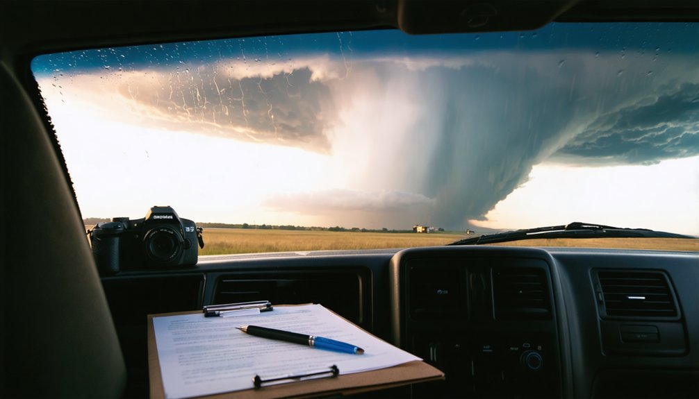
You’re likely contributing far less to meteorological research than you think. Meaningful scientific advancement requires high-resolution numerical models, standardized data collection protocols, and instruments calibrated to capture specific atmospheric parameters—not dashboard cameras and smartphone footage.
Unless you’re deploying radiosondes, mobile mesonets, or dual-polarization radar systems as part of coordinated field campaigns, your observations lack the temporal and spatial resolution necessary for assimilation into predictive frameworks.
Research Contribution Reality Check
Scientific storm chasing operates on fundamentally different principles than its amateur counterpart, with researchers deploying targeted instrumentation to fill critical gaps in atmospheric data collection. Projects like Penn State’s helium-delivered 13-gram probes and RAAVEN drones gather thermodynamic measurements that advance tornado formation theories beyond visual documentation.
However, increased chaser numbers create data accuracy compromises and resource allocation challenges for research teams:
- Crowded road networks obstruct van-based helium launch systems requiring rapid deployment
- Visual congestion interferes with targeted positioning in storm’s right front quadrant
- Communication bandwidth saturation degrades coordination between TORUS project vehicles
- Scientific access delays reduce critical measurement windows when only 10-15% of mesocyclones produce tornadoes
You’ll find legitimate research requires precise thermodynamic validation, not spectacle-driven pursuits that obstruct systematic atmospheric investigation.
High-Resolution Model Requirements
Research teams navigate crowded road networks and bandwidth saturation, but amateur chasers face a different obstruction: misplaced confidence in high-resolution weather models. You’re watching HRRR runs display flashy supercell scenarios at specific locations, treating 3-kilometer grid spacing as precision targeting. That’s model interpretation pitfalls in action.
These systems simulate environmental conditions near grid points—they don’t forecast storm placement at “Dodge City at 7:12 PM.” Model resolution accuracy doesn’t eliminate the fundamental limitation: mathematical approximations based on incomplete atmospheric data.
When single HRRR runs show isolated convective setups unsupported by other modeling systems, you’re seeing noise, not signal. Effective targeting requires multi-model consensus, observable parameter validation through surface dewpoints and wind fields, and recognition that even advanced models suggest potential rather than guarantee outcomes.
When and Where Convergence Hits Hardest
When storm chasers converge on the same meteorological targets, they’re typically responding to predictable spatiotemporal patterns that concentrate severe weather activity. Regional risk analyses reveal distinct convergence hotspots where atmospheric conditions favor supercell development.
Primary Convergence Zones:
- Tornado Alley (April-June) – Texas through South Dakota experiences 1,200 annual tornadoes from Gulf moisture clashing with Rocky Mountain dry air
- Southeastern Corridor (Spring) – Alabama, Mississippi, Tennessee average 300 tornadoes yearly from quasi-linear convective systems
- Kansas Lead Territory – Highest photogenic tornado frequency drives concentrated chaser activity
- High-Potential Days – Only 20% of supercells produce tornadoes, creating bottleneck scenarios
Understanding ideal convergence thresholds helps you anticipate when excessive chaser density compromises safety and operational effectiveness during peak outbreak conditions.
Frequently Asked Questions
How Do Emergency Responders Communicate When Roads Are Blocked by Chasers?
You’ll find emergency responders utilize alternative communication channels like amateur radio networks and spotter coordination systems when chasers block roads. Traffic management strategies include pre-positioned units and established severe weather nets, ensuring you’re maintaining operational freedom during atmospheric events.
Are Storm Chasers Required to Have Permits or Special Training?
Currently, you’re not required to obtain specialized certifications or follow pre-approved chase routes nationwide. However, Oklahoma’s proposed voluntary licensing program could establish precedent for privileges like emergency lighting, though mandatory requirements remain absent.
What Insurance Considerations Exist for Vehicles Damaged While Storm Chasing?
You’ll need extensive storm damage coverage, not vehicle collision insurance, since tornado damage falls under weather events. Insurers may deny claims if they link damage to intentional high-risk chasing, so review your policy’s exclusions beforehand.
How Do Meteorologists Verify Reports From Unknown Versus Veteran Chasers?
When you’re an unknown chaser reporting a tornado, meteorologists cross-reference your report against NEXRAD velocity signatures and independent observation methods from trained spotters. Unknown chaser reliability increases when radar data confirms your reported mesocyclone characteristics and timing.
Do Convergence Issues Affect Tornado Warning Accuracy or Timing?
Convergence doesn’t directly impact tornado warning accuracy or timing. However, traffic congestion can delay your ground-truth reports from reaching forecasters, potentially affecting resource allocation for warning verification and post-event damage surveys in critical situations.