We're successful at predicting storms because we combine advanced technology, real-time data analysis, and collaboration with meteorologists. Our Doppler radar and satellite systems provide essential data while machine learning algorithms refine predictive accuracy. Field observations using instruments like anemometers are vital for collecting real-time atmospheric conditions. We interpret complex datasets swiftly through data visualization tools, and our meteorological expertise fine-tunes the storm tracking techniques. By constantly analyzing variables like humidity, wind speed, and jet streams, we create robust models for timely and accurate forecasts. To understand the intricacies behind these techniques, you might want to explore further.
Key Points
- Direct Field Observations: Real-time data collection and precise measurements validate and enhance predictive models.
- Advanced Technology: Utilization of Doppler radar and satellite systems significantly improves storm prediction accuracy.
- Collaboration with Meteorologists: Expert interpretation of atmospheric data ensures robust and precise forecasts.
- Machine Learning Algorithms: Predictive models refined by machine learning enhance the accuracy of storm predictions.
Understanding Weather Patterns
To predict storms accurately, we must first analyze and comprehend the intricate behavior of weather patterns. In weather forecasting, we explore atmospheric science to identify how air masses, pressure systems, and temperature gradients interact. By studying historical climate data and real-time observations, we can recognize patterns that signal the formation of storms.
Understanding atmospheric dynamics involves examining variables like humidity, wind speed, and barometric pressure. For instance, when warm, moist air rises and meets cooler, dry air, it often results in thunderstorms. Data from weather balloons and satellite imagery provide critical insights into these interactions. We utilize models that simulate the atmosphere's behavior, helping us forecast storm paths and intensities with increased accuracy.
Analyzing specific weather phenomena, such as jet streams and ocean currents, allows us to predict storm development on a larger scale. For example, the El Niño–Southern Oscillation affects global weather patterns, leading to increased storm activity in certain regions.
Advanced Technology Usage
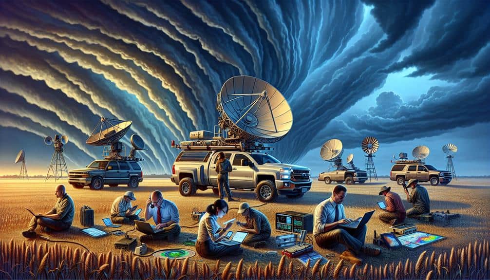
Leveraging state-of-the-art technologies like Doppler radar, satellite systems, and machine learning algorithms, we enhance our ability to predict storms with unparalleled precision. These tools allow us to perform remote sensing, capturing atmospheric data from locations we can't physically access.
Doppler radar, for instance, provides real-time data on wind speed and precipitation patterns, essential for identifying storm development. Satellite systems offer a bird's-eye view, capturing high-resolution images and thermal data, enabling us to monitor large-scale weather systems over vast areas.
Machine learning algorithms process this data, identifying patterns and anomalies that might escape human observation. By analyzing historical weather data and real-time inputs, these algorithms improve predictive accuracy, offering forecasts that aren't only reliable but also timely.
Data visualization techniques help us interpret complex datasets, turning raw numbers into intuitive graphical formats. This makes it easier to communicate potential storm trajectories and intensities to both the public and decision-makers.
Advanced data visualization tools can display multi-layered information, such as wind speed, temperature, and humidity, in a cohesive manner, enabling us to make informed predictions and decisions swiftly.
Real-Time Data Analysis
Real-time data analysis enables us to process vast amounts of meteorological data instantaneously, providing vital insights into storm dynamics as they unfold. By leveraging predictive modeling, we transform raw data into actionable forecasts. Advanced data visualization tools allow us to interpret these intricate datasets quickly, enhancing our ability to make informed decisions in high-stakes situations.
We employ machine learning algorithms to refine our predictive analytics continuously. These algorithms analyze patterns in historical and current data, improving our storm prediction accuracy over time. For example, machine learning models can identify subtle atmospheric changes that precede severe weather events, giving us a significant edge in forecasting.
Our data-driven approach isn't just about collecting information; it's about synthesizing it into a coherent, predictive narrative. High-resolution satellite images, Doppler radar data, and sensor readings feed into our systems in real-time, enabling us to update our models dynamically. This continuous flow of information guarantees that our predictions are as current and accurate as possible, allowing us the freedom to act swiftly and decisively.
In essence, real-time data analysis empowers us to stay ahead of the storm, combining technology and data to protect lives and property.
Field Observations
Our team relies heavily on direct field observations to validate and enhance our predictive models. By being on the ground, we gather real-time data collection on various atmospheric conditions, such as temperature gradients, humidity levels, and wind speed. This hands-on approach allows us to capture the nuances of storm development that remote sensors might miss.
When we chase storms, we use a range of advanced instruments, including mobile Doppler radar, anemometers, and weather balloons. These tools give us precise measurements of atmospheric conditions, enabling us to refine our algorithms and improve prediction accuracy. By triangulating data from multiple sources, we can identify patterns and anomalies that signal a storm's potential path and intensity.
Field observations also provide us with invaluable qualitative data. Visual cues like cloud formations, lightning frequency, and precipitation type offer immediate insights that complement our quantitative analyses. This dual approach—combining hard data with observational expertise—ensures our models are robust and reliable.
In essence, field data collection isn't just supplementary; it's integral to our success. By immersing ourselves in the atmospheric conditions we study, we gain a thorough understanding that empowers us to predict storms with greater precision and confidence.
Collaboration With Meteorologists
Collaboration with meteorologists is vital for integrating advanced atmospheric models and enhancing our storm prediction capabilities. By leveraging meteorological expertise, we can fine-tune our storm tracking techniques, allowing us to anticipate severe weather events with greater accuracy.
Meteorologists provide essential data on atmospheric pressure, humidity, wind patterns, and temperature gradients, which are indispensable for modeling storm behavior.
We work closely with meteorologists to interpret this data, ensuring our predictive models are both robust and adaptive. Their insights guide us in identifying key indicators of storm formation and progression.
For instance, meteorologists can pinpoint areas of potential atmospheric instability, which we then monitor using our storm tracking techniques. This synergy enables us to create real-time forecasts that are both timely and precise.
Moreover, collaboration allows us to validate our field observations against meteorological data, enhancing the reliability of our predictions. By cross-referencing our findings with their data, we can refine our techniques, eliminating errors and improving our models.
This partnership not only elevates our forecasting accuracy but also empowers us to make informed decisions, ultimately providing a greater degree of freedom in our storm-chasing endeavors.
Frequently Asked Questions
How Do Storm Chasers Prepare for Extreme Weather Conditions?
We prepare for extreme weather by ensuring equipment preparation and implementing safety measures. Our team conducts thorough forecast analysis and maintains constant team coordination. This approach empowers us to face unpredictable conditions effectively and safely.
What Training Do Storm Chasers Undergo Before Heading Into the Field?
We undergo intense training—like deciphering a million-piece puzzle—focused on weather patterns, forecasting, emergency response, and preparedness. Mastering meteorological data and real-time analysis guarantees we're ready to face the storm's unpredictable wrath with precision and freedom.
Are There Safety Protocols Storm Chasers Must Follow During a Chase?
We adhere to strict safety measures, including maintaining communication protocols and using advanced equipment requirements such as radar and GPS. These precautions guarantee our safety while granting us the freedom to gather vital storm data effectively.
How Do Storm Chasers Balance Their Passion With the Risks Involved?
We balance our passion with the risks by implementing rigorous safety precautions and risk management strategies. The adrenaline rush and thrill-seeking drive us, but data-driven decisions guarantee we chase storms responsibly while maximizing our freedom.
What Are the Psychological Impacts of Storm Chasing on Individuals?
The psychological impacts on storm chasers can be monumental. We develop mental health resilience through stress management and coping strategies, enabling us to handle the intense pressure and maintain our freedom to chase our passion.


