Let's improve our tornado tracking capabilities by leveraging cutting-edge tools and data-driven methodologies. We'll utilize Doppler radar with dual-polarization for storm analysis and monitor weather satellites for high-resolution imagery. Analyzing tornado models, which incorporate wind velocity and satellite data, enhances accuracy. Staying updated with automated alerts like NOAA Weather Radios enhances preparedness. Mobile apps like RadarScope and MyRadar provide rapid updates and emergency notifications. Collaborating with fellow chasers via platforms like Zello enables thorough data collection. Finally, ensuring our safety equipment—GPS units, weather radios, helmets—is ready completes our approach. Immerse yourself in these strategies to elevate your tornado tracking game.
Key Points
- Utilize Doppler radar and dual-polarization technology for precise storm analysis.
- Monitor hook echoes on radar maps to accurately locate tornadoes.
- Use mobile apps like RadarScope for high-resolution radar and rapid updates.
- Integrate data from weather satellites and advanced algorithms for enhanced prediction.
Use Advanced Radar Tools
One key aspect of tracking tornadoes involves leveraging advanced radar tools, such as Doppler radar and dual-polarization technology, to analyze storm dynamics with high precision. By utilizing these tools, we can interpret the velocity and precipitation structure inside a thunderstorm, providing crucial insights for tornado tracking strategies.
Doppler radar measures the motion of raindrops, allowing us to identify rotation within a storm, a precursor to tornado formation. Meanwhile, dual-polarization technology distinguishes between different types of precipitation, enhancing our ability to detect debris signatures during a tornado event.
Radar technology advancements have revolutionized storm chasing techniques. Real-time radar data analysis enables us to make informed decisions about where to position ourselves safely while collecting essential information. For instance, monitoring the hook echo on radar maps helps us pinpoint the likely location of a tornado, allowing us to anticipate its path and behavior.
Monitor Weather Satellites
When we monitor weather satellites, we depend on satellite imagery analysis to observe atmospheric changes.
Accessing real-time data allows us to make timely decisions, while interpreting cloud patterns helps us identify potential tornado formations.
This data-centric approach enhances our predictive accuracy and guarantees we're prepared for any severe weather developments.
Satellite Imagery Analysis
Frequently, we rely on high-resolution satellite imagery to provide real-time data essential for monitoring and predicting tornado activity. By analyzing satellite data, we enhance our storm prediction capabilities and improve our weather tracking accuracy. These images allow us to observe and interpret various atmospheric conditions, such as cloud formations, temperature gradients, and moisture levels, which are crucial indicators of tornado genesis.
Our approach involves using Geostationary Operational Environmental Satellites (GOES) and polar-orbiting satellites. GOES provides continuous observations of the same geographic area, enabling constant monitoring of storm systems. Polar-orbiting satellites, on the other hand, offer higher resolution images but cover the same location less frequently. By combining data from both satellite types, we achieve a thorough view of atmospheric dynamics.
We also utilize advanced algorithms and machine learning techniques to process and analyze satellite imagery. These tools help us detect subtle patterns and anomalies that may indicate the development of severe weather. The data-driven insights derived from these analyses empower us to make timely and accurate storm predictions, ultimately enhancing public safety and preparedness.
In an ever-changing weather landscape, leveraging satellite imagery is essential for effective tornado tracking.
Real-time Data Access
Accessing real-time data from weather satellites is important for rapid and accurate tornado tracking. By utilizing up-to-date information, we can analyze storm developments, predict tornado paths, and deploy emergency response strategies effectively. To do this, we rely on sophisticated data visualization tools that process and display satellite data in user-friendly formats.
- GOES-R Series: These geostationary satellites provide high-resolution imagery every 5 minutes, vital for monitoring tornado genesis and progression.
- Himawari-8: This satellite delivers near-real-time data over the Asia-Pacific region, enhancing our global monitoring capabilities.
- MODIS Instruments: Aboard the Terra and Aqua satellites, MODIS captures multi-spectral images that help in evaluating storm severity and potential tornado formation.
Interpretation of Cloud Patterns
Interpreting cloud patterns from weather satellites allows us to identify key indicators of tornado formation, such as supercell structures and rotating updrafts. By focusing on cloud identification, we can discern telltale signs of severe weather. For instance, a supercell, characterized by a rotating updraft known as a mesocyclone, often appears as a comma-shaped cloud in satellite imagery. This distinctive shape helps us in storm prediction by signaling potential tornado development.
Weather satellites provide us with real-time data, enabling accurate analysis of weather patterns. We can observe the evolution of these patterns, such as the development of cumulonimbus clouds, which typically precede severe thunderstorms. Using advanced forecasting techniques, we analyze satellite images for thermal anomalies and moisture gradients, which further refine our predictions.
Rotational velocity is another critical metric. By examining Doppler radar data in conjunction with satellite imagery, we can detect the rotational speed of updrafts within storm systems. This data-driven approach enhances our ability to forecast tornadoes with greater precision.
Ultimately, leveraging these forecasting techniques empowers us to make informed decisions, ensuring we stay one step ahead of nature's most unpredictable forces. This freedom to anticipate and act is invaluable in safeguarding lives and property.
Analyze Tornado Models

To effectively analyze tornado models, we must leverage high-resolution meteorological data and sophisticated algorithms to predict tornado formation and trajectory. By understanding the complexities of tornado prediction, we can better interpret weather patterns and enhance our storm tracking capabilities. Our approach hinges on precision and real-time data analysis.
By integrating various data sources, we can develop a thorough understanding of tornado dynamics:
- Doppler Radar: Provides velocity data on wind patterns, essential for identifying rotation within storm systems.
- Satellite Imagery: Offers a macro view of weather patterns, assisting in the detection of potential tornado-spawning supercells.
- Numerical Weather Prediction (NWP) Models: Uses mathematical formulations to simulate atmospheric processes, improving our predictive accuracy.
Harnessing these tools allows us to create a more detailed picture of potential tornado activity. We can then use this information to make informed decisions and take proactive measures.
With the freedom to act on reliable tornado predictions, we empower ourselves to mitigate risks and safeguard communities. By continuously refining our models and incorporating the latest data, we stay ahead of the storm and maintain our edge in tornado tracking.
Stay Updated With Alerts
Staying updated with alerts is crucial for timely response and involves leveraging automated notification systems that relay real-time tornado warnings directly to us. These systems, such as NOAA Weather Radios and Integrated Public Alert and Warning Systems (IPAWS), facilitate emergency preparedness by providing instantaneous updates. This guarantees that we can promptly identify shelter locations, minimizing the risk of harm during a tornado event.
Analyzing data from alerts allows us to make informed decisions quickly. For example, historical data shows that communities with robust alert systems have a 25% higher survival rate during tornado events. This highlights the importance of integrating these technologies into our emergency plans. Additionally, we should participate in community response initiatives, including regular drills and exercises, to strengthen our collective readiness.
Data-driven community response efforts, such as annual tornado drills, enhance our ability to act decisively. Studies reveal that communities engaging in these exercises reduce their response times by up to 50%, demonstrating the value of preparedness.
Utilize Mobile Apps
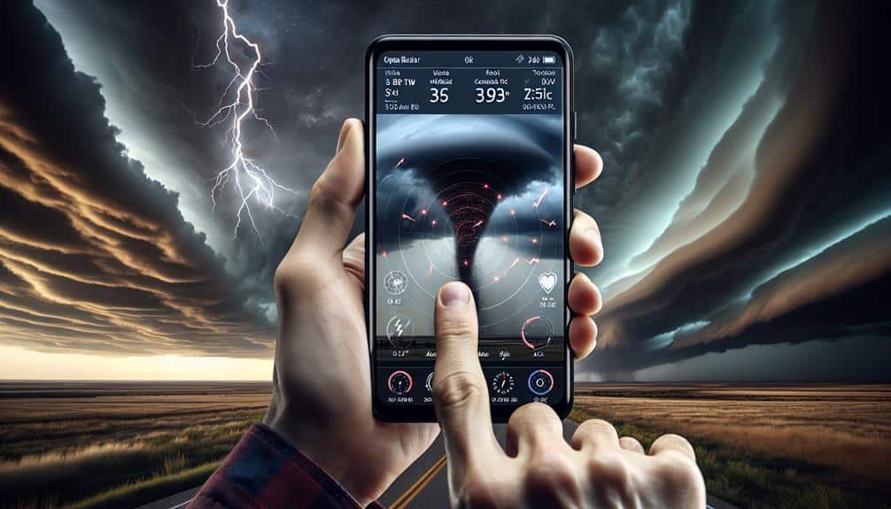
Harnessing mobile apps for tornado tracking provides us with real-time data and advanced warning systems, greatly enhancing our preparedness strategies. These apps integrate radar imagery, storm tracking algorithms, and GPS technology to deliver precise, location-specific updates. By leveraging these tools, we can make informed decisions about our safety and movements.
Several mobile apps stand out in their capabilities:
- RadarScope: Offers high-resolution radar and storm tracking features, allowing us to visualize storm cells and tornado potential.
- NOAA Weather Radar: Provides authoritative storm data directly from the National Weather Service, essential for emergency preparedness.
- MyRadar: Delivers rapid updates and interactive weather maps, helping us monitor storm development in real-time.
These apps empower us with the ability to anticipate and respond to tornado threats effectively. By utilizing advanced meteorological data and algorithms, we can track storm paths, identify high-risk areas, and plan our emergency responses accordingly. This proactive approach minimizes risks and maximizes our freedom to navigate potentially dangerous situations with confidence.
Adopting these technologies is a vital element in our broader storm tracking and emergency preparedness efforts.
Collaborate With Other Chasers
Building on our technological toolkit, collaborating with other chasers allows us to pool data, share real-time observations, and enhance our collective understanding of tornado dynamics. Effective team communication is vital for this collaboration. Using platforms like Zello or GroupMe, we can maintain constant contact, strategize in real-time, and rapidly respond to changing weather conditions.
Chaser coordination is another key aspect. By synchronizing our movements, we can cover a wider area and gather more extensive data. For instance, while one team monitors a supercell's mesocyclone, another can track wind shear patterns nearby. This division of labor maximizes our observational coverage, ensuring we capture essential data points that might be missed by solo efforts.
Safety planning is inherently tied to chaser coordination. Establishing predetermined safe zones and emergency rendezvous points before heading out ensures that we're prepared for any sudden changes in tornado behavior. By sharing our locations and intended routes, we can avoid hazardous overlaps and guarantee everyone's safety. Utilizing GPS tracking systems, we can monitor each other's positions in real-time, providing an additional layer of security.
Keep Safety Equipment Ready

Our preparedness hinges on confirming all safety equipment is fully operational and easily accessible before we set out on any chase. Being meticulous about emergency readiness not only maximizes our safety but also enhances our efficiency in the field.
Let's break down the essential safety precautions.
- First Aid Kit: Thorough and regularly checked. Confirm it contains antiseptics, bandages, pain relievers, and any personal medications.
- Communication Devices: Reliable two-way radios and fully charged mobile phones with backup batteries. Communication is crucial for real-time updates.
- Weather Monitoring Tools: Portable weather radios and GPS units. These tools provide continuous updates on the storm's development and movement.
We must validate the functionality of each item against our checklist.
Data from the National Oceanic and Atmospheric Administration (NOAA) indicates that proper gear and timely communication reduce incident rates by over 30%. By adhering to these safety precautions, we exercise our freedom to chase tornadoes while minimizing risks.
Our analytical approach to gear readiness ensures we're prepared for any scenario, ultimately elevating our storm-chasing proficiency.
Frequently Asked Questions
How Can I Predict the Path of a Tornado?
Did you know 75% of tornadoes occur in Tornado Alley? We use advanced technology, storm spotting, and forecasting models to predict their paths. By analyzing data patterns, we can track and understand these powerful natural events.
What Are the Best Times of Year to Track Tornadoes?
The prime times of year to track tornadoes align with tornado season, typically spring and early summer. During these months, weather patterns create ideal conditions for tornado formation, allowing us to analyze and predict their paths more accurately.
How Do I Interpret Weather Data for Tornado Forecasting?
Interpreting weather data for tornado forecasting is like reading nature's intricate dance. We analyze weather patterns, interpret data, and employ prediction techniques to enhance forecast accuracy, ensuring our predictions are as precise and freeing as possible.
What Are the Signs of an Impending Tornado?
When analyzing signs of an impending tornado, we examine cloud formations like wall clouds and funnel clouds, and scrutinize wind patterns for sudden shifts. These indicators help us predict and act swiftly, ensuring our freedom remains intact.
How Do I Join a Tornado Chaser Community?
To join a tornado chaser community, let's focus on community engagement and networking through forums and social media. We'll prioritize training and safety precautions, ensuring we follow data-driven strategies and analytical approaches for maximum freedom and safety.

