We use advanced technologies to track storm trajectories and their directions precisely. Satellite imagery provides high-resolution, real-time data on storm development and movement. Doppler radar complements this by measuring precipitation intensity and storm motion, including velocity and rotation within systems. GPS tracking pinpoints exact storm coordinates, enhancing forecasting accuracy. Portable mobile weather stations equipped with high-precision sensors and real-time data transmission guarantee accurate monitoring. These stations, crucial for storm chasing, enable immediate updates and detailed analysis. To understand the subtleties of these technologies and their deployment, you can explore further information.
Key Points
- Satellite imagery provides high-resolution data for real-time monitoring and precise tracking of storm trajectories.
- Doppler radar measures precipitation intensity and storm motion, offering detailed insights into storm direction and velocity.
- GPS tracking pinpoints exact coordinates of storms, enabling accurate location data and improved forecasting.
- Mobile weather stations collect real-time data on meteorological parameters, enhancing storm trajectory analysis.
Satellite Imagery
For tracking storm trajectories, we heavily depend on satellite imagery due to its high-resolution data and real-time monitoring capabilities. These images, captured via remote sensing technologies, provide us with vital information about storm development, structure, and movement. By utilizing advanced image analysis techniques, we can extract precise data on cloud formations, wind patterns, and temperature variations.
Satellite imagery allows us to monitor vast areas of the Earth's atmosphere continuously. This constant surveillance is essential for identifying early signs of storm formation and potential paths. Using geostationary satellites, we obtain images at frequent intervals, enhancing our ability to predict rapid changes in storm intensity and direction. By combining these images with algorithms that analyze pixel-level data, we gain insights into storm dynamics that are both accurate and timely.
Remote sensing technology, which includes instruments like radiometers and spectrometers, captures electromagnetic radiation across various wavelengths. This data is invaluable for differentiating between cloud types and identifying moisture levels. Consequently, our ability to analyze this information translates directly into more dependable storm predictions, empowering us to make informed decisions and take proactive measures. This ensures we maintain our autonomy while staying ahead of potential weather threats.
Doppler Radar
Complementing the capabilities of satellite imagery, Doppler radar provides real-time data on precipitation intensity and storm motion by measuring the velocity of rain droplets within the storm. Utilizing advanced radar technology, we can monitor storm trajectories with remarkable precision, offering important insights that empower us to make informed decisions during severe weather events.
Doppler radar operates by emitting microwave pulses and analyzing the returned signals reflected off precipitation particles. This technology allows us to determine both the speed and direction of storm elements, facilitating accurate storm tracking. By capturing data on the radial velocity of raindrops, Doppler radar can identify rotation within a storm system, a key indicator of potential tornado development.
The dual-polarization capability of modern Doppler radar systems enhances our understanding by distinguishing between different types of precipitation, such as rain, hail, and snow. This differentiation is essential for evaluating storm severity and potential impact areas. Additionally, Doppler radar's high temporal resolution ensures continuous monitoring, providing near-instantaneous updates that are important for real-time decision-making.
In essence, Doppler radar technology revolutionizes our approach to storm tracking, offering a dynamic, data-driven method to anticipate and respond to the ever-changing nature of severe weather, thereby safeguarding our freedom to navigate unpredictable elements.
GPS Tracking
GPS tracking plays a crucial role in storm monitoring by providing precise location data of severe weather systems. By utilizing satellite technology, we can pinpoint the exact coordinates of a storm, allowing for real-time updates and improved forecasting accuracy. This precision enables us to conduct more nuanced data analysis, identifying shifts in weather patterns that might otherwise go unnoticed.
The integration of GPS tracking into our storm monitoring toolkit offers several advantages:
- High-Resolution Data: GPS systems provide detailed positional data, enhancing our understanding of storm movements.
- Real-Time Updates: Continuous data feeds allow us to monitor storm trajectories as they happen, offering timely alerts.
- Enhanced Predictive Models: Accurate location data feeds into predictive models, improving their reliability and reducing false alarms.
- Scalability: GPS technology can be deployed across various scales, from local to global, ensuring thorough coverage.
Mobile Weather Stations
Let's examine how mobile weather stations, or portable data collection units, enhance our storm tracking capabilities. By providing real-time weather tracking, these units enable us to gather accurate meteorological data instantly.
We'll also cover essential deployment and maintenance tips to guarantee peak performance and reliability.
Portable Data Collection Units
Mobile data collection units, often referred to as portable weather stations, enable real-time monitoring and analysis of storm trajectories with unmatched accuracy. These units are essential in storm chasing, offering the freedom to collect thorough meteorological data directly from the field.
By deploying these mobile stations, we gather precise information on temperature, humidity, wind speed, and atmospheric pressure, which are vital for data analysis.
Our mobile weather stations are equipped with state-of-the-art sensors and GPS technology to guarantee data integrity and accuracy. They allow us to track storms dynamically, adapting to changes in storm paths instantaneously.
Here are key features of portable data collection units:
- High-precision sensors: Measure meteorological parameters with minimal error margins.
- GPS integration: Provides accurate geolocation data for precise storm tracking.
- Wireless data transmission: Ensures real-time data relay to remote analysis centers.
- Robust design: Built to withstand extreme weather conditions.
Real-time Weather Tracking
Utilizing the capabilities of real-time weather tracking, our portable weather stations offer immediate updates on storm conditions directly from the field. By utilizing advanced sensors and telemetry systems, we capture high-resolution data on temperature, humidity, wind speed, and atmospheric pressure. These variables are essential for accurate storm prediction and understanding evolving weather patterns.
Our portable units are equipped with state-of-the-art technology, including Doppler radar and LIDAR (Light Detection and Ranging) systems, enabling us to monitor precipitation rates and cloud formations with remarkable precision. This real-time data allows us to generate detailed storm models, enhancing the accuracy of our predictive algorithms. As a result, we can issue timely warnings and advisories, empowering communities to take proactive measures for their safety.
To guarantee the integrity of our data, we utilize redundant systems and cross-validate information from multiple sources. This approach minimizes errors and enhances the reliability of our storm prediction models. Moreover, the mobility of our stations allows us to position them strategically, capturing localized weather patterns that fixed stations might miss.
This flexibility is crucial for tracking rapidly changing storm trajectories and providing actionable insights.
Essentially, our portable weather stations represent a powerful tool for real-time, data-driven storm monitoring and prediction.
Deployment and Maintenance Tips
For best performance, we must carefully select deployment sites that maximize sensor exposure while minimizing environmental interference. Optimal deployment strategies are essential in capturing accurate storm data. When choosing a site, we should consider the following factors:
- Elevation: Higher altitudes offer clearer atmospheric readings but may require more robust equipment.
- Accessibility: Guarantee easy access for regular maintenance schedules without compromising the station's strategic positioning.
- Power Supply: Reliable power sources, whether solar or battery, are critical for uninterrupted operation.
- Communication: Strong signal reception is necessary for real-time data transmission.
Once deployed, maintaining the integrity of our mobile weather stations is equally vital. We need to establish regular maintenance schedules to ensure sensors are calibrated and functioning correctly. Frequent inspections can preemptively identify and rectify potential issues, thereby minimizing downtime.
Aerial Drones
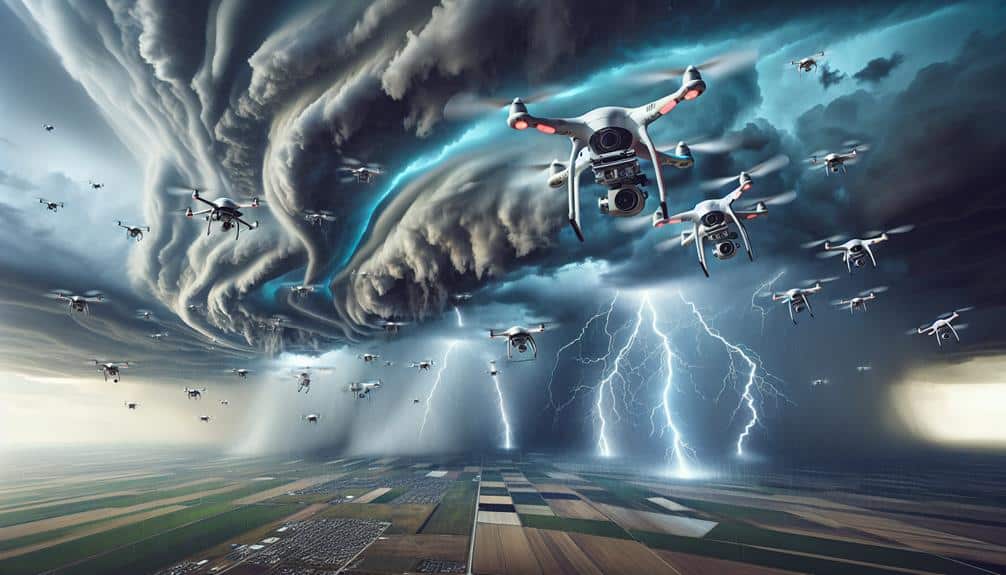
In our analysis of storm trajectories, we can't overlook the pivotal role of aerial drones. These advanced units provide unparalleled surveillance and data collection capabilities, enabling real-time weather mapping.
Surveillance and Data Collection
Aerial drones equipped with advanced sensors and real-time data transmission capabilities provide unparalleled precision in tracking storm paths. By leveraging these technologies, we can improve our storm surveillance and data collection efforts significantly. Unlike traditional methods such as weather balloon tracking and ocean buoys, drones offer flexibility and high-detail data collection that are essential for precise storm monitoring.
Drones can seamlessly integrate with existing remote sensing technologies and ground-based sensors, creating a robust and dynamic surveillance network. This integration guarantees thorough coverage and real-time updates, allowing us to predict storm trajectories with greater accuracy and responsiveness. Our ability to deploy drones in various atmospheric conditions further enhances their usefulness in storm tracking.
Key advantages of aerial drone surveillance include:
- High-Detail Imaging: Captures detailed atmospheric data.
- Real-Time Data Transmission: Provides immediate updates and situational awareness.
- Versatility: Operates in diverse weather conditions and terrains.
- Cost-Effective: Reduces the need for expensive manned aircraft missions.
Real-time Weather Mapping
Harnessing the unmatched precision of aerial drones, we can develop up-to-the-minute weather maps that boost our ability to monitor and forecast storm behavior to a great extent. By deploying drones equipped with advanced meteorological sensors, we capture high-resolution atmospheric data, including temperature, humidity, pressure, and wind speed. This data is instantly relayed to weather tracking apps, facilitating real-time analysis and updates.
Our storm prediction models benefit greatly from this influx of detailed information. The integration of drone data allows for more accurate simulations of storm trajectories, enhancing predictive capabilities. This, in turn, empowers us to make more informed decisions regarding emergency response and disaster preparedness.
For instance, real-time weather mapping enables swift identification of areas at highest risk, ensuring timely evacuation orders and resource allocation. Furthermore, drones excel in accessing remote or hazardous locations that ground-based instruments can't reach, providing a thorough view of developing weather systems. This capability is vital for improving our understanding of storm dynamics and refining our predictive models.
Enhanced Accuracy Techniques
By employing state-of-the-art aerial drones, we achieve unparalleled accuracy in tracking storm trajectories through sophisticated data acquisition and analysis techniques. These drones, equipped with advanced remote sensing technologies, provide real-time, high-resolution data essential for precise storm monitoring. Leveraging machine learning algorithms, we can interpret vast amounts of data rapidly, enhancing our predictive capabilities.
Our approach includes:
- Multi-spectral imaging: Captures diverse data layers, offering a thorough understanding of atmospheric conditions.
- Lidar technology: Measures distances by illuminating the storm with laser light, enabling detailed topographical mapping.
- Thermal sensors: Detect temperature variations within storm systems, aiding in identifying storm intensity and potential development.
- High-frequency radar: Monitors wind speed and direction, important for accurate trajectory predictions.
These technologies allow us to gather granular data, which, when processed through machine learning models, results in precise storm path predictions. This empowers us to make well-informed decisions, ensuring the safety and preparedness of communities.
Storm Spotter Networks
Storm spotter networks, comprising trained volunteers and professional meteorologists, play an essential role in providing real-time, ground-level data that enhances the accuracy of storm trajectory predictions. These networks leverage community involvement to augment storm preparedness efforts, guaranteeing that critical information reaches emergency response teams swiftly.
By integrating observations from multiple ground-based sources, we can identify storm patterns and anomalies that may not be visible through satellite imagery alone.
Volunteer training is a cornerstone of these networks. Participants undergo rigorous instruction in meteorological phenomena, data reporting protocols, and safety procedures. This training guarantees that volunteers can accurately identify and report storm characteristics such as wind speed, hail size, and tornado formation. Their contributions are invaluable during severe weather events, providing on-the-ground intelligence that complements radar and satellite data.
Emergency response teams rely heavily on the precision and timeliness of reports from storm spotter networks. These real-time updates enable us to make informed decisions about issuing warnings and coordinating evacuations.
This collaborative approach not only saves lives but also empowers communities. By participating in storm spotter networks, individuals gain a sense of agency and contribute to collective resilience against the unpredictable forces of nature.
Computer Models

In conjunction with ground-level observations from storm spotter networks, computer models provide advanced simulations that predict storm trajectories with remarkable precision. These models leverage vast datasets and cutting-edge technology to enhance our storm prediction capabilities. By integrating data visualization tools, we can interpret complex weather patterns and make informed decisions faster than ever.
Key aspects of computer models in storm prediction include:
- Algorithm Optimization: Continuous improvements in algorithms guarantee more accurate and reliable weather forecasting.
- Real-Time Data Integration: Incorporating live data from various sources, including satellites and radar, refines predictions.
- High-Resolution Simulations: Detailed simulations offer granular insights into storm behavior, helping us anticipate changes in trajectory.
- Predictive Analytics: Using historical data, predictive analytics identify trends and potential anomalies in storm patterns.
Frequently Asked Questions
How Do Changes in Climate Affect Storm Trajectory Patterns?
Climate patterns' dramatic shifts cause unprecedented storm shifts. Temperature impacts radically alter storm behavior, leading to erratic and unpredictable paths. We're seeing extreme deviations that challenge our predictive models and demand adaptive strategies for all seeking freedom.
What Role Do Ocean Temperatures Play in Storm Formation and Direction?
We observe a strong ocean temperature correlation with storm formation and direction. Warmer seas often lead to higher storm intensity impact, influencing both the genesis and path of tropical cyclones, as evidenced by recent climatological data.
How Can Historical Storm Data Improve Future Trajectory Predictions?
Imagine a chess player using past games to anticipate opponents' moves. By applying data analysis to historical storm data, we can enhance prediction accuracy, giving us the freedom to better prepare and respond to future storms.
What Are the Limitations of Current Storm Tracking Technologies?
We face challenges with satellite inaccuracies and radar limitations. Our satellite data can sometimes be imprecise due to resolution constraints, and radar often struggles with range and signal interference, limiting our storm tracking accuracy.
How Do Various Atmospheric Pressures Influence Storm Paths?
When push comes to shove, wind patterns and pressure systems greatly affect storm paths. Atmospheric dynamics shift pressure systems, altering storm movement. High-pressure areas can steer storms away, while low-pressure zones often draw them in.

