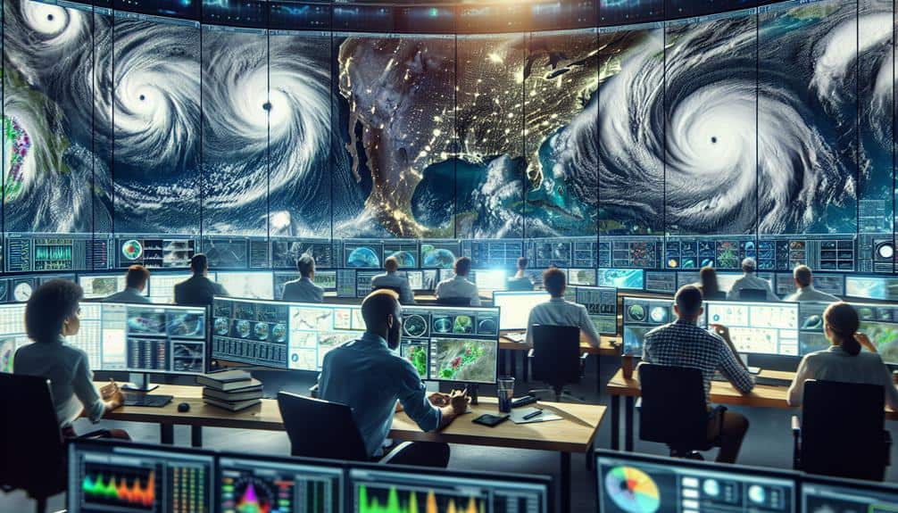
We utilize advanced weather models and ensemble forecasting to integrate real-time data, enhancing our hurricane tracking capabilities. High-definition radar imagery from dependable tools gives us detailed views of storm structures and precipitation patterns. By analyzing satellite images, we monitor hurricane development and intricate weather patterns. Understanding storm patterns through historical data and real-time metrics is crucial for predicting trajectories. Real-time weather apps and customizable alerts keep us informed, while GPS technology offers accurate tracking and adaptation strategies. Effective communication using radio frequencies and satellite phones guarantees coordination and data accuracy. Learn more to elevate your storm chasing strategies.
Key Points
- Utilize high-resolution radar and satellite imagery for accurate, real-time hurricane tracking.
- Leverage ensemble forecasting to account for uncertainties and enhance prediction accuracy.
- Set up customizable alerts on weather apps for immediate updates on storm developments.
- Communicate effectively with fellow storm chasers using reliable radio frequencies and satellite phones.
Monitor Weather Models
We rely on advanced weather models to predict the trajectory and intensity of hurricanes with high accuracy. These models integrate vast amounts of atmospheric data, acquired from satellites, aircraft reconnaissance, and weather stations. By continually updating with real-time inputs, they enhance our weather tracking capabilities. Key parameters include wind speeds, barometric pressure, sea surface temperatures, and humidity levels, which collectively inform the predictive algorithms.
In our data analysis, we employ ensemble forecasting techniques, running multiple simulations to account for uncertainties in initial conditions. This approach generates a range of possible storm paths and intensities, allowing us to evaluate probabilistic outcomes.
For instance, the European Centre for Medium-Range Weather Forecasts (ECMWF) and the Global Forecast System (GFS) are two primary models we consult. Each offers unique insights based on differing initial conditions and algorithmic structures.
Use Reliable Radar Tools
We prioritize using dependable radar tools to guarantee accurate, real-time weather updates, which are essential for tracking hurricanes.
By integrating mobile radar apps with satellite imagery sources, we enhance our ability to predict storm trajectories and intensities.
These data-driven tools allow us to make informed decisions quickly and efficiently.
Real-Time Weather Updates
Accurate hurricane tracking demands the use of advanced radar tools that provide real-time weather updates essential for timely decision-making. As storm chasers, we rely on cutting-edge weather tracking technology to guarantee our safety and improve our ability to track hurricanes effectively. Real-time data allows us to anticipate changes in the storm's path, intensity, and speed, which is vital for emergency preparedness and making informed decisions on the ground.
By leveraging radar tools, we can access:
- High-resolution radar imagery: This provides detailed visual data on the storm's structure and precipitation patterns.
- Doppler radar: Critical for measuring wind speeds and detecting rotational patterns that may indicate tornado formation.
The integration of these tools into our storm chasing strategy isn't just about the thrill; it's about ensuring storm chasing safety and enhancing our situational awareness. These technologies empower us to act swiftly and strategically, minimizing risks while maximizing our ability to gather valuable data.
Accurate, real-time weather updates are the backbone of efficient hurricane tracking, guaranteeing that we're always one step ahead of the storm.
Mobile Radar Apps
Utilizing mobile radar apps is necessary for accessing reliable, real-time weather data while on the go. With advanced radar technology, these apps provide us with high-resolution storm tracking capabilities, enabling us to make informed decisions quickly. The integration of Doppler radar data allows for accurate detection of precipitation intensity, storm structure, and wind patterns, which are essential when navigating through severe weather conditions.
One of the key advantages of mobile radar apps is their ability to offer layered data. We can view multiple data layers such as reflectivity, velocity, and wind shear, which helps us assess the severity and trajectory of a hurricane. By analyzing these layers, we gain a thorough understanding of storm dynamics, enhancing our ability to predict movement and potential impact zones.
Moreover, mobile radar apps are equipped with push notifications and real-time alerts, ensuring we're always updated on any sudden changes in storm patterns. This high level of situational awareness is invaluable for those of us who prioritize freedom and safety while storm chasing. Utilizing reliable radar tools, we can minimize risks and maximize our efficiency in tracking and studying hurricanes.
Satellite Imagery Sources
Satellite imagery serves as an indispensable tool in our arsenal for monitoring hurricane development and progression with unmatched clarity and precision. Leveraging these high-resolution images, we can perform detailed weather analysis and storm tracking that empowers us with actionable data.
Here are three reliable satellite imagery sources to take into account:
- NOAA's GOES Satellites: These geostationary satellites provide continuous imagery of the Western Hemisphere, enabling us to track storm systems in near real-time.
- NASA's Terra and Aqua Satellites: Equipped with the MODIS instrument, these satellites offer high-resolution images that are essential for in-depth weather analysis.
Understand Storm Patterns

By analyzing historical data and real-time metrics, we can identify patterns in storm behavior that enhance our predictive models. Examining past hurricanes, we notice recurring trends in how these storms develop, intensify, and dissipate. For instance, many hurricanes follow similar trajectories based on prevailing wind patterns and ocean temperatures. Such insights allow us to refine our forecast accuracy, providing more reliable information for both preparation and response.
We leverage advanced algorithms and machine learning to sift through vast datasets, isolating variables like sea surface temperature, atmospheric pressure, and humidity levels. These factors greatly influence storm behavior, offering clues about potential paths and intensity levels. By correlating these variables with historical storm data, we enhance our ability to predict future storm movements more accurately.
Moreover, integrating real-time data from satellite imagery, buoys, and radar systems helps us continuously update our models. This dynamic approach ensures that our forecasts remain as precise as possible, even as conditions evolve.
Understanding storm patterns not only supports our immediate objectives but also contributes to long-term improvements in meteorological science. Ultimately, this empowers us to make informed decisions, granting us the freedom to safely navigate the challenges hurricanes present.
Stay Updated With Alerts
We must utilize real-time weather apps to access immediate data on hurricane developments.
Government alert systems provide verified and vital information that enhances our ability to make informed decisions.
Together, these tools guarantee we receive timely updates, essential for effective tracking and response.
Real-Time Weather Apps
How can storm chasers guarantee they stay ahead of hurricanes in real time? Leveraging real-time weather apps is essential for effective storm tracking and emergency preparedness. These apps provide us with immediate access to critical meteorological data, making sure we're never caught off guard.
Real-time weather apps offer a suite of features that enhance our storm tracking capabilities:
- High-resolution radar maps: These maps allow us to visualize storm paths and intensities with precise accuracy.
- Customizable alerts: Tailored notifications keep us updated on changes in weather conditions, ensuring we can make well-informed decisions quickly.
By integrating these apps into our storm-chasing toolkit, we can analyze data trends and adjust our strategies in real-time. This proactive approach is vital for maintaining our safety and maximizing our effectiveness in the field.
Utilizing real-time weather apps aligns with our desire for freedom, as it empowers us to navigate uncertain environments with confidence. Staying updated with alerts from these apps ensures we're always prepared, reducing risks and enhancing our ability to respond to rapidly changing situations.
Government Alert Systems
Why rely solely on real-time weather apps when government alert systems provide an additional layer of crucial, timely updates during hurricane tracking? Government alert systems like NOAA Weather Radio and FEMA's Integrated Public Alert and Warning System (IPAWS) offer precise, data-driven information that can enhance our emergency response strategies. These platforms deliver updates directly from meteorological experts and emergency management agencies, ensuring we receive the most accurate and current data available.
By integrating government alerts into our communication strategies, we can achieve a higher level of readiness. These systems not only disseminate warnings about hurricane paths and intensities but also provide actionable advice on evacuation routes, shelter locations, and other essential safety measures. This inclusive approach ensures we're not just tracking hurricanes but actively preparing for potential impacts.
Moreover, government alerts are designed to reach us even when traditional communication networks fail. They utilize multiple channels, including radio, television, and mobile alerts, to guarantee redundancy and reliability. In a field where every second counts, having access to robust, multi-channel communication strategies can be the difference between effective emergency response and being caught off guard.
Let's leverage these systems to maximize our situational awareness and autonomy.
Analyze Satellite Imagery
By leveraging high-resolution satellite imagery, we can meticulously track and analyze the development and trajectory of hurricanes. This allows us to understand complex weather patterns and predict storm behavior with greater accuracy. Advanced image analysis and tracking techniques enable us to monitor changes in the storm's intensity, size, and movement, providing essential data for timely decision-making.
High-resolution satellite images offer several advantages:
- Real-time Updates: Continuous satellite feeds give us up-to-the-minute data, allowing us to observe the storm's progression and make informed predictions.
- Detailed Visuals: The clarity of high-resolution images helps us spot minute changes in the storm's structure, such as the formation of an eye or shifts in cloud density.
Through these methods, we can map out the storm's potential path and intensity, aiding in evacuation planning and resource allocation. Understanding weather patterns and storm behavior is essential for storm chasers who thrive on the freedom to venture into the heart of the storm while ensuring their safety.
Utilize GPS Technology
Using GPS technology, we can accurately track the real-time location and movement of hurricanes, improving our ability to predict their impact with greater precision. GPS precision allows us to pinpoint the exact coordinates of a storm's eye, providing invaluable data for forecasting models. By integrating this information with meteorological data, we enhance the tracking efficiency of these powerful weather systems.
In the field, our GPS devices offer continuous updates, ensuring we're always informed about the hurricane's trajectory. This up-to-the-minute data empowers us to make knowledgeable decisions on positioning and movement, optimizing our safety while maximizing observational opportunities. The accuracy of modern GPS technology means we can identify even tiny shifts in the storm's path, enabling us to adapt our strategies dynamically.
Moreover, GPS accuracy is essential for coordinating with other storm chasers and emergency services. By sharing precise location information, we create an all-encompassing, current map of the hurricane's progression. This collaborative approach enhances our collective ability to assess risks and develop effective response plans.
Essentially, GPS technology isn't only a tool; it's our vital link, allowing us to pursue storms with unmatched precision and efficiency, all while safely navigating these extreme environments.
Communicate With Fellow Chasers
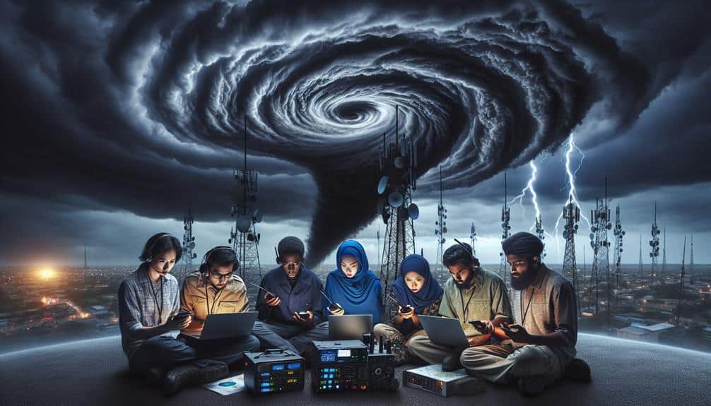
Effective communication with fellow storm chasers is critical for coordinating efforts and sharing real-time data during hurricane tracking missions. We need to make sure our channels are open and reliable, leveraging technology to maintain constant contact. This is essential not only for data accuracy but also for adhering to safety protocols and executing emergency plans.
To maintain effective communication, we should:
- Utilize radio frequencies: Make sure all team members are tuned to the same frequency for seamless updates.
- Deploy satellite phones: These provide a reliable backup when cellular networks fail.
Safety protocols must be rigorously followed. This includes regular check-ins and status updates to monitor everyone's position and condition. Emergency plans should be pre-established and understood by all team members, detailing specific actions to take in various scenarios, such as getting cut off by floodwaters or encountering unexpected storm surges.
Frequently Asked Questions
What Equipment Should I Pack for a Storm Chasing Trip?
We should pack essential gear like high-quality cameras, GPS devices, and weather radios. Don't forget emergency supplies: first aid kits, non-perishable food, water, and portable chargers. This guarantees our safety and data accuracy during the trip.
How Do I Stay Safe While Chasing Hurricanes?
Imagining the swirling chaos, we prioritize safety precautions: monitoring weather updates, avoiding flood zones, and keeping emergency shelters mapped. By analyzing storm patterns and data, we secure our freedom to chase while staying safe and informed.
What Are the Best Vehicles for Storm Chasing?
When selecting storm chasing vehicles, we prioritize SUVs or trucks with reinforced exteriors, ample space for emergency shelters, and robust communication devices. These vehicles guarantee mobility, safety, and real-time data exchange, essential for effective storm tracking.
How Can I Get Funding or Sponsorship for My Storm Chasing Activities?
Did you know that 80% of storm chasers rely on external funding? We can explore funding opportunities through grants and sponsorship strategies, like collaborating with weather agencies and tech companies, to gain financial freedom for our storm chasing endeavors.
What Online Communities Are Best for Networking With Other Storm Chasers?
For effective networking and making connections with fellow storm chasers, we recommend using social media platforms and specialized forums. Data shows that these channels provide rich, real-time interactions, essential for our storm chasing community's collaboration and knowledge-sharing.

