You’ll need to master core safety protocols before your first chase: maintain continuous situational awareness through real-time weather analysis, position vehicles away from north/east storm quadrants where lightning strikes concentrate, and never compromise road visibility for radar monitoring. Deploy a dedicated spotter-driver configuration, identify RFD gust fronts while tracking mesocyclone development, and maintain respectful distances from fellow chasers and emergency responders. These foundational principles represent just the surface layer of exhaustive chase protocols that’ll separate professional intercepts from dangerous amateur mistakes.
Key Takeaways
- Maintain safe distances from other chasers to avoid obstructing views and coordinate through private channels before public criticism.
- Complete National Weather Service storm spotter training to enhance safety knowledge and operational effectiveness in the field.
- Never interfere with emergency responders or violate private property boundaries during tornado intercepts or damage documentation.
- Prioritize continuous situational awareness through dedicated spotter-driver teams and avoid radar fixation that compromises road visibility.
- Demonstrate ethical conduct when leading tour groups, as experienced chasers shape standards and influence future chasing community behavior.
Fundamental Safety Rules for Storm Chasers
Storm chasing demands rigorous adherence to safety protocols that directly correlate with survivability during severe convective events. You’ll maintain continuous situational awareness through on-site weather analysis, identifying RFD gust fronts and inflow tails while monitoring mesocyclone development.
Vehicle inspection procedures prevent critical failures during intercepts—your mobility equals survival. Never penetrate precipitation cores; large hail and rain-wrapped tornadoes eliminate visual confirmation of threat assessment.
You’re responsible for independent route planning that preserves multiple escape vectors perpendicular to tornado tracks. Avoid traffic congestion from blindly following other chasers. Equip your vehicle with emergency provisions, protective gear including helmets and goggles, plus redundant communication systems.
Acknowledge that freedom requires personal accountability—your decisions determine whether you document severe weather or become a casualty statistic requiring rescue resources.
Understanding Lightning Risks and Protection Strategies
While tornadoes command the spotlight in chase documentation, lightning constitutes the statistically superior threat to your survival during severe weather operations. With 40 million annual ground strikes and 27 yearly fatalities, you’re facing odds of 1 in 15,300 over your lifetime. Direct strikes carry 10% mortality rates, while ground current and side flash mechanisms account for most injuries—75% of survivors sustain permanent sequelae.
Planning shelter options requires hardtop vehicle positioning away from north/east storm quadrants where lightning persists post-passage. Mitigating direct strike risks demands monitoring flash intervals; upward lightning precursors exhibit 3-10 minute spacing with horizontal sky-spanning luminosity. You’ll face peak exposure during afternoon-evening intercepts in Plains supercells. Maintain situational awareness during outdoor photography by exploiting gaps between discharges, prioritizing multidisciplinary medical evaluation for occult injuries including pulmonary edema.
Maintaining Clear Visibility During the Chase
Because situational awareness deteriorates exponentially when visual contact fails, maintaining unobstructed sightlines represents your primary operational imperative during active pursuit operations. Activate headlights during precipitation events while utilizing parking lights when stationary.
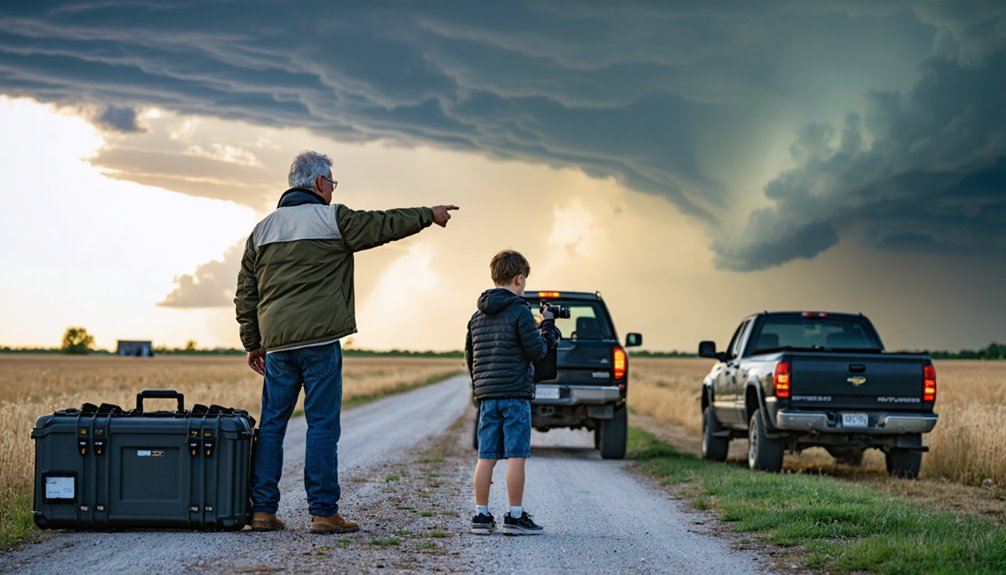
Core-punching eliminates visibility through heavy rain corridors where tornado encounters occur without warning. Deploy a dedicated spotter-driver configuration: your partner maintains road focus while you handle radar analysis and documentation.
Improving night visibility conditions requires sufficient lightning frequency or lunar illumination, particularly when optimizing camera setup for low light documentation. Position yourself in high-relief terrain avoiding wooded obstructions.
Identify critical storm features—RFD gust fronts display horseshoe configurations with inflow tails indicating tornadic regions. Never compromise road visibility for radar fixation. Remember: you can’t avoid hazards you can’t see.
Strategic positioning means nothing if the approach route destroys your vehicle or traps you in a flood zone. Before deployment, analyze road networks and terrain features to identify potential navigational constraints. This reconnaissance prevents compromising situations that limit your operational flexibility.
Critical safety protocols include:
- Water crossing precautions: Turn Around Don’t Drown—two feet of moving water displaces most vehicles, while six inches of fast-moving current destabilizes adults
- Low visibility challenges: Avoid core punching through precipitation shafts; windshield-shattering hail and tornado encounters result from desperate positioning
- Escape route optimization: Position at four-way intersections providing multiple egress options when storm motion shifts
- Hydroplaning indicators: Tire-path water accumulation and splashing sounds signal immediate risk
Maintain vehicle readiness with functional tires and running engines when proximate to storm tracks.
Ethical Standards and Respectful Behavior in the Field
Beyond vehicular safety protocols, storm chasing demands adherence to ethical frameworks that preserve community relationships and operational integrity. You’ll maintain operational distance from fellow chasers to prevent view obstruction and road blockage. Address concerns through private communication channels before public criticism.
Your community engagement should exemplify proper conduct, particularly when leading tour groups who’ll shape future chasing standards. Don’t interfere with first responders—stay clear of operational zones and avoid driving through disaster areas unless you’re providing trained assistance. Respect private property boundaries and local traffic regulations during pursuits.
Counter sensationalist media representation by advocating objective documentation practices. Complete National Weather Service storm spotting courses to enhance your operational knowledge. Foster ethical standards through shared resources and community reflection, balancing pursuit objectives with public safety imperatives and property rights.
Risk Assessment and Decision-Making Protocols
Risk assessment protocols in storm chasing operate through systematic evaluation of meteorological data, environmental conditions, and operational constraints that collectively determine pursuit viability and abandonment thresholds.
You’ll maintain storm intensity monitoring through continuous Doppler radar analysis and multi-source weather integration, enabling rapid position adjustments when supercell behavior shifts unexpectedly. Equipment maintenance protocols guarantee vehicle reliability during critical intercept windows, preventing mechanical failure coinciding with storm approach.
Your decision framework requires:
- Pre-determined escape routes that prioritize movement away from rotating mesocyclones and precipitation cores
- Core avoidance strategies eliminating exposure to large hail and visibility-limiting rain shafts
- Road condition assessment accounting for hydroplaning risk, flooding potential, and debris fields
- Real-time threat recalibration triggering immediate chase abandonment when meteorological conditions exceed safety parameters
Technology and Backup Planning for Emergency Situations
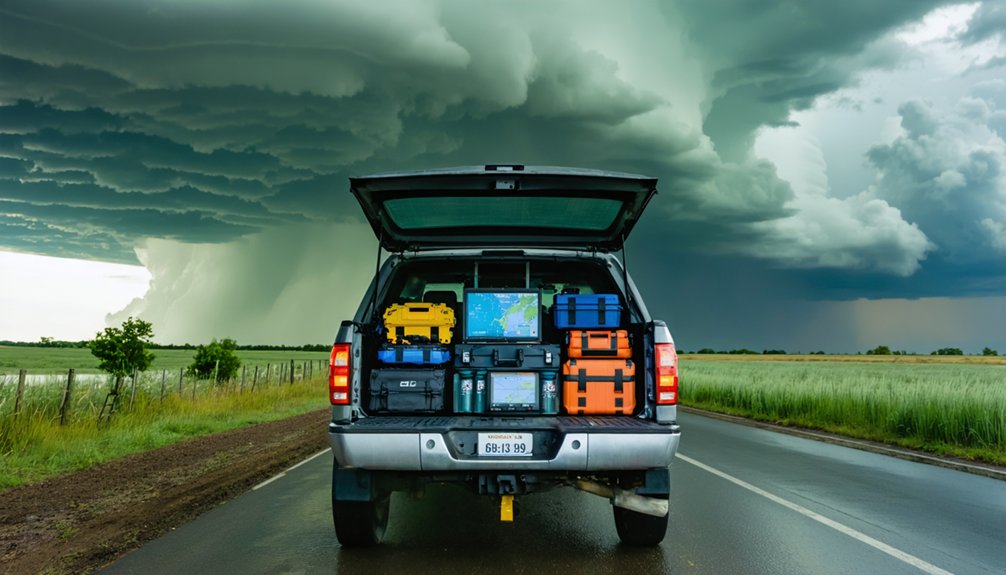
Multiple redundant communication systems form the technological backbone of emergency preparedness during severe weather intercepts, with satellite connectivity serving as the critical failsafe when terrestrial networks collapse under storm-induced infrastructure damage. You’ll need satellite redundancy through systems like DataStorm or Garmin inReach Mini 2, supplementing primary 4G LTE connections.
Satellite systems provide essential backup communications when terrestrial networks fail during severe weather events and infrastructure collapse scenarios.
Mount dual AcuRite weather sensors on your vehicle—if debris strikes one during pursuit, you’ll maintain atmospheric data collection capabilities. Implement data backup strategies using PC Connect features to preserve meteorological readings for post-event analysis.
Your dashboard should house Midland MXT575 MicroMobile and Yaesu FT-991A radios for independent communication channels. Download offline maps through Garmin Overlander and Google Maps before deployment. Maintain paper atlases as final navigation backup.
Deploy Iridium Extreme PTT satellite phones when cellular infrastructure fails completely during disaster scenarios.
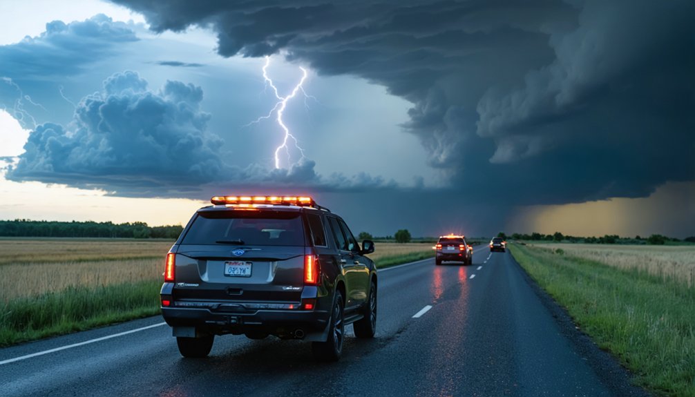
Traffic Hazards: The Leading Threat to Chasers
You’ll face substantially higher mortality risk from vehicular incidents than from tornadoes themselves—car accidents have claimed 14 documented storm chaser lives compared to just 5 tornado-related fatalities. Adherence to posted speed limits and traffic control devices remains critical, as the 2017 Spur, Texas collision that killed three chasers resulted from operators traveling approximately 70 mph through a stop sign.
Heavy precipitation, reduced visibility from blowing dust, and rapidly deteriorating road conditions compound standard driving hazards, requiring strict compliance with traffic regulations and weather-appropriate operating speeds.
Obey All Traffic Laws
While tornadoes dominate public perception of storm chasing dangers, vehicular accidents constitute the statistically significant threat to chaser mortality. Since 2005, car crashes have claimed 14 lives compared to 5 tornado-related fatalities, establishing road travel as your primary risk vector.
The March 28, 2017 Spur, Texas incident exemplifies this reality—three chasers died when their vehicle exceeded 70 mph through a stop sign.
You’ll mitigate these risks through avoiding reckless behaviors and monitoring traffic conditions:
- Maintain posted speed limits regardless of meteorological urgency
- Execute complete stops at intersections, even on rural roads
- Monitor GPS positioning to prevent convergence-related congestion
- Yield emergency vehicle access without exception
Your statistical fatality rate stands at approximately 1 in 944,444 person-days. Common-sense regulation adherence protects both your autonomy and community perception.
Hazardous Weather Driving Conditions
Why does severe weather exponentially compound vehicular risk beyond baseline traffic hazards? Heavy rain, gusty winds, hail, and blowing dust systematically degrade visibility while eliminating traction parameters you’ve calibrated for dry conditions. You’re maneuvering intersections at elevated speeds where road friction adjustments become critical—yet environmental factors prevent accurate assessment of stopping distances.
Weather optimized driving techniques demand constant recalibration: reducing velocity before hydroplaning thresholds, anticipating crosswind vectors, and recognizing when optical conditions prohibit safe maneuvering. Car accidents have killed 14 chasers since detailed tracking began, nearly triple tornado fatalities at 5. The 2017 Spur, Texas collision—where drivers exceeded 70 mph past stop signs—demonstrates how convergence dynamics and adverse conditions create lethal scenarios. Your freedom to chase depends on mastering vehicular physics under meteorological duress.
Maintaining Clear Visibility Standards
Traffic collisions account for 14 of 19 documented storm chaser fatalities, establishing vehicular incidents as the activity’s predominant mortality vector—nearly tripling tornado deaths at 5 and exceeding all weather-element fatalities combined (lightning, flash floods, and hail have produced zero chaser deaths through 2023).
Monitoring visibility conditions becomes critical when environmental factors compound:
- Heavy precipitation reduces driver sightlines to near-zero distances
- Blowing dust creates sudden opacity shifts on otherwise clear days
- Gusty winds generate debris fields that impair visual acquisition
- Hail accumulation transforms road surfaces into low-traction zones
The March 2017 Spur, Texas incident demonstrates fatal consequences: three chasers exceeded stop signs at 70 mph, terminating in collision. Your operational protocol must prioritize avoiding dangerous maneuvers over data collection—vehicular risks persist independent of storm proximity.
Community Responsibility and Victim Assistance
As storm chasers operate in environments where severe weather threatens lives and property, you assume heightened responsibilities beyond personal safety protocols. Reporting storm impacts requires immediate electronic communication with authorities, transmitting real-time observations without terminating active pursuits. Your meteorological expertise enables accurate damage assessments that contribute to disaster prevention databases.
When intercepting storms that strike without warning systems, you’re positioned to alert vulnerable residents before impact.
Assisting disaster victims often places trained chasers as first responders at incident sites. You’ll provide emergency medical interventions and triage procedures before professional services arrive. Community expectations demand this proactive engagement when you possess relevant skills.
Your actions establish standards for the entire chasing community, making ethical conduct essential. Avoid reckless behaviors that compromise public safety or damage collective reputation through trespassing and negligence.
Group Chase Dynamics and Following Instructions
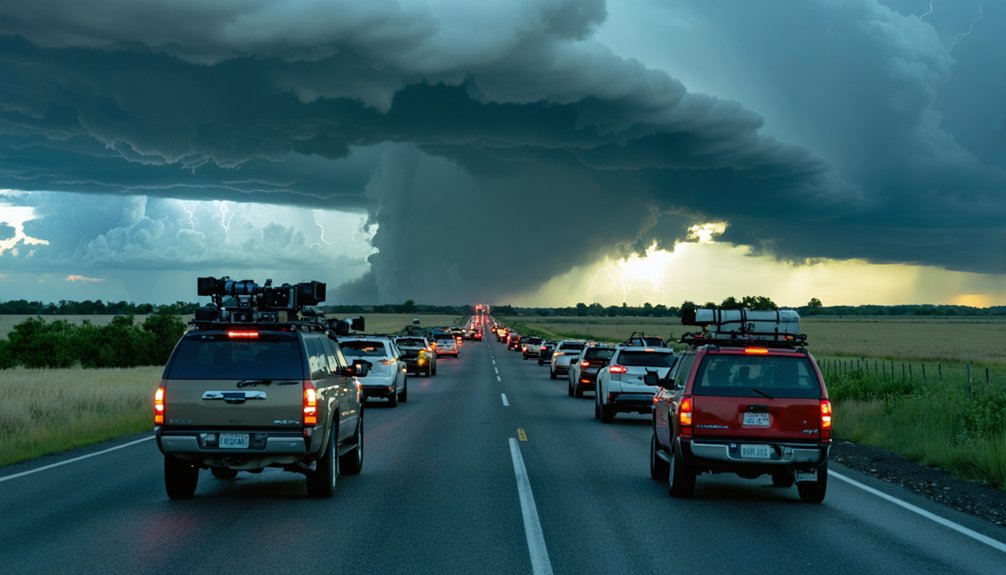
Beyond individual responsibility for disaster response, storm chasers must navigate the complex operational challenges created by increased participant density in target zones. Communication dynamics and team coordination determine operational effectiveness when multiple vehicles converge on limited road networks.
Operational effectiveness hinges on coordinated communication when multiple chase teams converge on limited road networks in high-density target zones.
Strategic Group Operations Protocol:
- Arrive minimum 60 minutes pre-initiation to assess boundary evolution and secure positioning ahead of convergence zones
- Maintain southeast positioning relative to tornado tracks; approach exclusively from west, south, or east vectors to preserve maneuverability
- Execute real-time data reanalysis when boundaries shift; prioritize high-resolution radar feeds over consumer applications for tactical decisions
- Coordinate escape route redundancy with partners; never compromise mobility by following vehicles into constrained road networks or direct storm paths
Ride-alongs with experienced operators provide essential observational learning before independent deployment. Your freedom depends on disciplined positioning and adaptive route selection.
Frequently Asked Questions
What Insurance Coverage Should Storm Chasers Have for Vehicle Damage?
You’ll need all-encompassing vehicle insurance, not just auto liability coverage, since liability only protects others’ property. All-inclusive covers hail, wind, and tornado damage—critical meteorological hazards you’ll encounter. It’s your financial safeguard for pursuing severe weather independently.
How Do I Obtain Proper Storm Chasing Credentials or Identification?
You’ll research proper training programs like SKYWARN certification through the National Weather Service, though no federal credentials exist. Currently, you can’t acquire government-issued chasing permits nationwide, except where state-specific legislation like Oklahoma’s SB 158 applies.
What Legal Permits Are Required for Chasing on Private Property?
No permits exist—ironically, bureaucracy-free chasing still demands you secure explicit landowner permission requirements before property entry. You’ll face legal liability considerations including trespassing charges, civil suits, and potential arrest without documented consent from owners.
Which Weather Apps or Radar Systems Work Best for Chasers?
You’ll maximize storm intercept success using RadarScope’s real-time weather monitoring with dual-polarization data, or RadarOmega’s advanced data integration featuring volumetric viewers and spotter networks. Both deliver unprocessed NWS feeds, ensuring you’re operating with forecaster-grade meteorological intelligence.
How Should Chasers Document Storms for Scientific Research Purposes?
Like a scientist’s field journal, you’ll document storms using proper photographic techniques with timestamped metadata and accurate note-taking methods recording temperature, pressure, wind speed, storm motion vectors, and precise GPS coordinates for valuable meteorological data analysis.