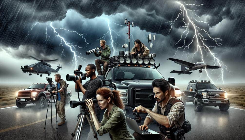
We explore top storm chasing expeditions encompassing Tornado Alley in the USA, Cyclone Season in Australia, Monsoon Rains in India, Typhoon Tracking in Japan, European Storm Fronts, and South African Thunderstorms. In the USA's Tornado Alley, we intercept supercells using Doppler radar. Australia's cyclone season demands high-resolution cameras and anemometers. India's monsoon rains require accurate weather monitoring systems. For typhoons in Japan, we leverage satellite imagery, Doppler radar, and ocean buoys. European storms are analyzed with high-speed cameras and atmospheric models. Finally, South African thunderstorms provide fascinating lightning photography and real-time data collection. Follow along for an in-depth glimpse into each expedition.
Key Points
- Tornado Alley in the USA attracts storm chasers with its high tornado frequency and advanced prediction tools.
- Australia's Cyclone Season requires robust equipment and safety measures for tracking tropical cyclones from November to April.
- India's Monsoon Rains demand precise timing and advanced weather monitoring to capture the intense seasonal precipitation.
- Japan's Typhoon Tracking utilizes advanced meteorological systems and evacuation procedures to monitor and mitigate typhoon impacts.
Tornado Alley, USA
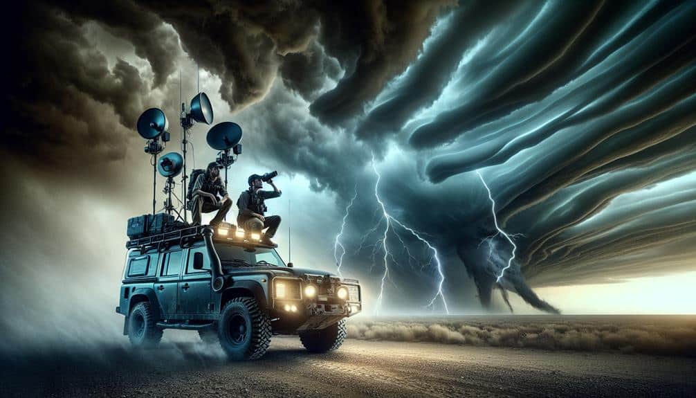
Tornado Alley, USA, is renowned for its high frequency of tornado occurrences, with an average of 1,000 tornadoes annually. This region, encompassing parts of Texas, Oklahoma, Kansas, Nebraska, and South Dakota, offers prime conditions for extreme weather phenomena. When we set out on storm chasing expeditions here, we're not just in pursuit of an adrenaline rush; we're chasing scientific data and unparalleled photography opportunities.
Our journeys take us through a meteorological hotspot where warm, moist air from the Gulf of Mexico clashes with cool, dry air from Canada. This convergence creates supercells, the parent storms of tornadoes. By utilizing Doppler radar and satellite imagery, we can predict storm paths with remarkable accuracy, enhancing both safety and success.
The thrill of storm chasing in Tornado Alley is unmatched. As we capture high-resolution images of rotating updrafts and funnel clouds, we're documenting the raw power of nature. Each photograph serves as a proof to the dynamic weather systems at play. Additionally, these expeditions contribute valuable data to the scientific community, aiding in the understanding and forecasting of severe weather events.
In Tornado Alley, the quest for freedom and discovery drives us to explore and document some of nature's most formidable forces.
Cyclone Season, Australia
Cyclone Season in Australia presents a unique set of challenges and opportunities for storm chasers, driven by the tropical cyclones that form over the warm waters of the Coral Sea and the Indian Ocean. These cyclones, with their intense wind speeds and heavy rainfall, offer a dynamic environment for capturing extreme weather phenomena.
Given the specific climate conditions of Australia during cyclone season, we need to be meticulously prepared. Our equipment must be robust and reliable, including high-resolution cameras, barometers, and anemometers to measure wind speeds. GPS systems are critical to navigate the often remote and rugged landscapes of northern Queensland and the Northern Territory.
Key considerations for storm chasing in Australia during cyclone season include:
- Timing: Cyclone season typically spans from November to April, requiring strategic planning.
- Location: Hotspots include the Coral Sea and Indian Ocean coastal regions, where cyclones frequently make landfall.
- Safety Measures: Ensuring we've emergency communication devices and first aid kits.
Monsoon Rains, India
As we turn our focus to monsoon rains in India, precise timing and meticulous preparation are paramount for successful expeditions.
We'll analyze historical precipitation data, onset patterns, and regional variability to optimize our plans.
Ensuring safety involves adhering to stringent protocols, including monitoring real-time weather updates and maintaining robust communication systems.
Timing and Preparation
Timing our storm chasing expeditions to coincide with India's monsoon rains requires careful planning and a deep understanding of meteorological patterns. We must synchronize our schedules with the onset of the monsoon, typically between June and September, when the southwestern winds bring heavy rains across the subcontinent.
We start by creating a detailed equipment checklist and an emergency plan. Our equipment checklist includes weather monitoring tools, high-resolution cameras, GPS devices, and protective gear. These tools are essential for capturing data and ensuring our safety during unpredictable weather conditions. Additionally, our emergency plan outlines specific evacuation routes and procedures in case we encounter life-threatening situations.
To enhance our predictive capabilities, we use advanced weather monitoring systems. These systems help us track storm patterns and identify potential hotspots. By analyzing satellite data, Doppler radar outputs, and climate models, we can accurately pinpoint when and where the most intense storms will occur.
- Weather monitoring tools
Accurate timing and thorough preparation are essential for a successful and safe storm chasing expedition during India's monsoon season. With meticulous planning, we maximize our chances of capturing the essence of these powerful natural phenomena while safeguarding our freedom and well-being.
Safety Measures Required
Ensuring our safety during India's monsoon rains necessitates the implementation of thorough safety measures and adherence to best practices in storm tracking and response.
First, we need to establish emergency shelters and robust evacuation plans. These shelters should be strategically located in flood-prone areas and equipped with essential supplies. Evacuation plans must be clear and rehearsed, ensuring swift and orderly relocation.
Weather monitoring is pivotal. We should utilize advanced meteorological tools like Doppler radar and satellite imagery to track storm systems accurately. These tools provide real-time data on rainfall intensity, wind speed, and storm progression. By continually updating our data, we can predict hazardous conditions and respond proactively.
Effective communication protocols are equally important. We need a reliable system to disseminate weather alerts and evacuation notices rapidly. Mobile apps, emergency broadcasts, and social media platforms can serve as efficient channels for real-time information exchange.
Typhoon Tracking, Japan
Japan's advanced meteorological systems enable precise tracking of typhoons, providing vital data for real-time analysis and forecasting. These systems are essential for identifying storm surge and flooding risks, allowing us to anticipate and respond to the most severe impacts.
By monitoring atmospheric pressure, wind patterns, and sea surface temperatures, we can predict the path and intensity of impending typhoons with remarkable accuracy.
To guarantee public safety, Japan has developed detailed evacuation procedures and established numerous emergency shelters across vulnerable regions. The seamless integration of satellite imagery, Doppler radar, and ocean buoys enhances our ability to track typhoons and mitigate potential disasters.
- Satellite Imagery: High-resolution images allow us to monitor cloud formations and storm development in real-time.
- Doppler Radar: Provides vital data on rainfall intensity and wind speed, essential for predicting storm behavior.
- Ocean Buoys: Measure sea surface temperatures and wave heights, helping to forecast storm surge and flooding.
European Storm Fronts
Let's examine European storm fronts by focusing on Mediterranean thunderstorm phenomena, Alpine storm patterns, and Atlantic coastal systems.
We'll analyze meteorological data to understand the frequency, intensity, and seasonal variations of these storms.
Our goal is to identify key factors influencing storm development and behavior across diverse geographical regions.
Mediterranean Thunderstorm Phenomena
Mediterranean thunderstorms, frequently characterized by intense electrical activity and heavy rainfall, form primarily due to the complex interplay between warm, moist air masses from the sea and cooler air masses moving south from Europe. As storm chasers, we find the Mediterranean region offers unique opportunities for lightning photography. Using specialized techniques and equipment is pivotal here.
High-speed cameras and wide-angle lenses allow us to capture the intricate details of lightning strikes, turning each photo into a scientific marvel.
Predicting storm intensity in this region requires an array of advanced meteorological tools. Doppler radar and satellite imagery help us track storm development in real-time, while atmospheric models provide forecasts on storm trajectory and potential severity. This data-driven approach guarantees we're in the right place at the right time, maximizing both safety and the quality of our observations.
- High-speed cameras: Capture each lightning strike in stunning detail.
- Doppler radar: Essential for tracking storm cells and their movements.
- Satellite imagery: Provides a macro view of storm systems and their development.
Alpine Storm Patterns
While the Mediterranean's thunderstorms are an impressive sight, the Alpine region presents its own set of challenges and opportunities with its dynamic storm fronts shaped by the towering mountain ranges. The high altitudes and steep gradients create a unique environment for extreme weather phenomena. Alpine snowstorms, often enhanced by orographic lift, can rapidly intensify as moist air masses are compelled to ascend the rugged terrain.
In our expeditions, we've observed how glacier storms develop, particularly around the Mont Blanc massif. These storms can bring heavy snowfall and powerful winds, creating hazardous conditions. Data from recent studies show that wind speeds can exceed 150 km/h during peak events, while snow accumulation rates can reach up to 30 cm per hour.
The complexity of alpine meteorology demands precise forecasting tools. High-resolution models and satellite data are essential for predicting the onset of these storms. We rely on ground-based radar and automated weather stations placed at various altitudes to monitor real-time changes.
For those of us chasing freedom through storm chasing, the Alpine region offers a thrilling yet demanding landscape. The interplay of mountain topography and atmospheric dynamics guarantees every expedition is both challenging and fulfilling.
Atlantic Coastal Systems
Traversing the Atlantic coastal systems demands our keen attention to the intricate interplay of oceanic and atmospheric dynamics that define European storm fronts. We must understand the coastal storm anatomy and the weather patterns that drive these powerful systems. It's imperative to analyze data from satellite observations, ocean buoys, and meteorological models to forecast the development and trajectory of these storms.
European storm fronts bring unique challenges and opportunities for storm chasers. The interaction between warm ocean currents and cold continental air masses often results in intense cyclogenesis. This causes significant storm surge risks to coastal communities, posing both a threat and a spectacle for those of us who seek the thrill of nature's raw power.
- Cyclogenesis Study: Studying the formation of cyclones where warm and cold air masses meet.
- Satellite Data Utilization: Leveraging satellite imagery to track storm development and movement.
- Meteorological Modeling: Using advanced models to predict storm intensity and paths.
South African Thunderstorms
Witnessing the electrifying power of South African thunderstorms offers a unique opportunity to study severe weather systems in one of the world's most dynamic meteorological environments. Situated at the convergence of subtropical and temperate climates, South Africa presents a diverse array of storm phenomena, making it a prime destination for thunderstorm chasing.
The Highveld region, in particular, is renowned for its intense electrical storms due to its elevated plateau and atmospheric conditions. We often engage in lightning photography during these expeditions. Capturing the intricate patterns of lightning strikes isn't just an artistic endeavor; it's an essential component of our scientific analysis.
High-resolution images allow us to examine the structure and frequency of lightning, providing data vital for understanding storm dynamics and improving predictive models. Our thunderstorm chasing activities also involve deploying mobile weather stations to measure variables like wind speed, temperature, humidity, and barometric pressure in real time.
This data helps us to map the storm's progression and intensity. By studying the microphysics of these storms, we aim to contribute to the broader meteorological community's knowledge, ultimately enhancing public safety and preparedness. South Africa's thunderstorms offer both a thrilling adventure and a significant research opportunity.
Frequently Asked Questions
What Safety Measures Should Storm Chasers Take During Expeditions?
We should prioritize weather monitoring, preparedness, and establish robust emergency protocols. Effective communication is essential. By utilizing real-time data and scientific terminology, we can guarantee our safety while enjoying the freedom of storm chasing.
Are There Professional Guides Available for Storm Chasing Tours?
Imagine finding your way through a labyrinth without a guide. Yes, there are professional guides for storm chasing tours. They provide expert guidance and guarantee safety precautions during storm watching, even in extreme weather, balancing freedom with safety.
How Can I Capture High-Quality Photographs of Storms?
To capture high-quality photographs of storms, we should focus on camera settings, composition, lighting, and angles. Use a low ISO, a fast shutter speed, and wide aperture. Compose shots to highlight dramatic lighting and unique angles.
What Equipment Is Essential for a Storm Chasing Expedition?
When heading into the eye of the storm, preparation is key. Gear essentials include a reliable vehicle, storm tracking tools, and robust communication devices. Our freedom thrives on being data-driven and scientifically accurate in such adventures.
What Time of Year Is Best for Storm Chasing in Different Regions?
We should chase storms in the Great Plains during spring for the best weather patterns. Australia's summer offers prime conditions. Always take precautions, as these regions and seasons are prone to severe storms requiring careful planning and equipment.