We rely on technologies like Doppler radar systems, which help measure precipitation velocity, and satellite imagery analysis that provides a global view of storm developments using machine learning. Supercomputer simulations model atmospheric dynamics and offer precise predictions. Mobile weather apps give real-time updates, while UAVs provide detailed aerial data. These tools collectively enhance our ability to predict storm formations and offer actionable insights for storm chasers. By exploring these technologies further, we can understand their specific roles in storm prediction and tracking.
Key Points
- Doppler radar systems measure precipitation particle velocity to predict storm formations accurately.
- Satellite imagery analysis provides a global perspective and real-time monitoring of storm developments.
- Supercomputer simulations model atmospheric dynamics, integrating vast data for precise storm predictions.
- Mobile weather apps deliver real-time updates and alerts, using advanced algorithms and predictive models.
Doppler Radar Systems
Doppler radar systems play a vital role in our ability to predict storm formations with high accuracy. These systems work by emitting pulses of microwave energy and measuring the changes in frequency of the returned signals. This allows us to track the motion of precipitation particles within a storm, giving us a detailed view of its structure and movement.
By analyzing the Doppler shift, we can determine the velocity of these particles towards or away from the radar. This information is essential for storm tracking and helps meteorologists identify potentially severe weather conditions such as tornadoes, hail, and heavy rainfall. The ability to track these elements in real-time enhances our weather prediction capabilities, enabling us to provide timely warnings and advisories.
Doppler radar data is instrumental in constructing detailed weather models. These models simulate atmospheric conditions and predict future weather patterns with high precision. By integrating Doppler radar inputs, we can refine our storm tracking algorithms, making our forecasts more reliable. This technology empowers us to prepare for adverse weather, ensuring our safety and freedom to plan our activities without fear of unexpected meteorological events.
Satellite Imagery Analysis
Satellite image analysis provides an essential tool for meteorologists to observe and predict storm formations from a global viewpoint. By capturing detailed images of the Earth's atmosphere, these satellites enable us to identify weather patterns that could lead to severe storms. The data collected is extensive and diverse, requiring advanced techniques for accurate weather prediction and storm tracking.
We utilize machine learning algorithms to sift through terabytes of satellite data, identifying patterns that human eyes might overlook. These algorithms enhance our ability to forecast storms by quickly analyzing atmospheric variables such as temperature, humidity, and wind speed. With machine learning, we can enhance the accuracy and timing of our predictions, giving storm chasers more lead time to react.
Furthermore, data analysis from satellite imagery allows us to monitor storm developments in real-time. As storms evolve, satellite images provide continuous updates, enabling us to track their path and intensity. This real-time monitoring is vital for issuing timely warnings and for storm chasers planning their routes.
Satellite image analysis, coupled with advanced data analysis techniques, provides a strong framework for anticipating and understanding storm formations, ensuring we stay ahead of nature's most unpredictable events.
Supercomputer Simulations
Leveraging the insights gained from satellite imagery, we employ supercomputer simulations to model complex atmospheric dynamics and predict storm formations with unparalleled accuracy. These simulations integrate vast amounts of data from various sources, including temperature, humidity, and wind patterns, to create a thorough climate modeling framework. By simulating the interactions between these variables, we can anticipate how storms will develop and evolve over time.
Our advanced weather forecasting tools rely on the immense computational power of supercomputers to process and analyze this data in real time. This allows us to generate highly detailed data visualizations that reveal the intricate structures and behaviors of potential storm systems. These visualizations are essential for storm tracking, enabling us to pinpoint the exact location and movement of a storm with exceptional precision.
Furthermore, the predictive capability of supercomputer simulations empowers us to provide early warnings and actionable insights to storm chasers and emergency services. This proactive approach not only enhances our understanding of storm dynamics but also guarantees that we can respond swiftly and effectively to impending weather threats.
Mobile Weather Apps
In an era of ubiquitous smartphones, mobile weather apps have revolutionized how we access and interpret meteorological data. These apps offer real-time updates, guaranteeing we stay ahead of rapidly changing weather conditions. For storm chasers, the ability to receive data instantly can mean the difference between a successful mission and a missed opportunity.
We can leverage these apps to receive severe alerts, which are essential for anticipating storm formations and taking necessary precautions. The precision of mobile weather apps is driven by advanced algorithms that process vast amounts of meteorological data from multiple sources, including satellites and ground-based sensors. This data is then synthesized into user-friendly interfaces that allow us to make informed decisions quickly.
Moreover, many of these apps feature radar imagery and predictive models that show storm trajectories and intensities. By examining these features, we can identify potential high-risk areas and plan our routes accordingly. The integration of GPS functionality ensures that the data we receive is relevant to our specific locations, enhancing our situational awareness.
UAV Technology
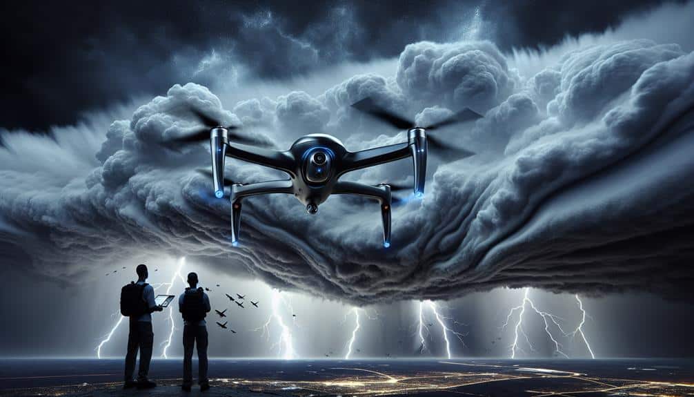
Unmanned Aerial Vehicles (UAVs) have emerged as pivotal tools in advancing our ability to monitor and predict storm formations with unparalleled accuracy. By leveraging UAV technology, we can conduct thorough aerial surveillance, capturing real-time data from altitudes and locations that are otherwise inaccessible. This capability allows us to gather critical meteorological information, such as wind speeds, temperature variations, and humidity levels, which are essential for accurate weather tracking.
UAVs are equipped with sophisticated sensors and cameras that facilitate the continuous monitoring of storm systems. These sensors relay high-resolution data back to our ground stations, enabling us to analyze storm patterns and predict potential developments. Unlike traditional manned aircraft, UAVs can operate in hazardous conditions without risking human lives, providing a safer and more efficient means of data collection.
Furthermore, the deployment of UAVs in storm tracking enhances our predictive models. The real-time data they collect feeds directly into advanced algorithms, refining our understanding of storm dynamics. This level of precision in weather tracking empowers us to make more informed decisions, ultimately improving our ability to forecast severe weather events and mitigate their impact on communities.
Through UAV technology, we gain a powerful tool that enhances our freedom to explore and understand the natural world.
Frequently Asked Questions
How Do Storm Chasers Communicate With Each Other During a Chase?
We use various communication methods like radios, smartphones, and GPS for real-time updates. Technology advancements enhance our coordination and safety protocols, ensuring we can share critical information swiftly while maintaining our freedom to chase storms.
What Kind of Vehicles Are Typically Used by Storm Chasers?
We use heavily modified vehicles that are practically tanks on wheels. Vehicle modifications include reinforced frames, safety equipment, and advanced technology integration. Cost considerations are essential, but investing in safety and precision tech guarantees we can chase storms effectively.
How Do Storm Chasers Ensure Their Safety While Tracking Severe Storms?
We prioritize safety measures and use advanced tracking devices to monitor storm paths. By maintaining constant communication and following real-time data, we mitigate risks, ensuring we're always a step ahead of severe weather conditions.
Are There Any Legal Regulations for Storm Chasing Activities?
We've got to follow legal restrictions and regulations while storm chasing. Safety protocols and precautions are essential to guarantee our protection. These rules balance our freedom to chase storms with the necessity of maintaining safety.
What Training or Education Is Required to Become a Professional Storm Chaser?
To become professional storm chasers, we need meteorology expertise, field experience, and extensive training in safety protocols and emergency response. This specialized knowledge guarantees we can predict storm formations accurately while prioritizing our safety and freedom in the field.


