We prioritize top-tier gear like anemometers, barometers, and GPS units, and we maintain them meticulously. Understanding weather patterns through Doppler radar, satellite imagery, and forecasting models informs our decisions. Safety isn't negotiable; we enforce strict protocols and use robust communication tools like satellite phones. Coordinating seamlessly with networks ensures operational efficiency. We leverage advanced technology, including drones and radar systems. Documenting observations accurately with standardized forms and geotagging locations is critical. Regular reviews of historical data and tactical improvements via training simulations keep our skills sharp. By delving deeper, you'll get insights into each key aspect further.
Key Points
- Maintain and regularly check equipment like anemometers, barometers, and GPS units for optimal performance.
- Wear weather-resistant clothing and sturdy footwear to ensure personal safety during missions.
- Utilize drones and radar systems for real-time storm data and aerial reconnaissance.
- Use satellite phones and high-frequency radios for reliable communication and coordination.
Choose the Right Equipment
Choosing the right equipment is vital for enhancing our data accuracy and guaranteeing the safety of our storm spotting missions. First, we must prioritize equipment maintenance. Regular checks and calibrations of our anemometers, barometers, and GPS units guarantee data precision.
Proper attire, including weather-resistant clothing and sturdy footwear, is non-negotiable for protecting ourselves against harsh weather conditions.
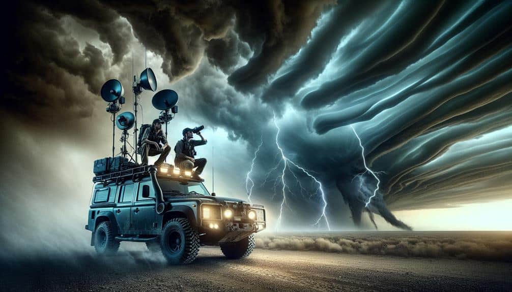
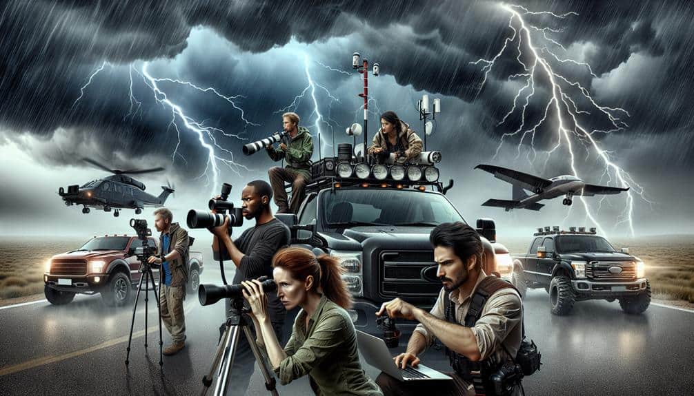
Next, vehicle selection is key. We need robust, all-terrain vehicles equipped with four-wheel drive to navigate through various landscapes. These vehicles should also have reinforced windows and additional fuel capacity.
Our vehicles must house advanced communication devices. Reliable two-way radios and satellite phones are indispensable for maintaining contact with our team and emergency services, especially when cellular networks fail.
Moreover, we should carry portable power sources, such as solar chargers and backup batteries, to keep all our equipment operational. Dashcams and weather cameras mounted on our vehicles can capture real-time data and visuals, which are essential for analysis.
Understand Weather Patterns
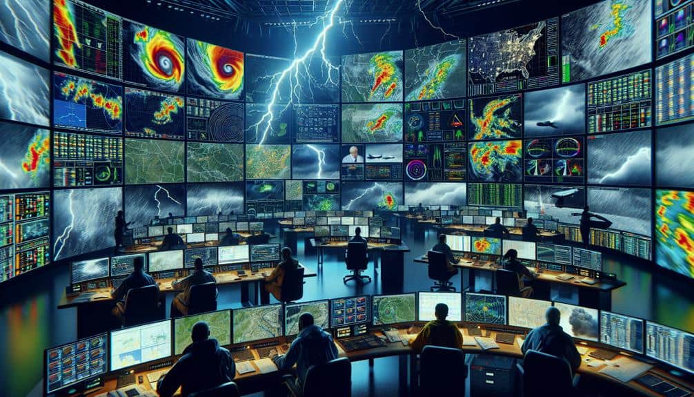
How can we accurately predict storm developments without a thorough understanding of weather patterns and atmospheric dynamics? We can't. Successful storm spotting missions hinge on our ability to interpret complex weather forecasting models and storm prediction algorithms. By analyzing atmospheric conditions, we can discern the likelihood of severe weather events.
Utilizing climate analysis, we identify patterns that precede storm formation, such as temperature gradients, humidity levels, and wind shear. Advanced data-driven tools, including Doppler radar and satellite imagery, provide real-time information on storm trajectories and intensities. By correlating this data with historical weather patterns, we enhance our predictive capabilities.
In our quest for freedom, we must master the art of interpreting synoptic charts and upper air soundings. These tools reveal the vertical and horizontal distribution of atmospheric pressures and temperatures. By understanding the dynamics between high and low-pressure systems, we can anticipate the development of supercells and other severe weather phenomena.
Let's remember that storm prediction isn't just about observing current conditions but also about understanding the broader climatic trends. By integrating weather forecasting with climate analysis, we empower ourselves to make informed decisions during our storm spotting missions.
Prioritize Safety Precautions
Before initiating any storm spotting mission, we must thoroughly evaluate and implement thorough safety protocols to mitigate potential hazards. Conducting a detailed risk assessment is essential. We should analyze meteorological data, historical storm tracks, and potential environmental hazards to identify high-risk zones. This data-driven approach allows us to anticipate adverse conditions and plan accordingly.
Safety protocols are non-negotiable. We need to guarantee that each team member is equipped with necessary gear, including weather radios, GPS devices, and first aid kits. It's vital that we develop an emergency plan, detailing evacuation routes and emergency contact numbers. This plan should be rehearsed regularly to ensure swift execution under pressure.
Effective communication strategies are crucial for operational success. We must establish reliable communication channels, using both radio frequencies and digital platforms, to maintain constant contact. This enables real-time updates and rapid response to changing conditions. Additionally, having a designated communication officer to manage information flow can prevent miscommunication and ensure clarity.
Coordinate With Networks
To improve our storm spotting effectiveness, we must leverage advanced communication tools and establish clear protocols.
Real-time data sharing and consistent updates are vital for accurate situational awareness.
Utilize Communication Tools
Effective storm spotting demands leveraging advanced communication tools, enabling us to seamlessly coordinate with meteorological networks and emergency response teams. Maintaining peak signal strength is paramount, as any lapse could compromise real-time updates. Consequently, we must establish robust backup plans to mitigate potential communication failures.
Team coordination hinges on real-time updates, provided by sophisticated tools such as GPS tracking systems, satellite phones, and high-frequency radios. Utilizing these technologies allows us to relay critical data swiftly and efficiently, guaranteeing that all team members and network partners remain on the same page during high-stakes operations.
To enhance our storm spotting missions, consider the following communication tools and strategies:
- Satellite Phones: Guarantee consistent signal strength, even in remote areas where cellular networks might fail, hence acting as a critical component of our backup plans.
- High-Frequency Radios: Facilitate real-time updates across large distances, essential for maintaining team coordination and relaying timely information to meteorological networks.
Establish Clear Protocols
Establishing clear protocols ensures we maintain cohesion and operational efficiency, particularly when coordinating with meteorological networks and emergency response teams. Protocol consistency is paramount in guaranteeing our data collection and reporting standards align seamlessly with those of national weather services and local emergency management agencies. Effective communication protocols allow us to relay critical information in real-time, minimizing response times and enhancing safety measures.
We need to establish predefined communication channels, such as encrypted radio frequencies and digital platforms, to maintain secure and reliable exchanges of information. Utilizing standardized reporting formats guarantees that our observations can be immediately actionable by meteorologists and emergency responders. This systematic approach not only optimizes our data's utility but also enhances our credibility as reliable sources.
In the field, adherence to these protocols isn't optional; it's essential. During high-stakes storm spotting missions, protocol consistency and effective communication reduce risks. By integrating our efforts with broader emergency response frameworks, we contribute to more efficient allocation of resources and swifter implementation of safety measures. Thus, meticulous protocol adherence isn't just about operational efficiency—it's about safeguarding lives and property, embodying the true spirit of freedom through preparedness and resilience.
Utilize Advanced Technology
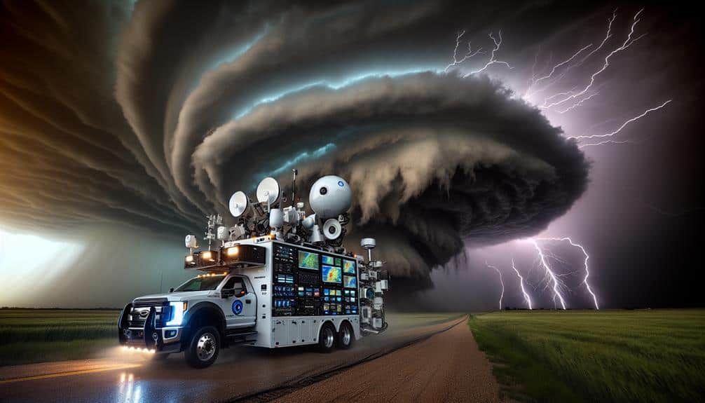
Leveraging state-of-the-art meteorological tools and software, we can significantly enhance the accuracy and timeliness of our storm spotting missions. By integrating drone surveillance and radar tracking, we gain real-time data that allows us to pinpoint storm locations with unmatched precision.
Deploying drones equipped with high-resolution cameras and sensors, we can capture essential storm dynamics that are often missed by ground observations alone.
Satellite imagery and weather mapping further bolster our capabilities. High-resolution satellite data provides a macro-level view of storm systems, enabling us to track their progression and potential impact zones. Advanced weather mapping software synthesizes this data, offering predictive analytics that help us anticipate storm behavior and plan our missions accordingly.
To optimize our technology use, we should:
- Drone Surveillance: Utilize drones for aerial reconnaissance to gather real-time data on storm formation and movement.
- Radar Tracking: Employ radar systems to monitor storm intensity and velocity, offering critical insights for on-the-ground decision-making.
Document Observations Accurately
Accurately documenting our observations during storm spotting missions is important for generating reliable data that can be used for predictive analytics and future preparedness. We must meticulously record data to maintain its integrity and usefulness. Every variable—wind speed, barometric pressure, temperature fluctuations—requires precise measurement and notation. Utilizing standardized forms and digital tools guarantees consistency across our observations, enhancing the dataset's overall dependability.
To track progress effectively, we should timestamp each entry, capturing the exact moment of observation. This temporal data is essential for correlating weather patterns and understanding storm evolution. Additionally, geotagging our locations provides spatial context, enabling more accurate storm path predictions. By integrating GPS coordinates with our observational data, we create a thorough spatial-temporal dataset that can be invaluable for both real-time decision-making and retrospective analyses.
Our commitment to precision extends to qualitative observations as well. Descriptive notes on cloud formations, lightning frequency, and precipitation types complement quantitative data, offering a fuller picture of storm dynamics. This dual approach—combining hard metrics with detailed narratives—equips us to contribute meaningfully to meteorological databases, ultimately aiding in the development of more accurate forecasting models.
Let's prioritize precision to empower our predictive capabilities and guarantee public safety.
Review and Improve Tactics

While our meticulous documentation lays a solid foundation, we must continuously review and refine our storm spotting tactics to enhance their effectiveness and make certain we remain at the forefront of meteorological advancements.
By leveraging data-driven insights and cutting-edge technology, we can improve accuracy and enhance efficiency across our operations.
To achieve these goals, we should focus on the following strategies:
- Analyze Historical Data: Regularly review past storm events and our recorded observations to identify patterns and areas for improvement. Look for discrepancies in data accuracy and develop corrective measures.
- Implement Advanced Tools: Integrate state-of-the-art meteorological instruments and software to provide real-time analytics and forecasting. This step not only improves accuracy but also streamlines data collection and analysis.
Frequently Asked Questions
How Do I Become a Certified Storm Spotter?
To become certified storm spotters, we must first complete storm spotter training through the National Weather Service. The certification process includes online modules, in-person classes, and practical assessments. This rigorous training guarantees accurate, timely data collection.
What Is the Best Time of Year for Storm Spotting?
Spring offers dynamic weather patterns; however, summer enhances storm spotting safety. By analyzing data, we find that spring's volatility contrasts with summer's stability, making both ideal yet different for our missions. Freedom lies in understanding these patterns.
How Do I Report My Storm Observations to Authorities?
To report our storm observations, we must follow established reporting procedures, ensuring accuracy and timeliness. We'll need to gather precise contact information for local authorities. Quick, systematic communication maximizes our data's impact and supports community safety efforts.
What Clothing Should I Wear During a Storm Spotting Mission?
We should wear appropriate attire: waterproof jackets, sturdy boots, and layered clothing. Safety gear is essential: helmets, gloves, and reflective vests. This guarantees mobility, protection, and visibility, enhancing our freedom to conduct effective storm spotting missions.
How Can I Stay Updated on Upcoming Storms in My Area?
To stay updated on upcoming storms in our area, we should use weather apps and follow social media channels. Additionally, emergency alerts and weather radios provide real-time information, ensuring we have the freedom to act promptly.