We'll master storm tracking by utilizing real-time updates and leveraging cutting-edge technology. Prioritize reliable storm trackers with high temporal and spatial resolution. Use mobile apps with minute-by-minute updates and detailed radar imagery. Leverage social media for hyper-local information, and monitor government alerts from agencies like NWS and FEMA. Join storm spotting networks for collaborative data, and subscribe to radar services for high-resolution imagery. Analyze satellite data for storm formation insights, and use professional weather software for integrated data analysis. Finally, follow expert meteorologists for refined forecast interpretations. By refining these techniques, we'll enhance our storm tracking efficacy.
Key Points
- Use mobile apps with real-time notifications and high-precision forecasts for minute-by-minute storm updates.
- Customize push notifications in storm tracking apps to receive immediate alerts tailored to specific weather conditions.
- Leverage advanced radar technologies and satellite imagery for accurate, high-resolution storm data.
- Engage with local storm spotting networks and weather stations for collaborative and real-time forecasting.
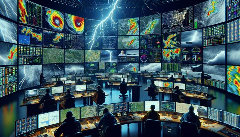
Choose Reliable Storm Trackers
When selecting dependable storm trackers, we must prioritize platforms that provide real-time information, high precision, and extensive coverage. As storm chasers, our goal is to stay ahead of severe weather conditions, necessitating the most accurate and current weather updates. Platforms utilizing advanced radar technologies and satellite imagery offer essential insights into storm development, trajectory, and potential impact zones.
Using systems with high temporal resolution guarantees we receive weather updates at frequent intervals, enabling quick decision-making. For example, systems offering updates every 5 minutes or less can greatly enhance our ability to track storm movements accurately.
Moreover, spatial resolution is crucial; high-definition data pinpoints storm locations down to specific coordinates, vital for planning safe routes and avoiding dangerous areas.
Cross-referencing multiple data sources, like NOAA's National Weather Service, commercial weather services, and academic institutions, can further enhance accuracy and reliability. These platforms often integrate various meteorological models and historical data, providing a thorough overview of current and predicted weather patterns.
Utilize Mobile Apps
Let's explore the most efficient weather tracking apps available, focusing on their real-time alert capabilities and user interface efficiency.
We'll evaluate apps based on accuracy metrics, alert customization options, and ease of navigation.
Best Weather Tracking Apps
In today's digital age, leveraging top-tier weather tracking apps can provide real-time storm updates with unmatched accuracy and convenience. These apps utilize advanced algorithms and satellite data to enhance weather prediction accuracy, which is vital during extreme weather events. Our top recommendation is the NOAA Weather Radar Live app, known for its precision and detailed data. It provides minute-by-minute updates and detailed radar imagery, guaranteeing we stay informed about developing weather systems.
For those of us prioritizing emergency preparedness, the AccuWeather app is essential. It offers hyper-local forecasts and severe weather warnings, allowing us to make timely decisions. The app's MinuteCast feature delivers minute-by-minute precipitation forecasts, which are necessary for outdoor activities safety.
Another outstanding option is the Weather Underground app, which aggregates data from over 250,000 personal weather stations worldwide. This crowd-sourced approach enhances the granularity and accuracy of weather predictions.
Finally, for those who value a blend of functionality and user experience, the Dark Sky app offers a sleek interface and high-precision forecasts. Its storm tracking capabilities and real-time notifications make it a dependable choice.
Using these apps guarantees we've the most accurate information at our fingertips, empowering us to make well-informed decisions, whether we're preparing for a storm or planning outdoor adventures.
Real-Time Alerts Setup
To efficiently establish real-time alerts using mobile applications, we need to explore the app configurations and customize notifications based on our specific requirements and geographic location. We should start by selecting applications that offer detailed control over alert categories, such as severe weather notifications, tornado warnings, and flood advisories. By inputting our precise geographic coordinates, we can make sure we're receiving location-specific updates.
Next, we must activate push notifications for immediate delivery of crucial information. This proactive strategy enhances our emergency response capabilities by ensuring we're informed of potential threats in real-time. Additionally, most applications allow us to set thresholds for different weather occurrences, enabling us to receive alerts tailored to specific conditions, such as wind velocities or precipitation levels.
Moreover, incorporating community engagement features within these applications can enhance our preparedness efforts. By sharing relevant alerts with local networks, we promote a culture of collective vigilance and prompt response. This not only benefits individual safety but also fortifies the resilience of our wider community.
Exploring the user interface of mobile storm tracking apps requires familiarity with key features such as interactive maps, customizable dashboards, and real-time data feeds. These elements are vital for optimizing user engagement and guaranteeing we can access essential information swiftly.
Firstly, interactive maps allow us to visualize storm trajectories and intensity levels. By zooming in and out, panning across regions, and toggling various data layers, we gain a thorough understanding of potential storm impacts. The precision of these maps enhances our ability to make informed decisions on the go.
Customizable dashboards play a pivotal role in interface design, enabling us to prioritize the information we consider most important. We can adjust settings to display specific weather parameters, such as wind speed, precipitation levels, and temperature variations. This tailored approach enhances our situational awareness and response readiness.
Real-time data feeds guarantee that we're always updated with the latest meteorological observations and forecasts. These feeds, often sourced from reliable agencies like the National Weather Service, provide us with the most current information, helping us to stay ahead of any sudden changes.
Leverage Social Media

Harnessing the power of social media platforms allows us to gather real-time storm updates from a vast network of local eyewitnesses and official meteorological sources. By leveraging social media engagement, we can tap into community support systems that provide instantaneous data about storm conditions. Platforms like Twitter and Facebook enable us to monitor posts from individuals experiencing the storm, thereby acquiring hyper-localized information that often exceeds traditional media in speed and specificity.
Online forums and crowdsourced data are invaluable for precision tracking. Communities on Reddit or specialized weather forums offer a wealth of real-time information and expert analysis. Here, users share firsthand reports, photographic evidence, and even video footage, which collectively enhance our situational awareness. This crowdsourced data is essential for validating official reports and detecting anomalies that may otherwise go unnoticed.
Furthermore, social media algorithms can be fine-tuned to prioritize storm-related updates by using specific hashtags and following key meteorological accounts. This guarantees that we receive the most relevant information promptly. Integrating this data into our storm tracking systems allows for a dynamic, real-time flow of information, empowering us to make informed decisions swiftly and effectively.
Monitor Government Alerts
We must closely monitor government alerts to ensure we receive the most accurate and authoritative storm information available. Government agencies like the National Weather Service (NWS) and the Federal Emergency Management Agency (FEMA) provide critical updates that can greatly enhance our emergency response capabilities and guarantee community safety. These alerts are based on real-time meteorological data and sophisticated modeling, making them an indispensable resource for storm tracking.
Staying updated with government alerts involves several practical steps:
- Subscribe to Alerts: Register for automated notifications through official channels to receive timely updates directly on your devices.
- Utilize Mobile Apps: Download and configure apps like FEMA App or NWS Now, which offer push notifications for immediate awareness.
Join Storm Spotting Networks
Let's discuss the considerable benefits of joining storm spotting networks, including enhanced access to real-time data and collaborative forecasting.
By leveraging advanced communication tools such as digital radio systems and specialized weather apps, we can enhance our situational awareness.
These networks enable us to share critical information swiftly, ensuring timely updates and coordinated responses.
Network Membership Benefits
Joining a storm spotting network offers unparalleled access to real-time data and collaborative forecasting tools. By being part of these specialized communities, we gain a significant edge in storm tracking. The benefits are numerous and highly practical, enhancing our ability to stay ahead of severe weather events.
Key membership advantages include:
- Exclusive events and networking opportunities: We can attend member-only webinars, conferences, and workshops where leading meteorologists and storm trackers share insights and advanced techniques. These events are invaluable for staying updated on the latest research and best practices.
- Special discounts and resources: Network members often receive discounts on essential storm tracking equipment, software, and educational materials. These resources enable us to upgrade our tools and knowledge base without breaking the bank.
Communication Tools Overview
Leveraging advanced communication tools within storm spotting networks enhances our ability to share real-time data and coordinate efforts during severe weather events. By integrating cutting-edge technologies, we secure our communications are both efficient and protected.
Data encryption is pivotal in safeguarding the integrity and confidentiality of the information we transmit. This guarantees that our sensitive updates and alerts remain shielded from unauthorized access.
To maintain robust network security, we must utilize platforms that offer end-to-end encryption and multi-factor authentication. These measures prevent potential breaches and unauthorized data manipulation, preserving the trust and reliability within our network.
Real-time data sharing is essential, and the tools we employ should support instantaneous updates without compromising security.
Furthermore, joining storm spotting networks enables us to access a wealth of collective knowledge and resources. Tools such as encrypted messaging apps, secure cloud storage, and collaborative mapping software allow us to disseminate and analyze data rapidly. These technologies not only boost our operational efficiency but also empower us to act promptly and decisively.
Engage With Local Weather Stations
We should regularly monitor local weather stations for the most accurate and up-to-date storm data. These stations play a crucial role in providing precise, localized information that can greatly enhance our storm tracking efforts. By establishing weather station partnerships and fostering community engagement, we gain access to exclusive data of utmost importance for informed decision-making.
Engaging with local stations allows us to leverage storm tracking collaboration and data sharing. This interaction ensures that we're not solely reliant on broader, less specific forecasts. Local stations often utilize advanced radar and meteorological tools, enabling them to detect and report weather changes with remarkable precision.
- Real-Time Alerts: Local stations offer immediate alerts tailored to our specific geographic area, ensuring timely responses.
- Localized Data: They provide granular data that large, national services may overlook, offering a more precise picture of our immediate environment.
Ultimately, by integrating the resources and expertise of local weather stations into our storm tracking strategy, we can achieve a higher degree of preparedness and flexibility in our response to severe weather conditions.
Subscribe to Radar Services

When we subscribe to radar services, we gain access to real-time radar alerts that enhance our storm tracking capabilities. Subscription plans often include benefits like advanced forecasting tools and priority data access.
Additionally, customizable notification options allow us to receive alerts tailored to our specific needs and preferences.
Real-Time Radar Alerts
Subscribing to real-time radar services provides important, up-to-the-minute weather data that enhances storm tracking accuracy. By leveraging these services, we can make informed decisions swiftly, guaranteeing our weather tracking efforts are both thorough and precise. Real-time radar alerts give us the freedom to stay ahead of severe weather, critical for effective emergency preparedness.
Real-time radar alerts provide:
- Instant Notification: Immediate updates on storm developments, enabling rapid response.
- Enhanced Accuracy: High-resolution radar imagery ensures precise tracking of storm paths and intensity.
These radar services utilize advanced algorithms and high-frequency data feeds to offer unparalleled insight into atmospheric conditions. With these tools at our disposal, we can monitor storm cell formations, track their progress, and anticipate potential impacts. This proactive approach to weather tracking empowers us to make timely decisions, whether for personal safety or wider community alerts.
Furthermore, integrating real-time radar alerts into our emergency preparedness plans guarantees we're not caught off guard. These alerts provide the data we need to coordinate evacuations, allocate resources, and minimize risks.
Subscription Plan Benefits
Utilizing a subscription plan for radar services enhances our ability to access cutting-edge weather data, ensuring our storm tracking efforts are both thorough and precise. By subscribing, we gain real-time access to high-resolution radar imagery and advanced meteorological models that liberate us from the constraints of basic data feeds. This precision translates to more accurate forecasts and timely alerts, empowering us to make well-informed decisions.
When evaluating subscription plans, a pricing comparison reveals that the investment is justified by the return in data quality and exclusive content. Premium plans often include access to proprietary algorithms, detailed storm reports, and historical data archives. These features are essential for those of us who require thorough weather analyses.
Furthermore, subscription services frequently offer tiered plans to suit varying needs and budgets. This flexibility allows us to choose a plan that aligns with our specific requirements without overspending.
The exclusive content, such as early access to new tools and features, further enhances our storm tracking capabilities, providing a competitive edge.
Customizable Notification Options
Our subscription plan's advanced features include customizable notification options that guarantee we receive timely alerts tailored to our specific storm tracking needs. By leveraging custom alert settings, we can fine-tune our notifications to monitor storm activity with precision. This means we can choose specific parameters, like wind speed or precipitation levels, and receive push notifications directly to our devices.
Personalized notifications guarantee that we're not bombarded with irrelevant data. Instead, we receive text alerts that matter most to us, allowing us to stay informed without feeling overwhelmed. This level of customization empowers us to focus on areas of interest and make informed decisions swiftly.
These features are essential for those who desire autonomy over their storm tracking experience. We can set thresholds for various weather conditions, guaranteeing we only get notified when those criteria are met. This control over our notifications means we can react promptly and efficiently, maximizing our readiness and safety during severe weather events.
- Custom alert settings: Tailor alerts based on specific storm parameters.
- Push notifications: Instant updates directly to our mobile devices.
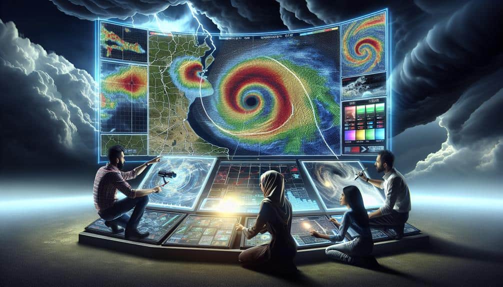
Analyze Satellite Imagery
To effectively analyze satellite imagery, we must focus on interpreting cloud patterns, storm formation, and wind movement with precision. By scrutinizing these elements, we can perform a detailed weather patterns analysis, which is pivotal for accurate storm prediction. Satellite imagery provides a wealth of data on atmospheric conditions, allowing us to monitor real-time changes and predict weather behavior with high accuracy.
We start by examining cloud formations, which are key indicators of storm development. High-resolution images reveal the structure and density of cloud masses, helping us identify areas of convection and potential cyclogenesis. Precise interpretation of these cloud formations is essential for early detection of storm formation, enabling timely warnings and proactive measures.
Next, we assess wind movement by tracking cloud displacements over time. This allows us to gauge the speed and direction of atmospheric currents, providing insights into the storm's potential path. By integrating this data with weather prediction models, we can refine our forecasts and deliver more reliable updates.
Ultimately, mastering satellite imagery analysis empowers us to make informed decisions, harnessing the freedom to act swiftly and effectively in the face of dynamic atmospheric conditions.
Use Professional Weather Software

When analyzing storm patterns, we use professional weather software to synthesize vast datasets and enhance predictive accuracy. These tools allow us to conduct detailed storm mapping, enabling us to visualize storm trajectories, intensity, and potential impact zones. This is essential for real-time weather tracking and making informed decisions quickly.
Professional weather software provides several advantages:
- Data Integration: Merges information from satellites, radar, and ground-based sensors.
- Predictive Models: Utilizes sophisticated algorithms to forecast storm development and movement.
By employing these tools, we can achieve higher precision in our forecasts. For example, data integration ensures we're not relying on a single source, which could be flawed. Instead, we use a multitude of data points to confirm patterns and anomalies.
Predictive models allow us to simulate various scenarios, giving us a range of potential outcomes that enhance our preparedness. The user interface streamlines the data interpretation process, allowing even non-experts to grasp important information swiftly.
In essence, professional weather software is essential for accurate storm mapping and weather tracking. It empowers us with the data and tools necessary to anticipate and respond effectively to storm events, providing us with the freedom to act proactively rather than reactively.
Follow Expert Meteorologists
By leveraging the insights of expert meteorologists, we gain access to refined analyses and interpretations of complex weather data that enhance our storm tracking capabilities. These professionals possess advanced meteorology education and have undergone rigorous training, making them invaluable in deciphering atmospheric patterns that are often too intricate for automated systems alone.
Their expertise enables us to understand the nuances of storm behavior, which can be vital for making informed decisions. Expert meteorologists utilize cutting-edge storm tracking technology, such as Doppler radar, satellite imagery, and numerical weather prediction models. By following their real-time updates, we can stay ahead of storm developments, ensuring our safety and preparedness.
They provide context that raw data lacks, interpreting shifts in barometric pressure, wind speed, and precipitation levels to forecast storm trajectories with precision. Moreover, these meteorologists often disseminate their findings through various platforms, including social media, specialized weather apps, and dedicated meteorological websites.
Frequently Asked Questions
How Can I Prepare My Home for an Approaching Storm?
When storms approach, we reinforce roofs and protect windows. Coincidentally, we secure yards and stock emergency supplies. Data shows these measures drastically reduce damage, giving us the freedom to stay safe and resilient.
What Should Be in an Emergency Storm Survival Kit?
In an emergency storm survival kit, we should include shelter essentials like tarps and thermal blankets, as well as emergency supplies such as non-perishable food, water, first aid kits, flashlights, batteries, and a multi-tool.
How Do I Create a Family Emergency Communication Plan?
Remember the blackout last summer? Our crisis communication plan guaranteed neighborhood safety. Establish primary and secondary contact methods, designate meeting points, and practice regularly. Let's secure our family's freedom and security during emergencies with precise planning.
What Are the Signs of an Impending Storm?
We can identify an impending storm by observing cloud formations and wind patterns. Additionally, rapid drops in barometric pressure and sudden temperature changes are precise indicators that enhance our ability to anticipate severe weather conditions accurately.
How Can I Stay Safe During a Storm if I'm Outdoors?
To guarantee outdoor safety during a storm, let's locate emergency shelter options immediately. Seek low-lying areas away from trees, metal structures, and water bodies. Prioritize wind-resistant shelters or vehicles to minimize exposure to hazardous conditions.