Exploring storm chasing demands precise tools, and we've identified some top apps for the job. RadarScope and Storm Shield guarantee exceptional forecast reliability, while MyRadar provides real-time tracking with precise coverage. Weather Underground excels with robust analytics and crowd-sourced reports. These apps leverage advanced radar technology and meteorological data, offering hyper-localized forecasts and emergency notifications. They feature Doppler radar for predictive analysis, customizable alerts, and user-friendly interfaces. These functionalities not only enhance tracking efficiency but also aid in emergency preparedness. Staying ahead in storm chasing starts with the right app, and understanding their features can elevate our exploration capabilities.
Key Points
- RadarScope and Storm Shield: Exceptional reliability for storm forecasts and real-time tracking.
- MyRadar: Precise real-time tracking with high-resolution radar imagery.
- Weather Underground: Robust analytics and crowd-sourced weather reports for comprehensive storm tracking.
- Interactive Radar Tools: Doppler radar, time-lapse, and future-cast capabilities for detailed storm analysis.
Top Storm Tracking Apps
When it comes to tracking storms, our top app recommendations excel in providing real-time data and accurate forecasts. These apps leverage advanced radar technology and meteorological data, giving us unparalleled coverage precision. They enable us to monitor storm movement meticulously, guaranteeing we stay informed about the storm's path and potential impact areas.
Apps like RadarScope and Storm Shield stand out for their exceptional forecast reliability. RadarScope offers high-resolution radar data that professional meteorologists trust, while Storm Shield provides hyper-localized forecasts and emergency notifications. These features empower us to make timely decisions, enhancing our preparedness during severe weather events.
Additionally, MyRadar delivers real-time tracking with impressive coverage precision. Its intuitive interface shows storm movement dynamically, allowing us to visualize the storm's progression. The app also includes emergency notifications that alert us to critical weather updates, ensuring we're never caught off guard.
For those of us who crave detailed data, the Weather Underground app provides robust analytics. It integrates crowd-sourced reports, enhancing forecast reliability through user-generated insights. This blend of professional data and community input ensures we have the most accurate storm information at our fingertips.
Real-Time Weather Updates
Real-time weather updates are necessary for staying ahead of rapidly changing storm conditions, providing us with timely and accurate information to make informed decisions. Leveraging advanced weather forecasting technology, these updates help us monitor storm paths, intensity, and potential impact zones. This information is vital for our emergency preparedness, as it allows for swift actions and adjustments to our plans.
Accurate, minute-by-minute data from meteorological sensors and satellites guarantee that we're never caught off guard. Apps that offer real-time updates compile data from various sources, including the National Weather Service, ensuring a thorough understanding of the storm's trajectory. By receiving instant notifications on our devices, we can prioritize safety and make proactive decisions—such as moving to a safer location or alerting others in the storm's path.
The reliability of these updates hinges on the technology behind them. High-resolution models and continuous data feeds ensure precision. As storm chasers, we depend on this real-time information to navigate safely and efficiently. Staying informed with cutting-edge weather forecasting tools empowers us to embrace our quest for freedom without compromising safety.
Interactive Radar Features
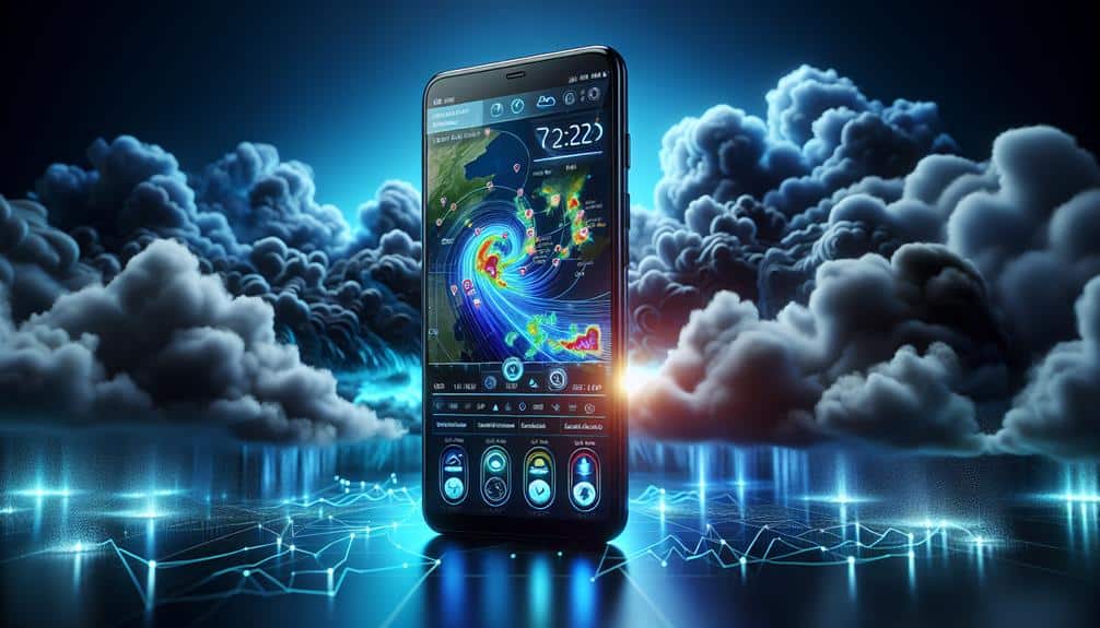
Interactive radar characteristics enable us to visualize storm developments in real-time, providing a dynamic and detailed perspective on weather patterns. Using advanced radar accuracy, these tools enable us to track storms with precision, enhancing our ability to make informed decisions when we're out in the field. The capacity to see a storm's movement, intensity, and potential path empowers us to stay ahead of severe weather, ensuring both safety and optimal positioning for storm observation.
High-resolution radar imagery is essential for effective storm visualization. By leveraging Doppler radar technology, we can detect wind patterns and precipitation levels, giving us a thorough understanding of storm dynamics. This level of detail is crucial, as it helps us identify potential threats such as hail, tornadoes, and flash floods. The ability to zoom in on specific regions and adjust settings for different radar products, like reflectivity and velocity, allows us to customize our view based on current needs.
Furthermore, interactive radar characteristics often include time-lapse and future-cast capabilities, enabling us to analyze past storm behavior and predict upcoming developments. This predictive power is necessary for planning our next move, ensuring we remain agile and well-informed in the ever-changing landscape of storm chasing.
Customizable Alert Settings
Customizable alert settings empower us to tailor notifications to our specific needs, ensuring we receive timely updates on storm activity that could impact our location. By leveraging advanced settings, we can specify the types of alerts we want, such as severe thunderstorms, tornadoes, or flash floods. This precision allows us to filter out unnecessary notifications and focus on critical weather events that require immediate attention.
Incorporating customizable notifications enhances our ability to stay informed and make proactive decisions. For instance, we can set thresholds for wind speeds, precipitation levels, and lightning activity, ensuring alerts are relevant to our storm-chasing goals. Additionally, many apps enable us to define alert zones, allowing us to monitor multiple locations simultaneously. This feature is particularly beneficial when tracking storms over a wide area or planning a chase route.
Furthermore, advanced settings often include options for alert frequency and notification methods. We can choose to receive updates via push notifications, emails, or SMS, depending on our preferences and communication needs. By fine-tuning these parameters, we maximize situational awareness while minimizing distractions. Ultimately, customizable alert settings provide the flexibility and control necessary to navigate storm-chasing effectively and safely.
User-Friendly Interfaces
A user-friendly layout is necessary for efficiently navigating storm tracking applications, guaranteeing we can access vital data quickly and intuitively. When monitoring unpredictable weather conditions, time is of the essence, and a well-designed app can make all the difference.
Mobile accessibility is a critical component; we need to be able to monitor storm paths and receive updates whether we're on the road or at home.
Advanced features should be seamlessly integrated into the app's design elements without overwhelming the user. For example, radar overlays, real-time alerts, and predictive analytics should be easy to locate and interpret. The best apps prioritize a clean layout that highlights necessary information, reducing the learning curve and enhancing our overall user experience.
Furthermore, the app's interface should be customizable to cater to both new users and experienced storm chasers. Personalization options, such as adjustable map layers and alert settings, allow us to tailor the app according to our specific needs. This flexibility not only improves usability but also empowers us to make informed decisions swiftly.
Ultimately, a user-friendly layout guarantees we can utilize the full potential of advanced features, maximizing our mobile accessibility and overall storm-tracking efficiency.
Offline Tracking Capabilities
When connectivity is limited or nonexistent, offline tracking capabilities become essential for maintaining access to critical storm data. We understand how important it's to stay informed during severe weather events, especially when our usual communication channels may be disrupted.
Offline mapping and emergency preparedness tools can make sure we're never caught off guard. Here are three essential features to look for in storm tracking apps that support offline functionality:
- Offline Mapping: The ability to download maps for offline use ensures we can still navigate and track storm paths even without internet access. This feature is important for identifying safe routes and shelter locations.
- Local Data Storage: Apps that store weather data locally allow us to access the latest updates and forecasts without relying on real-time data streams. This can be a lifesaver when cell towers or Wi-Fi networks are down.
- Emergency Alerts: Some apps can push emergency alerts based on pre-downloaded data. These alerts can provide timely warnings about approaching storms, giving us an important head start in our emergency preparedness efforts.
Frequently Asked Questions
How Can I Ensure My Safety While Storm Chasing?
Did you know that 70% of storm chasers encounter unexpected hazards? To guarantee our safety, we focus on emergency preparedness and risk management, constantly updating our plans and gear to handle any situation that arises.
What Gear Is Essential for Storm Chasing?
For gear essentials, we recommend a reliable weather radio, GPS device, and sturdy vehicle. Storm preparation is essential, so pack first aid kits and emergency supplies. Equipment recommendations include cameras for documentation, ensuring storm safety while chasing.
Are There Any Legal Considerations for Storm Chasing?
Every storm chaser's dream could be crushed by missing permits! We must understand restrictions, safety measures, and regulations to guarantee our freedom. Always check local laws to avoid legal troubles during our thrilling adventures.
How Do I Interpret Weather Data Effectively?
To interpret weather data effectively, we focus on analyzing data patterns and trends. We prioritize forecast accuracy by cross-referencing models and historical data. This approach empowers us to make informed decisions and maintain our freedom during weather events.
What Is the Best Time of Year for Storm Chasing?
When dark clouds swirl and lightning dances across the sky, it's peak season for storm chasing. We find the best times are spring and early summer, aligning with storm patterns that create thrilling, unpredictable chases.

