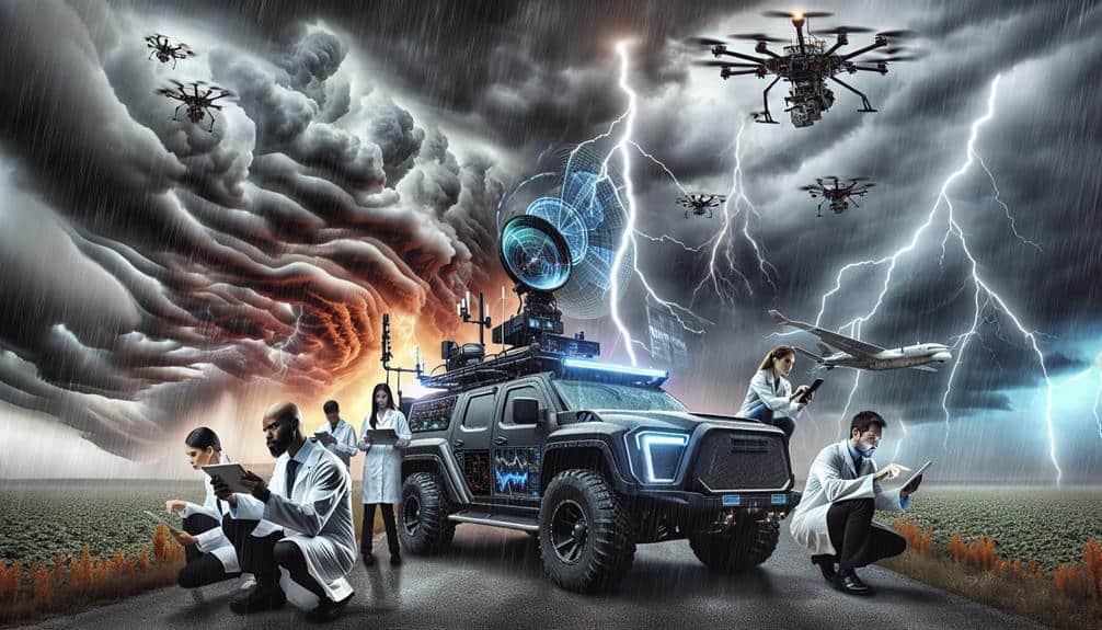
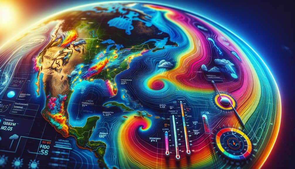
To analyze storm intensity factors, we employ satellite imagery for high-resolution data and Doppler radar for real-time velocity and precipitation patterns. We track wind speed and direction, monitor barometric pressure using high-precision sensors, and estimate rainfall rates through radar reflectivity and machine learning. Temperature gradient analysis reveals convective processes, while humidity assessment quantifies atmospheric moisture. Additionally, we predict storm surges, count tornado frequencies, and assess lightning activity with ground-based and satellite networks. These methods, integrated into our predictive models, refine our storm intensity analysis. Discover how these advanced techniques provide detailed insights into storm dynamics and severity.
Key Points
- Utilize satellite imagery for high-resolution storm intensity evaluation.
- Apply Doppler radar to measure storm velocity and precipitation patterns in real-time.
- Monitor atmospheric pressure with high-precision barometers and digital sensors.
- Estimate rainfall rates using radar reflectivity and rain gauge data.
Satellite Imagery Analysis
Satellite imagery analysis provides us with real-time, high-resolution data important for evaluating storm intensity factors accurately. By leveraging advanced satellite technology, we can perform precise cloud formation analysis, allowing us to discern the structural dynamics of storm systems. These advancements enable us to track the development and progression of storms with unprecedented clarity.
Utilizing this technology, we gain a thorough understanding of storm tracking capabilities. Satellites equipped with state-of-the-art sensors capture essential meteorological data, facilitating accurate weather pattern recognition. This data allows us to identify and monitor key indicators like cloud tops, temperatures, and moisture levels, which are crucial for evaluating storm intensity.
Furthermore, the continuous improvements in satellite technology advancements enhance our ability to analyze atmospheric phenomena in real-time. This real-time monitoring is important for identifying rapid changes in storm behavior, thereby improving predictive models and response strategies. By integrating satellite data with other meteorological tools, we can optimize our approach to storm intensity evaluation.
Doppler Radar Measurements
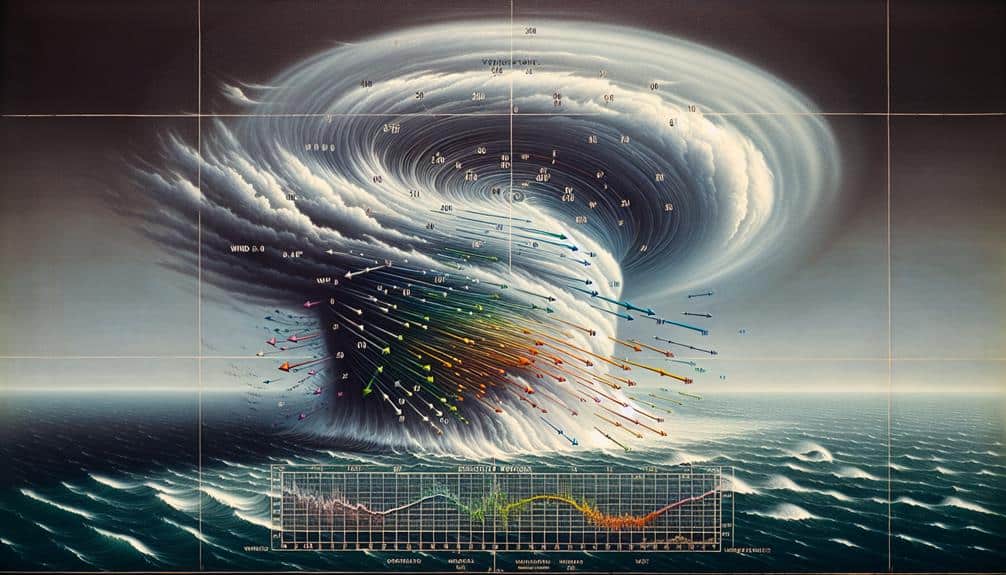
Let's examine how Doppler radar measurements provide significant insights into storm intensity through velocity and precipitation data. By analyzing the Doppler shift, we can quantify wind speeds and precipitation rates with high temporal resolution.
However, we must consider the range and resolution limits that can affect the accuracy of these measurements.
Velocity and Precipitation Data
Doppler radar measurements provide essential data on storm velocity and precipitation patterns, enabling us to analyze storm intensity with high precision.
By utilizing advanced data visualization techniques, we can interpret complex velocity fields and precipitation distributions. This allows us to perform correlation analysis between storm dynamics and observed weather phenomena, offering insights into the storm's potential impact.
Our approach to storm impact assessment integrates Doppler radar data to evaluate the severity and trajectory of storms. By correlating velocity data with precipitation intensity, we can identify high-risk zones and predict potential flooding or wind damage. This correlation analysis is pivotal for developing accurate emergency response planning.
Furthermore, Doppler radar enables us to monitor real-time changes in storm intensity. Rapid updates on velocity and precipitation help us refine our predictive models, ensuring timely and effective response strategies. These data-driven insights empower communities to make informed decisions, enhancing safety and resilience.
Range and Resolution Limits
How do the inherent range and resolution limits of Doppler radar measurements affect our ability to accurately analyze storm intensity factors?
The range and resolution constraints of Doppler radar are critical in determining the precision of sensor accuracy. As the radar's range extends, its resolution diminishes, leading to potential inaccuracies in detecting storm structures and dynamics. This trade-off becomes particularly problematic when tracking fast-evolving weather systems where high resolution is imperative for precise measurements.
Our reliance on Doppler radar data necessitates meticulous data interpolation techniques to fill gaps caused by these limitations. However, interpolation can introduce errors, particularly in regions where storm features are rapidly changing. By understanding these limitations, we can better calibrate our radar systems and develop advanced algorithms to mitigate errors.
Moreover, sensor accuracy is directly influenced by the radar's capacity to discern between different storm intensities within its range. Enhanced resolution allows for more granular readings, but only within a limited distance. Consequently, balancing range and resolution is paramount.
Wind Speed Tracking
Accurately monitoring wind speed is necessary for evaluating storm intensity, as it provides quantifiable data on the storm's potential impact. By employing advanced anemometers and Doppler radar systems, we can capture precise measurements of wind velocities. These tools not only measure speed but also facilitate wind direction analysis, offering insights into storm formation patterns.
To achieve this, we utilize high-resolution data from satellite observations and ground-based sensors. This integrated approach allows us to track wind speed changes in real-time, identifying sudden gusts and sustained winds. Analyzing these fluctuations helps us predict storm trajectories and potential landfall impacts, important for issuing timely warnings.
Moreover, incorporating wind speed data into predictive models enhances our understanding of storm dynamics. By cross-referencing wind speed with other meteorological variables, we can fine-tune our forecasts and improve accuracy. It's crucial to use data assimilation techniques, which merge observational data with model predictions, ensuring a detailed analysis.
In essence, precise wind speed tracking empowers us to decode the complexities of storm behavior, providing actionable intelligence for communities seeking to safeguard their freedom and security. This meticulous approach equips us to anticipate and mitigate storm-related hazards effectively.
Barometric Pressure Monitoring
Let's focus on barometric pressure monitoring, which requires precise instruments like aneroid barometers and digital pressure sensors.
We'll discuss data collection techniques, emphasizing the importance of continuous, high-resolution measurements to capture rapid fluctuations.
Equipment and Tools Needed
To effectively monitor barometric pressure for storm intensity analysis, we rely on high-precision barometers and digital pressure sensors. Traditional mercury barometers offer exceptional accuracy but are less portable.
Digital barometers, however, provide real-time data and can be integrated with other instruments for thorough storm analysis. As storm chasers, we often depend on portable digital barometers due to their robustness and ease of use in the field.
Weather balloons equipped with radiosondes are indispensable for collecting atmospheric pressure data at various altitudes. These balloons ascend through the atmosphere, transmitting data back to ground stations, allowing us to analyze vertical pressure profiles essential for understanding storm dynamics.
The radiosondes attached to weather balloons measure not just barometric pressure but also temperature and humidity, providing a multi-faceted view of storm conditions.
Ground-based automated weather stations (AWS) also play a pivotal role. These stations continuously monitor barometric pressure and other meteorological variables, offering a consistent stream of data. AWS units are often strategically placed in storm-prone areas, ensuring that we capture important data during storm events.
Data Collection Techniques
Collecting accurate barometric pressure data is essential for understanding and forecasting storm intensity. We utilize high-precision barometers to measure atmospheric pressure changes, ensuring that every reading is reliable. This process begins with data accuracy verification, where we cross-reference our barometer readings with standardized benchmarks to confirm precision. If discrepancies arise, calibration protocols are immediately enacted to rectify them.
After ensuring data accuracy, we proceed with real-time data collection. We install barometers at strategic locations, often integrating them into automated weather stations. These stations transmit data continuously, providing a constant stream of information that we can analyze. This extensive dataset allows us to detect even the slightest pressure variations, critical for anticipating storm developments.
Next, we engage in forecast model comparison. By feeding our verified barometric pressure data into various predictive models, we can assess which models align most closely with observed conditions. This comparative analysis helps refine our forecasting methods, enhancing our predictive accuracy.
Our goal is to empower individuals with precise, actionable storm forecasts, granting them the freedom to make informed decisions.
Interpretation of Results
By analyzing real-time barometric pressure data, we can identify patterns that indicate the onset and progression of storm intensity. Our interpretation of results relies heavily on precise statistical analysis and robust visualization techniques. Through these methods, we can effectively quantify shifts in pressure that correlate with changes in storm dynamics.
Correlation analysis is fundamental in understanding how barometric pressure interacts with other meteorological variables. By identifying key trends, we can forecast storm behavior with greater accuracy. Trend identification allows us to pinpoint critical moments that signify an escalation or decline in storm intensity.
To enhance our analysis, we use the following approaches:
- Data visualization: We employ advanced visualization techniques to create intuitive graphs and charts, making complex data more accessible and easier to interpret.
- Time-series analysis: By examining pressure data over time, we can detect recurring patterns and anomalies that provide insight into storm development.
Our goal is to provide actionable insights that empower decision-makers to respond swiftly and effectively to evolving storm conditions.
Rainfall Rate Estimation

We employ radar reflectivity measurements and rain gauge data to achieve precise rainfall rate estimation. Radar reflectivity provides spatial and temporal resolution, allowing us to map rainfall distribution effectively. By correlating radar data with ground-based rain gauges, we can calibrate the reflectivity-rainfall rate relationship, thereby improving the accuracy of our precipitation estimates.
Analyzing precipitation patterns involves scrutinizing the intensity, duration, and spatial extent of rainfall. We use dual-polarization radar to differentiate between rain, snow, and hail, thereby refining our understanding of precipitation types. This distinction is vital for accurate rainfall rate estimation, as different precipitation types have varied reflectivity values.
For high-resolution data, we integrate radar with satellite precipitation measurements. This multi-sensor approach enables us to capture transient precipitation events that might be missed by ground-based systems alone. By leveraging machine learning algorithms, we can automate the analysis of large datasets, quickly identifying anomalies and trends in rainfall distribution.
Incorporating these methodologies, we obtain detailed insights into storm dynamics. This empowers us to make more informed decisions, enhancing our ability to predict and mitigate the impacts of severe weather. Accurate rainfall rate estimation is an essential tool in our arsenal for understanding and managing storm intensity factors.
Lightning Activity Detection
Understanding lightning activity is vital for analyzing storm intensity. We utilize advanced detection networks to monitor and quantify lightning strikes with high accuracy. By leveraging sophisticated sensors and satellite technology, we can map lightning strike patterns and assess their correlation with thunderstorm activity monitoring, providing important insights for storm analysis.
Our approach includes several key methodologies:
- Ground-based Lightning Detection Networks: We use a network of sensors that measure electromagnetic pulses generated by lightning strikes. These networks offer real-time data, enabling precise localization and frequency analysis.
- Satellite-based Lightning Imaging: Satellites equipped with optical and infrared sensors capture comprehensive lightning data over large geographic areas. This method is particularly effective for remote or oceanic regions where ground-based networks are sparse.
These techniques collectively allow us to quantify the intensity and distribution of lightning strikes, essential for effective thunderstorm activity monitoring. Our data-driven approach not only improves weather forecasting but also supports proactive measures to mitigate the impact of severe weather events.
Through precise, real-time monitoring, we empower individuals and communities to make informed decisions and maintain a sense of freedom in the face of nature's unpredictable forces.
Temperature Gradient Analysis
Frequently, analyzing the temperature gradient within a storm system reveals critical insights into its development and potential severity. By examining the boundary layer, we can identify variations in temperature that indicate the presence of instability. This instability is often a precursor to more intense storm activity. Specifically, the boundary layer's temperature differential acts as a catalyst for convective processes, driving vertical motion and cloud formation.
In our isothermal analysis, we assess the uniformity of temperature across different altitudes within the storm system. A significant temperature gradient between the boundary layer and upper atmospheric levels can signify strong updrafts. These updrafts are instrumental in the formation of severe thunderstorms and tornadoes. By mapping temperature variations, we can predict areas of potential updraft and, consequently, the likely path of storm intensification.
Moreover, by employing remote sensing technologies and high-resolution weather models, we obtain precise data on temperature gradients. This data enables us to refine our predictive algorithms, providing more accurate warnings and allowing individuals to make informed decisions.
Essentially, our focus on temperature gradient analysis empowers us to anticipate storm behavior more effectively, enhancing both safety and preparedness.
Humidity Level Assessment
In evaluating humidity levels, we'll focus on quantifying atmospheric moisture using specific humidity and dew point measurements.
Accurate data on these variables allow us to model the direct correlation between moisture concentration and storm strength.
Measuring Atmospheric Moisture
Evaluating atmospheric moisture involves quantifying the humidity level using precise instruments like hygrometers and satellite remote sensing. Moisture content evaluation is essential for understanding how atmospheric water vapor relates to precipitation patterns. By measuring humidity accurately, we can establish a strong precipitation correlation, which is vital for predicting storm behavior.
We must recognize the pivotal role of humidity in storm dynamics. The humidity impact on atmospheric conditions directly influences the storm intensity relationship. Higher humidity levels often result in more intense storms due to the increased availability of moisture, which fuels storm development.
To measure atmospheric moisture, we utilize several advanced techniques:
- Hygrometers: These instruments provide direct and precise readings of relative humidity, offering immediate data on moisture content.
- Satellite Remote Sensing: Satellites monitor global humidity levels, providing large-scale moisture distribution data that are essential for weather modeling.
Impact on Storm Strength
Understanding how humidity levels affect storm strength involves analyzing the direct correlation between atmospheric moisture content and the energy available for storm intensification. When we assess humidity levels, we specifically look at the dew point, relative humidity, and precipitable water.
High humidity levels provide ample latent heat, which fuels the storm's updrafts, thereby intensifying the storm.
By examining historical storm data, we can observe a pattern where increased humidity often correlates with stronger storms. This is particularly relevant in the context of climate change impact, as rising global temperatures lead to higher evaporation rates and, consequently, elevated atmospheric moisture content.
The interplay between climate change and storm formation influences is vital, as it helps us predict future storm behaviors.
Accurate humidity level assessment utilizes advanced tools like weather satellites, radiosondes, and ground-based hygrometers. These instruments collect precise data, enabling us to create detailed models of storm development.
Our analysis shows that understanding the nuances of humidity variations can help us better predict storm strength, ultimately aiding in effective disaster preparedness and response. This knowledge empowers us to mitigate risks and make informed decisions, fostering a sense of control in an era of increasing climatic uncertainty.
Storm Surge Prediction

When predicting storm surges, we must consider a combination of atmospheric pressure, wind velocity, and coastal topography to generate accurate models. These factors are essential in storm surge modeling, allowing us to conduct effective risk evaluations. By integrating precise meteorological data and topographic details, we can predict surge heights and their potential impact on coastal regions.
Accurate storm surge prediction is crucial for evaluating coastal infrastructure vulnerability. This involves assessing the resilience of buildings, roads, and utilities to withstand flooding. Proper risk evaluation informs resilience planning, helping communities implement measures to mitigate damage and protect lives.
Key considerations in storm surge prediction include:
- Atmospheric pressure and wind velocity: Low pressure and strong winds drive water toward the shore, increasing surge levels.
- Coastal topography: The shape and features of the coastline influence how water accumulates and disperses.
Tornado Frequency Counting
Accurately counting tornado frequency necessitates robust data collection methods and advanced statistical analysis to identify patterns and trends. To achieve this, we must integrate multiple data sources, including Doppler radar readings, satellite imagery, and ground reports.
Tornado alley analysis is pivotal, as this region experiences a higher frequency of tornadoes, providing a rich dataset for our investigations.
We utilize storm chaser insights to enhance our data accuracy. Storm chasers offer real-time, ground-level observations that complement remote sensing technologies. Their firsthand accounts help validate radar signatures and confirm tornado touchdowns, which markedly enhances our frequency counts.
Our methodology involves aggregating data from the National Weather Service (NWS), local meteorological stations, and storm chaser networks. We then apply advanced statistical models, such as Poisson regression and time-series analysis, to discern temporal and spatial patterns. These techniques enable us to distinguish between random fluctuations and notable trends, essential for understanding tornado dynamics.
Frequently Asked Questions
How Does Climate Change Influence Storm Patterns Over the Years?
We've observed that climate change impacts storm patterns markedly. Rising ocean temperatures increase storm intensity, leading to more severe and frequent storms. Data indicates a direct correlation between warmer waters and the amplification of storm systems.
What Role Do Ocean Temperatures Play in Storm Intensity?
Let's investigate: Ocean temperatures directly influence storm formation by providing the necessary heat and moisture. Warmer waters intensify storms, increasing their energy and destructive potential. Tracking these changes helps us predict and understand storm behaviors.
Can Storm Intensity Be Predicted Weeks in Advance?
We can predict storm intensity weeks in advance using long term forecasting and meteorological models. By integrating environmental factors and rigorous data analysis, we enhance our predictive capabilities, offering valuable freedom to prepare and adapt.
How Do Human Activities Impact Storm Severity?
Isn't it ironic how our quest for urban development and deforestation for agriculture exacerbates storm severity? Increased runoff, reduced natural barriers, and climate change fuel more intense storms, impacting our freedoms with devastating consequences.
Are There Specific Regions More Prone to Intense Storms?
We find specific regions with higher geographic vulnerability, often termed storm hotspots. Analyzing historical data shows these areas experience increased storm frequency. This data-driven approach helps us understand and mitigate risks, ensuring greater freedom from storm devastation.