To document storm damage accurately, we begin with extensive pre-storm readiness, safeguarding important documents and supplies. We utilize GPS coordinates and geotagging to pinpoint damage locations, along with high-quality photography, detailed video recordings, and drone footage for thorough visual records. Advanced damage assessment tools and software assist us in conducting accurate evaluations, while integrating witness statements adds valuable firsthand accounts. Weather data analysis links damage with specific storm characteristics, and consistent data backup using cloud storage guarantees reliability. By incorporating these methods, we can capture a precise and detailed picture of storm impacts, ensuring all essential elements are fully covered.
Key Points
- Utilize high-quality photography and video recording with GPS coordinates for detailed visual documentation.
- Integrate witness statements for valuable firsthand accounts and context.
- Employ damage assessment software for real-time data input and precise records.
- Cross-reference weather data with damage locations to attribute specific storm characteristics.
Pre-Storm Preparation
Why is it important for us to implement thorough pre-storm preparation to guarantee accurate storm damage documentation?
By preparing extensively before a storm hits, we can make sure that we've all the necessary tools and information to document damages accurately, which is critical for insurance claims and repairs. One of the first steps is organizing emergency supplies. This includes having a well-stocked kit with items like flashlights, batteries, first-aid supplies, and non-perishable food.
These supplies not only help us stay safe during the storm but also ensure we're ready to document any damage once it's safe to do so.
In addition to emergency supplies, crafting a detailed evacuation plan is paramount. Knowing where to go and how to get there quickly can save lives. It also allows us to safeguard essential documents and electronic devices needed for post-storm documentation.
Our evacuation plan should include multiple routes and designated meeting points to account for blocked or damaged roads. By combining these elements—emergency supplies and a solid evacuation plan—we're not only prepared to weather the storm but also positioned to accurately assess and document the aftermath, ensuring a smoother recovery process.
Utilizing GPS Coordinates
In the domain of storm damage documentation, utilizing GPS coordinates allows us to pinpoint the exact locations of damage, facilitating accurate and efficient reporting. By geotagging evidence, we can create a precise map of affected areas, which is vital for coordinating response efforts and allocating resources effectively. This method guarantees that no damaged area is overlooked and helps us maintain a detailed record of the storm's impact.
Employing remote sensing technology enhances our ability to collect data from hard-to-reach areas. Using Geographic Information Systems (GIS), we can integrate GPS data with satellite imagery analysis, providing a detailed and layered view of the damage. This approach allows us to compare pre- and post-storm conditions, offering insights into the extent and nature of the damage.
Moreover, the integration of GPS coordinates with satellite imagery guarantees that our documentation isn't only accurate but also verifiable. This is particularly important when presenting findings to stakeholders who require validation of the reported damage. By leveraging these technologies, we empower ourselves with the freedom to explore, analyze, and respond to storm damage in a more informed and efficient manner.
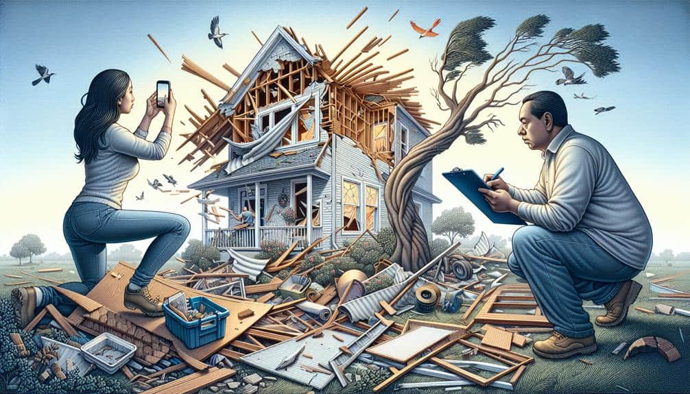
High-Resolution Photography
Combining GPS coordinates with high-quality photography allows us to capture detailed visual records of storm damage, guaranteeing each affected area is documented with clarity and precision. This method offers an undeniable visual account that can be cross-referenced with exact locations, facilitating more accurate assessments and streamlined reporting.
To achieve the best results, the use of advanced lighting techniques is vital. Appropriate lighting minimizes shadows and highlights the extent of the damage, making sure that no detail is missed. We often rely on natural light when possible, but portable lighting solutions can be invaluable for overcast conditions or indoor damage.
Photo editing also plays an essential role in refining these images. While the goal is to present an honest depiction, subtle adjustments in brightness, contrast, and sharpness can make the damage more perceptible. These edits should always be documented to maintain transparency.
High-quality photography empowers us to create a thorough and reliable visual archive. It's a tool that not only helps in immediate damage assessment but also serves as a lasting record for future reference, insurance claims, and restoration planning. With the right approach, we can make sure every detail is captured accurately and responsibly.
Detailed Video Recording
To complement our photographic records, we employ detailed video recording to capture a thorough and dynamic view of storm damage. This method allows us to document the extent of damage in a way that still images cannot, providing a more complete perspective. By recording a continuous sequence, we can effectively illustrate the scope and severity of the destruction, which is essential for accurate assessments and insurance claims.
Our video recording process begins with the careful selection and maintenance of equipment. Ensuring our cameras and accessories are in top condition is paramount. Regular equipment maintenance prevents malfunctions and ensures high-quality footage. We also prioritize using stabilizers to avoid shaky recordings, which can obscure damage details.
Video editing is a vital step in our documentation process. We meticulously review and edit the footage to highlight key areas of interest and guarantee clarity. This involves trimming unnecessary parts, adjusting lighting, and adding annotations to emphasize specific damage points. These edits make the final video a powerful tool for conveying the full impact of the storm.
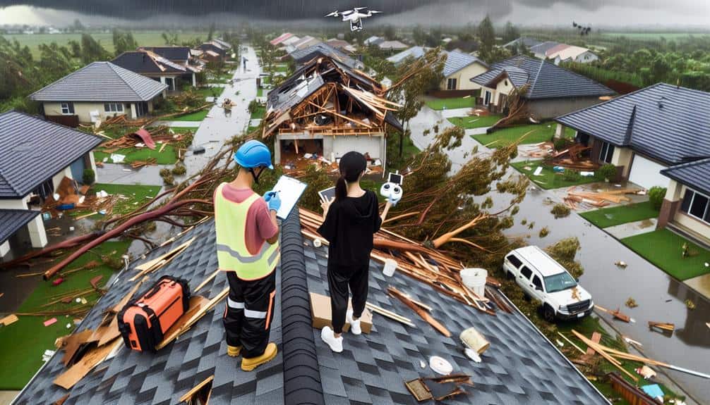
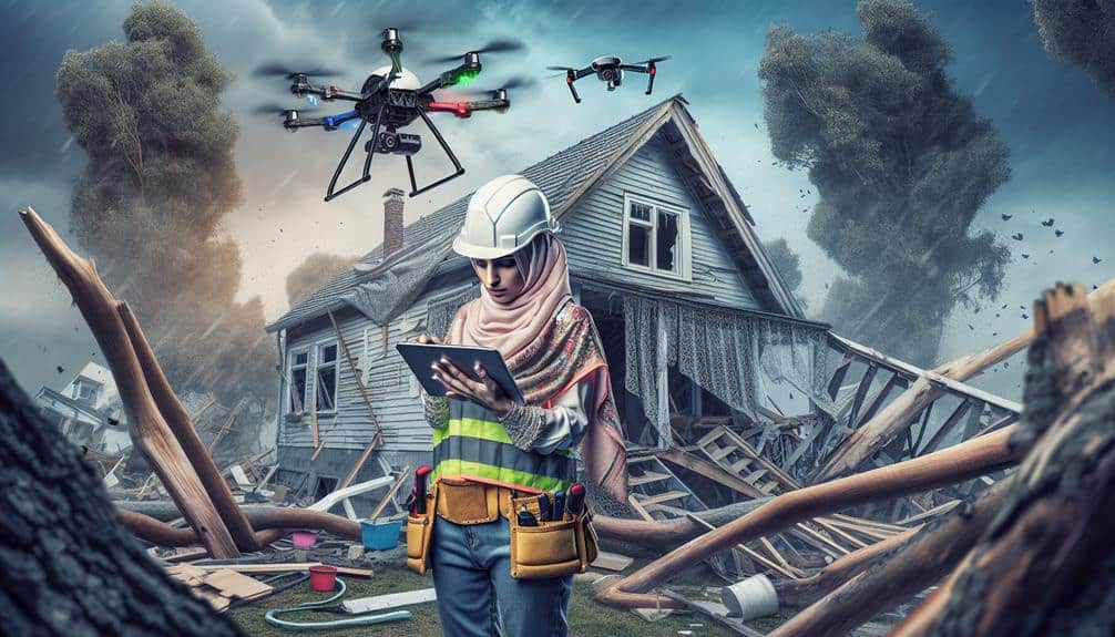
Drone Footage Capture

Utilizing drone technology allows us to capture an aerial perspective of storm damage, providing a wide-ranging and detailed view that ground-based methods can't achieve. When conducting drone surveillance in the storm aftermath, we gain access to in-depth visual data that enhances our damage documentation process. This aerial assessment reveals the full extent of the destruction, from roof damage to flooded areas, granting us a holistic understanding of the situation.
Our approach includes deploying drones equipped with high-resolution cameras capable of capturing still images and video footage. This enables us to document even the smallest details that might be missed at ground level. By systematically covering affected areas, we ensure no damage is overlooked, which is essential for accurate reporting and subsequent recovery efforts.
Additionally, drone footage allows us to create detailed maps and 3D models of the impacted areas. These models provide valuable insights into the structural integrity of buildings and the overall landscape changes. The efficiency and precision of drone technology streamline the documentation process, saving time and resources while providing an objective record of the storm's impact.
Utilizing drones, we enhance our capability to deliver thorough and accurate storm damage assessments.
Comprehensive Note-Taking
Effective detailed note-taking is vital for guaranteeing that all observations and details of the storm damage are meticulously recorded and easily accessible for analysis and reporting. When we take thorough notes, we equip ourselves with a robust foundation to support our damage assessments and claims. This process involves several important steps that guarantee no detail is overlooked.
- Elaborate sketches, in-depth descriptions: By creating elaborate sketches and providing detailed descriptions, we capture a visual and verbal record of the damage that can be cross-referenced later. This helps in visualizing the extent and specific nature of the damage.
- Precise measurements, exact timestamps: Recording precise measurements and exact timestamps allows us to quantify the damage and track when it occurred. This is essential for understanding the progression of the storm and its impact on different structures.
We need to remember that our goal is to document everything as accurately and thoroughly as possible. By adhering to these practices, we can guarantee that our storm damage documentation is both reliable and actionable, empowering us to act with confidence.
Damage Assessment Tools
When evaluating storm damage, we rely on a variety of specialized tools to make certain our evaluations are accurate and thorough. One essential tool is damage assessment software. This software enables us to input data in real-time, guaranteeing our records are up-to-date and precise. It can integrate photos, videos, and notes, creating a detailed digital record. By analyzing patterns in the data, the software helps us identify areas most in need of immediate attention.
Satellite imagery is another crucial component in our toolkit. With high-resolution images, we can assess large areas quickly, even those that are challenging to access on foot. This imagery provides an aerial view, revealing the complete extent of the storm's impact, from downed power lines to flooded neighborhoods. By comparing pre- and post-storm images, we can pinpoint changes and prioritize our efforts effectively.
Together, damage assessment software and satellite imagery provide us the flexibility to make informed decisions swiftly. These tools enhance our ability to document storm damage accurately, ultimately leading to more efficient recovery efforts. By leveraging technology, we ensure that our evaluations aren't only thorough but also actionable.
Witness Statements
Beyond the technological tools at our disposal, gathering witness statements offers valuable firsthand accounts that can provide context and nuance to the storm damage we document. Witnesses can offer perspectives that no device can capture, making their input essential for an accurate assessment.
To effectively gather these statements, we must employ robust interview techniques and conduct a thorough credibility assessment. Here are three key components:
- Preparation: Crafting open-ended questions that encourage detailed responses can help us gather in-depth accounts.
- Listening skills: Active listening ensures we capture the full narrative, including subtle details that might be overlooked.
Understanding the legal implications is crucial when incorporating witness statements into our documentation. Properly documented witness accounts can serve as compelling evidence in legal proceedings, where expert testimonies may rely on these firsthand narratives. This adds a layer of authenticity that purely technical data may lack.
Witness statements not only enrich our documentation but also offer a human element that underscores the real-life impact of storm damage. By combining technological tools with credible, well-documented witness accounts, we can provide a holistic view that withstands both scrutiny and the test of time.
Weather Data Integration

Incorporating weather data into our storm damage documentation allows us to correlate specific meteorological events with the observed damage, providing a thorough and scientifically grounded evaluation. By leveraging advanced data analysis techniques, we can accurately attribute damage to particular storm characteristics such as wind speed, precipitation levels, and hail size. This analytical approach ensures that our documentation isn't only all-encompassing but also verifiable.
The integration of modern technology plays a crucial role in this process. Utilizing tools such as satellite imagery, real-time weather monitoring systems, and historical weather databases, we can gather precise data that enhances the accuracy of our reports. For instance, by cross-referencing damage locations with radar data, we can pinpoint the exact time and intensity of the storm impact. This level of detail not only strengthens our documentation but also assists in substantiating insurance claims and legal proceedings.
Moreover, technology integration facilitates the automation of data collection and analysis, reducing human error and increasing efficiency. By implementing these state-of-the-art techniques, we empower ourselves to produce storm damage documentation that isn't only precise but also resilient to scrutiny, thereby upholding our commitment to providing dependable and credible assessments.
Consistent Data Backup
Ensuring consistent data backup is crucial for maintaining the integrity and reliability of our storm damage documentation. By regularly backing up our data, we safeguard it from unexpected loss or corruption, confirming that our records remain complete and accurate. Consistent data backup not only safeguards our documentation but also enhances our credibility and efficiency when dealing with claims or assessments.
To achieve robust data security and reliability, we should focus on the following key practices:
- Automated Backups: Implement automated backup systems to make sure our data is consistently and accurately saved without relying on manual intervention.
- Cloud Storage Solutions: Utilize cloud storage for backups to provide scalable, secure, and easily accessible storage options, confirming our data is protected against physical hardware failures.
These practices help us maintain a high standard of data security and accessibility. When we're aware our data is secure and backed up consistently, we can focus on analyzing and documenting storm damage with greater confidence and accuracy. Embracing these strategies allows us the freedom to manage our documentation processes more effectively and respond swiftly to any unforeseen challenges.
Frequently Asked Questions
How Do I Handle Personal Safety While Documenting Storm Damage?
When documenting storm damage, we prioritize safety precautions by wearing protective gear and staying aware of hazards. We also have an emergency response plan ready, ensuring we can quickly evacuate if conditions worsen.
What Are the Best Practices for Organizing Storm Damage Documentation Files?
We should prioritize file organization by categorizing documents by date and type. For photo management, let's use labeled folders and metadata tags. This guarantees quick access, making it easier to assess and address the storm damage effectively.
Are There Any Specific Apps Recommended for Storm Damage Documentation?
We've found that mobile apps like Encircle and Claim Leader are worth their weight in gold. They offer robust image processing capabilities, ensuring precise documentation. These tools empower us, providing the freedom to handle storm damage efficiently.
How Can I Ensure My Documentation Is Legally Admissible?
We should guarantee our documentation's admissibility as legal evidence by prioritizing accuracy, timestamping photos, maintaining detailed records, and using credible sources. Accurate documentation is essential for legal evidence, making our case stronger and more credible in court.
What Should I Do if I Miss Documenting Some Storm Damage Initially?
Imagine the aftermath of a storm. If we miss documenting some damage initially, we should quickly conduct follow-up documentation. This helps guarantee the remediation process, damage assessment, and insurance claims are accurate and thorough.