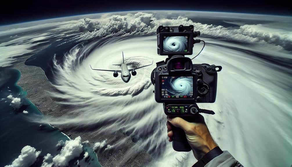
We leverage advanced technologies to track hurricanes accurately from aircraft. Satellite communication provides real-time data and high-resolution imagery. Doppler radar systems offer detailed insights into hurricane dynamics. Dropsonde deployment allows us to measure atmospheric conditions within storms. High-altitude surveillance gives a detailed overview of hurricane structures from 60,000 feet or more. Onboard weather sensors capture precise meteorological parameters and turbulence data. Aerial photography monitors storm progression with high-resolution images. Infrared imaging detects temperature variations and thermal patterns. By combining these methods, we enhance our predictive models and improve our response strategies during hurricanes. Discover how each technique contributes uniquely to our efforts.
Key Points
- Satellite communication offers real-time high-resolution imagery and atmospheric data to track hurricanes.
- Doppler radar systems provide accurate data on hurricane dynamics, enhancing storm forecasting.
- Dropsonde deployment gathers detailed vertical profiles of temperature, humidity, pressure, and wind speed.
- High-altitude surveillance gives a broad view of hurricane structure and intensity from altitudes above 60,000 feet.
Satellite Communication
Harnessing satellite communication, we can acquire real-time data crucial for tracking the development and trajectory of hurricanes. This technology enables us to utilize remote monitoring techniques, capturing high-resolution imagery and atmospheric measurements. Satellite data is invaluable for discerning wind speeds, storm intensity, and potential landfall locations, allowing us to make well-informed decisions rapidly.
By integrating satellite communication into our emergency response protocols, we enhance our ability to predict and respond to natural disasters. Real-time data transmission guarantees that emergency management teams receive timely updates, facilitating swift and effective action.
For example, satellites equipped with advanced sensors can detect changes in sea surface temperatures and cloud formations, which are indicators of hurricane formation. This information is then relayed to aircraft equipped with specialized instruments, enabling precise monitoring.
The fusion of satellite data with aircraft observations provides a thorough understanding of hurricane dynamics. We can track the storm's evolution, anticipate its path, and assess its potential impact on populated areas. Consequently, this integrated approach empowers communities to prepare adequately, safeguarding lives and property.
Doppler Radar Systems
Doppler radar systems greatly enhance our ability to collect high-resolution data on hurricane dynamics. By providing real-time storm analysis, these systems allow us to track wind speeds and precipitation rates with remarkable precision.
Consequently, this data improves our predictive accuracy, enabling more effective storm forecasting and preparedness.
Data Collection Efficiency
How do Doppler radar systems enhance our efficiency in collecting vital hurricane data from aircraft?
By integrating Doppler radar systems into our aircraft, we can optimize both flight patterns and data collection methods to a great extent. These systems provide high-resolution data on weather patterns, allowing us to navigate through the most informative sections of a storm while minimizing risk. As a result, we can gather extensive data sets without unnecessary exposure to hazardous conditions.
Doppler radar systems offer unparalleled data accuracy, essential for understanding storm intensity and structure. By emitting microwave signals and measuring their reflection, we can accurately determine wind speeds and precipitation rates within the hurricane. This real-time data is invaluable for constructing precise models of the storm's behavior.
Moreover, the advanced capabilities of Doppler radar allow us to map the vertical structure of the storm, offering insights into the dynamics of updrafts and downdrafts. This detailed information enhances our understanding of the hurricane's development and potential impact.
Through efficient data collection, we can provide timely and accurate forecasts, ultimately aiding in the preparation and response efforts for those in the storm's path.
Real-time Storm Analysis
With the integration of Doppler radar systems, we can conduct real-time storm analysis that provides immediate insights into a hurricane's intensity and trajectory. This advanced technology enables us to measure wind speed and precipitation rates with unparalleled accuracy. During storm chasing missions, Doppler radar's high-resolution data is pivotal for aerial reconnaissance, allowing us to pinpoint the most intense parts of the storm.
Utilizing Doppler radar, we enhance our weather monitoring capabilities, capturing detailed images of the hurricane's internal structure. The radar system transmits and receives microwave signals that bounce off raindrops, providing a thorough view of wind patterns and precipitation levels. This real-time feedback is vital for flight navigation, as it helps pilots adjust their course to avoid the most hazardous conditions.
Moreover, Doppler radar systems facilitate the identification of mesocyclones and tornadoes embedded within the hurricane. By continuously analyzing data, we can detect sudden changes in wind velocity, which are indicative of severe weather phenomena. This immediate insight allows us to issue timely warnings and take proactive measures to guarantee safety.
Through meticulous data collection and analysis, we can better understand and respond to these powerful natural events, embodying the spirit of freedom and exploration.
Enhanced Predictive Accuracy
Harnessing the real-time data from Doppler radar systems, we enhance our predictive accuracy regarding hurricane trajectories and intensities. By integrating Doppler radar's remote sensing capabilities with our storm modeling techniques, we acquire high-resolution data on wind speed, precipitation rates, and storm structure. This detailed data allows us to refine our predictive algorithms, leading to more precise forecasts.
Doppler radar systems measure the velocity of particles within a storm, providing crucial insights into atmospheric dynamics. By analyzing this data, we can model the internal workings of a hurricane with exceptional detail. This level of detail aids in identifying rapid intensification phases and potential shifts in the storm's path. Our ability to predict these changes in real-time provides invaluable lead time for evacuation and disaster preparedness.
Moreover, the integration of Doppler radar data into our predictive algorithms notably reduces the margin of error in our forecasts. As a result, we can provide communities with accurate and timely information, empowering them with the freedom to make informed decisions.
Essentially, Doppler radar systems aren't just tools; they're pivotal in our ongoing mission to safeguard lives and property from the devastating impacts of hurricanes.
Dropsonde Deployment

Deploying dropsondes from aircraft provides critical real-time data on atmospheric conditions within and around hurricanes. By releasing these small, expendable weather reconnaissance devices into a storm system, we can obtain high-resolution measurements of temperature, humidity, pressure, and wind speed at various altitudes. This data is pivotal for understanding the intricate weather patterns driving hurricane dynamics and evolution.
As dropsondes descend through the atmosphere, they continuously transmit data back to the aircraft. This real-time information allows us to build a detailed vertical profile of the storm's structure. We can then analyze the collected data to refine models predicting the hurricane's path, intensity, and potential impact.
Dropsondes enable us to capture snapshots of the atmospheric conditions that are otherwise difficult to measure, particularly within the turbulent and hostile environments of hurricanes.
High-Altitude Surveillance
High-altitude surveillance aircraft provide a broad and thorough view of the hurricane's overall structure and movement. By flying at altitudes of 60,000 feet or more, these aircraft can achieve a detailed perspective of the storm. This vantage point is essential for remote monitoring, allowing us to analyze weather patterns with high precision. We utilize sophisticated radar and imaging systems onboard to collect data that helps us understand the dynamics of the hurricane.
Aircraft surveillance plays a crucial role in storm tracking. By observing the storm from above, we can monitor changes in its intensity and trajectory in real time. This high-altitude perspective enables us to detect shifts in the hurricane's eye, wall structure, and cloud formations that might be missed at lower altitudes. This data is vital for making accurate forecasts and issuing timely warnings.
Moreover, the ability to cover large areas quickly allows us to track multiple systems simultaneously, enhancing our capacity for thorough storm tracking. With these advanced capabilities, high-altitude surveillance aircraft are indispensable for modern hurricane monitoring, providing important insights that enhance our understanding of these powerful weather phenomena.
Onboard Weather Sensors
Onboard weather sensors gather real-time data on various meteorological parameters, such as temperature, humidity, pressure, and wind speed, which are essential for comprehending a hurricane's behavior. By analyzing this data, we can identify changes in weather patterns and pinpoint areas of turbulence, which are necessary for predicting the storm's path and intensity.
These sensors allow us to measure wind speed with high precision, providing valuable insights into the hurricane's core dynamics. Understanding these wind patterns is pivotal for forecasting potential landfall and subsequent impacts.
Additionally, advanced precipitation detection technology enables us to quantify rainfall rates within the storm, helping predict flooding risks and informing emergency response strategies.
Using real-time data from onboard weather sensors, we can conduct detailed turbulence analysis, enhancing our comprehension of the storm's internal structure. This information is crucial for improving the accuracy of our predictive models, giving communities more time to prepare and respond.
Aerial Photography
Utilizing aerial photography, we capture high-resolution images that offer essential visual data on the hurricane's structure and progression. This technique allows us to monitor the storm's eye, cloud formations, and precipitation patterns with unmatched clarity. By employing drone surveillance, we can gather detailed imagery from altitudes and angles that manned aircraft might find challenging to reach.
Our aerial photography efforts are integral to accurate storm mapping, providing necessary information for weather monitoring and disaster response. High-resolution images enable us to track changes in the hurricane's intensity, direction, and potential impact areas. These visual data points are crucial for creating predictive models and issuing timely warnings to affected regions.
Moreover, drone surveillance enhances our ability to perform real-time assessments with minimal risk to human life. Unmanned aerial vehicles (UAVs) can be deployed quickly and cover vast areas, ensuring thorough coverage of the storm's development. This capability is vital for effective disaster response, as it allows for rapid evaluation of damage and identification of areas requiring urgent aid.
Infrared Imaging
Infrared imaging allows us to measure temperature variations within a hurricane, providing critical data on its internal dynamics and energy distribution. Utilizing this technique, we can capture detailed thermal mapping, enabling us to analyze the energy patterns that drive these powerful storms.
By detecting variations in cloud cover temperatures, we discern the structure and intensity of various hurricane components, such as the eye, eyewall, and rainbands.
Infrared imaging offers several advantages in hurricane tracking:
- Thermal Mapping: Identifying temperature differences within the hurricane to understand its strength and potential impact.
- Cloud Cover Analysis: Evaluating the thickness and formation of clouds to predict storm development.
- Night-Time Monitoring: Capturing data regardless of daylight, allowing for continuous observation.
- Energy Distribution: Mapping the heat energy within the hurricane to study its evolution and intensity changes.
Frequently Asked Questions
How Do Pilots Ensure Their Safety During Hurricane Tracking Missions?
We guarantee our safety by adhering to strict safety protocols and risk management. Effective communication strategies and emergency procedures are essential. Our data-driven approach prioritizes real-time information and analytical decision-making to mitigate risks during hurricane tracking missions.
What Training Do Crews Undergo for Hurricane Reconnaissance?
We immerse ourselves in rigorous crew preparation and safety precautions, mastering aircraft instrumentation and data collection techniques. Our training guarantees we're equipped to navigate turbulent skies, gather critical data, and ultimately, safeguard lives while preserving our freedom to explore.
How Are Hurricanes Named and Categorized?
We use meteorological criteria for hurricane naming and categorization. Names are pre-selected from a rotating list, while categorization relies on wind speed and pressure data, using the Saffir-Simpson scale to determine intensity and potential impact.
What Are the Costs Involved in Hurricane Tracking Missions?
For the Current Question, we must analyze the cost breakdown. Equipment maintenance, fuel, personnel, and data processing all contribute meaningfully. Detailed cost analysis guarantees efficient resource allocation, empowering us to continue our critical, freedom-enhancing missions effectively.
How Does Data From Aircraft Compare to Ground-Based Observations?
Aircraft data serves as our beacon in the storm, offering higher data accuracy and detailed weather patterns. Compared to ground-based observations, aircraft data provides a more detailed analysis, allowing us to predict and respond with greater precision.