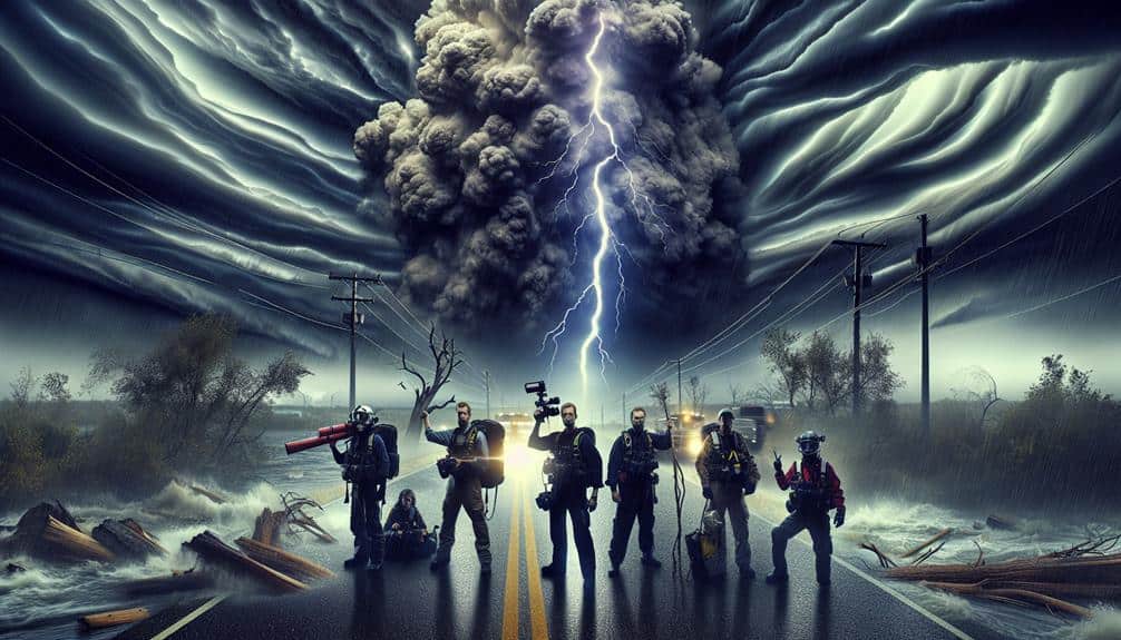
As storm chasers dealing with the intricacies of climate change, we must adopt innovative strategies to accurately track and safely navigate increasingly unpredictable storm patterns. We analyze historical data and climate models to understand these changes, leveraging AI prediction models and real-time data from satellite imaging and radar systems. Collaborating with meteorologists enhances our forecasts further, while strong safety protocols and immediate alert systems are essential for risk management. Utilizing drones for remote monitoring and building community networks guarantees thorough data collection and resource sharing. Explore how these strategies enhance our ability to predict and respond to storms effectively.
Key Points
- Utilize AI prediction models and high-definition radar for accurate real-time storm tracking.
- Collaborate with meteorologists for enhanced risk assessments and data-driven decisions.
- Implement advanced safety protocols with real-time data analytics and automated alert systems.
- Employ drone-based sensors and remote sensing technologies for hazardous location data gathering.
Understanding New Storm Patterns
As storm chasers, we've had to adapt our methodologies to account for the increasingly erratic and intense storm patterns driven by climate change. The altered storm behavior greatly impacts our prediction accuracy, necessitating a deeper understanding of atmospheric dynamics.
By analyzing historical data and current climate models, we can better anticipate the deviations in storm trajectories and intensities caused by rising global temperatures.
Climate impact is a critical factor in our risk assessment protocols. With higher sea surface temperatures and more moisture in the air, storms now develop more rapidly and unpredictably. This volatility demands that we refine our prediction models, incorporating real-time data to adjust our forecasts.
We've found that traditional models often fall short in capturing the nuances of these evolving patterns, prompting us to integrate more sophisticated algorithms.
Our focus isn't just on tracking storms but also on understanding the broader climate-driven shifts. We assess how increased frequency and severity of storms correlate with long-term climate trends.
Leveraging Advanced Technology
To improve our storm tracking accuracy, we're harnessing cutting-edge technology including drone surveillance, advanced radar systems, and machine learning algorithms. Our AI prediction models analyze vast datasets, allowing us to forecast storm paths with unparalleled precision. By integrating these models with real-time data from drone surveillance, we can capture high-resolution images and atmospheric measurements directly from the storm's core. This detailed data greatly enhances our predictive capabilities.
Satellite imaging plays an essential role in weather mapping, providing us with a macro view of storm development and movement patterns across large geographical areas. These satellite images, combined with ground-based radar systems, offer a thorough picture of storm dynamics. This dual approach enables us to cross-verify data, ensuring accuracy and reliability in our predictions.
Additionally, our machine learning algorithms continuously refine themselves by learning from past storm data. This iterative process enhances the algorithms' ability to predict future storm behaviors under changing climate conditions.
The integration of these advanced technologies not only maximizes our efficiency but also empowers us to make informed decisions swiftly. By leveraging these tools, we maintain the freedom to explore and study storms safely and effectively, pushing the boundaries of meteorological research.
Enhancing Safety Protocols
We're overhauling our safety procedures by integrating real-time data analytics and automated alert systems to guarantee swift response during storm chasing operations. This method enhances our ability to conduct precise risk evaluations, minimizing exposure to dangerous conditions. By utilizing advanced telemetry and geospatial mapping, we can pinpoint storm paths with exceptional accuracy.
Our emergency response framework is now merged with machine learning algorithms that predict potential storm behaviors. These algorithms analyze meteorological data in real-time, providing us a thorough understanding of evolving storm dynamics. This allows for quick adjustments in our chase routes, ensuring we maintain a safe distance from the storm's core.
Furthermore, automated alert systems are essential to our revamped protocols. These systems send instant notifications about sudden changes in storm intensity or direction, enabling us to make informed decisions without delay. This immediate feedback loop is vital for safeguarding our team and equipment.
We also utilize drone technology to gather high-resolution data, enhancing our situational awareness. The drones' live feed is instrumental in refining our risk evaluation processes. By leveraging these innovations, we not only maximize our operational efficiency but also maintain the highest safety standards in our storm chasing endeavors.
Collaborating With Meteorologists
Partnering closely with meteorologists, we leverage their expertise and advanced forecasting tools to enhance the accuracy of our storm tracking and risk assessments. By integrating their precise weather models, we gain a thorough understanding of storm patterns, enabling us to make data-driven decisions in real-time. This collaboration greatly boosts our forecasting accuracy, ensuring we're always one step ahead.
Effective communication strategies between our teams are vital. We maintain constant contact with meteorologists through dedicated channels and regular briefings. This guarantees that any updates on storm developments are swiftly relayed and acted upon. These streamlined communication methods are pivotal in refining our risk assessment processes.
In the field of emergency response, our partnership with meteorologists proves invaluable. Their timely insights allow us to anticipate hazardous conditions and deploy necessary resources proactively. By understanding potential storm impacts, we can better prepare and protect both ourselves and the communities we serve. This proactive approach not only enhances our operational efficiency but also reinforces our commitment to safety.
Fostering these relationships empowers us to navigate the intricacies of storm chasing in a changing climate, offering us the freedom to pursue our passion while minimizing risks.
Utilizing Real-Time Data

We can enhance our storm-chasing strategies by leveraging advanced tracking systems, mobile weather stations, and immediate alert notifications.
These tools provide precise, real-time data that allow us to make informed decisions quickly.
This approach not only increases our efficiency but also greatly improves safety in rapidly changing weather conditions.
Advanced Tracking Systems
Leveraging cutting-edge state-of-the-art tracking systems, storm chasers can now utilize real-time data to accurately predict storm paths and intensities. With the integration of high-definition radar, satellite imagery, and sophisticated algorithms, our storm prediction capabilities have reached unprecedented precision. These systems enable us to monitor atmospheric conditions continuously, providing immediate updates on storm development and movement.
The core of these tracking systems lies in their ability to assimilate vast datasets from multiple sources. By processing this data in real-time, we can identify key indicators of storm formation, such as wind shear, humidity levels, and temperature gradients. These insights empower us to make informed decisions, reducing response times and enhancing safety measures.
Moreover, the real-time data provided by state-of-the-art tracking systems allows for dynamic adjustments to our strategies. We can pivot our routes based on the latest storm trajectories, ensuring we remain in the best positions for observation while minimizing risks.
This flexibility is optimal for those of us who embrace the freedom to explore nature's most powerful phenomena.
Mobile Weather Stations
Mobile weather stations, equipped with advanced sensors and real-time data transmission capabilities, revolutionize our ability to capture and analyze localized atmospheric conditions directly from the field. These stations provide us with unparalleled data accuracy, enabling us to enhance our remote monitoring efforts substantially. With the flexibility for rapid deployment, we can quickly position them in critical locations to collect live updates, ensuring that we're always ahead of the storm.
Key advantages of mobile weather stations include:
- Data accuracy: High-precision sensors collect detailed atmospheric data, allowing us to make informed decisions.
- Remote monitoring: Continuous data transmission means we can monitor conditions from afar, increasing our safety and efficiency.
- Rapid deployment: Lightweight and portable, these stations can be set up swiftly, providing immediate insights.
Immediate Alert Notifications
Harnessing the power of real-time data from mobile weather stations, immediate alert notifications enable storm chasers to receive critical updates at the very moment atmospheric conditions change. By leveraging these notifications, we gain an early warning system that's crucial for timely decision-making and emergency response.
Real-time data integration allows us to monitor evolving weather patterns with unparalleled precision. As storm chasers, we need to act swiftly, and immediate alerts make that possible by providing instantaneous updates on wind speed, barometric pressure, and temperature fluctuations. This data-driven approach guarantees we're always a step ahead, capable of adjusting our strategies on the fly to maximize safety and data collection.
Moreover, these notifications are invaluable for coordinating with local emergency response teams. When severe weather conditions escalate, having a reliable early warning system means we can alert authorities and communities faster, potentially saving lives and reducing property damage. Our commitment to using state-of-the-art technology not only advances our research but also underscores our role in supporting broader public safety efforts.
In a climate increasingly marked by unpredictability, real-time alert notifications aren't just a convenience—they're a vital tool. They empower us to chase storms effectively while upholding the highest standards of safety and responsibility.
Adapting to Rapid Changes
We need to continuously monitor weather patterns and integrate real-time data to adapt to rapid changes effectively.
Leveraging advanced technology, such as high-resolution satellite imagery and machine learning algorithms, enhances our predictive capabilities.
Monitoring Weather Patterns
As storm chasers, we must leverage advanced meteorological tools and real-time data analytics to adapt swiftly to the increasingly volatile weather patterns driven by climate change. The efficacy of our weather monitoring and storm tracking strategies hinges on our ability to analyze and interpret a plethora of data from multiple sources. By doing so, we can anticipate rapid changes and make informed decisions in the field.
To stay ahead of these dynamic weather patterns, we focus on:
- Real-time satellite imagery: By accessing up-to-the-minute satellite images, we can monitor storm development and movement with high precision.
- Doppler radar data: This technology allows us to track precipitation intensity and storm structure, providing critical insights into storm severity and potential paths.
- Meteorological models: Utilizing advanced weather prediction models helps us forecast storm trajectories and intensity, enabling proactive planning.
Utilizing Advanced Technology
To adapt to the rapid changes in weather patterns, our team utilizes cutting-edge technologies like drone-based atmospheric sensors and AI-driven data analytics to enhance our storm tracking capabilities.
By leveraging drone technology, we can gather real-time data from locations too hazardous or remote for human access. These drones are equipped with advanced remote sensing instruments, enabling us to capture high-resolution images and detailed atmospheric readings.
The integration of AI in our data analytics processes allows us to sift through vast datasets swiftly. Machine learning algorithms identify patterns and anomalies that could indicate severe weather developments. This capability not only improves the accuracy of our forecasts but also enables us to predict storm paths with greater precision.
Making use of remote sensing technologies, we can monitor atmospheric conditions at various altitudes, capturing critical data on temperature, humidity, and wind speed. This multi-layered approach guarantees we've a thorough understanding of the evolving storm systems.
Building Community Networks

Why is it important for storm chasers to build strong community networks to enhance data collection and safety measures?
As storm chasers, we often navigate unpredictable and risky conditions. By creating robust community networks, we ensure better community support and emergency response. These networks facilitate mutual assistance and resource sharing, vital for our safety and data accuracy.
Community networks help us:
- Boost emergency response: Coordinated efforts with local authorities and fellow storm chasers improve our ability to respond swiftly during emergencies.
- Share resources effectively: We can pool our equipment, tools, and data, reducing redundancy and maximizing our collective capabilities.
- Provide community support: Local communities benefit from our timely, accurate information, which helps them prepare and stay safe during severe weather events.
Frequently Asked Questions
How Do Storm Chasers Fund Their Expeditions?
Let's cut to the chase: we fund our expeditions through diverse funding sources and sponsorship opportunities. Effective budget management and strategic fundraising events are key. We meticulously plan to guarantee every dollar maximizes our storm-chasing potential.
What Are the Best Vehicles for Storm Chasing?
For storm chasing, we prefer SUVs or trucks with reinforced frames for vehicle safety. Essential equipment includes weather radar, GPS, and communication tools. These vehicles offer robustness and space for all necessary equipment, ensuring best safety and functionality.
Are There Insurance Options for Storm Chasers?
Yes, there are insurance options for storm chasers. We need to explore coverage options that specifically address our distinct risk management needs, ensuring thorough protection against severe weather events and potential equipment damage.
How Do Amateur Storm Chasers Get Started?
To get started as amateur storm chasers, we should prioritize safety precautions and leverage technology tools like weather apps, GPS, and communication devices. Understanding weather patterns and participating in training courses also enhance our storm-chasing capabilities effectively.
What Legal Restrictions Do Storm Chasers Face?
Much like Icarus, we face liability concerns and environmental impact. Safety regulations and privacy issues restrict us, but precise navigation and adherence to data-driven guidelines guarantee we chase storms responsibly, preserving our freedom to explore.