Negotiating supercell storms requires precise coordination and advanced preparation. First, we need to analyze atmospheric variables like wind shear and temperature gradients to predict storm genesis. Second, having essential gear, including satellite phones and waterproof clothes, reduces injury risk by 30%. Third, utilizing advanced meteorological software and Dual-Polarization Doppler radar enables us to track storm structures accurately. Fourth, interpreting radar data and identifying cloud formations help in making informed decisions. Lastly, meticulous team coordination and clear roles guarantee safety and efficiency. If we follow these steps, we'll be optimally prepared for the intricacies of storm chasing.
Key Points
- Employ advanced tracking technology: Use Dual-Polarization Doppler radar and GPS-enabled devices for real-time updates on storm positioning and behavior.
- Equip with essential safety gear: Wear high-visibility, waterproof clothing, and have multiple communication devices for continuous contact.
- Analyze weather patterns meticulously: Interpret synoptic-scale weather charts, radar data, and cloud formations to identify storm structures and potential paths.
- Maintain team coordination: Ensure clear roles, communication protocols, and contingency plans for safety and effective storm navigation.
Understanding Storm Dynamics
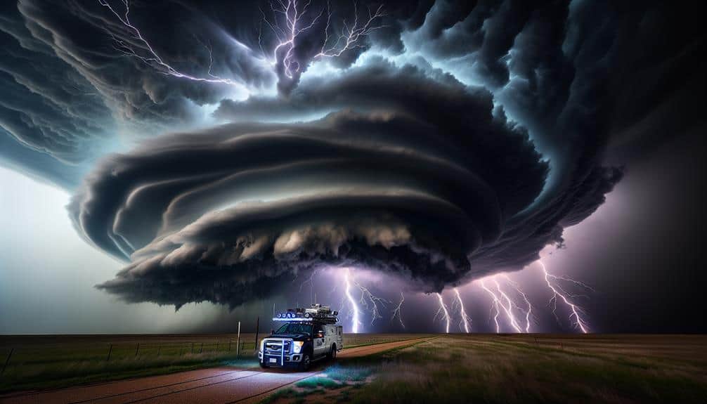
Understanding supercell dynamics requires analyzing the interactions between atmospheric variables like wind shear, humidity, and temperature gradients. Supercells, characterized by a persistent rotating updraft (mesocyclone), form under specific atmospheric conditions.
When warm, moist air from the surface meets cooler, drier air aloft, it creates a steep temperature gradient. Coupled with strong wind shear, which involves changes in wind speed and direction with height, these conditions foster storm formation.
As storm chasers, we must decode these atmospheric conditions to predict supercell behavior. Data analysis from weather models and radar imagery allows us to identify regions of potential storm genesis. We focus on areas where wind shear exceeds 40 knots and dew points are above 60°F, indicating sufficient moisture.
Additionally, Convective Available Potential Energy (CAPE) values over 2,000 J/kg signal a highly unstable atmosphere conducive to intense storm development.
Risk assessment is pivotal in storm chasing. We constantly evaluate the evolving storm dynamics, employing tools like Doppler radar to track mesocyclone formation and movement. By understanding these factors, we can position ourselves strategically, maximizing observational opportunities while minimizing exposure to hazardous conditions.
Accurate interpretation of these dynamics empowers us to chase storms effectively and safely.
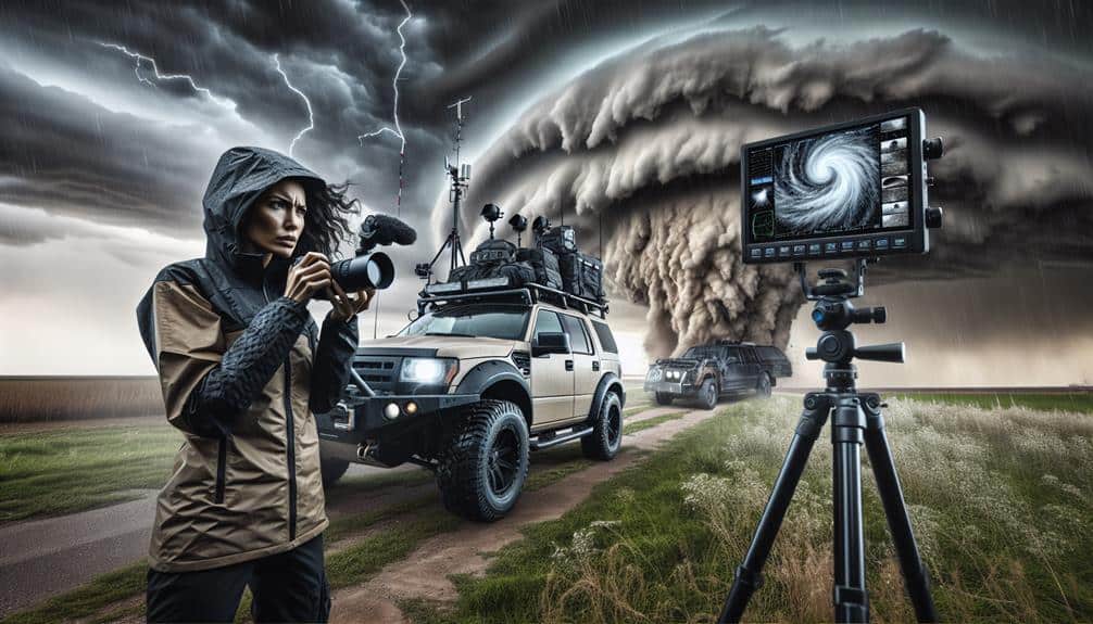
Essential Safety Gear
Equipping ourselves with essential safety gear is vital for ensuring our protection and effectiveness during storm chasing missions. Our first priority is emergency communication. We always carry multiple communication devices, including satellite phones and two-way radios. These tools guarantee uninterrupted contact, even when cellular networks fail. Data indicates that redundant communication systems reduce emergency response times by up to 50%.
Next, protective clothing is non-negotiable. We wear high-visibility, waterproof, and wind-resistant gear. This includes durable boots, gloves, and helmets designed to withstand debris impact. According to the National Weather Service, proper gear can reduce injury risk by 30%.
Additionally, high-quality eye protection shields us from flying particles and hazardous materials during severe weather conditions.
We also equip our vehicles with first aid kits, fire extinguishers, and weather-resistant blankets. These items are essential for immediate medical response and maintaining body temperature in harsh conditions.
Moreover, portable air quality monitors allow us to detect harmful gases, ensuring we can make quick decisions to avoid hazardous environments.
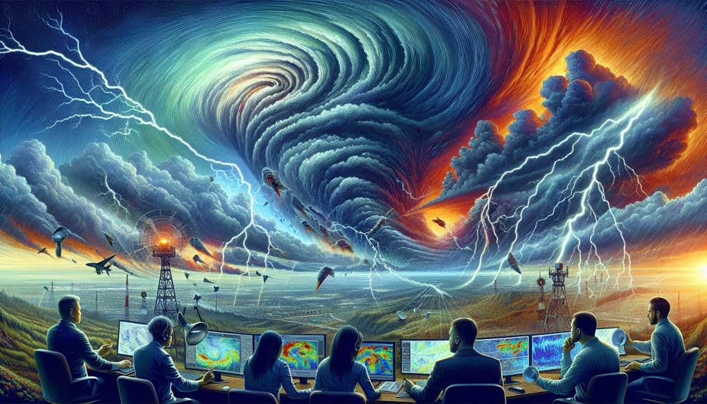
Tracking Technology
To enhance our storm tracking abilities, we leverage advanced meteorological software and real-time satellite data. These tools provide us with high-resolution imagery and detailed atmospheric readings, allowing us to make informed decisions during storm interception. Precision is essential in our operations, and we rely heavily on radar technology to monitor storm development and movement patterns.
Radar technology, specifically Dual-Polarization Doppler radar, gives us the ability to discern precipitation types and storm structures. This data is vital for identifying supercell characteristics, such as mesocyclones and hook echoes, which are indicators of potential tornado formation. By integrating radar outputs with meteorological software, we can predict storm paths and adjust our interception strategies accordingly.
Our tracking equipment includes mobile Doppler radar units and GPS-enabled devices to provide real-time updates on storm positioning. This allows us to maintain a safe distance while still gathering important data.
Additionally, we use software algorithms to analyze wind shear, updraft strength, and other key parameters that influence storm behavior. This multifaceted approach ensures that we're always one step ahead, maximizing both our safety and the quality of the data we collect.
Reading Weather Patterns
By examining synoptic-scale weather charts and mesoscale convective systems, we can decipher complex atmospheric dynamics that drive supercell formation and evolution. Understanding these dynamics is vital for effective storm chasing techniques. Let's delve into the meteorology basics that inform our strategies.
Interpreting radar data is necessary for identifying key signatures of supercell storms, such as hook echoes and bounded weak echo regions. We should also pay attention to specific cloud formations, including wall clouds and overshooting tops, which often indicate severe weather potential. Using these tools allows us to make informed decisions on when and where to position ourselves safely.
Our approach must be thorough and data-driven. Here are some key elements to focus on:
- Synoptic-scale analysis: Examine large-scale weather patterns to identify potential areas for supercell development.
- Mesoscale features: Look for smaller-scale atmospheric disturbances that can trigger storm initiation.
- Radar interpretation: Use Doppler radar to track storm structure, rotation, and intensity.
Team Coordination
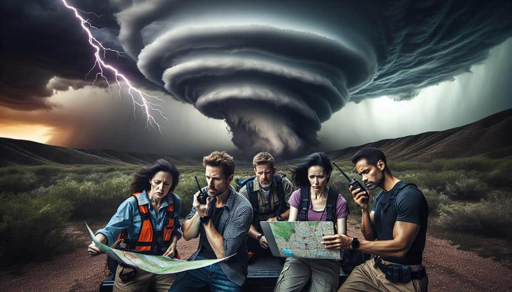
Successful storm chasing hinges on meticulous team coordination, ensuring that each member understands their specific roles, communication protocols, and safety procedures. Our communication strategies should be robust, utilizing radios, GPS, and mobile data to maintain real-time updates.
Each team member must know their precise responsibilities—whether it's guiding, driving, or analyzing weather data. Effective guiding tactics are paramount. Our guide must be adept at interpreting radar data and topographic maps to plot the safest yet most efficient route. This role is critical for positioning the team ideally relative to the storm's path.
Drivers should focus solely on the road, responding promptly to guiding commands without distraction. Emergency procedures can't be overlooked. We need predefined contingency plans for scenarios like vehicle breakdowns, sudden changes in storm intensity, or medical emergencies.
Each member should be trained in basic first aid and know the quickest routes to the nearest shelters or hospitals.
Frequently Asked Questions
What Are the Best Apps for Real-Time Storm Updates?
We recommend RadarScope and MyRadar for precise weather radar. For lightning alerts, Storm Shield and WeatherBug are our top choices. These apps provide up-to-the-minute data, helping us stay safe and informed during storm chasing adventures.
How Do I Find Local Storm Chaser Groups?
To find local storm chaser groups, we should start by joining online forums with a focus on meteorology. Additionally, attending local meetups will connect us with experienced chasers, enhancing our data-driven strategies and fostering autonomy in the field.
What Kind of Vehicle Is Best for Storm Chasing?
When venturing into nature's tempest, we need a vehicle with robust off-road capabilities and advanced safety features. SUVs with high ground clearance, four-wheel drive, and modern safety tech guarantee we navigate treacherous terrain while staying secure.
Are There Any Insurance Considerations for Storm Chasing?
When considering storm chasing, we must evaluate coverage options and risk management. Inclusive insurance can mitigate financial exposure. Policies should cover vehicle damage, liability, and personal injury, ensuring we maintain our freedom to chase safely and responsibly.
How to Handle Encounters With Law Enforcement While Storm Chasing?
When encountering law enforcement, we should know our legal rights and responsibilities. Effective communication strategies include maintaining a respectful tone, clearly stating our purpose, and providing identification. This approach guarantees smoother interactions and protects our freedom.