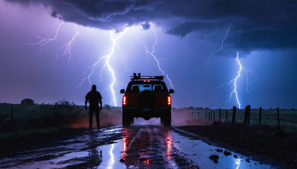
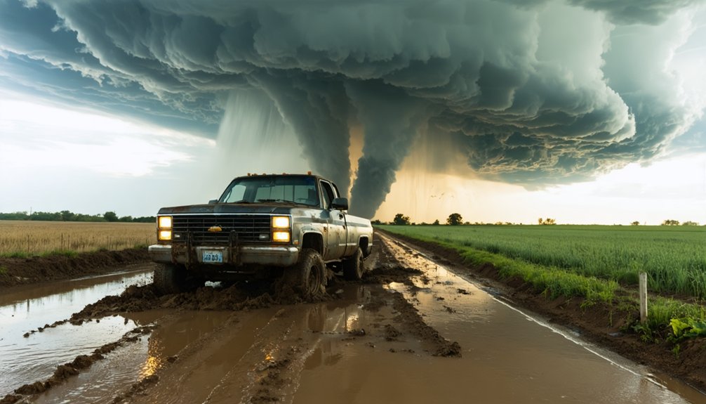
You’ll face more danger from road hazards than tornadoes when chasing storms—wet pavement causes 870 deaths yearly while fog produces the highest fatality rate at 17.3 deaths per 1,000 crashes. That’s why you must identify every bridge, dead-end, and unpaved surface before positioning yourself 3-5 miles right of the storm’s motion vector. Map multiple exits from west, south, and east directions, because when that wall cloud starts rotating and visibility drops, your pre-planned escape routes become your only lifeline to safety.
Key Takeaways
- Pre-planned escape routes prevent trapping when storms intensify unexpectedly or shift direction during active chasing operations.
- Multiple exit paths from west, south, and east positions ensure rapid evacuation when tornadoes approach your observation location.
- Road hazards like wet pavement and limited visibility cause more chaser deaths than tornadoes, demanding planned safe routes.
- Situational awareness failures during high-stress moments require immediate activation of pre-established escape protocols for survival.
- Mapping infrastructure limitations including single-bridge crossings and dead-ends prevents entrapment in high-risk chase positions.
The Real Dangers Storm Chasers Face on the Road
Why do more storm chasers die in car accidents than from the very tornadoes they pursue? The statistics reveal a harsh reality: 14 chasers have died in vehicle accidents compared to only 5 from tornadoes.
Your freedom to chase comes with serious road-based risks—wet pavement causes skids, reduced visibility limits reaction time, and extensive mileage increases fatigue-related errors. You’ll cover 3,000-4,000 miles weekly, often crossing multiple states in single operations.
Large hail breaks windshields at critical moments, compromising structural integrity during evasive maneuvers. Modern radar data analysis and hail detection systems help you identify threats, but simultaneous exposure to flash floods, lightning, and precipitation compounds dangers.
Understanding these road hazards isn’t optional—it’s essential for survival. Reckless “yahoos” without proper meteorological knowledge continue to take dangerous risks that give responsible chasers a bad reputation. As experienced chaser Pecos Hank emphasizes, driving is the most dangerous aspect of storm chasing, making you far more likely to be involved in a traffic accident than struck by a tornado or hail.
Understanding Escape Route Fundamentals Before the Chase
Before you ever start your vehicle on chase day, your survival depends on meticulous escape route planning that accounts for every possible storm evolution. Study your target location’s infrastructure—single-bridge crossings, unpaved roads that become mud traps, and dead-end routes that’ll pin you against advancing circulation. Route redundancy isn’t optional; map multiple exits from west, south, and east before committing to any position.
Identify alternate access points including potential shelters and paved east-west corridors that won’t trap you during rapid storm shifts. Check cell phone coverage maps to maintain communication when decisions turn critical. Review local restrictions on Native American lands that could block escape paths. Evaluate gravel roads as last-resort westward exits when tornadoes approach. Download Radarscope for real-time NEXRAD Level 3 radar data that shows GPS positioning and storm movement as conditions evolve. Avoid getting trapped between the storm and roads, especially on the north side where visibility and escape options become severely compromised. Your pre-chase map should highlight every turn, every bridge, every option—because reactive positioning gets chasers killed.
Optimal Storm Positioning for Safe Visibility and Exit Options
Your ideal position lies 3-5 miles to the right of the storm’s motion vector—typically southeast when storms track northeast at 35 mph—which provides critical visual access to the updraft base while maintaining clear escape routes east or southeast. You’ll avoid the high-risk notch region and rotating wall clouds by staying right of the mean motion, as supercells rarely execute hard right turns that would intersect your path.
This positioning strategy eliminates the fatal trap of left-side placement, where you’d face the hail core, tornado circulation, and zero viable escape options to your north or west. Larger storms like hurricanes and supercells move more predictably than smaller systems, making their motion vectors more reliable for positioning decisions. Before committing to any position, check SPC mesoanalysis helicity maps to verify the latest storm motion forecast and confirm your planned location keeps you ahead of the mean storm vector.
Southeast Positioning Strategy Benefits
When storm chasing in the Southeast, positioning yourself to the south and east of your target storm provides critical advantages that Plains chasers often take for granted. This strategy maximizes your freedom to maneuver while maintaining visual contact with developing storms.
Key benefits of southeast positioning include:
- Extended observation windows from elevated vistas before storm arrival
- Multiple route selection through curvy road networks for rapid exits
- Reduced trapping risks from unexpected storm shifts in unstructured environments
- Optimal radar-guided intercepts compensating for tree and hill obstructions
Your terrain awareness becomes paramount when traversing Dixie Alley’s challenging geography. Pre-positioning near high vistas before warnings develop secures you’ll have escape routes available when storms intensify. Understanding storm motion and speed helps you anticipate how quickly conditions may deteriorate and when to execute your exit strategy. This approach balances safety with the extended observation time needed for capturing significant weather events without core-penetrating risks. The increased population density in the Southeast also elevates traffic accident risks, making predetermined exit strategies essential for maintaining both mobility and safety during active chase scenarios.
Avoiding Rotating Wall Clouds
Proper storm positioning requires you to identify rotating wall clouds before committing to an observation location. You’ll recognize these formations by their lowered base beneath the rain-free region, with vigorous spinning indicating intensifying conditions.
Watch for rotating wall cloud characteristics like clouds moving left-to-right at the front and opposite at the rear—this signals dangerous rotation. Position yourself southeast of the updraft zone where you’ll maintain clear sight lines and multiple escape routes. Don’t trap yourself near the precipitation core where visibility drops and exit options disappear.
Understanding tornado development patterns means recognizing that significant rotation and vertical motion can precede touchdowns by minutes. When you observe persistent rotation with downward funnel extension, you’ve got limited time to reposition or evacuate entirely. The twisting, rotating movement of the wall cloud serves as the most obvious sign of a severe storm developing, demanding immediate action to secure your position or retreat. Be aware that cold outflow winds can signal a storm’s dissipation, as these winds expelled from dying supercells reduce the tornado threat and may indicate safer conditions ahead.
Maintaining Clear Escape Routes
Strategic positioning during a storm chase demands that you establish and maintain multiple escape routes before committing to any observation point. You’ll need continuous traffic flow monitoring and awareness of weather station positions to verify your buffer zone remains intact. Your freedom to maneuver depends on road quality and visibility—prioritize paved highways over residential streets.
Essential positioning requirements include:
- Buffer maintenance: Keep measurable distance between you and the storm’s motion vector
- Primary route: North-northeast on major highways for reliable exit capability
- Backup plan: Secondary paved road avoiding the tornado’s projected path
- Visibility confirmation: Clear sightlines to assess storm behavior and escape options
Don’t compromise your buffer zone by drifting too close. Radar data combined with weather station positions helps you calculate ideal standoff distances while maintaining visual contact with the updraft region.
Highway Hazards That Claim More Lives Than Tornadoes
While storm chasers rightfully fear tornadoes’ destructive power, the highway itself poses a statistically deadlier threat. Hazardous weather conditions you’re pursuing kill nearly 6,000 people annually on roads—dwarfing the 70 tornado fatalities nationwide. Wet pavement alone accounts for 870 deaths yearly, while fog produces the highest fatality rate at 17.3 deaths per 1,000 crashes. You’ll face elevated risks on interstates, where wet road crashes occur 17.2% more frequently than other routes.
Urban traffic patterns compound these dangers when you’re traversing escape routes during active chases. Icy roads claim 407 lives annually—exceeding Midwest tornado deaths. When you’re monitoring developing storms, remember that your vehicle’s interaction with weather-compromised surfaces presents immediate, quantifiable danger. Your situational awareness must extend beyond the supercell to the asphalt beneath you.
Pre-Chase Planning: Maps, Coverage, and Terrain Analysis
Successful storm chasing begins hours before you turn the ignition key, when you’re studying road networks across your target area. You’ll analyze mesoscale discussions alongside Verizon 4G and NOAA NEXRAD coverage maps, ensuring communication reliability when you’re intercepting.
Real time radar updates demand you’ve already identified escape routes from rural dirt roads and narrow terrain-limited paths.
Your ideal routing analysis must account for:
- Coverage gaps where NEXRAD radar and cellular signals fade
- Terrain constraints including flood zones requiring higher ground access
- Road network density determining your staging position flexibility
- Emergency shelter locations mapped against storm trajectories
Integrate StormCenter’s 24-hour tracking with detailed road maps, validating each potential intercept point offers multiple exits. Pre-chase coordination separates successful chasers from those who’ll find themselves trapped when conditions deteriorate.
Rural Versus Urban Escape Strategies and Limitations
Your escape strategy fundamentally changes based on whether you’re chasing across the flat, gridded roads of the Great Plains or traversing the tree-lined, winding routes through southeastern terrain. Plains chasers enjoy 360-degree visibility and multiple bailout routes through structured storms, while southeastern pursuits demand radar dependence due to hills and trees blocking tornado detection until dangerous proximity.
Urban areas introduce debilitating traffic congestion—El Reno’s 2.6-mile-wide tornado trapped hundreds bumper-to-bumper on narrow southbound roads. Rural road obstructions in wooded regions eliminate visual confirmation, forcing you to trust instruments over eyes.
Unexpected weather dynamics, particularly rear-flank downdrafts in populated zones, can trap your vehicle among panicked locals and convergent chasers. Know your terrain’s limitations before positioning, because blind curves and chaser crowds eliminate your freedom to maneuver safely.
Managing Chaser Convergence and Heavy Traffic Situations
On high-risk chase days, you’ll encounter traffic densities that directly compromise your escape route viability and maneuverability. Chaser convergence creates road hazards equivalent to severe meteorological threats—congested intersections prevent critical turns, vehicle clusters reduce your ability to maintain safe speeds, and concentrated traffic on limited road networks eliminates backup escape options.
You must weight traffic conditions as seriously as storm dynamics when evaluating whether your current position maintains adequate safety margins.
Traffic Density on High-Risk Days
How quickly can road conditions deteriorate when hundreds of chasers converge on the same severe weather target? On high-risk days drawing 14-34 chase opportunities per season, you’ll face density levels matching rush hour traffic. Historical convergence trends since 2005 show exponential growth, transforming rural routes into parking lots. Understanding regional road impacts proves critical for maintaining mobility.
Traffic density peaks when:
- Annual tornado counts reach 800-1200 events, concentrating resources
- Fast-moving storms exceed 60 MPH through populated Eastern Cornbelt zones
- Interstate boundaries like I-70 and I-90 funnel multiple convergence points
- Local media encourages civilian participation, multiplying vehicle counts
You’ll need pre-planned escape routes before engaging any target. Storm motion often outpaces your ability to reposition through congested areas, especially near population centers like Indianapolis where multiple highways intersect.
Road Safety During Convergences
When multiple chase teams target the same supercell, maintaining road safety requires deliberate coordination and defensive driving protocols. You’ll need coordinating communications with other teams by logging your positions and intentions, ensuring everyone knows traffic flow patterns.
Never stop on main roads—pull completely into side roads or parking lots for viewing. Keep vehicles moving when trailing chasers approach, and speed up collectively when rain-wrapped circulations threaten stationary lines.
Avoiding obstructions means staying clear of driveways, fire lanes, and intersections while maintaining awareness of vehicles behind you. Use a dedicated driver separate from filming duties, keep lights on during low visibility, and respect law enforcement access.
During convergences, your situational awareness must extend beyond radar screens to rapidly deteriorating road conditions and approaching hazards.
Vehicle Vulnerabilities in Severe Weather Conditions
Understanding your vehicle’s physical limits can mean the difference between a successful chase and a catastrophic rollover. Your sedan becomes vulnerable to upset at wind speeds between 51-67 m/s (115-150 mph), while minivans withstand slightly higher forces at 58-80 m/s.
Vehicle load factors shift dramatically when winds strike at 45° and 135° angles from your front—these are your critical vulnerability zones.
Research shows impressive stability under real conditions:
- 72% of vehicles remained upright at F1/F2 damage sites
- 50% stayed grounded even at F3/F4 locations
- Storm-chase vehicles endured 47 m/s winds without incident
- Wind tunnel tests confirm tire lift at critical angles
High wind maneuverability decreases considerably with suspension tilt beyond 5°. You’ll maintain superior stability compared to mobile structures, but knowing these thresholds protects your freedom to chase another day.
Maintaining Situational Awareness During Active Pursuits
Your ability to perceive, understand, and respond to rapidly changing storm conditions forms the cornerstone of safe chase operations. You’ll face task saturation when simultaneously monitoring radar, maneuvering, communicating, and observing—especially during nighttime pursuits when visual confirmation diminishes.
Set your ego aside and recognize when you’ve lost situational awareness; this triggers your pre-planned escape protocol. Over-reliance on radar during high-adrenaline moments leads to misinterpretation of tornado location and movement patterns.
Situational awareness failures demand immediate escape protocol activation—radar dependence during peak stress creates dangerous misreads of tornado position and behavior.
Heavy precipitation, blowing dust, and darkness demand reduced speeds to maintain peripheral awareness. Implement defensive driving by delegating non-driving tasks through effective team communication. Continuous environmental scanning requires constant head movement to track rapidly shifting tornado positions.
Address fatigue mitigation proactively—drowsy driving compounds risk during extended chases. Multiple escape routes require continuous reassessment as conditions evolve.
Frequently Asked Questions
What Should I Do if My Only Escape Route Becomes Blocked?
You’ll need to immediately reassess your position and track alternate routes using real-time radar. Monitor weather updates constantly, then execute your pre-planned backup escape route. Don’t hesitate—your freedom depends on decisive action now.
Like a pilot trusting instruments through clouds, you’ll master nighttime visibility techniques by reducing speed, using GPS with compass backup, and employing driving in low light conditions protocols—headlamps, reflective markers, and terrain features guide your independent path forward.
What Equipment Should I Carry for Roadside Emergencies During Chases?
You’ll need an emergency repair kit with tools, jumper cables, and a flashlight, plus spare tire maintenance equipment including tire iron and jack. Don’t forget water, first aid supplies, and recovery straps for self-sufficiency during remote chases.
How Can I Communicate With Other Chasers to Coordinate Safe Positioning?
Stay connected like your life depends on it—because it does. You’ll need reliable radio communication through ham or GMRS systems, plus Spotter Network integration for chase coordination. These tools guarantee you’re sharing real-time positions and threats safely.
What Are the Legal Consequences of Violating Traffic Laws While Chasing?
You’ll face fines up to $500, potential license revocation, and reckless driving charges for traffic law violations while chasing. Your legal responsibilities include obeying all traffic codes—licensing doesn’t exempt you from consequences of dangerous driving decisions.
References
- https://www.flame.org/~cdoswell/chasesums/Chase_safety.html
- https://en.wikipedia.org/wiki/Storm_chasing
- https://stormhighway.com/chasingfaq.php
- https://ultratechlife.com/blog/is-storm-chasing-out-of-control/
- https://www.wiu.edu/SevereWeather/images/presentations/How_to_Effectively_Storm_Chase.pdf
- https://www.weather.gov/oun/stormspotting
- https://stepo.ai/blog/storm-chasing-and-workplace-safety
- https://stormhighway.com/tornadoes__dangerous_storm_chasing_myth.php
- https://stormtrack.org/threads/how-does-storm-chasing-compare-to-other-high-risk-activities.30926/
- https://www.chriskridler.com/skydiary/kids/stormchasing/