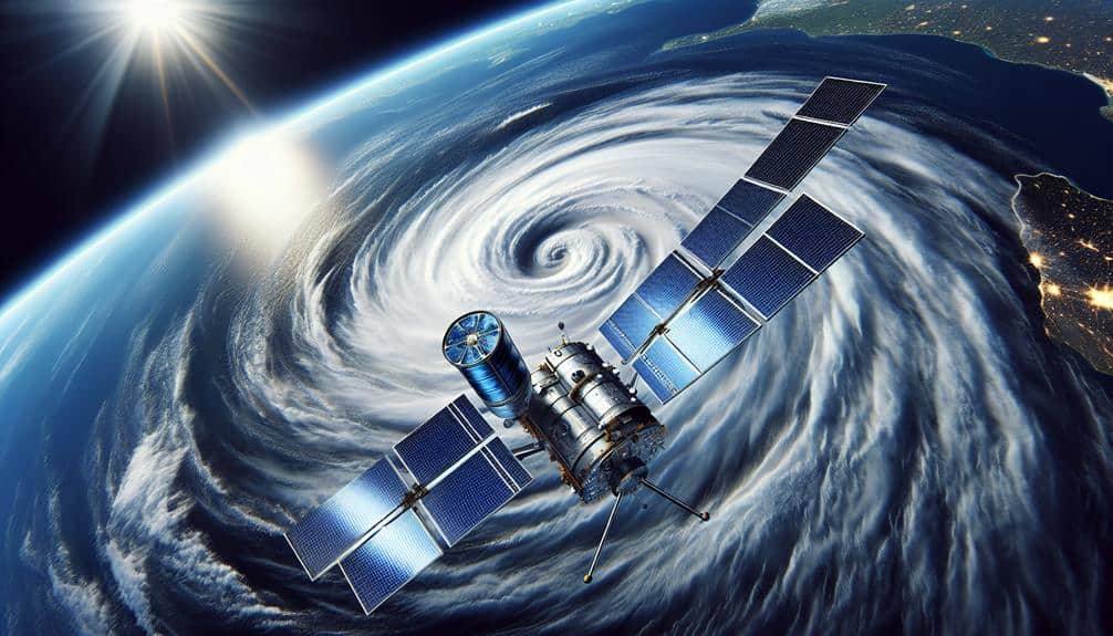
We depend on GOES-16, with its high-resolution sensors and real-time tracking, to monitor hurricanes effectively. Himawari-8's rapid multi-spectral imaging and precise spatial resolution aid in accurate storm analysis. Metop-C, part of the EUMETSAT Polar System, uses sophisticated instruments like AMSU-A and IASI for detailed environmental insights. Suomi NPP provides vital data with advanced technology including VIIRS and ATMS, enhancing both weather forecasting and climate change detection. Finally, Sentinel-6 excels in measuring sea levels, which is essential for predicting hurricane formation and trajectories. Each satellite offers unique capabilities, greatly enhancing our hurricane tracking technology. Explore these satellites' features to grasp their full impact.
Key Points
- GOES-16 provides real-time tracking and high-resolution meteorological data for effective anticipation of extreme weather events.
- Himawari-8 offers rapid scanning and high spatial resolution with multi-spectral imaging for detailed hurricane monitoring.
- Metop-C supports real-time weather forecasting with its AMSU-A and IASI instruments, offering crucial data for hurricane tracking.
- Suomi NPP's advanced technology, including VIIRS and ATMS, ensures high-resolution imagery and accurate data for severe weather tracking.
GOES-16
Launched in 2016, GOES-16 is a geostationary satellite that revolutionized hurricane tracking with its advanced imaging and atmospheric measurement capabilities. We now benefit from unprecedented weather monitoring thanks to its high-resolution cameras and sensors. This satellite provides real-time tracking of meteorological data, enabling us to anticipate and respond to extreme weather events more effectively.
GOES-16's Advanced Baseline Imager (ABI) captures images in 16 spectral bands, including two visible, four near-infrared, and ten infrared channels. This high-resolution imaging allows us to observe atmospheric phenomena with remarkable clarity. The ABI's rapid scanning capabilities mean we can track the evolution of hurricanes almost in real time, providing critical data for early warnings and disaster preparedness.
Additionally, the Geostationary Lightning Mapper (GLM) aboard GOES-16 detects lightning activity, a key indicator of storm intensity and development. It helps us understand the dynamics within severe storms and track their progression.
Himawari-8
While GOES-16 has transformed hurricane monitoring over the Atlantic, Himawari-8 serves a similar purpose for the Asia-Pacific region with its state-of-the-art meteorological instruments. This satellite provides invaluable satellite imagery and Earth observation data, enhancing our weather forecasting capabilities significantly.
Himawari-8, operated by the Japan Meteorological Agency (JMA), is positioned in geostationary orbit, allowing it to continuously monitor the same region. Its advanced sensors capture high-resolution images every 10 minutes, which is essential for tracking the rapid development of tropical cyclones.
The key features of Himawari-8 include:
- Multi-Spectral Imaging: Offers 16 different spectral bands, including visible, infrared, and water vapor channels, providing a detailed view of atmospheric conditions.
- Rapid Scanning: Capable of scanning the full disk of Earth every 10 minutes, and specific areas of interest every 2.5 minutes, ensuring timely updates.
- High Spatial Resolution: Delivers images with a spatial resolution of up to 500 meters, enabling in-depth analysis of storm structures.
- Advanced Data Processing: Utilizes sophisticated algorithms for real-time data processing, ensuring accurate and reliable meteorological data.
Metop-C
Metop-C, part of the EUMETSAT Polar System, provides important data for weather forecasting and climate monitoring through its suite of advanced instruments. By orbiting the Earth in a sun-synchronous manner, Metop-C can continuously deliver high-resolution meteorological data and environmental monitoring, which are necessary for accurate hurricane tracking.
The satellite's capabilities include the Advanced Microwave Sounding Unit (AMSU-A) and the Infrared Atmospheric Sounding Interferometer (IASI). These instruments measure temperature, humidity, and atmospheric composition, offering precise data essential for climate research. By analyzing this data, we can better predict hurricane formation, track their paths, and anticipate their intensity.
Metop-C's Global Navigation Satellite System Receiver for Atmospheric Sounding (GRAS) and Advanced Scatterometer (ASCAT) further enhance its environmental monitoring capabilities. GRAS provides data on atmospheric density and temperature by tracking signals from GPS satellites, while ASCAT measures ocean surface winds, crucial for understanding hurricane dynamics.
In essence, Metop-C equips us with a robust dataset that supports both real-time weather forecasting and long-term climate research. Its advanced technology guarantees that we've the freedom to anticipate and prepare for severe weather events, safeguarding lives and property.
Suomi NPP
Suomi NPP, a pivotal satellite in the Joint Polar Satellite System (JPSS), provides essential data for weather forecasting, climate monitoring, and environmental observations through its suite of sophisticated instruments. We rely on Suomi NPP's satellite capabilities to deliver high-resolution imagery and accurate data that enhance our understanding of atmospheric conditions and improve our environmental monitoring efforts. This satellite plays a vital role in detecting climate change and tracking severe weather events, including hurricanes.
Suomi NPP's advanced technology includes a variety of sensors and instruments, such as the Visible Infrared Imaging Radiometer Suite (VIIRS), which captures detailed images of the Earth's surface in multiple wavelengths. These instruments contribute to more precise weather forecasting and climate change detection.
Here's a breakdown of what Suomi NPP offers:
- VIIRS: Provides high-resolution imagery for weather forecasting and environmental monitoring.
- ATMS (Advanced Technology Microwave Sounder): Measures atmospheric temperature and moisture profiles.
- CrIS (Cross-track Infrared Sounder): Collects data on atmospheric temperature, humidity, and pressure.
- OMPS (Ozone Mapping and Profiler Suite): Monitors ozone levels and air quality.
Sentinel-6
Sentinel-6, an advanced satellite developed through an international collaboration, focuses on precise sea level measurements and plays an important role in monitoring climate change and ocean dynamics. By leveraging state-of-the-art altimetry technology, Sentinel-6 offers unparalleled accuracy improvements in sea level data collection. This precision is vital for understanding how rising sea levels influence hurricane intensity and frequency.
We utilize Sentinel-6's data to track variations in sea surface height with millimeter-level precision. This accuracy is achieved through innovative data collection techniques, such as dual-frequency radar altimeters and advanced GNSS radio occultation instruments. These tools enable us to capture detailed measurements of the ocean's surface, providing essential insights into ocean currents, temperature, and salinity.
The data collected by Sentinel-6 enhances our predictive models for hurricane formation and trajectory. By integrating this precise sea level data, we can better anticipate the strength and path of hurricanes, ultimately aiding in more effective emergency response and preparedness strategies.
Sentinel-6's contributions underscore the importance of continuous improvement in accuracy and data collection techniques, empowering us to make informed decisions and protect our communities from the impacts of severe weather events.
Frequently Asked Questions
How Do Satellites Predict the Intensity of Hurricanes?
Imagine satellites as our eyes in the sky. They predict storm intensity by measuring wind speeds, sea surface temperatures, and atmospheric pressure. This satellite technology empowers us to foresee and prepare for hurricanes' wrath.
What Role Do Satellites Play in Early Hurricane Warning Systems?
Satellites play an essential role in early hurricane warning systems by providing real-time satellite imagery and data for weather forecasting. They enable us to predict storm paths and intensities, enhancing preparedness and ensuring timely evacuations.
Can Satellite Data Be Accessed by the Public for Research Purposes?
Yes, we can access satellite data for public research purposes. Public accessibility to this data enhances research opportunities, providing valuable insights into hurricane patterns, improving predictive models, and contributing greatly to scientific advancements in meteorology.
How Do Satellites Differentiate Between a Hurricane and a Regular Storm?
We study satellite imagery to detect hurricane characteristics like organized convection, eye formation, and intense wind patterns. Differentiating from regular storms involves evaluating these specific attributes to accurately classify and track the hurricane's development and trajectory.
What Are the Advancements in Hurricane Tracking Technology Expected in the Next Decade?
Advancements in satellite capabilities suggest that hurricane tracking technology will be revolutionized in the next decade. Despite concerns, these innovations will provide unprecedented precision, allowing us to safeguard lives and enhance our freedom from nature's unpredictability.