We depend heavily on technology to gather real-time weather data, monitor storm structures, and guarantee effective communication during storm chasing missions. With advanced radar systems and GPS navigation, we can accurately track storm cells and optimize routes for safety and efficiency. Real-time updates from satellites and ground stations alert us to sudden weather changes, allowing quick decisions and coordination. High-resolution data collection tools, such as drones, provide vital insights into atmospheric conditions. Cutting-edge technology not only enhances our understanding of storm dynamics but also enhances forecasting accuracy and public safety. Discover how these tools revolutionize storm chasing.
Key Points
- Real-time updates: Instant alerts and continuous weather data ensure timely responses to sudden storm behavior shifts.
- Advanced radar systems: High-resolution radar provides detailed images of storm structures and dynamics, aiding accurate predictions.
- Effective communication: Satellite phones and two-way radios maintain constant contact, enabling coordinated and data-driven decisions.
- GPS navigation: Real-time tracking and route optimization ensure safe distances from storms and efficient data collection.
Real-time Weather Data
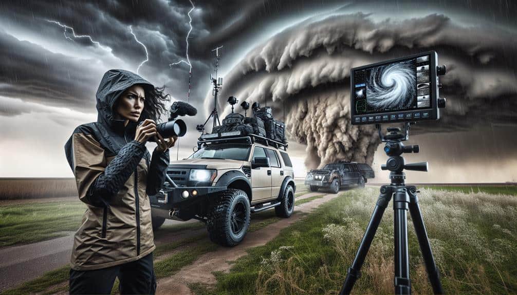
In storm chasing, having access to current weather data is necessary for making informed decisions and ensuring safety. We rely on remote monitoring systems that provide continuous updates on weather conditions. These systems enable us to track storm developments as they happen, allowing for a dynamic response to changing environments.
Remote monitoring tools, such as weather satellites and ground-based observation stations, feed us crucial data that we can analyze to predict storm paths and intensities.
Instant alerts play an important role in our storm chasing activities. When a storm's behavior shifts suddenly, instant alerts notify us immediately, giving us the valuable time needed to adjust our course or strategy. These alerts often come from sophisticated algorithms that process vast amounts of meteorological data in real-time.
By receiving these notifications, we can avoid hazardous situations and focus our efforts on the most promising storm formations.
Real-time weather data not only enhances our decision-making process but also significantly improves our safety. With precise, up-to-the-minute information, we're empowered to explore and chase storms effectively while minimizing risks. This freedom to operate safely and efficiently underscores the essential importance of advanced data systems in our field.
Advanced Radar Systems
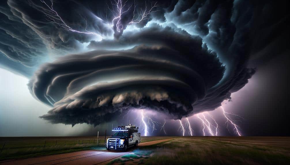
Advanced radar systems, our most crucial tools in storm chasing, provide high-resolution data that allows us to monitor storm structures and movements with exceptional precision. These systems enable us to achieve improved tracking and enhanced accuracy, which are crucial for predicting storm paths and potential impacts.
Here's how advanced radar systems benefit our storm-chasing endeavors:
- Improved Tracking: By offering detailed images of storm cells, we can track the development and movement of severe weather with greater certainty. This helps us anticipate changes and make informed decisions on the ground.
- Enhanced Precision: High-resolution radar data minimize errors in predicting storm behavior, giving us a clearer understanding of potential threats. This precision is essential for both safety and scientific research.
- Visualization of Storm Dynamics: Radar systems provide visual representations of storm dynamics, including wind patterns and precipitation intensity. This detailed view helps us study storm mechanisms and their evolution over time.
- Real-time Updates: By continuously updating data, radar systems allow us to stay informed about the most current storm conditions. This timeliness guarantees we can respond swiftly to changing situations.
In storm chasing, advanced radar systems are indispensable. They empower us with the data necessary to navigate the unpredictable nature of severe weather, ensuring our safety and the success of our missions.
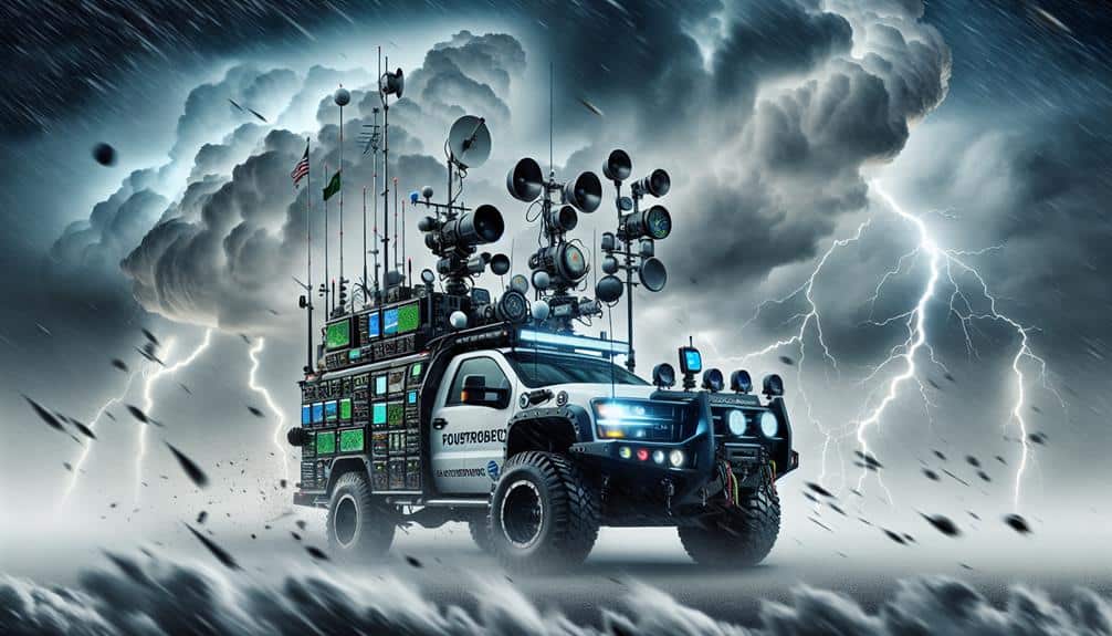
Communication Tools
While radar systems offer us detailed insights into storm dynamics, our communication tools ensure we can share this critical information in real-time with our team and other stakeholders. Effective communication tools are essential for coordinated efforts during storm chasing. By leveraging these technologies, we guarantee seamless emergency communication, which can be the difference between safety and catastrophe.
Our communication arsenal includes satellite phones, two-way radios, and advanced mobile networks. These devices enable us to stay in constant contact, even in remote areas where traditional communication networks might fail. Remote monitoring systems allow us to track storm progression and relay updates instantly. This guarantees that every team member is fully aware of the evolving situation, enhancing our operational efficiency.
Data from remote monitoring systems can be integrated with our communication tools to provide a detailed view of the storm's impact. This integration allows us to make data-driven decisions swiftly, ensuring timely and accurate dissemination of information.
The ability to communicate effectively underpins our entire storm-chasing strategy, enabling us to act decisively and maintain the safety of our team. By utilizing state-of-the-art communication tools, we empower ourselves to chase storms with confidence and precision.
Leveraging GPS navigation, we can accurately track our position relative to the storm, ensuring precise movements and optimizing our response strategy. GPS technology enables us to make real-time adjustments to our route, which is vital for both safety and effective storm chasing. By providing exact coordinates, GPS systems allow us to avoid hazardous weather conditions and navigate through complex terrains with confidence.
Here's how GPS navigation enhances our storm chasing operations:
- Real-time tracking: We can continuously monitor our location relative to the storm, allowing us to stay within safe distances and avoid direct hits.
- Route optimization: GPS helps us find the fastest and safest routes, minimizing travel time and maximizing our ability to gather critical data.
- Emergency response: In case of an emergency, GPS provides accurate location data, ensuring that help can reach us as quickly as possible.
- Collaboration: By sharing our GPS coordinates, we can coordinate with other storm chasers and emergency services, enhancing overall operational efficiency.
Using GPS navigation, we're empowered to make data-driven decisions that prioritize both our safety and our mission objectives. This technology is indispensable, offering us the freedom to explore and analyze storms effectively.
Data Collection Methods
To grasp the intricacies of severe weather, we utilize a range of data collection methods that capture essential atmospheric and environmental information. Drone surveillance has revolutionized our approach, providing high-resolution, real-time data from altitudes and angles previously inaccessible. By flying drones into the core of storms, we can measure wind speeds, temperature gradients, and humidity levels with unparalleled accuracy. These drones are equipped with advanced sensors and cameras, allowing us to gather crucial data without risking human lives.
Satellite imagery is another cornerstone of our data collection toolkit. Satellites orbiting the Earth offer a thorough view of storm systems, tracking their development and movement across vast distances. This imagery helps us identify the formation of supercells and other severe weather phenomena, enhancing our predictive capabilities. By analyzing satellite data, we can detect changes in cloud formations, precipitation patterns, and thermal anomalies, providing a macro-level perspective that complements the micro-level data collected by drones.
Together, drone surveillance and satellite imagery enable us to build a multi-faceted understanding of storm dynamics. These advanced technologies not only improve our forecasts but also empower us to make informed decisions, ultimately enhancing our ability to guarantee public safety.
Frequently Asked Questions
What Safety Measures Do Storm Chasers Follow During Severe Weather Events?
We follow strict communication protocols to stay connected and informed. We always identify emergency shelters along our route. This guarantees we can quickly find safety if severe weather conditions become too dangerous for continued pursuit.
How Do Storm Chasers Prepare Their Vehicles for Extreme Weather Conditions?
Imagine a beast armored for battle; that's our storm-chasing vehicle. We perform vehicle modifications like reinforced windows and install equipment upgrades such as radar systems. These enhancements guarantee we withstand extreme weather and gather essential data.
What Role Do Drones Play in Modern Storm Chasing?
Drones enhance our storm chasing by providing advanced drone capabilities and surveillance benefits. They collect real-time data, assess storm behavior, and improve safety, allowing us to make informed decisions while experiencing the freedom to explore extreme weather.
How Does Storm Chasing Contribute to Scientific Research and Public Safety?
Storm chasing helps us understand weather patterns through data analysis, improving public education and disaster response. By gathering real-time data, we can predict storms more accurately, ultimately enhancing public safety and empowering people to make informed decisions.
What Qualifications and Training Are Required to Become a Professional Storm Chaser?
Imagine charting storms like modern-day explorers; we need meteorology training, extensive field experience, and advanced technology. Communication skills are essential to relay data accurately. Our journey merges science and freedom, revealing nature's secrets while ensuring public safety.