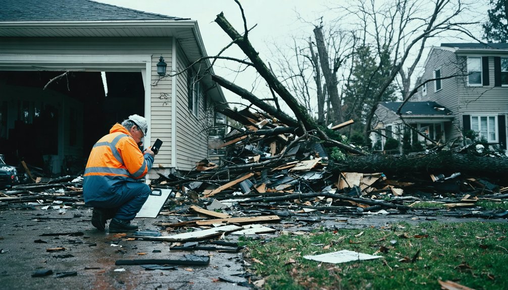
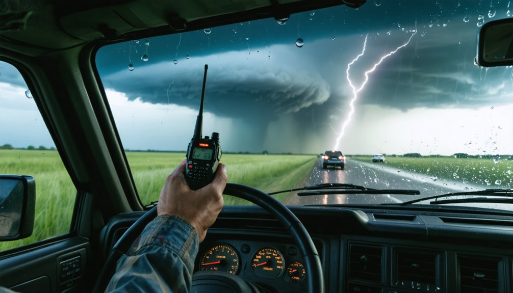
You’ll need to map primary and backup evacuation routes with at least two exit points, while monitoring NOAA Weather Radio for storm direction changes. Prepare your vehicle with verified tire pressure, brake responsiveness, and adequate fuel reserves. Use professional radar apps with reflectivity and velocity overlays to identify tornado precursors, and position yourself 3-5 miles southeast of storm systems. Establish communication protocols across chase vehicles, designate meeting points, and maintain waterproof documentation of shelter locations. The strategies below will guarantee your team’s coordinated safety during severe weather pursuits.
Key Takeaways
- Map primary evacuation routes with at least two exit points and backup paths accounting for flooding, debris, and single-bridge rural crossings.
- Monitor real-time road conditions through Drivetexas.org and NOAA Weather Radio to avoid flooded roadways and adhere to official evacuation routes.
- Establish communication protocols for multiple chase vehicles, designate specific meeting points, and maintain waterproof documentation of routes and contacts.
- Maintain 92-gallon fuel capacity and stock emergency supplies for three days per person with six-month rotation schedules.
- Position 3-5 miles southeast of storms with secure perimeter setups ensuring multiple escape routes and clear team evacuation procedures.
Establish Detailed Route Plans With Alternative Paths and Shelter Locations
Successful storm chasing evacuations require thorough route planning that accounts for rapidly changing conditions and multiple contingencies. You’ll need to map primary evacuation routes using highways and main roads while developing backup paths for flooding or debris scenarios. OSHA guidelines mandate at least two exit points, so identify these based on storm direction and real-time NOAA Weather Radio updates. Alternate navigation systems like physical maps become critical when GPS fails during power outages.
Your storm mitigation strategies should include pre-scouting less crowded paths to avoid chaser convergence and accounting for single-bridge crossings in rural areas. Document shelter locations outside impacted zones with lighting and cellular service, ensuring you’ve verified multiple addresses. Designate specific meeting points for separated groups and maintain waterproof documentation of all routes, contacts, and shelter information for immediate access.
Ensure Complete Vehicle Preparation and Adequate Fuel Reserves
Your vehicle serves as both your mobile command center and potential emergency shelter during storm chasing evacuations, making thorough preparation non-negotiable. Complete pre-departure maintenance checks of all critical systems, establish a strategic fuel supply plan that accounts for remote areas and extended operations, and equip your vehicle with weather-specific gear that addresses both breakdown scenarios and severe conditions.
These foundational steps directly determine whether you’ll maintain mobility and safety when conditions deteriorate or face dangerous stranding situations.
Pre-Departure Maintenance Checks
Every storm chasing mission depends on a vehicle that won’t fail when you’re traversing torrential rain, hail corridors, or unpaved escape routes miles from the nearest mechanic. Complete these pre-departure maintenance checks to guarantee independence from roadside assistance:
- Tires and Suspension: Verify tread depth exceeds 4/32 inches, confirm proper tire pressure, and inspect suspension components for damage assessment procedures after previous deployments.
- Brake and Fluid Systems: Test brake responsiveness, check all fluid levels including engine oil and coolant, and replace compromised belts or hoses.
- Electrical Reliability: Test battery strength with your lithium-ion power source backup, verify alternator output, and confirm all lighting systems function properly.
- Recovery Equipment: Stock tire repair tools, jumper cables, and recovery straps in organized, accessible locations for quick roadside fixes.
Emergency Fuel Supply Strategy
When storm systems develop hundreds of miles from your base location, inadequate fuel reserves can strand you in remote areas or force you to abandon intercept opportunities at critical moments. You’ll need fuel capacity enabling 600+ mile ranges to maintain operational independence across vast storm-prone regions.
Plan routes identifying fuel station availability between origin points and intercept locations, prioritizing high-volume stations that guarantee fresh seasonal blends. Your vehicle should accommodate 92 gallons for excellent extended-range capability, though standard configurations must exceed minimum requirements by 100+ miles for safety margins.
Between chase seasons, maintain fuel storage quality using stabilizer additives and circulate fresh blends through your system with 10-15 minute engine runs. Calculate reserves accounting for unpredictable tracking patterns requiring extended pursuit distances.
Weather-Ready Vehicle Equipment
How effectively can you intercept severe weather without the right equipment securing your vehicle’s operational readiness? Your chase vehicle demands systematic preparation before deployment.
Essential Weather-Ready Equipment:
- Mechanical Reliability Tools – Pack tire irons, bottle jacks, mechanics toolkits, and multimeters for roadside vehicle maintenance. These enable self-sufficiency when commercial help isn’t available.
- Recovery Systems – Carry recovery straps, tow straps, jumper cables, and lithium-ion jump starters. You’ll unstick yourself from muddy fields without waiting for assistance.
- Communication Arrays – Install GPS navigation, cell boosters, two-way radios, and weatherband receivers. Reliable intel keeps you mobile and aware.
- Documentation Gear – Mount dashcams and maintain charged cameras with hail measurement tools. Document conditions while pursuing storms.
Prioritize strategic equipment storage that maintains accessibility during rapid deployments. Your independence depends on thorough vehicle maintenance protocols.
Utilize Professional-Grade Real-Time Radar Imagery Systems
You’ll need specialized radar applications like RadarScope Pro or Baron Mobile Threat Net to track storm intensity, rotation, and movement with sufficient detail for evacuation decisions.
Select apps that integrate multiple data sources including reflectivity, velocity radar, and lightning overlays to identify tornado precursors such as hook echoes and mesocyclone signatures.
Understand that radar imagery updates every 4-6 minutes, creating critical gaps where storms can intensify or change direction between scans, requiring you to account for this delay in your evacuation timing.
Choose Specialized Radar Apps
Professional-grade radar apps form the backbone of safe storm chasing operations, providing real-time data essential for tracking supercell development and positioning your team away from immediate threats. You’ll need tools with continuous data integration and enhanced visualization capabilities to make split-second routing decisions.
Select apps that deliver these critical features:
- RadarScope Pro – Provides dual-screen velocity data and lightning overlays for detecting mesocyclone rotation and hook echoes in real-time
- GRLevel3 Pro – Offers storm-relative motion views and high-resolution data overlays for minute-by-minute positioning adjustments
- Baron Mobile Threat Net – Delivers accurate wind speed predictions and severe weather tracking trusted by professional chasers
- Radar Omega – Enables GPS-integrated live streaming with storm position overlays for coordinating multiple chase vehicles
Understand Image Update Delays
Even the most sophisticated radar app can’t overcome the fundamental physics of data collection and transmission. NWS radar scans inherently carry latency from volume coverage patterns, while most consumer apps add processing delays by rendering JPEG/GIF images on remote servers.
You’ll minimize this lag by choosing RadarScope, which processes raw NWS data directly on your device, matching forecaster-grade speed. For reducing image latency during critical evacuation decisions, enable the “Latency US Radar Scan Updates” feature to display true scan timing.
Smoothed radar products blend pixels and mask short-term changes—stick with raw reflectivity and velocity data. Storm relative motion settings aid rotation detection despite base delays, optimizing storm visualization when tornadogenesis demands split-second decisions.
Cell signal boosters maintain uninterrupted streaming during mobile operations.
Maintain Continuous Storm Monitoring and Communication Networks

Setting up robust monitoring and communication systems separates successful storm evacuations from chaotic ones. You’ll need real-time radar data updating every 5 minutes through XM Weather, combined with GIS layers highlighting flood zones and critical facilities.
Mobile connectivity solutions like satellite terminals with generators guarantee you’re never isolated when cell towers fail post-storm.
Essential Communication Infrastructure:
- Deploy zone-based tracking – Monitor threats across defined areas, averaging 57 zones at advisory level for incident based response coordination
- Install satellite systems – Maintain DataStorm mobile internet and Ku-band antennas for backup connectivity
- Distribute two-way radios – Enable push-to-talk communication with built-in weather channels when networks collapse
- Integrate situational feeds – Unite live cameras, dispatch updates, and ham radios for thorough awareness
Identify and Communicate Safe Sheltering Positions in Advance
You’ll need to pre-identify multiple shelter locations across your evacuation zones before storm season begins, mapping both primary and alternate facilities in schools, municipal buildings, and places of worship.
Establish clear communication protocols that designate an out-of-area contact person and utilize multiple channels—media, social platforms, and emergency alerts—to share shelter positions with all stakeholders.
Conduct annual shelter drills with your team and community partners to test evacuation routes, verify adequate spacing capacity, and guarantee everyone understands zone-based sheltering procedures.
Pre-Identify Multiple Shelter Locations
Successful storm chasing operations require establishing at least three to five shelter locations along your planned route before severe weather develops. You’ll maintain control of your safety by mapping these positions during pre-trip planning rather than scrambling during crisis conditions.
Your shelter identification checklist:
- Pre identify backup shelter sites meeting FEMA P-320 or ICC 500 standards within 15-minute intervals along your route
- Mark NSSA-certified facilities with reinforced concrete walls and EF-5 rated doors on GPS devices
- Verify basement access or purpose-built safe rooms away from power lines and floodplains
- Pre select appropriate media outlets and emergency contacts for real-time tornado tracking updates
Avoid wide-span structures like gymnasiums. Focus on central interior rooms on lowest floors where you’ll position away from windows and doors during actual shelter-in-place scenarios.
Establish Clear Communication Protocols
Streamline reporting hierarchies through standardized procedures covering evacuation orders, resource requests, and medical emergencies. Designate out-of-area contact points and establish team meeting locations outside impact zones.
Conduct protocol briefings before deployments, ensuring everyone understands their assigned channels and responsibilities.
Test alarm systems regularly and verify devices stay fully charged. Limit voice calls to true emergencies, preventing network overload while maintaining operational control during critical moments.
Conduct Annual Shelter Drills
Before severe weather strikes, establish designated shelter locations for every facility in your operation zone. You’ll need interior rooms on the lowest floor, away from windows and exterior walls. Map these routes clearly so everyone knows where they’re headed when conditions deteriorate.
To conduct collaborative drills and improve evacuation awareness:
- Schedule announced drills during tornado season, simulating real warnings with alarms or NOAA tone-alert radios to trigger immediate response.
- Time your evacuations from start to shelter arrival, identifying bottlenecks in stairwells or narrow passages that’ll slow movement.
- Practice proper positioning—crouch low, face down, hands protecting heads in interior spaces away from corners.
- Conduct after-action reviews with your team, documenting what worked and what needs adjustment before the next event.
Understand Proper Safety Distances and Lightning Protection Protocols
Maintaining proper distance from an active storm system represents the most critical decision you’ll make during chase operations. Position yourself 3-5 miles southeast of the storm to preserve observation capability while establishing a secure perimeter setup that accounts for sudden trajectory changes.
Critical positioning demands 3-5 miles southeast of active storms—balancing observation capability against sudden trajectory shifts that could compromise your safety perimeter.
Four-way intersections offer ideal vantage points with multiple escape routes. Never penetrate the storm core—heavy rain, hail, and debris fields extend well beyond visible funnels.
Lightning demands absolute respect. No outdoor location is safe during electrical activity. Remain in your hard-topped vehicle for 30 minutes after the last thunder.
Mobile lightning detection devices provide real-time strike data, enabling proactive repositioning away from high-activity zones. Monitor NOAA Weather Radio and professional-grade radar systems like Radarscope for continuous intelligence updates that preserve your operational independence.
Recognize and Avoid Flooding Hazards During Evacuation Routes
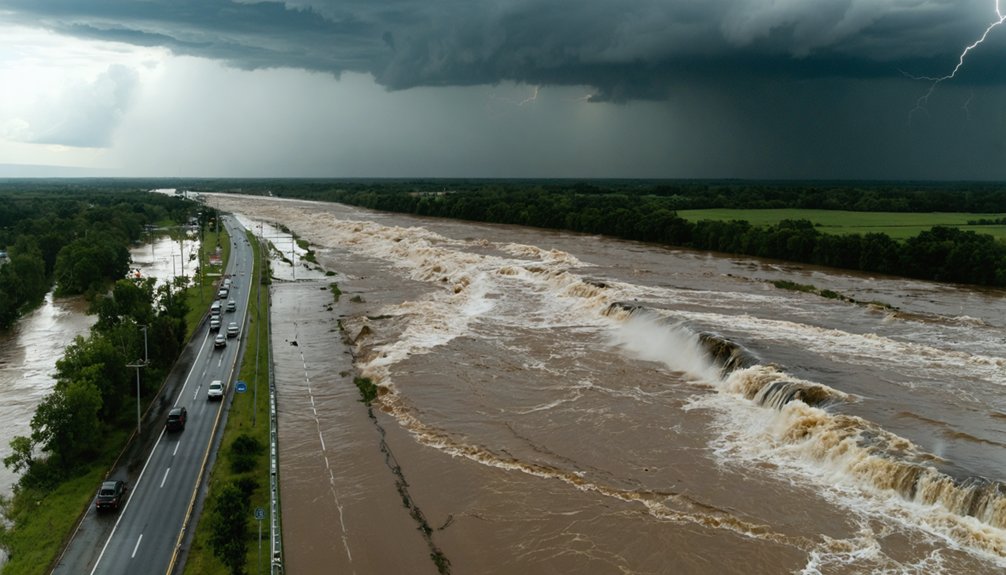
Floodwaters kill more people during severe weather events than any other hazard, making water-covered roadways your deadliest threat during storm chase evacuations. You’ll need strategic planning to navigate safely:
- Pre-identify high ground evacuation routes using storm surge risk maps before entering coastal zones, establishing multiple exit paths that avoid low-lying areas and leveed regions marked with Class Value 99.
- Monitor real time traffic monitoring systems like ETIS to track road closures, flooding incidents, and evacuation flow patterns as conditions evolve.
- Distinguish coastal versus inland flood threats – coastal areas face immediate storm surge while inland zones experience delayed river flooding and infrastructure failures.
- Never attempt crossing water-covered roads regardless of perceived depth; turn around immediately and select alternate high ground evacuation routes.
Follow Emergency-Recommended Roads and Bypass Dangerous Shortcuts
When emergency managers designate official evacuation routes, they’ve analyzed traffic capacity, flood risks, and infrastructure integrity that unmarked backroads lack. You’ll find these highways clearly marked and monitored through Drivetexas.org‘s real-time updates. Adhere to recommended routes rather than attempting “faster” alternatives that may lead into hazardous conditions.
Always bypass flooded roadways, regardless of how shallow they appear. Six inches of fast-moving water can knock you down, while just one foot sweeps vehicles away. Floodwaters compromise roadbed stability beneath the surface, creating hidden collapse risks.
Check Drivetexas.org before departure and throughout your journey. Official routes receive priority clearing, emergency services, and traffic management. Your independence depends on making informed decisions—not reckless shortcuts that endanger yourself and divert rescue resources from others.
Equip All Locations With Comprehensive Emergency Supply Kits
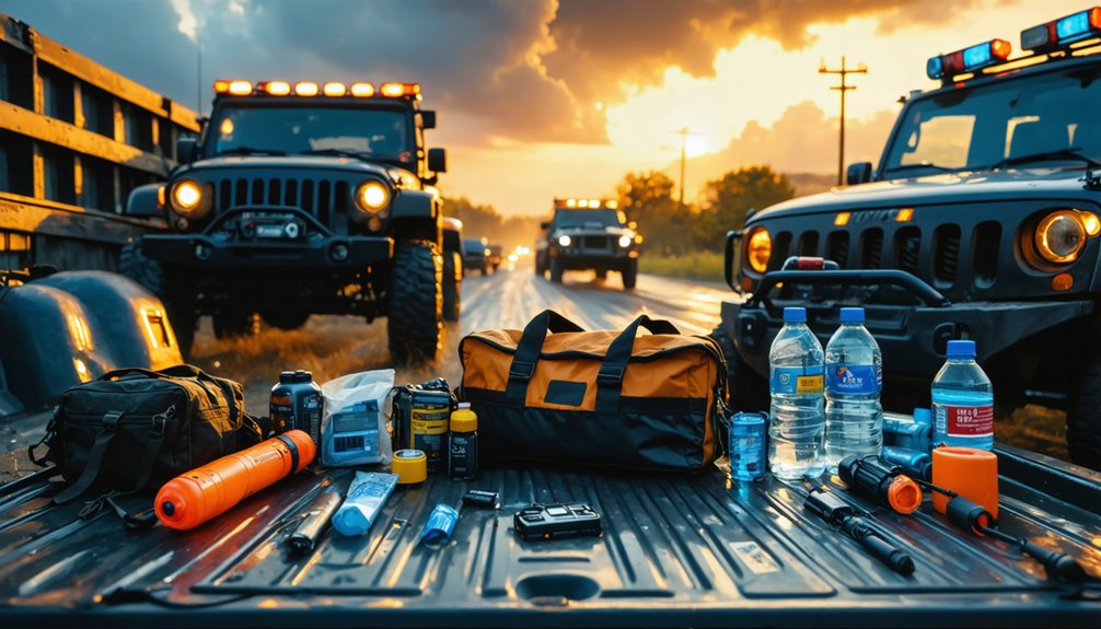
Detailed emergency supply kits function as your lifeline during storm evacuations, whether you’re sheltering at home or evacuating to safety. Effective supply storage management guarantees you’ll maintain self-sufficiency when infrastructure fails. Establish kits at multiple locations—home, vehicle, and workplace—so you’re never caught unprepared.
Strategic placement of emergency kits at home, work, and in vehicles ensures you’re equipped to survive infrastructure collapse regardless of location.
Essential Kit Components:
- Water and Food: Store one gallon per person daily for three days, plus non-perishable high-energy foods like peanut butter and trail mix.
- Medical Supplies: Pack a thorough first aid kit with 3-5 days of prescription medications, pain relievers, and personal medical documents.
- Communication Tools: Include battery-powered radios, flashlights, cell phone chargers, and local maps for navigation independence.
- Sanitation Equipment: Stock moist towelettes, garbage bags, hand sanitizer, and personal hygiene items.
Implement emergency supply rotation every six months to maintain freshness and reliability.
Conduct Regular Training and Drills for All Team Members
Having emergency supplies ready matters little if your team doesn’t know how to respond when severe weather strikes. You’ll need structured training that covers storm recognition, emergency procedures, and evacuation protocols.
Start with SKYWARN certification through the National Weather Service—it’s free and provides essential baseline knowledge. Guarantee at least one team member maintains current CPR and First Aid certification to handle lightning strikes or injuries while emergency responders arrive.
Partner newcomers with experienced chasers who’ll teach storm structure and escape route planning. Schedule refresher sessions periodically to maintain skills and review training curriculum annually when responsibilities shift or procedures change.
Run realistic simulations covering shelter operations and evacuation assistance. OSHA requires certification with 70% quiz scores, but your goal is genuine competence, not just compliance.
Frequently Asked Questions
What Insurance Coverage Is Recommended for Storm Chasing Vehicle Damage?
You’ll need thorough auto insurance with weather-related coverage for storm chasing vehicles. It protects against hail, wind damage, falling debris, and flooding. Guarantee your policy’s active before departing, as you can’t purchase coverage once storms threaten your area.
How Do You Coordinate Evacuations Across Different Time Zones During Chases?
You’ll establish cross region communication strategies through standardized UTC time references, you’ll implement multi agency coordination protocols with neighboring states, and you’ll synchronize updates using real-time digital platforms that guarantee everyone’s operating on identical schedules.
What Medical Certifications Should Team Members Obtain Before Storm Chasing?
You’ll need CPR certification and first aid training as baseline requirements. Consider adding Wilderness EMT or TCCC credentials for remote operations. These qualifications guarantee you’re prepared to handle emergencies independently when help isn’t immediately available.
How Do You Handle Equipment Failure During Active Storm Situations?
Like a pilot’s pre-flight checklist, you’ll prevent equipment failure through rigorous equipment maintenance protocols before deployment. When systems fail mid-storm, immediately switch to backup power sources while evacuating to safety and activating your emergency operations plan.
What Legal Liability Protections Exist for Storm Chasing Team Leaders?
You’ll need broad general liability insurance coverage requirements meeting state minimums, plus documented legal liability mitigation strategies including pre-trip protocols, emergency action plans, and proper equipment maintenance records to protect against negligence claims.