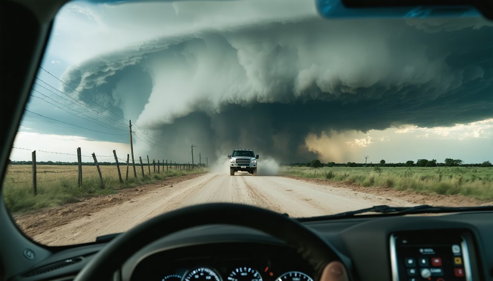
For storm chasing, you’ll rely on a core stack of geospatial tools built for speed and precision. GRLevel2 and GRLevel3 deliver real-time radar and SPC data on desktop, while RadarScope handles mobile hook echo detection in the field. Satsquatch adds high-resolution satellite imagery with mesoanalysis overlays, and Street Atlas keeps your GPS positioning accurate across Tornado Alley. Each tool connects in real time, creating a unified operational picture that separates informed intercepts from dangerous guesses—and there’s far more to unpack about configuring each one effectively.
Key Takeaways
- GRLevel2 provides super-resolution radar data with 99% reliability, matching National Weather Service speeds across Windows, Linux, and macOS platforms.
- GRLevel3 integrates SPC mesoscale discussions, convective outlooks, and station plot overlays into one streamlined workspace for efficient storm analysis.
- RadarScope delivers mobile super-resolution radar with hook echo detection, designed specifically for touchscreen navigation during active storm chases.
- Satsquatch combines high-resolution satellite imagery with mesoanalysis overlays, including CAPE, Storm-Relative Helicity, METARs, and real-time lightning detection.
- StormWindow enhances situational awareness by displaying chaser coordinates, storm photographs, and live tweets pulled from the SpotterNetwork API.
Accuracy, Speed, and Platform: How to Evaluate Storm Chasing Tools
When evaluating storm chasing tools, three criteria matter most: accuracy, data speed, and platform compatibility. You’ll want software that delivers reliable storm prediction without lag, since outdated data can compromise field decisions.
Prioritize tools with intuitive user interfaces that streamline data visualization under pressure. Mobile connectivity determines whether you’re receiving real-time weather alerts while repositioning on rural roads.
Software compatibility across Windows, macOS, or mobile platforms expands your operational flexibility.
Don’t overlook community engagement — active user bases generate faster bug fixes, shared workflows, and practical training resources that accelerate your learning curve. You’re not just buying software; you’re joining an ecosystem.
Evaluate each tool against these benchmarks independently. Your safety and situational awareness depend on choosing instruments that perform when conditions deteriorate fastest.
Desktop or Mobile: Which Platform Works in the Field?
How you deploy your tools in the field hinges on one fundamental decision: desktop or mobile platform. Desktop compatibility delivers processing power, while mobile usability grants freedom of movement. Your software preferences and interface design needs should drive the final call.
Desktop or mobile—your platform choice shapes every field decision, from processing power to freedom of movement.
Consider these critical field-condition factors:
- Battery consumption drains faster on laptops during extended chases.
- Connectivity issues hit mobile devices harder in rural Tornado Alley corridors.
- Data accessibility remains stronger on GRLevel2’s desktop stream at 99% reliability.
- Multi-device integration lets you pair RadarScope mobile with desktop GRLevel3 simultaneously.
- User experience differs sharply between touchscreen navigation and mouse-driven precision.
Neither platform dominates universally.
You’ll maximize effectiveness by running desktop software in your vehicle while keeping RadarScope active on your mobile device, ensuring redundant, uninterrupted data coverage.
GRLevel3: Real-Time Frontal and SPC Data for Desktop Chasers
When you run GRLevel3 on your desktop, you gain access to real-time frontal movement data that lets you track boundary interactions critical to storm initiation and intensification.
You can overlay Storm Prediction Center data directly onto your display, integrating mesoscale discussions, watch boxes, and convective outlooks into a single analytical workspace.
Although GRLevel3 operates on a lower-resolution data stream than Level II sources, it’s sufficient for clear storm mode identification and SPC-driven situational awareness during an active chase.
Frontal Movement Data Display
GRLevel3 lets you overlay real-time frontal movement data directly onto your radar display, giving desktop chasers a detailed picture of synoptic-scale forcing without switching between multiple applications.
Using frontal analysis techniques alongside display customization options, you can isolate exactly what matters during rapidly evolving chase scenarios.
Key capabilities include:
- Cold, warm, and stationary front overlays rendered directly on your radar canvas
- Customizable color schemes for distinguishing frontal boundaries from precipitation signatures
- Adjustable transparency controls preventing clutter over reflectivity data
- Storm Prediction Center mesoscale discussion integration for real-time convective threat context
- Station plot overlays confirming surface boundary positions against observed wind shifts
These frontal analysis techniques eliminate guesswork, letting you position yourself ahead of the most favorable forcing regions with precision and confidence.
SPC Storm Integration Features
Beyond frontal overlays, GRLevel3 pulls in Storm Prediction Center data streams that give you a consolidated operational picture during active severe weather setups.
SPC data integration delivers real-time alerts for mesoscale convective discussions, tornado watches, and severe thunderstorm watches directly onto your spatial analysis workspace. You’re seeing predictive modeling outputs layered against current storm tracking positions, which sharpens your tactical decision-making before committing to an intercept route.
The integration benefits extend beyond situational awareness. Data accuracy improves when you’re cross-referencing SPC outlooks against observed radar signatures, eliminating interpretive gaps that cost chasers critical positioning time.
Weather forecasting workflows accelerate because you’re operating from a single desktop platform rather than toggling between applications. Chaser collaboration also improves since teams share a common SPC-referenced operational picture during rapidly evolving events.
GRLevel2: Super-Res Radar That Keeps Pace With the Storm
When you upgrade to GRLevel2, you’re working with super-resolution Level II data that delivers sharper, more detailed radar returns than GRLevel3’s lower-resolution stream.
You’ll find the data pipeline remarkably dependable, running at 99 percent reliability and matching the exact speed National Weather Service forecasters use during active events.
Whether you’re running Windows or a Linux/macOS alternative, GRLevel2 keeps your situational awareness locked in step with rapidly evolving storm structures.
Super-Resolution Data Advantage
While GRLevel3 serves storm chasers well for broad situational awareness, GRLevel2 takes your radar analysis to a higher tier by leveraging super-resolution Level II data as its primary workhorse. The super resolution benefits translate directly into sharper, more actionable storm intelligence.
Key data visualization techniques reveal critical operational advantages:
- Higher pixel density uncovers finer hook echo signatures and rotation couplets
- Faster refresh cycles match National Weather Service forecaster processing speeds
- Precise velocity data identifies mesocyclone development earlier
- Detailed reflectivity gradients distinguish storm mode shifts accurately
- 99% reliable data streams guarantee uninterrupted situational awareness during active chases
You’re not just viewing weather — you’re dissecting it.
GRLevel2 gives you the resolution independence and analytical depth to make confident, real-time decisions when conditions evolve rapidly.
Reliable Real-Time Performance
Raw analytical power means nothing if your data pipeline fails mid-chase. GRLevel2 delivers a 99 percent reliable data stream, matching the exact speed National Weather Service forecasters use when issuing real time alerts. That benchmark matters when you’re repositioning under a rotating wall cloud.
Performance benchmarks confirm GRLevel2’s stream consistently outpaces lower-resolution alternatives, giving you super-resolution Level II data without latency-induced blind spots. You’re not waiting for degraded packets to reconstruct a hook echo while a tornado touches down ahead of your position.
The software runs natively on Windows, with Linux and macOS alternatives available, keeping your operational setup flexible.
When your data connection is solid and your refresh rate is tight, you chase with genuine confidence rather than guesswork.
RadarScope: Mobile Hook Echo Detection During Active Chases
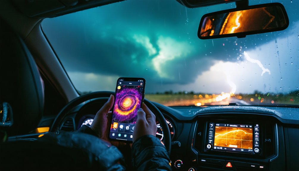
During an active chase, RadarScope gives you super-resolution Level II data on a mobile platform, making it the go-to tool for identifying hook echo signatures in real time. Its higher pixel resolution sharpens storm detail, letting you execute precise real time analysis without slowing your chase coordination.
Key capabilities that make RadarScope essential:
- Hook echo detection with superior pixel clarity over GRLevel3
- Mobile detection optimized for field usability across iOS and Android
- Data integration pulling live feeds directly to your device
- User interface designed for rapid interpretation during severe weather
- App compatibility supporting seamless workflow alongside Satsquatch and RadarOmega
As a storm chaser, you need tools that keep pace with evolving supercells.
RadarScope delivers exactly that—precise, fast, and uncompromising in the field.
Satsquatch: Satellite Imagery and CAPE Overlays for Storm Chasers
RadarScope keeps your radar sharp in the field, but storm chasing demands more than reflectivity data alone—Satsquatch fills that gap by pairing high-resolution satellite imagery with critical mesoanalysis overlays.
As a companion app to RadarScope and RadarOmega, Satsquatch features zoom-and-pan satellite visualization that lets you assess storm structure independently of radar returns.
You’ll overlay METARs, Storm-Relative Helicity, and CAPE analysis directly onto your satellite view, giving you a multi-layered atmospheric picture before committing to a chase route.
Lightning detection and customizable radar overlays expand your situational awareness further.
The 2025 version advances real-time severe weather integration, sharpening your decision-making when conditions evolve rapidly.
If you’re chasing without Satsquatch, you’re operating with an incomplete picture of the convective environment surrounding your target storm.
Street Atlas: GPS Mapping Across Tornado Alley
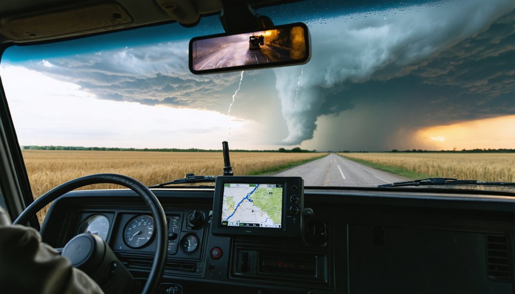
Satellite intelligence only takes you so far—once you’ve locked a target, you need precise ground-level navigation to position yourself effectively against a moving storm.
DeLorme’s Street Atlas delivers detailed tornado tracking capability across Tornado Alley with GPS accuracy that keeps you oriented during rapid repositioning.
DeLorme’s Street Atlas keeps storm chasers locked on target with GPS-precise navigation built for Tornado Alley’s unpredictable terrain.
Key operational advantages include:
- Annual map updates ensuring current road infrastructure data
- Live GPS position plotting against detailed regional cartography
- Integrated route planning for dynamic intercept adjustments
- Extensive coverage of rural Tornado Alley road networks
- Real-time position synchronization during active chasing scenarios
Street Atlas functions as your GIS backbone, translating radar data into actionable ground movement.
When storm motion forces split-second route decisions, you’re operating from verified geographical intelligence rather than guesswork.
StormWindow: Real-Time Chaser Positions and Field Intelligence
GPS navigation locks your ground position, but storm chasing isn’t a solo operation—you’re working within a larger field intelligence network where knowing where other chasers are positioned gives you a tactical edge.
StormWindow delivers that advantage through a map-based web application pulling chaser positions directly from the SpotterNetwork API, ensuring data accuracy across your operational picture.
You’re seeing real time communication translated into actionable field conditions: chaser coordinates, storm photographs submitted within 24-hour windows, and live tweets from deployed personnel.
Technology integration extends further through compatibility with RadarPro and GRLevelX applications, strengthening your storm tracking workflow.
Equipment reliability becomes less critical when crowd-sourced intelligence supplements your mobile applications.
The result is a user experience built for weather forecasting decisions and chaser safety simultaneously—freedom through distributed situational awareness.
How to Run GRLevel2, RadarScope, and Satsquatch Together in the Field
Running GRLevel2, RadarScope, and Satsquatch together creates a layered sensor stack that covers radar resolution, mobile flexibility, and environmental context simultaneously.
Tool compatibility across Windows and mobile platforms lets you synchronize storm tracking data without redundancy. Application integration tightens your workflow, reducing switching delays during active chasing.
Deploy this stack using these field efficiency priorities:
Deploy this stack using these field efficiency priorities to maximize analytical depth and reduce switching delays during active chasing.
- Run GRLevel2 on your laptop for super-resolution Level II radar and weather alerts
- Use RadarScope on mobile for hook echo detail and user interface flexibility
- Pull Satsquatch mesoanalysis overlays including CAPE and SRH for environmental context
- Align data synchronization timestamps across all three apps before intercept
- Conduct a performance comparison during setup to confirm each feed’s latency
This configuration gives you independent redundancy across platforms while maximizing analytical depth per decision.
Budget Tier to Expert Setup: Matching Tools to Your Chase Level
Whether you’re chasing your first storm or running a professional intercept operation, your geospatial toolkit should match your experience level and budget constraints.
At the entry level, RadarScope on a mobile device gives you super-resolution Level II data at minimal cost, covering the core radar analysis you need without overwhelming complexity.
As you advance, you’ll integrate GRLevel2 on a dedicated laptop, pair it with Satsquatch for high-resolution satellite and mesoanalysis overlays, and add Street Atlas for precise GPS-driven route planning across Tornado Alley.
Entry-Level Budget Tools
Starting out in storm chasing doesn’t require a five-figure equipment budget—you can build a functional, reliable toolkit for under $100 using tools that professional chasers rely on daily.
These affordable software options deliver essential features without compromising operational effectiveness.
- RadarScope (~$10): Super-resolution Level II data with high-pixel hook echo signatures
- Satsquatch (free/low-cost): Real-time satellite imagery with CAPE and SRH mesoanalysis overlays
- StormWindow (free): Web-based chaser position tracking via SpotterNetwork API integration
- GRLevel3 (budget-tier): Live radar with SPC data and station plots
- Street Atlas (affordable): GPS-integrated Tornado Alley mapping for precise route execution
Each tool addresses a specific operational gap—radar analysis, situational awareness, navigation, or communication—giving you independent, professional-grade capability without financial constraints limiting your chase decisions.
Advanced Expert Configurations
As your chase experience grows, your toolkit should scale with it—moving beyond single-platform radar viewing toward integrated, multi-layer configurations that match the complexity of the storms you’re targeting.
Expert setups typically pair GRLevel2’s super-resolution Level II data with Satsquatch’s high-resolution satellite imagery and mesoanalysis overlays, giving you simultaneous radar and environmental context.
You’re running RadarScope on mobile for field-level hook echo identification while Street Atlas handles your GPS-integrated routing across Tornado Alley.
Advanced configurations demand cross-platform redundancy—StormWindow’s SpotterNetwork integration keeps you networked with active chasers, reducing positional blind spots.
These aren’t isolated tools; they’re interconnected layers operating in real time.
When you build deliberately across radar, satellite, mapping, and communication platforms, you’re operating at the speed and precision that complex severe weather demands.
Frequently Asked Questions
Can Storm Chasing Tools Work Offline Without a Cellular Data Connection?
You’re not out of the woods yet — some tools work offline. Street Atlas supports offline map usage with strong GPS accuracy, letting you navigate freely without cellular data, though real-time radar apps like RadarScope require connectivity.
Are These Geospatial Tools Legal to Use While Driving During Chases?
You’ll face legal implications varying by state, but driving safety laws generally prohibit handheld device use while driving. You’re responsible for complying with local regulations—mount devices properly and use hands-free configurations during active chases.
How Do Storm Chasers Power Laptops and Devices in Their Vehicles?
You’ll typically power your laptops and devices using DC-to-AC inverters connected to your vehicle’s electrical system. Vehicle modifications like upgraded alternators and auxiliary batteries guarantee reliable portable power during extended chases.
Do Any of These Tools Support International Storm Chasing Outside the US?
Like a compass without a map, these international storm tools fall short globally—they’re built for U.S. radar networks. For global storm tracking, you’ll need alternatives like Windy or EUMETSAT-based platforms beyond these applications.
What Data Plans or Subscriptions Are Required for Real-Time Radar Access?
You’ll need a data subscription for real-time radar access. GRLevel2 and RadarScope require paid plans, while Satsquatch offers premium tiers. Choose subscriptions that give you unrestricted, fast data streams to maintain your operational independence in the field.
References
- https://www.stormtours.com/information/storm-chasing-technology/
- https://www.tornadotitans.com/p/the-ultimate-companion-app-to-radar
- https://www.geowgs84.ai/post/top-10-geospatial-analysis-software-in-2025
- https://www.youtube.com/watch?v=RE9GemgDryQ
- https://scopicsoftware.com/portfolio/stormchasing/
- https://www.youtube.com/watch?v=WPahO8iMzSg
- https://stormtrack.org/threads/new-map-based-storm-chasing-severe-weather-web-application.32010/
- https://www.spatialanalysisonline.com/software.html