If you’re chasing storms, location determines everything. The Great Plains delivers a 35.3% tornado sighting success rate during peak season, with gridded roads and near 360-degree visibility making it the gold standard. Florida ranks highest overall at 80.23, logging more tropical storm days than any other state. The Southeast offers variety but punishes chasers with dense terrain and limited sightlines. The data on where, when, and how to chase gets sharper from here.
Key Takeaways
- Florida ranks as the top U.S. storm chasing destination, scoring 80.23, offering hurricanes, tropical storms, and tornadoes year-round.
- The Great Plains provides a 35.3% tornado sighting success rate, aided by gridded roads and nearly 360-degree visibility.
- Peak tornado chasing season runs March through June, with May–June offering optimal Tornado Alley storm activity.
- Oklahoma City and Denver serve as prime operational bases, minimizing repositioning distances within the highest-density tornado corridors.
- Southeastern states present major visibility challenges due to dense forests, curved roads, and limited storm escape routes.
How Storm Frequency, Terrain, and Visibility Define a Chasing Hotspot
When evaluating storm chasing hotspots, three core variables determine a location’s viability: storm frequency, terrain navigability, and visibility. You need all three working together for a productive chase.
High storm frequency without clear sightlines produces dangerous, unproductive conditions. Southeastern states experience this tradeoff directly—dense tree coverage, curved roads, and Ozark terrain create significant visibility challenges that compromise both safety and storm tracking accuracy.
Dense forests and winding roads turn high storm frequency into a liability, not an advantage.
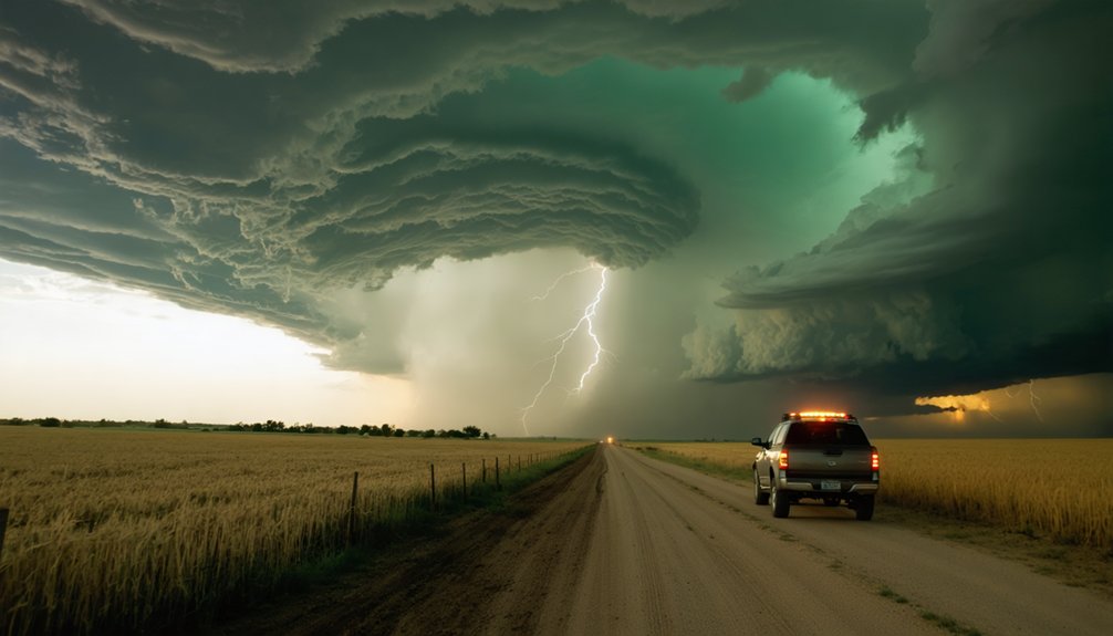
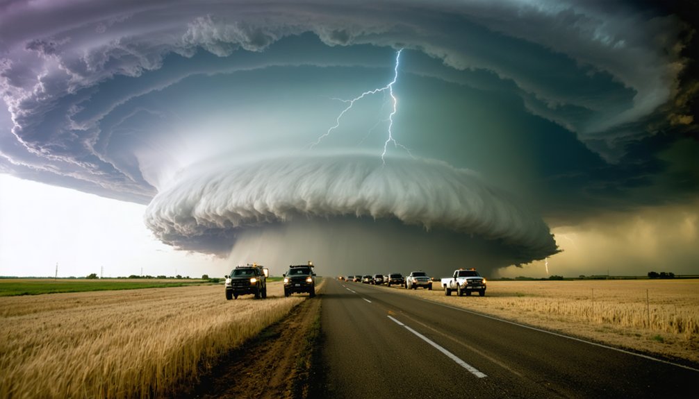
Conversely, the Great Plains delivers gridded road networks offering nearly 360-degree storm visibility alongside a 35.3% tornado sighting success rate. You’re not just chasing more storms—you’re chasing them smarter.
Florida tops all U.S. states with a score of 80.23, driven by tropical storm frequency and affordable access.
But frequency alone doesn’t define a hotspot; terrain and visibility ultimately dictate where you’ll succeed.
Why Florida Leads All U.S. Storm Chasing Destinations
If you’re selecting a storm chasing destination based on data, Florida’s top-ranked score of 80.23 makes it the clear frontrunner among all U.S. states.
The state logs more tropical storm days than any other, giving you consistent exposure to hurricanes, tropical storms, and tornadoes within a single operational region.
You’ll also find that average airfare to Florida undercuts every other state, reducing overhead costs and making repeated chase trips financially viable.
Florida’s Storm Activity Advantage
Florida earns its top ranking among U.S. storm chasing destinations with a composite score of 80.23, outpacing every other state through a combination of storm frequency, storm variety, and logistical accessibility.
No other state logs more tropical storm days annually, giving you consistent windows for hurricane preparedness research and storm photography opportunities throughout the season.
You’ll encounter hurricanes, tropical storms, and tornadoes across a single chase region, maximizing your exposure per trip.
Florida’s below-average airfare costs further reduce barriers, letting you allocate resources toward equipment and positioning rather than travel.
That combination of high storm frequency, multi-hazard variety, and affordable access creates a chasing environment where your probability of meaningful storm contact remains higher than anywhere else in the country.
Affordable Access To Florida
Airfare to Florida runs cheaper than any other U.S. state, which directly lowers your operational costs before a single storm enters your planning window.
Affordable airfare eliminates one of the most significant financial barriers in storm chasing logistics, giving you greater budget flexibility for equipment, fuel, and extended deployments.
Florida’s accessibility isn’t coincidental — competitive flight routes driven by high tourism demand consistently suppress ticket prices.
That pricing structure works in your favor operationally. When a tropical system organizes rapidly, you can mobilize faster and cheaper than you could targeting any comparable storm destination.
Lower entry costs mean you’re not forced to skip chase windows due to budget constraints, preserving your ability to pursue every viable opportunity the state’s historically active storm season delivers.
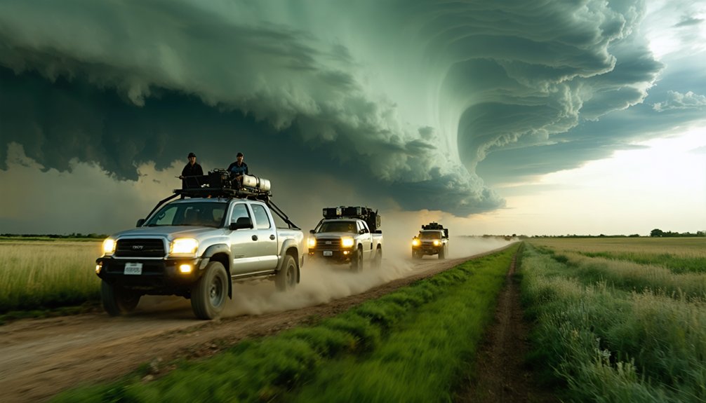
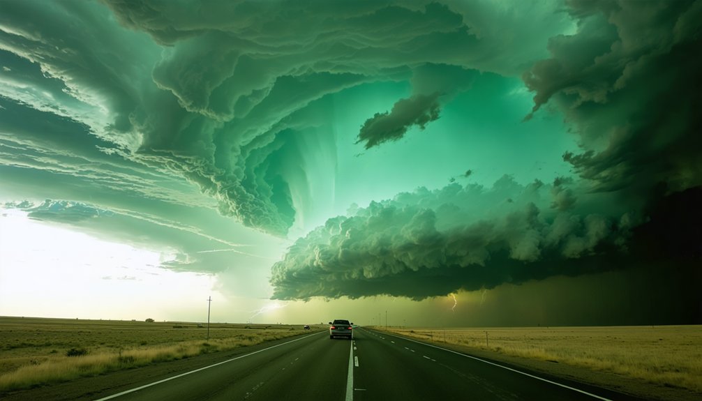
Tornado Alley’s Great Plains: The Gold Standard for Storm Chasers
When you shift your focus from Florida’s tropical activity to the interior of the continent, the Great Plains emerges as the gold standard for tornado chasing, boasting a 35.3% tornado sighting success rate—the highest of any U.S. region.
You’ll find that the area’s gridded road networks give you nearly 360-degree storm visibility and superior repositioning capability, advantages that southeastern terrain simply can’t match.
If you’re targeting peak probability, spring chasing in states like Oklahoma, Kansas, Colorado, and Nebraska delivers your best statistical chance of a tornado encounter on any given chase day.
Tornado Sighting Success Rates
Though Florida dominates overall storm chasing rankings, the Great Plains stands apart as the gold standard for tornado sighting success. You’ll find no better region for maximizing your tornado prediction accuracy and storm tracking efficiency.
The numbers speak clearly:
- 35.3% tornado sighting success rate — the highest of any U.S. region
- Gridded road networks deliver near 360-degree storm visibility and superior repositioning
- Spring season statistically produces the highest per-day tornado encounter probability
- Colorado, Oklahoma, Kansas, and Nebraska offer open terrain with unobstructed sightlines
- Professional tour operators run Tornado Alley routes 98% of their operational time
These conditions combine to create an environment where your chase decisions stay data-driven, your sight lines remain clear, and your odds of witnessing a tornado are measurably higher than anywhere else.
Strategic Road Network Advantages
What separates the Great Plains from every other storm chasing region isn’t just storm frequency — it’s the road infrastructure underlying every chase decision you’ll make.
The gridded road network gives you nearly 360-degree storm visibility and unmatched strategic positioning that curved, tree-lined southeastern roads simply can’t offer. You’re not locked into a single corridor hoping terrain cooperates — you’re operating on a systematic grid that lets you move north, south, east, or west with precision.
Road accessibility here means real-time repositioning without dead ends, blind curves, or vegetation blocking critical sightlines. In contrast, regions like the Ozarks and Gulf Coast force reactive decisions.
The Plains lets you stay proactive, maximizing every chase opportunity with infrastructure that functionally extends your operational range and tactical flexibility.
Peak Season Chase Opportunities
Spring releases the Great Plains’ full storm chasing potential, compressing the highest tornado probability into a tight seasonal window that no other region can replicate. Your chase preparation must align with these critical periods:
- March–April: Southeastern targets, challenging terrain
- May–June: Peak Tornado Alley activity, ideal visibility
- June–July: Northern expansion into Dakotas, Wyoming, Canada
- 35.3%: Tornado sighting success rate during prime season
- 98%: Professional tour operation rate within Tornado Alley
Each phase demands adjusted safety protocols, as atmospheric conditions shift dramatically across months.
May and June deliver your highest statistical return, concentrating supercell activity across Kansas, Oklahoma, and Nebraska.
You’re operating within a structured seasonal progression that maximizes encounters while maintaining predictable, manageable risk windows unavailable anywhere else.
Florida, Texas, and the Southeast’s Most Active Chasing States
Florida leads all U.S. states in storm chasing with a composite score of 80.23, driven by more tropical storm days than any other state and below-average airfare that makes it the most accessible destination for chasers.
Florida Storms deliver consistent exposure to hurricanes, tropical systems, and tornadoes, giving you multiple chase opportunities within a single trip.
Southeastern Chasing extends well beyond Florida’s borders. Eight of the top 10 storm chasing states sit across the southern and southeastern U.S., reflecting the region’s exceptional storm frequency.
However, dense vegetation, curved road networks, and limited sightlines create genuine operational challenges. You’ll encounter reduced visibility and tighter positioning windows compared to Plains chasing, so prioritize route planning and terrain awareness before committing to southeastern targets.
Why the Southeast Is Harder to Chase Than the Plains
If you’re chasing storms in the Southeast, you’ll face terrain and infrastructure challenges that simply don’t exist on the Plains.
Dense tree coverage across the Ozarks, Gulf Coast, and Carolinas blocks critical sightlines, while curved road networks replace the gridded systems that give Plains chasers near 360-degree storm visibility.
These combined factors don’t just reduce your observational effectiveness—they actively increase your operational risk.
Terrain Limits Storm Visibility
While the Southeast sees plenty of storm activity, its terrain makes chasing far less effective than in the Great Plains. Visibility challenges and terrain factors considerably reduce your ability to track and observe storms safely.
Key obstacles you’ll face in the Southeast:
- Dense tree coverage across the Ozarks, Gulf Coast, and Carolinas blocks critical sightlines
- Curved road networks limit your repositioning speed and precision
- Rolling terrain prevents the near 360-degree visibility available on the Plains
- Limited escape routes increase risk during rapidly evolving storm scenarios
- Population density complicates safe storm approach and departure
These conditions contrast sharply with the Plains’ gridded roads and open horizons.
If you’re prioritizing successful sightings over raw storm frequency, the Southeast’s structural disadvantages make it a far less efficient chase environment.
Curved Roads Reduce Safety
Road geometry directly determines how fast you can reposition during a chase, and the Southeast’s curved networks put you at a measurable disadvantage compared to the Plains’ gridded systems.
On the Plains, you’re working with near 360-degree storm visibility and predictable grid roads that let you adjust your position efficiently. In the Southeast, curved roads force longer route calculations, slower speeds, and compromised exit strategies — compounding both safety challenges and visibility issues simultaneously.
When a storm shifts direction unexpectedly, those extra seconds spent maneuvering winding roads translate directly into risk.
The Plains’ geometry gives you freedom to move laterally, parallel, or perpendicular to storm tracks with precision. The Southeast removes that tactical flexibility, making successful intercepts statistically harder and considerably more dangerous for even experienced chasers.
Dense Vegetation Blocks Sightlines
Beyond road geometry, dense tree coverage throughout the Ozarks, Gulf Coast, and Carolinas strips away the sightlines you’d otherwise depend on for safe storm observation.
Vegetation effects compound terrain impact, forcing you into reactive rather than proactive chase strategies.
Key visibility challenges you’ll face in the Southeast:
- Dense coverage reduces storm tracking windows to seconds instead of minutes
- Location scouting becomes critical before committing to any chase corridor
- Safety concerns escalate when tree lines obscure rotating wall clouds
- You can’t reposition effectively when curved roads meet blocked sightlines
- Plains chasers maintain nearly 360-degree visibility; southeastern chasers rarely achieve 90 degrees
These constraints explain why professional operators choose the Great Plains 98% of the time, where open terrain keeps you in control.
Midwest Hotspots: Illinois, Kansas, and Hidden Tornado Zones
Although Illinois and Kansas don’t fit the stereotypical image of prime storm chasing territory, both states crack the top 10 storm chasing destinations in the U.S. — a ranking driven by sufficiently high tornado impact rates rather than geographic convenience.
Midwest tornadoes demand adjusted chasing strategies: you’ll need roughly twice the chase days compared to Great Plains operations to achieve comparable results. The upside is operational efficiency — most Midwest tornadoes occur within two hours of a home base, reducing logistical overhead.
However, eastern Midwest terrain introduces visibility constraints that compress your positioning options. If you’re chasing here, prioritize flexible scheduling and shorter deployment windows.
These hidden tornado zones reward patience and precision, offering genuine opportunities without requiring the extended commitments that traditional Tornado Alley campaigns demand.
Storm Chasing Season: What Happens March Through August
Storm chasing season runs March through August, and where you chase shifts dramatically as the calendar advances. Tracking these seasonal patterns sharpens your chase strategies and maximizes your intercept probability.
- March–April: Southeastern terrain like Mississippi dominates, though dense vegetation limits visibility.
- May–June: Focus shifts west into classic Tornado Alley and the Great Plains.
- June–July: Activity stretches into South Dakota, North Dakota, Wyoming, and Canada.
- Late Spring–Summer: Storms spread across Texas, Oklahoma, Kansas, Nebraska, Colorado, Iowa, and Missouri.
- Peak Window: Spring Great Plains chasing delivers the highest tornado encounter probability per chase day.
Understanding this geographic migration lets you position yourself where conditions statistically favor success, rather than chasing blind across unpredictable terrain.
How Chase Targets Shift From Early Spring Into Summer
As winter releases its grip, chase targets migrate predictably from the southeast toward the northern plains, following a thermodynamic progression driven by jet stream positioning and surface moisture patterns.
March and April’s seasonal shifts push you into difficult southeastern terrain—Mississippi, the Ozarks, Gulf Coast—where curved roads and dense vegetation complicate operations.
By May and June, target shifts carry you westward into classic Tornado Alley, where Kansas, Oklahoma, and Nebraska deliver superior visibility and gridded road networks.
Late June and July extend your range into South Dakota, North Dakota, Wyoming, and occasionally Canada. You’ll find northern Texas, Colorado, Iowa, and Missouri filling out summer calendars.
Each shift reflects atmospheric mechanics, not arbitrary scheduling—understanding these patterns lets you position yourself where success probability peaks.
Top Storm Chasing Tour Companies Worth Booking
Knowing where storms develop and when they peak only gets you so far—the operator you choose determines whether that knowledge translates into actual sightings.
Choosing the right operator is what turns storm knowledge into actual, unforgettable sightings.
These established companies maximize your chase preparation and storm photography opportunities:
- StormTours.com – Operating since 1999, led by degreed meteorologists
- Tempest Tours – Combined 200 years of field experience across its team
- Silver Lining Tours – Highest annual tour volume with 5-11 day flexible options
- Storm Chasing Adventure Tours – First to deliver satellite footage to The Weather Channel
- Great Plains operators – Base from Oklahoma City, Denver, Kansas City, and Rapid City
Professional companies work Tornado Alley 98% of the time, where the 35.3% tornado sighting success rate gives you the strongest statistical advantage per chase day.
Best Cities to Base Your Storm Chasing Trip
Where you base your operations directly impacts intercept probability, repositioning speed, and daily drive times to active storm corridors. For optimized storm chasing logistics, four cities dominate professional tour company positioning: Oklahoma City, Denver, Kansas City, and Rapid City.
Oklahoma City centers you within Tornado Alley’s highest-density target zone, minimizing repositioning distances during volatile spring setups.
Denver provides western access into Colorado’s exceptional terrain while covering Nebraska and Kansas corridors efficiently.
Kansas City bridges Midwestern and Great Plains targets effectively.
Rapid City becomes strategically valuable during June and July when storm systems push into the Dakotas and Wyoming.
Strong weather forecasting infrastructure exists in all four hubs, giving you reliable meteorological data to execute calculated, time-sensitive chase decisions daily.
Frequently Asked Questions
What Personal Gear Should Storm Chasers Bring on a Chasing Expedition?
Ironically, the knowledge base doesn’t cover storm gear essentials or safety equipment recommendations — but you’ll want sturdy boots, rain gear, first aid kits, communication devices, and helmets to chase safely and freely on your expedition.
Are There Age or Health Restrictions for Joining Professional Storm Chasing Tours?
Most professional storm chasing tours don’t publish strict age limits, but you’ll need solid mobility and cardiovascular fitness. Health considerations and storm safety demands mean you must honestly assess your physical condition before booking any high-intensity chase expedition.
How Do Storm Chasers Handle Emergencies or Injuries While in the Field?
With a 35.3% tornado sighting success rate, you’ll want solid emergency preparedness protocols. Professional teams handle injury response using onboard first-aid kits, satellite communication, and pre-planned evacuation routes, ensuring you’re never stranded during intense field operations.
What Insurance Coverage Do Storm Chasing Tour Companies Typically Provide Participants?
The provided knowledge doesn’t specify storm insurance details, but you’ll typically sign liability waivers before joining tours. Research each operator’s coverage independently, as companies like StormTours.com and Tempest Tours structure participant protections differently based on operational risk assessments.
Can Beginners With No Meteorology Background Join Professional Storm Chasing Tours?
You’re in luck! You don’t need a meteorology background to join professional storm chasing tours. Companies like StormTours.com cover storm chasing basics and safety tips, letting you chase freely alongside veteran meteorologists with 200+ combined years of experience.
References
- https://www.mroelectric.com/blog/best-us-states-for-storm-chasers/
- https://www.accuweather.com/en/severe-weather/plains-vs-southeast-a-world-of-difference-for-storm-chasers/1767986
- https://www.stormchasingusa.com/where-do-you-chase/
- https://midlandusa.com/blogs/blog/storm-chasing-tours
- https://stormhighway.com/tornado_observing_stats.php
- https://www.spotternetwork.org
- https://stormcenter.app