When your cell tower fails mid-chase, you’ll need layered tools to stay connected. Satellite phones bypass terrestrial infrastructure entirely, while two-way radios handle direct vehicle-to-vehicle coordination. GPS tracking devices double as emergency beacons, transmitting SOS signals via satellite. Multi-carrier cell phones maximize partial network coverage, and ruggedized mobile data terminals deliver real-time Doppler overlays in the field. Pair everything with a robust portable power system, and you’ll find each tool serves a critical role worth understanding fully.
Key Takeaways
- Satellite phones bypass terrestrial infrastructure using networks like Iridium or Globalstar, maintaining communication when local cellular systems fail during storms.
- Two-way radios operate on HF/VHF bands, enabling direct vehicle-to-vehicle communication independently of cellular networks during severe weather.
- GPS tracking devices transmit real-time positions via satellite messaging and trigger SOS alerts without relying on cellular connectivity.
- Multi-carrier cell phones maximize signal availability by simultaneously accessing multiple partial networks during infrastructure degradation.
- Ruggedized power systems, including solar panels and high-capacity power banks, sustain all communication devices during extended field deployments.
Why Communication Fails Storm Chasers in the Field
Storm chasing pushes communication systems to their absolute limits, and understanding why they fail is critical before you ever deploy into the field. Severe thunderstorms generate intense electromagnetic interference that disrupts radio frequencies and degrades signal clarity across multiple bands.
Storm chasing doesn’t just test your nerves — it destroys your comms before the first funnel touches down.
You’ll encounter signal attenuation as precipitation density increases, physically weakening transmissions between you and your team. Cellular infrastructure collapses when towers sustain direct storm damage or when simultaneous emergency calls overwhelm network capacity.
Terrain further compounds these failures — valleys, ridgelines, and dense vegetation block line-of-sight transmissions entirely. Power surges from nearby lightning strikes can disable unprotected equipment instantly.
Recognizing these failure points lets you build redundant communication systems that keep you connected, informed, and operationally independent when standard infrastructure buckles under storm conditions.
Satellite Phones for Emergency Communication Off the Grid
When cellular towers fail and radio frequencies buckle under electromagnetic interference, satellite phones become your most reliable lifeline in the field. Unlike ground-based systems, they bypass signal obstructions entirely, routing communications through low-Earth orbit networks like Iridium or Globalstar.
Key operational advantages include:
- Two-way data transmission regardless of terrestrial infrastructure damage
- Satellite encryption protocols securing sensitive storm data from interception
- SOS signaling triggering immediate rescue team deployment in critical situations
- Weather-independent voice contact maintained across thousands of miles
You’re not dependent on carriers, towers, or compromised grids. When a supercell dismantles local infrastructure, your satellite phone keeps you connected to coordinators, emergency services, and your team—giving you autonomous communication capability that no storm can neutralize.
GPS Tracking Devices That Double as Emergency Beacons
Beyond communication, positional awareness is a core survival requirement in storm chasing—and modern GPS tracking devices deliver both. You’re not just orienteering unfamiliar terrain; you’re maintaining real-time visibility for your entire team through cloud-based tracking platforms.
Today’s devices support multi-GNSS constellations, ensuring precise positioning even when severe weather degrades standard signals. They integrate satellite messaging, letting you transmit critical data without relying on cellular infrastructure. That independence matters when you’re operating in network-dead zones during rapidly escalating events.
Most critically, these units function as dedicated emergency beacons, triggering SOS alerts directly to rescue coordination centers. Paired with topographic mapping and extended battery life, they give you autonomous operational capacity—no carrier dependency, no infrastructure vulnerability.
In storm chasing, that self-sufficiency isn’t optional; it’s essential.
Two-Way Radios Storm Chasers Rely On When Cell Towers Fail
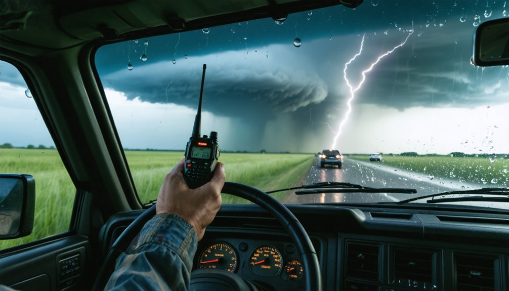
Cell towers fail exactly when storm chasers need them most—and two-way radios eliminate that dependency entirely. Through smart frequency coordination and advanced antenna technology, you maintain direct, independent communication when infrastructure collapses.
When cell towers fail, two-way radios keep storm chasers connected—independent, reliable, and fully in control.
Here’s what makes two-way radios indispensable:
- HF/VHF band access lets you coordinate with emergency services across storm-affected regions without cellular reliance.
- Encrypted frequency use secures your sensitive transmissions during chaotic storm operations.
- Extended battery life sustains multi-day expeditions without compromising communication reliability.
- Direct line-of-sight transmission keeps your team connected vehicle-to-vehicle regardless of network status.
You’re not dependent on anyone’s infrastructure—you control your own communication chain.
When the storm intensifies and towers go dark, your two-way radio keeps your operation running precisely and independently.
Multi-Carrier Cell Phones to Stay Connected in Storm Zones
Carrying phones on at least two different carriers—such as Verizon and AT&T—maximizes your signal availability when one network degrades or fails entirely in active storm zones.
You can pull real-time Doppler radar, updated weather models, and live map overlays directly through your mobile internet connection, keeping your situational awareness sharp as conditions shift.
Integrating GPS tracking apps across both devices also lets your team monitor each vehicle’s position simultaneously via cloud-based platforms, reducing the risk of losing contact during rapid storm repositioning.
Dual-Carrier Signal Coverage
When cellular networks buckle under storm conditions, how you maintain signal coverage can determine whether you stay informed or go dark. Carrying two phones on separate carriers builds signal redundancy into your setup, exploiting frequency overlap between networks to maximize connectivity.
Deploy dual-carrier coverage effectively by following these steps:
- Pair a Verizon device with T-Mobile to exploit their distinct tower infrastructure across rural corridors.
- Monitor both phones simultaneously to identify which carrier maintains stronger signal inside storm zones.
- Switch data-intensive tasks to whichever device holds connectivity during network degradation.
- Configure GPS tracking apps and radar platforms across both phones for uninterrupted situational awareness.
This approach keeps you operationally independent, ensuring partial network failures don’t strip your ability to track, report, or coordinate during critical chase windows.
Real-Time Weather Access
Real-time weather access defines your operational effectiveness when a storm system evolves faster than your last radar pull. Your multi-carrier cell phones deliver that access by connecting you to live Doppler radar overlays, updated atmospheric models, and critical weather alerts across competing network infrastructures simultaneously.
When one carrier drops satellite signal near a convective boundary, your secondary device pulls data through a separate tower grid, keeping your radar feed uninterrupted. You’re not guessing at storm structure—you’re analyzing it in motion.
Apps integrated with AWIPS and WRF model outputs let you recalibrate intercept routes based on current mesoscale data. You’re also pushing storm reports to authorities and media contacts without losing situational awareness.
Dual-carrier redundancy transforms your mobile setup into a reliable, field-grade meteorological intelligence platform.
GPS Team Location Tracking
GPS team location tracking locks your convoy’s spatial awareness into a single operational picture, and multi-carrier cell phones make that picture continuously available even as cellular infrastructure degrades around active storm cells. GPS precision eliminates positional ambiguity during rapid repositioning, while satellite encryption protects transmitted coordinates from interception.
Use smartphone apps integrating multi-carrier connectivity to maintain real-time team monitoring across fragmented network zones.
Maximize your tracking reliability by following these protocols:
- Carry two phones on separate carriers to exploit partial network availability simultaneously
- Enable GPS tracking apps that sync location data automatically across team devices
- Transmit coordinate updates at scheduled intervals to conserve bandwidth during congestion
- Cross-reference smartphone GPS data against dedicated tracking platforms for positional verification
This layered approach keeps every vehicle accountable throughout the entire chase operation.
Mobile Data Terminals for Real-Time Storm Tracking
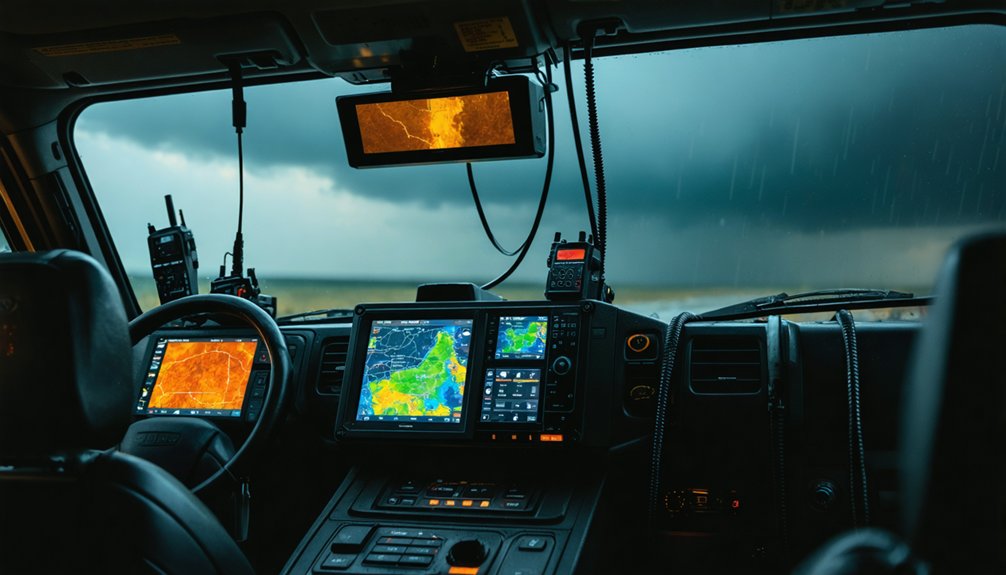
When you’re chasing storms in unfamiliar terrain, ruggedized tablets running advanced mapping software give you the navigational precision you need to stay ahead of dangerous conditions.
You can integrate real-time Doppler radar overlays directly into your mobile data terminal, allowing you to analyze storm structure and make split-second routing decisions.
With dashboard-mounted cameras linked to your terminal, you’ll also stream live footage for public documentation, creating a valuable record of storm behavior as it unfolds.
Ruggedized Tablets For Navigation
Ruggedized tablets serve as the backbone of mobile data terminals, giving storm chasers a durable, high-performance platform for real-time navigation and storm analysis. Their rugged durability withstands extreme heat, rain, and vibration — conditions that destroy standard consumer devices.
Leverage these four critical capabilities:
- Satellite integration syncs your tablet with GPS constellations for pinpoint positioning without cellular dependence.
- Doppler radar overlays display live storm structure directly on topographic maps.
- AWIPS and WRF model feeds deliver constantly updated atmospheric data for precise intercept decisions.
- Dashboard mounting systems keep your screen accessible while you navigate unpredictable terrain.
You’re operating in environments where equipment failure isn’t an option. A ruggedized tablet guarantees your navigation and analysis tools remain fully operational when conditions deteriorate fastest.
Real-Time Doppler Radar Integration
Real-time Doppler radar integration gives your mobile data terminal three core advantages: live storm structure visualization, velocity data for rotation detection, and reflectivity gradients that pinpoint precipitation intensity. You’ll pull NEXRAD feeds directly through your terminal’s mapping software, overlaying storm data onto GPS-synced route displays.
Satellite bandwidth becomes your critical variable here. Insufficient bandwidth throttles radar refresh rates, leaving you working with outdated storm positioning during rapid intensification events. Prioritize terminals supporting LTE aggregation or dedicated satellite uplinks to sustain high-resolution data streams.
Signal latency introduces its own tactical risk. A 30-second delay in mesocyclone data can misrepresent a tornado’s actual track by several hundred meters. You need sub-10-second latency thresholds to maintain accurate situational awareness and execute safe intercept positioning independently.
Live Streaming Storm Documentation
How you document a storm directly determines its scientific and public value. Mobile data terminals let you stream live footage directly from dashboard-mounted cameras, cutting through storm signal interference with stable, encrypted connections.
To maximize your documentation effectiveness:
- Enable satellite encryption on all outgoing video streams to protect sensitive meteorological data from interception.
- Mount ruggedized tablets with Doppler overlay software to simultaneously analyze structure while streaming.
- Integrate GPS coordinates into your live feed metadata for precise, timestamped storm positioning.
- Configure redundant upload pathways to compensate for storm signal interference disrupting primary connections.
Your terminal’s processing power lets you push real-time footage to research institutions and media outlets without sacrificing navigational awareness.
Satellite encryption ensures your transmissions remain secure, giving you complete operational autonomy in the field.
How Emergency Power Systems Keep Your Communication Gear Running
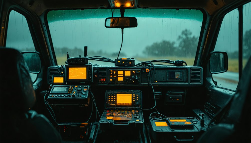
When your communication gear fails mid-chase, the culprit is often a drained battery rather than equipment malfunction. Battery longevity becomes your tactical advantage when you’re operating three days deep into a remote storm corridor with no grid access.
High-capacity portable power banks sustain satellite phones, two-way radios, and mobile data terminals simultaneously during extended deployments.
Solar integration amplifies your operational independence considerably. Mounting flexible solar panels on your vehicle roof converts ambient daylight into continuous charging capacity, even under overcast storm conditions.
Pair solar input with AC adapters to maintain voltage stability for sensitive electronics experiencing temperature fluctuations common in severe weather environments.
Prioritize ruggedized power systems rated for extreme conditions. Your communication chain is only as strong as its weakest power source.
Which Tool Should Storm Chasers Prioritize First?
Keeping your gear powered sets the foundation, but power means nothing if you’re running the wrong tool for your primary communication need. Prioritize based on your operational environment and storm chaser safety requirements.
- Satellite Phone — your first line when you’re beyond all terrestrial infrastructure
- Two-Way Radio — essential for direct vehicle-to-vehicle coordination without network dependency
- Multi-Carrier Cell Phones — maximize signal availability during partial network degradation
- GPS Tracking Device — guarantees real-time team monitoring and emergency SOS capability
Communication redundancy isn’t optional — it’s tactical. You shouldn’t rely on a single tool because no single system covers every failure scenario.
Stack your tools deliberately, starting with the satellite phone, then layer each additional system to cover gaps the previous one can’t handle.
Build a Layered Communication Kit That Won’t Fail You
Building a layered communication kit means selecting tools that compensate for each other’s failure points. You’ll want satellite phones handling total infrastructure collapse, two-way radios managing line-of-sight team coordination when cellular towers fail, and multi-carrier phones bridging partial network degradation. Each layer serves a distinct communication protocol tier.
Structure your kit around redundancy, not convenience. Mount your mobile data terminal for radar analysis, pair it with GPS tracking for real-time positioning, and back everything with a robust emergency power system. Without sustained power, your entire stack collapses.
Establish clear communication protocols before deployment — assign frequencies, designate backup contact windows, and define escalation triggers. Effective team coordination depends on pre-planned procedures, not improvised decisions made during active storm pursuit. Discipline in preparation preserves your freedom in the field.
Frequently Asked Questions
What Legal Licenses Do Storm Chasers Need for Two-Way Radio Operation?
You’ll need an FCC Technician or General license for VHF/HF operation, ensuring legal compliance with licensing regulations. Amateur radio certification grants you the freedom to operate encrypted frequencies during storm-chasing expeditions independently.
How Much Does a Complete Storm Chaser Communication Kit Typically Cost?
You’ll typically spend $2,000–$5,000 on a complete kit. Budget for a storm radio covering emergency frequencies, satellite phone, GPS tracker, mobile data terminal, and backup power systems to guarantee you’re fully equipped.
Are Storm Chaser Communication Tools Covered Under Specialized Insurance Policies?
Yes, you’ll find specialized insurance policies that cover storm chaser communication tools under risk management plans. These insurance coverage options protect your satellite phones, GPS devices, and radios against storm-related damage, theft, and equipment failure.
Which Satellite Network Offers the Best Global Coverage for Storm Chasers?
Iridium’s satellite coverage provides you with true global connectivity, reaching every corner of Earth via 66 low-orbit satellites. You’ll maintain reliable two-way data transmission and SOS signaling anywhere storms take you, ensuring uninterrupted emergency communication.
Can Storm Chasers Share Real-Time Data With Official Meteorological Agencies Directly?
Yes—you can share storm data sharing feeds directly with agencies using multi-carrier phones, enabling real-time uploads. You’ll trigger emergency alert protocols instantly, keeping meteorologists informed while you chase, unfiltered and free.
References
- https://stormtrack.org/threads/recommended-chaser-equipment-list.23013/
- https://store.sirui.com/blogs/guides/essential-equipment-for-storm-chasing-guide-for-2025
- https://crazystormchasers.com/communication-devices-for-storm-chasers/
- https://science.howstuffworks.com/nature/climate-weather/storms/storm-chaser3.htm
- http://www.ndtornado.com/primary/equipment.htm
- https://www.youtube.com/watch?v=AswKDts1i0o
- https://www.stormtours.com/information/storm-chasing-technology/
- https://crazystormchasers.com/storm-chaser-gps-tracking-devices/
- https://www.benholcomb.com/storm-chasing/equipment/
- https://crazystormchasers.com/storm-chaser-expedition-preparation-coverage/